SUNYGRAD
-
Posts
191 -
Joined
-
Last visited
About SUNYGRAD

- Currently Viewing Forum: Southeastern States
-
May see this on/off over parts of southeast thru weekend. Can use this also for some good info. NWS Greenville-Spartanburg Fire Weather Page
-
-

-
-
Does anyone remember this storm? The Spring Snowstorm of April 2-5, 1987. I was not living here but ran across this today. WOW-
-
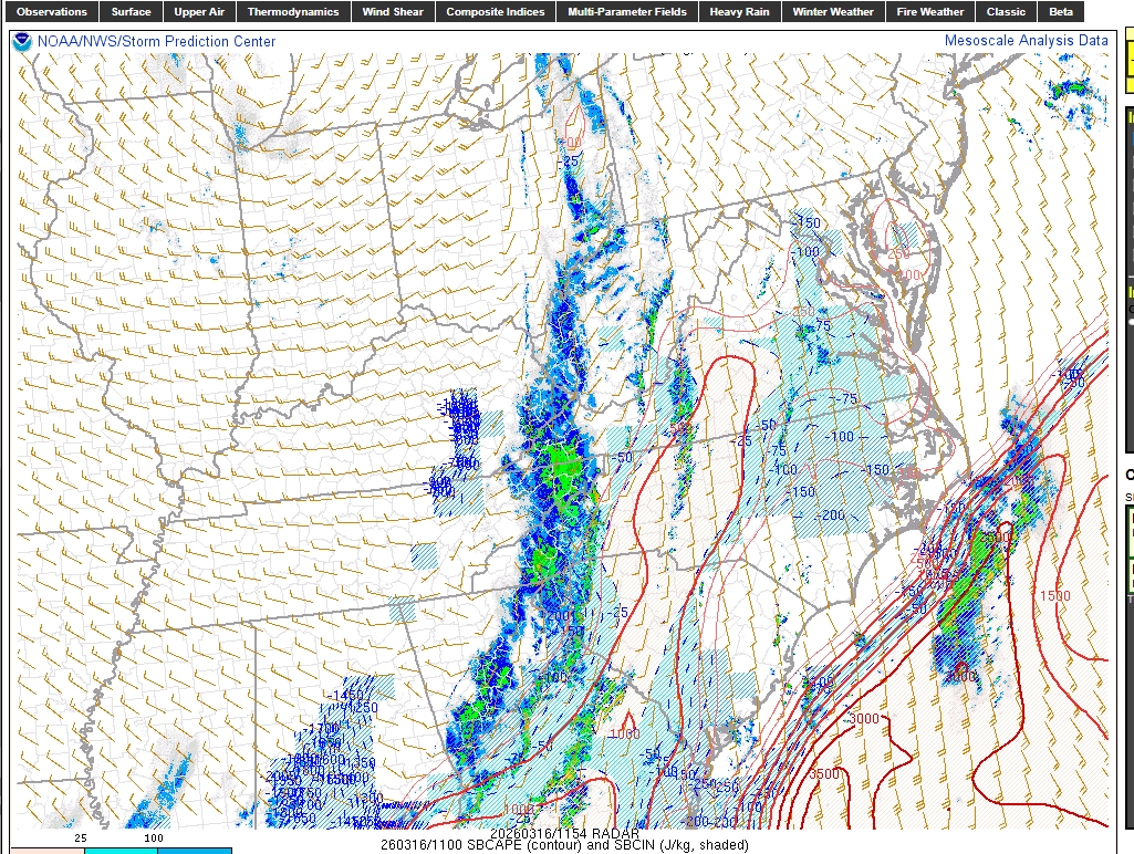
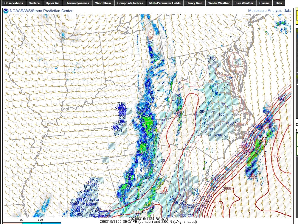
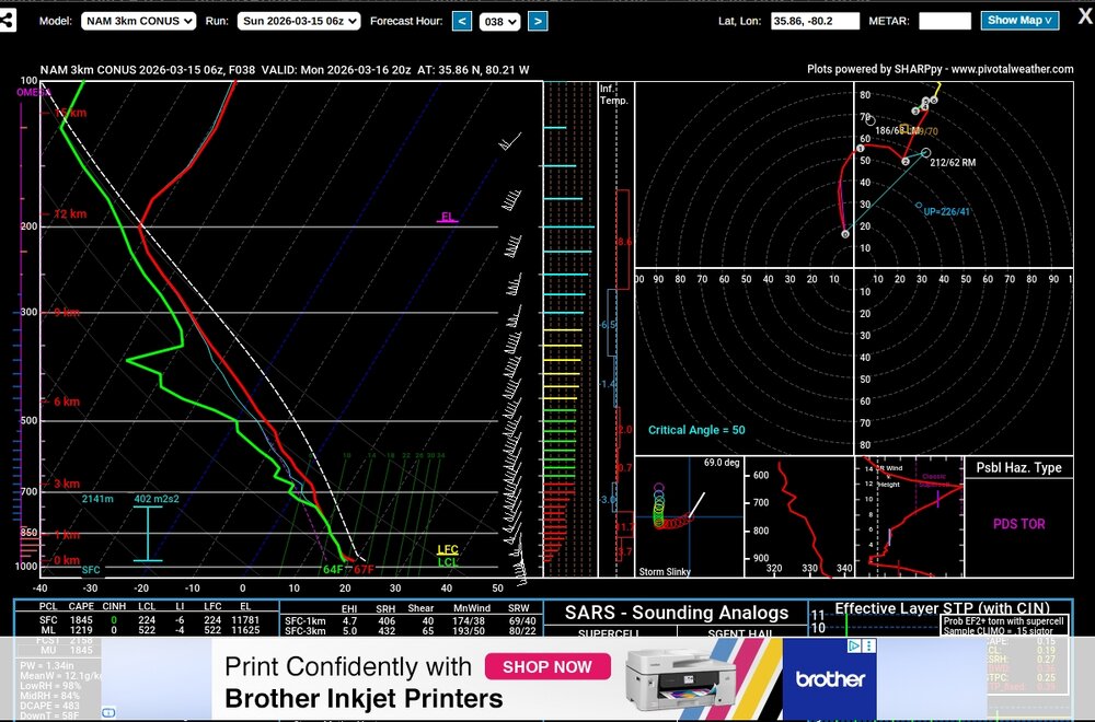
Good case study for sure. This what got my attention in am (below at 8:00 am) and RAP progression or lack of as the morning went on.
-
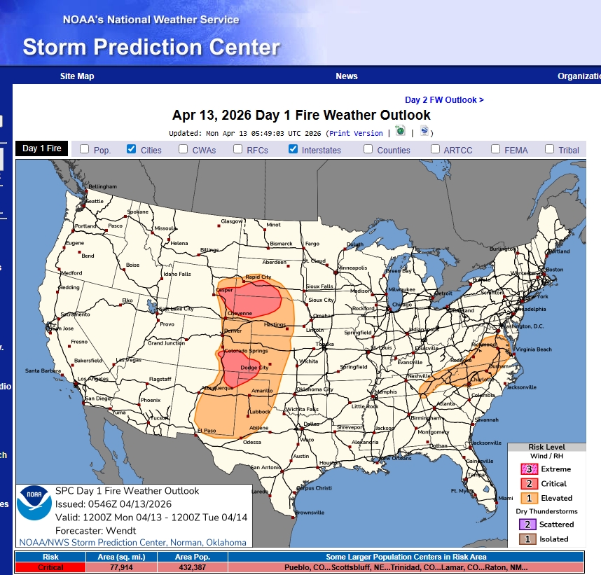
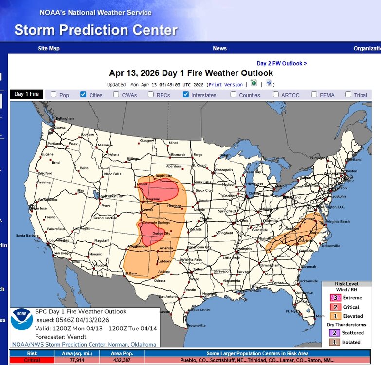
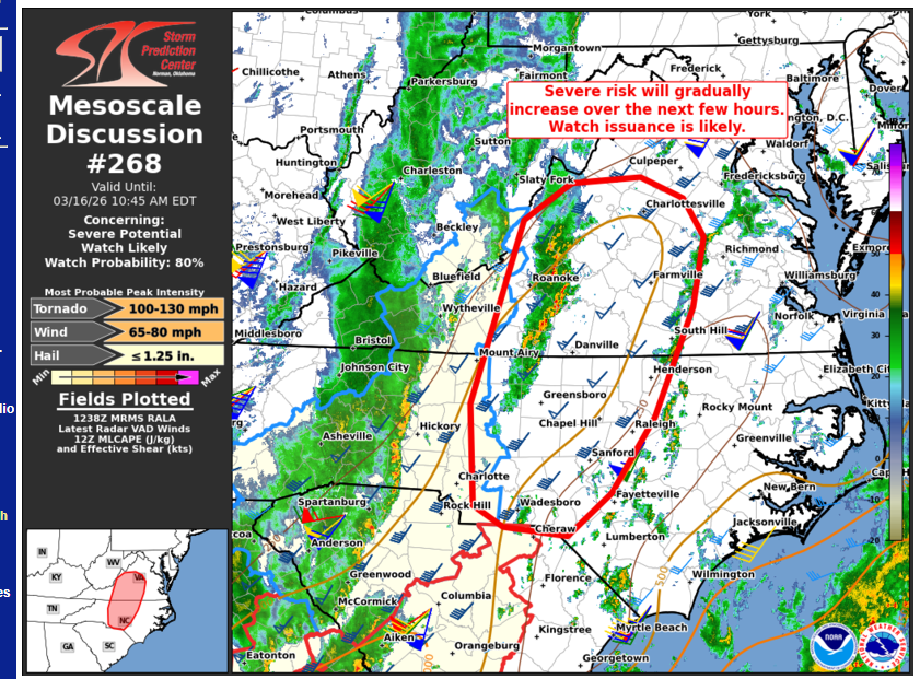
Pretty rare to see to see 3 categories "high."
-
A remnant QLCS is emerging east of the Appalachians, where it is showing some early signs of re-intensification. Farther east, a disorganized band of thunderstorms is also evolving over parts of western VA into NC. While overall convective evolution is not clear, these storms will continue spreading eastward into a destabilizing air mass (around 500-1000 J/kg MLCAPE). Despite the somewhat limited buoyancy, strong low/deep-layer shear characterized by clockwise-curved low-level hodographs (see GSO 12Z sounding) will favor a mix of organized line segments and supercells, with a risk of damaging wind gusts and a few tornadoes (some potentially strong). A watch issuance is likely for this activity.
-
-
Some sun trying to poke out in Winston Salem after first line moved thru. But still rather thick clouds.
-
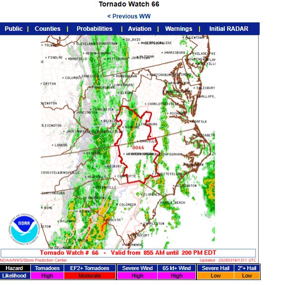
Storm Prediction Center Mar 16, 2026 1300 UTC Day 1 Convective Outlook -----issued 8:32 EDT SUMMARY.. Fast moving thunderstorms may become widespread and accompanied by the risk for damaging wind gusts and a few tornadoes across the Mid Atlantic today. There is potential that a couple of storms could become capable of producing strong and long track tornadoes. ...Southeast States... An intense upper trough continues to deepen over the Mid MS Valley, with its associated surface cold front surging eastward across the Appalachians and into the Carolinas/Mid-Atlantic. An active line of thunderstorms is accompanying the front from GA into western SC/NC/VA. Low-level winds are very strong along and ahead of these storms, encouraging the risk of numerous severe wind gusts and embedded QLCS tornadoes along the line. Clusters of thunderstorms have been developing ahead of the line as well, in a moist and strongly sheared environment. These storms will also pose a severe/tornado risk through the day as the primary large-scale ascent arrives.
-
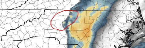
Power outage maps are not too bad at moment in states to our west and southwest, not sure this will hold in NC and other states to our north once the system moves east and all rounds of storms move thru. Georgia at moment has the highest at about 1% total customers.
-
-
Pretty big numbers for sure. One model NAM 3K, but this brings attention here in the Triad area.
-
Crazy weather. Snow on the Newfound GAP webcam and 33 F.