

ChangeYourScreenname
-
Posts
116 -
Joined
-
Last visited
Content Type
Profiles
Blogs
Forums
American Weather
Media Demo
Store
Gallery
Posts posted by ChangeYourScreenname
-
-
Oranges forming.
.gif.cbd67abf4f228e5f78251d0321d17837.gif)
-
Little higher beam look. Stuff west is no joke probably 2+ hour
.gif.bfac3180a7cee973091a2fbe8a3e1f23.gif)
-
 1
1
-
-
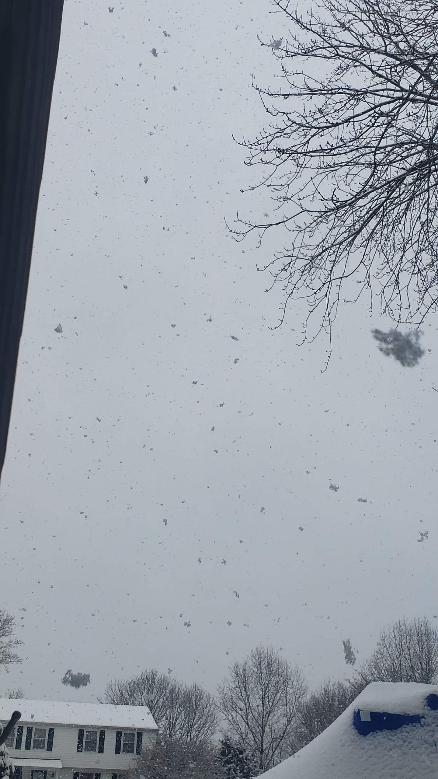
Definitely some heavy bands forming west of Baltimore
.gif.819034f8729b2c013fc7ac79468e2f1d.gif)
-
Just now, showmethesnow said:
Just shows how clueless he is that he couldn't understand the complexities of the setup.
Trololololol
-
Area Forecast Discussion
National Weather Service Baltimore MD/Washington DC
516 PM EST Mon Feb 11 2019

.SYNOPSIS...
Low pressure will pass to the northwest tonight and Tuesday.
High pressure will return for the middle portion of the week.

&&

.NEAR TERM /THROUGH TUESDAY/...
515 PM update: Added the central Virginia Blue Ridge to the
Winter Storm Warning. Also expanded the advisory through the
Baltimore area and into the northwest suburbs of Washington DC.
This is all due to expected freezing rain. In addition, a small
area of 5 to 8 inches of snow and sleet is likely north of
Interstate 70 in northern Maryland (mainly right along the
Pennsylvania border), when including snow from last night and
this morning.
-
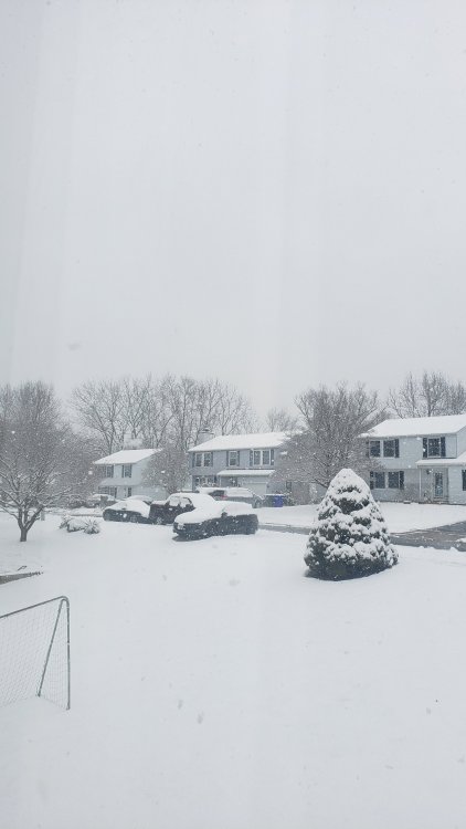
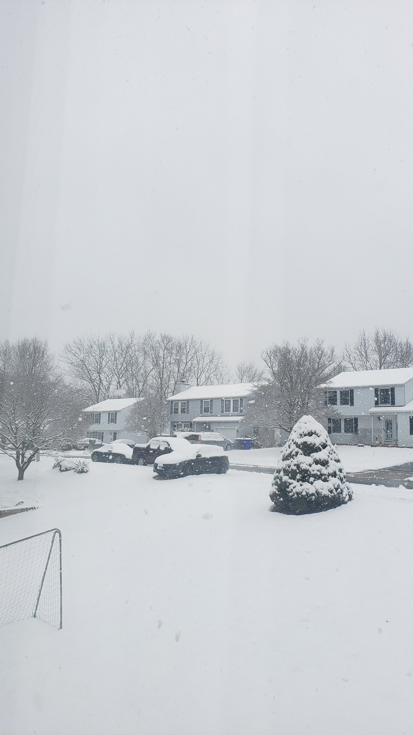
As the sun goes down roads are completely covered again. Gonna be a bad night to be out.
Area Forecast Discussion
National Weather Service Baltimore MD/Washington DC
516 PM EST Mon Feb 11 2019

.SYNOPSIS...
Low pressure will pass to the northwest tonight and Tuesday.
High pressure will return for the middle portion of the week.

&&

.NEAR TERM /THROUGH TUESDAY/...
515 PM update: Added the central Virginia Blue Ridge to the
Winter Storm Warning. Also expanded the advisory through the
Baltimore area and into the northwest suburbs of Washington DC.
This is all due to expected freezing rain. In addition, a small
area of 5 to 8 inches of snow and sleet is likely north of
Interstate 70 in northern Maryland (mainly right along the
Pennsylvania border), when including snow from last night and
this morning.
-
18 minutes ago, T. August said:
^ is that “local official” slantsticking the grass. Seems high
Is it still snowing in hdg?
-
10 minutes ago, T. August said:
^ is that “local official” slantsticking the grass. Seems high
No it's definitely 5-5.5 up here
-
000 NWUS51 KLWX 112149 LSRLWX PRELIMINARY LOCAL STORM REPORT NATIONAL WEATHER SERVICE BALTIMORE MD/WASHINGTON DC 448 PM EST MON FEB 11 2019 ..TIME... ...EVENT... ...CITY LOCATION... ...LAT.LON... ..DATE... ....MAG.... ..COUNTY LOCATION..ST.. ...SOURCE.... ..REMARKS.. 0436 PM SNOW BEL AIR 39.53N 76.35W 02/11/2019 M5.3 INCH HARFORD MD LOCAL OFFICIAL && EVENT NUMBER LWX1902272 $$ JMG -
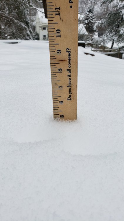
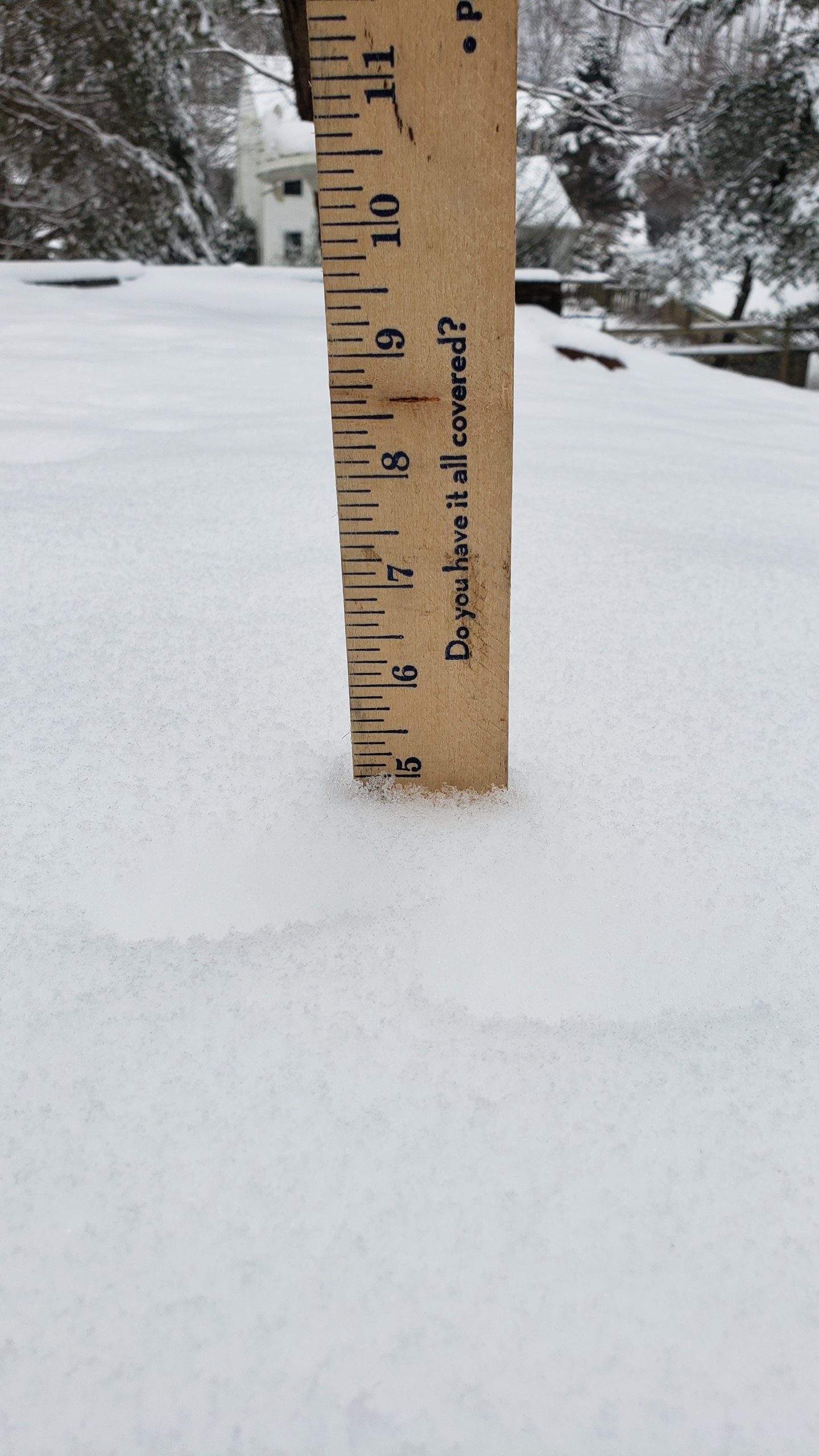
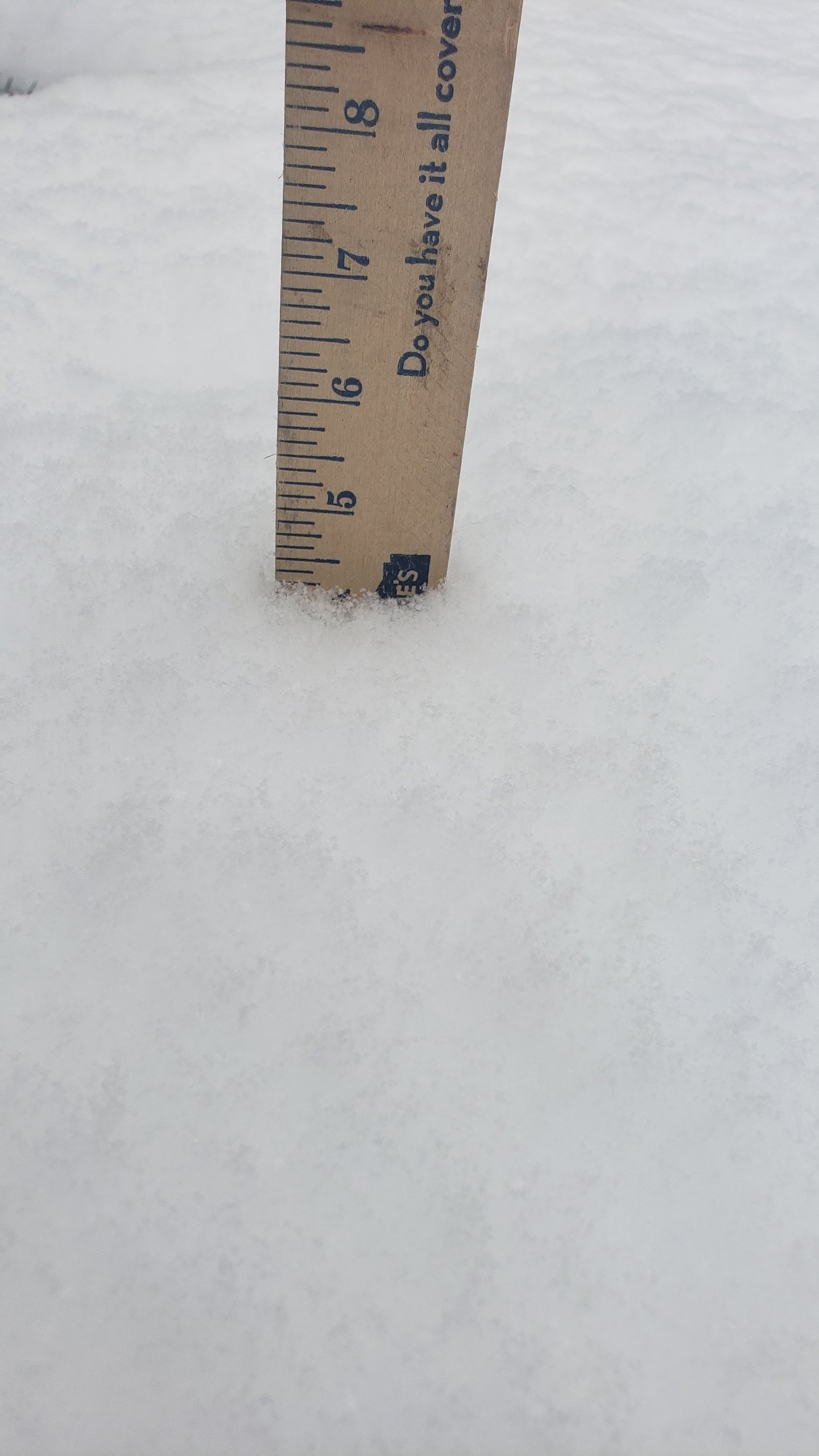
Everyone has a different total but here's my on the board total including compaction. Actual total is around 5.7 if these events were parted.
Coming down good still
No wsw
Nws calling for 1-2
-
1
-
-
I wish I knew what they are doing
Total snow 2 inches ? Horrible
Winter Weather Advisory
URGENT - WINTER WEATHER MESSAGE
National Weather Service Baltimore MD/Washington DC
221 PM EST Mon Feb 11 2019

MDZ003>006-507-120330-
/O.CON.KLWX.WW.Y.0010.000000T0000Z-190212T1500Z/
Washington-Frederick MD-Carroll-Northern Baltimore-
Northwest Harford-
221 PM EST Mon Feb 11 2019

...WINTER WEATHER ADVISORY REMAINS IN EFFECT UNTIL 10 AM EST
TUESDAY...

* WHAT...Snow, sleet and freezing rain expected. Total snow and
  sleet accumulations of up to two inches today. Ice
  accumulations of one to two tenths of an inch possible tonight.

* WHERE...Northern Baltimore, Carroll, Frederick MD, Washington
  and Northwest Harford Counties.

* WHEN...Until 10 AM EST Tuesday.

* ADDITIONAL DETAILS...Plan on slippery road conditions. The
  hazardous conditions will impact the evening and morning
  commute.


PRECAUTIONARY/PREPAREDNESS ACTIONS...

A Winter Weather Advisory means that periods of snow, sleet or
freezing rain will cause travel difficulties. Expect slippery
roads and limited visibilities, and use caution while driving.

When venturing outside, watch your first few steps taken on
steps, sidewalks, and driveways, which could be icy and slippery,
increasing your risk of a fall.

The latest road conditions for the state you are calling from can
be obtained by calling 5 1 1.

&&

$$

HTS
-
Heavier returns forming again
-
1
-
-
2 minutes ago, lpaschall said:
Still snowing in Westminster but does not seem to be sticking to surface. You can see where my truck was parked in driveway four hours ago. Temps steady at 30
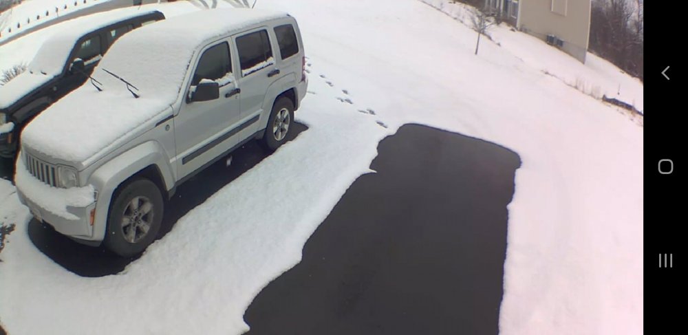
Sun angle is getting higher so blacktop will melt during the day
-
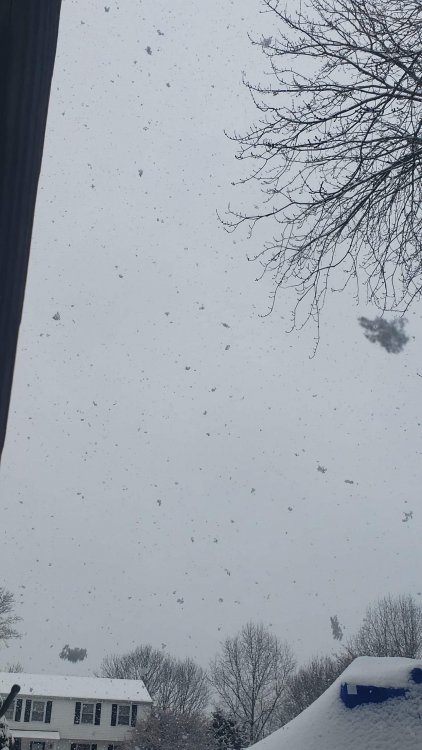
4.7 flake size has shrunk pretty decently. This is the modeled break before round 2 later
-
-
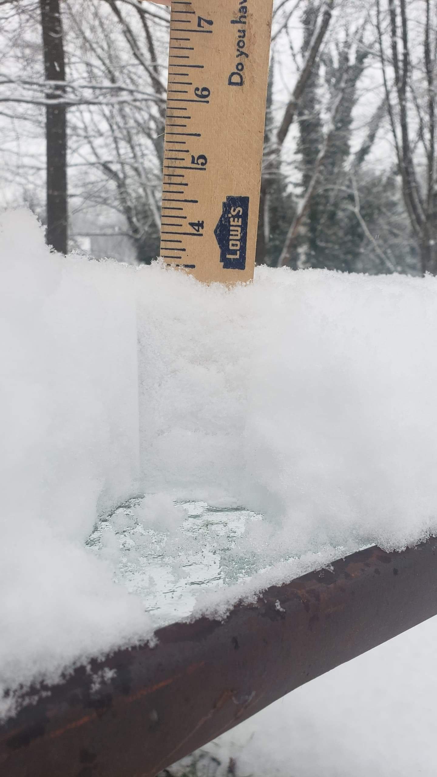
2 minutes ago, T. August said:
4.2” at 1123, just shy of 1”/hr
Make sure you report it to lwx! 4.5 here very much on tap to crack 5 soon
-
 2
2
-
-
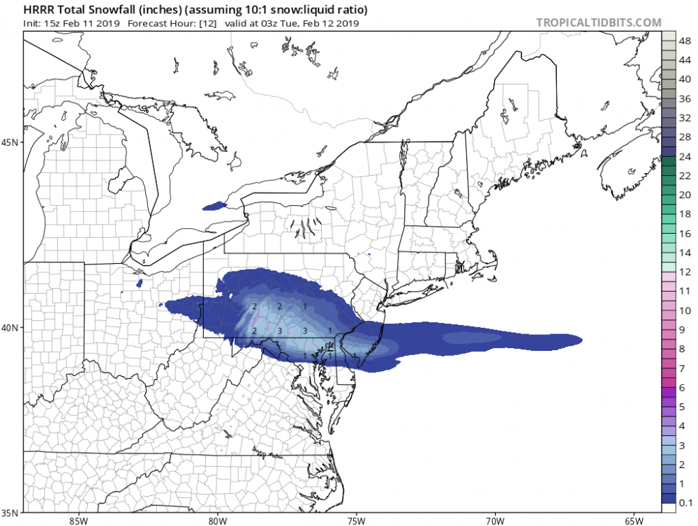
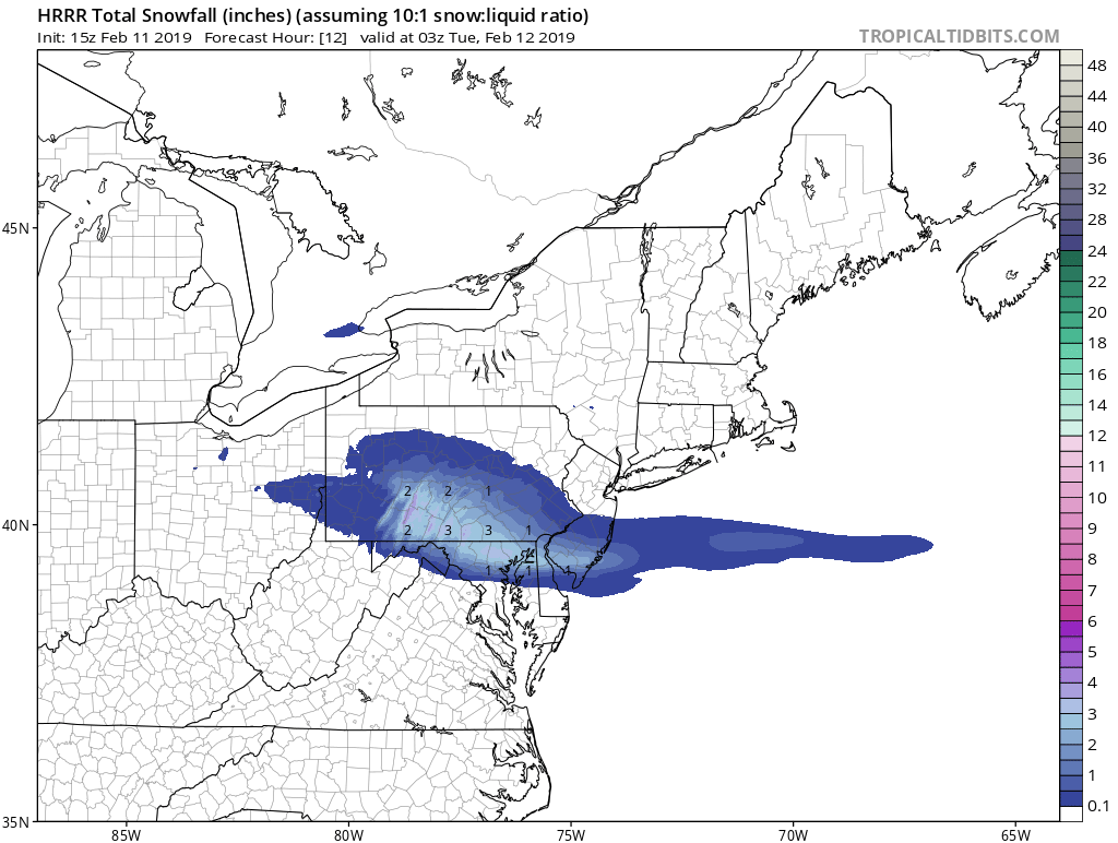
Hrrr says another 3-4 that would give me 7-8 in under 24 hours. Definitely wsw criteria. Nam actually is nailing this one up here pretty close
-
1 minute ago, T. August said:
That’s in addition to what’s fallen. Doesn’t look that unrealistic imo.
It was 1 inch a hour ago though pretty massive catch up
-
1
-
-
1 minute ago, WxUSAF said:
Seems like a significant risk of a missed WSWarning for the northern zones.
This is there latest update. Pretty dead wrong
.thumb.png.15f47bb701bc97540639705ca020884d.png)
-
Just now, WxUSAF said:
Seems like a significant risk of a missed WSWarning for the northern zones.
Over 4 here now agreed 5+ easy at this point
-
Big big flakes. Fyi rates are .75 to 1 per hour right now per cleared board
-
1
-
-
Bel air north

-
1
-
-
Big big flakes
-
3
-
-
3 minutes ago, T. August said:
Does lwx not take public snow reports anymore? All I see on the reported totals are
I usually use email

.png.14a5f77bbc3d8b65382e9e8f1a4066ad.png)
2/19-20 Winter Storm Observations
in Mid Atlantic
Posted
Wholly sh**