

ChangeYourScreenname
-
Posts
116 -
Joined
-
Last visited
Content Type
Profiles
Blogs
Forums
American Weather
Media Demo
Store
Gallery
Posts posted by ChangeYourScreenname
-
-
Just drove down to Essex temp was 37 in bel air and its 43 here. Amazing what a little elevation does.
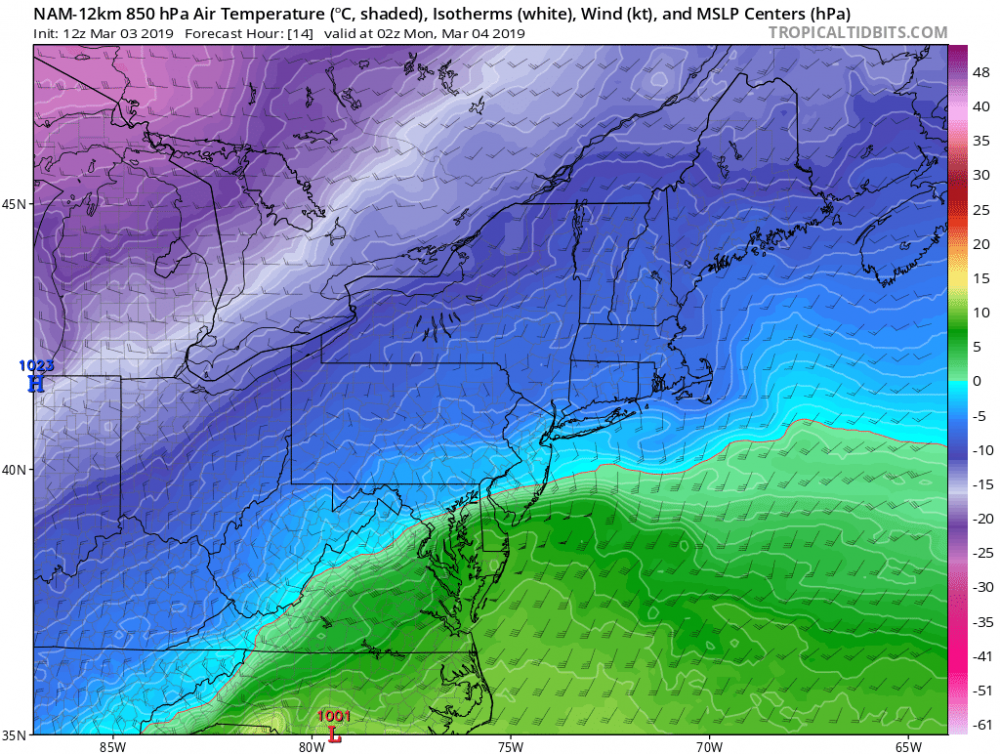
One thing the HRRR-NAM is too warm already up here
-
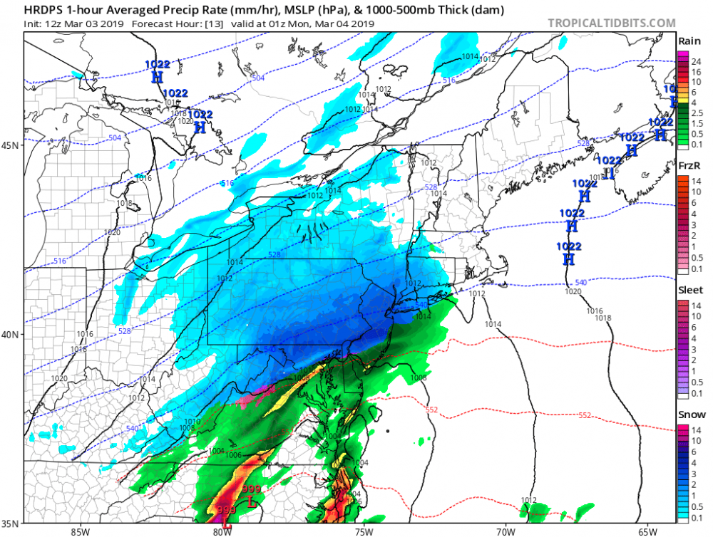
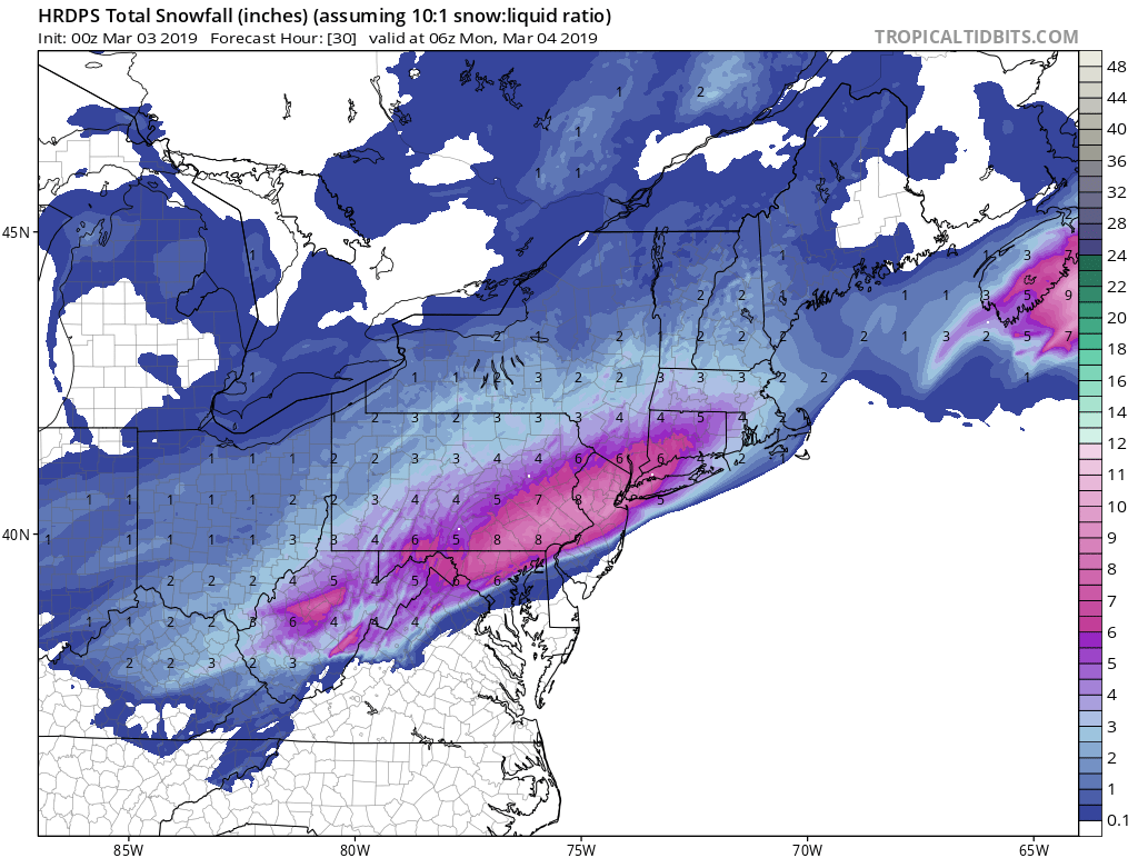
Hrdps
Much better at the surface 32-33 heavy snow does the work
-
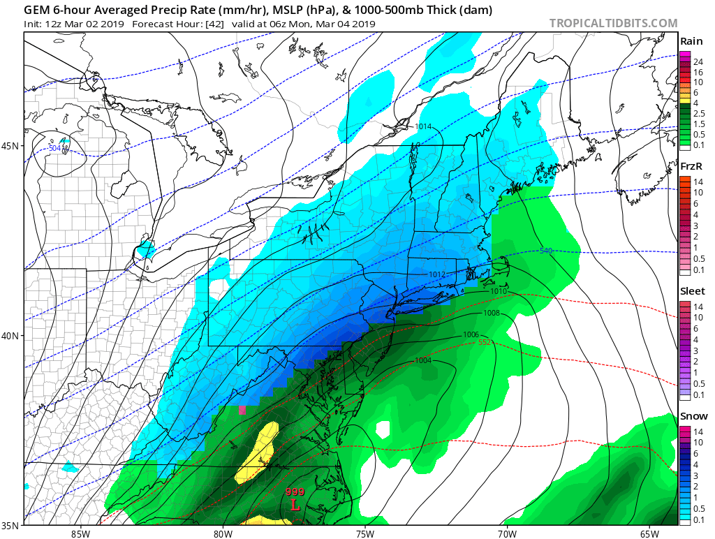
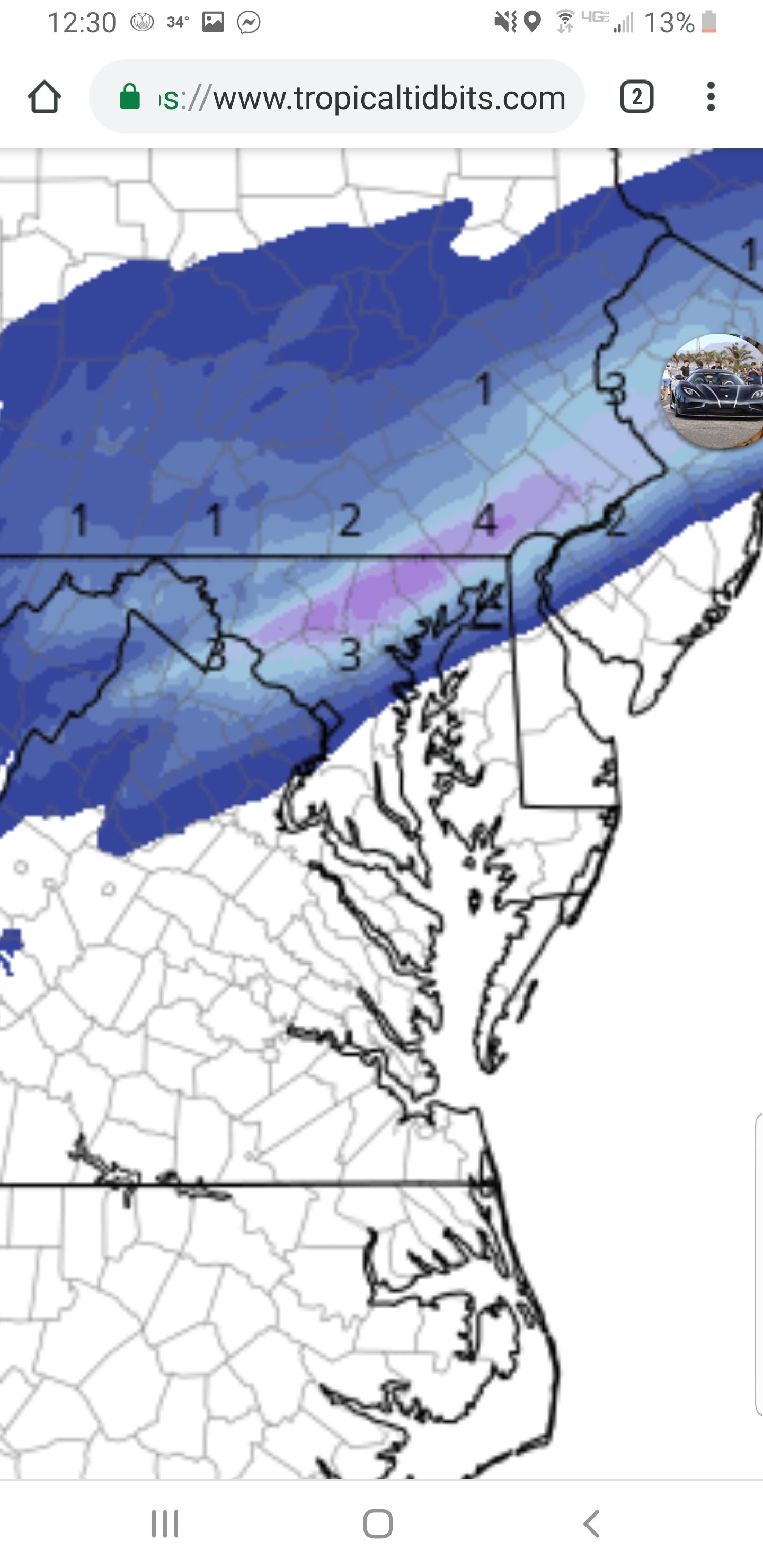
The biggest question at this point is how much temps can fall under the very heavy rates projected. GFS and NAM warm everyone to near 36-40. Dynamic cooling should be decent. That's TBD yet
37 here in bel air dew point is in the 20s tho
-
Snowing pretty good in parkton https://chart.maryland.gov/video/video.php?feed=01000de0003700b2004be2369e235daa
-
Nam has a super super small warm layer that tires to sneak into NMD but with the precip rates at this time that should overcome that.

-
Nam is definitely colder finally
-
 2
2
-
-
-
-
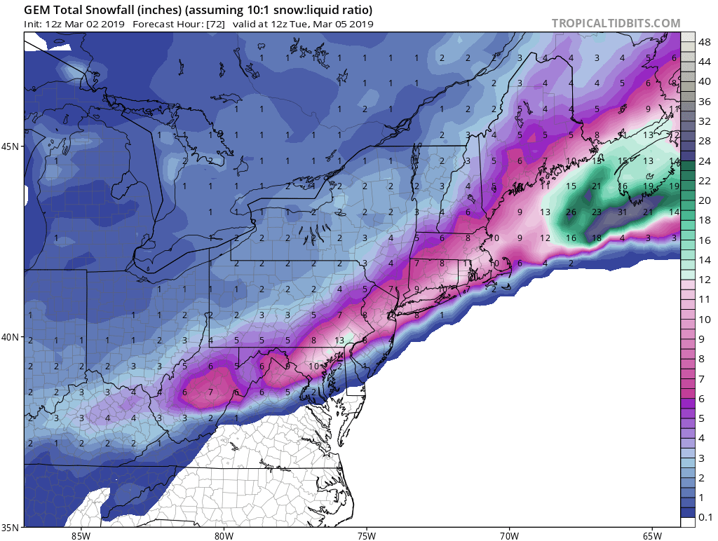
Looks like this will be the best GFS run yet for the northern tier
-
Winter Weather Advisory
URGENT - WINTER WEATHER MESSAGE
National Weather Service Baltimore MD/Washington DC
155 PM EST Sat Mar 2 2019

MDZ504-506-VAZ506-030300-
/O.NEW.KLWX.WW.Y.0019.190303T1700Z-190304T0900Z/
Central and Southeast Montgomery-Central and Southeast Howard-
Eastern Loudoun-
155 PM EST Sat Mar 2 2019

...WINTER WEATHER ADVISORY IN EFFECT FROM NOON SUNDAY TO 4 AM EST
MONDAY...

* WHAT...1 to 3 inches of snow and sleet expected.

* WHERE...In Maryland, Central and Southeast Montgomery and
  Central and Southeast Howard Counties. In Virginia, Eastern
  Loudoun County.

* WHEN...From noon Sunday to 4 AM EST Monday.

* ADDITIONAL DETAILS...Plan on slippery road conditions. The
  steadiest precipitation is expected Sunday afternoon and
  evening.

PRECAUTIONARY/PREPAREDNESS ACTIONS...

A Winter Weather Advisory means periods of wintry precipitation
will cause primarily travel difficulties. Expect slippery roads
and limited visibilities, and use caution while driving.

When venturing outside, watch your first few steps taken on
steps, sidewalks, and driveways, which could be icy and slippery,
increasing your risk of a fall and injury.

&&

$$
-
Winter Storm Warning
URGENT - WINTER WEATHER MESSAGE
National Weather Service Baltimore MD/Washington DC
155 PM EST Sat Mar 2 2019

MDZ003>005-VAZ505-WVZ052-053-030300-
/O.UPG.KLWX.WS.A.0006.190303T1200Z-190304T1200Z/
/O.NEW.KLWX.WS.W.0007.190303T1700Z-190304T0900Z/
Washington-Frederick MD-Carroll-Western Loudoun-Berkeley-
Jefferson-
155 PM EST Sat Mar 2 2019

...WINTER STORM WARNING IN EFFECT FROM NOON SUNDAY TO 4 AM EST
MONDAY...

* WHAT...4 to 8 inches of snow expected.

* WHERE...Portions of north central Maryland, northern Virginia
  and the eastern panhandle of West Virginia.

* WHEN...From noon Sunday to 4 AM EST Monday.

* ADDITIONAL DETAILS...Travel could be very difficult. The
  steadiest snow is expected Sunday afternoon and evening.

PRECAUTIONARY/PREPAREDNESS ACTIONS...

A Winter Storm Warning for snow means severe winter weather
conditions will make travel very hazardous or impossible. If you
must travel, keep an extra flashlight, food and water in your
vehicle in case of an emergency.

When venturing outside, watch your first few steps taken on
steps, sidewalks, and driveways, which could be icy and slippery,
increasing your risk of a fall and injury.

&&

$$
-
Winter Storm Warning
URGENT - WINTER WEATHER MESSAGE
National Weather Service Baltimore MD/Washington DC
155 PM EST Sat Mar 2 2019

MDZ006-507-030300-
/O.UPG.KLWX.WS.A.0006.190303T1200Z-190304T1200Z/
/O.NEW.KLWX.WS.W.0007.190303T1900Z-190304T0900Z/
Northern Baltimore-Northwest Harford-
155 PM EST Sat Mar 2 2019

...WINTER STORM WARNING IN EFFECT FROM 2 PM SUNDAY TO 4 AM EST
MONDAY...

* WHAT...4 to 6 inches of snow expected.

* WHERE...Northern Baltimore and Northwest Harford Counties.

* WHEN...From 2 PM Sunday to 4 AM EST Monday.

* ADDITIONAL DETAILS...Travel could be very difficult. The
  steadiest snow is expected late Sunday afternoon and evening.

PRECAUTIONARY/PREPAREDNESS ACTIONS...

A Winter Storm Warning for snow means severe winter weather
conditions will make travel very hazardous or impossible. If you
must travel, keep an extra flashlight, food and water in your
vehicle in case of an emergency.

When venturing outside, watch your first few steps taken on
steps, sidewalks, and driveways, which could be icy and slippery,
increasing your risk of a fall and injury.

&&

$$
-
-
Euro kutchera Looks good for the northern tier
-
-
-
-
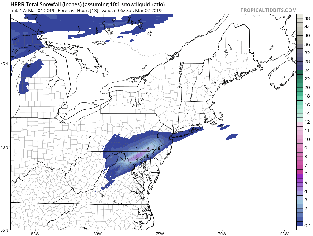
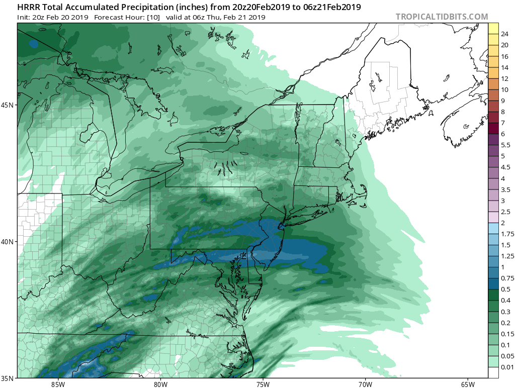
HRRR continues to improve.
-
2
-
-
Good test for the HRRR.
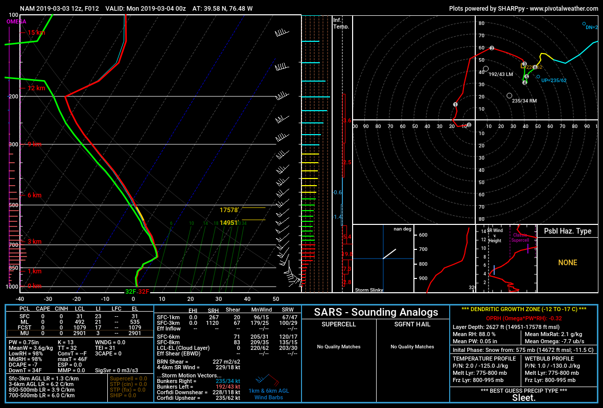
Shows dews in the upper 20s low 30s and temps near freezing the entire duration Soundings are snow soundings north of balt city but very close

-
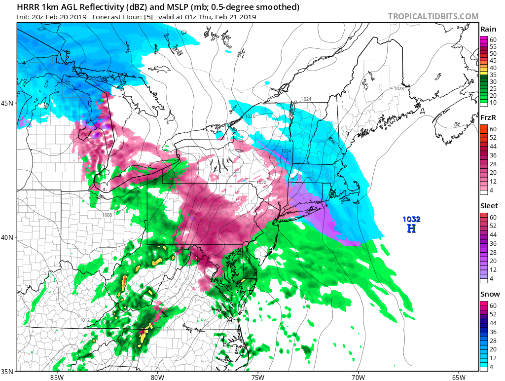
Hrrr is trending colder. It really looks like significant Ice later west of the 95 corridor.
90% of the total qpf is ice


-
1
-
-
Mega band moving into N-NE MD over 3.0 here in bel air really fluffy snow actually can use a broom.
.gif.0ab44142a516aa2d51f58d19b45705e7.gif)
-
Getting stronger as it lifts NE pretty intense
Snow here in bel air
.gif.0d7ff5510253c4d82b45598777773667.gif)
-
-
Pretty awesome
.gif.6f265c34c234383953d43118f0f51918.gif)


.png.32ccc1f5bc35e8418c38afa29fb8b4a0.png)


.gif.37bbbd781708ef3e4a5c09a0bf31b483.gif)
March 3-4, 2019 Snow Discussion and Obs
in Mid Atlantic
Posted
In regards to the HRRR its trending colder with dewpoints and temperature. Dynamic cooling is gonna do its thing later.