

ChangeYourScreenname
-
Posts
116 -
Joined
-
Last visited
Content Type
Profiles
Blogs
Forums
American Weather
Media Demo
Store
Gallery
Posts posted by ChangeYourScreenname
-
-
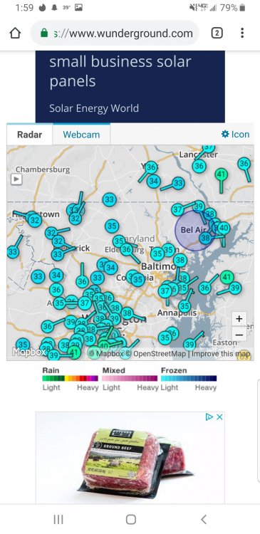
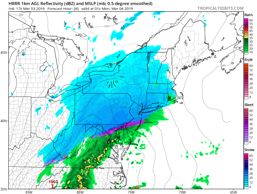
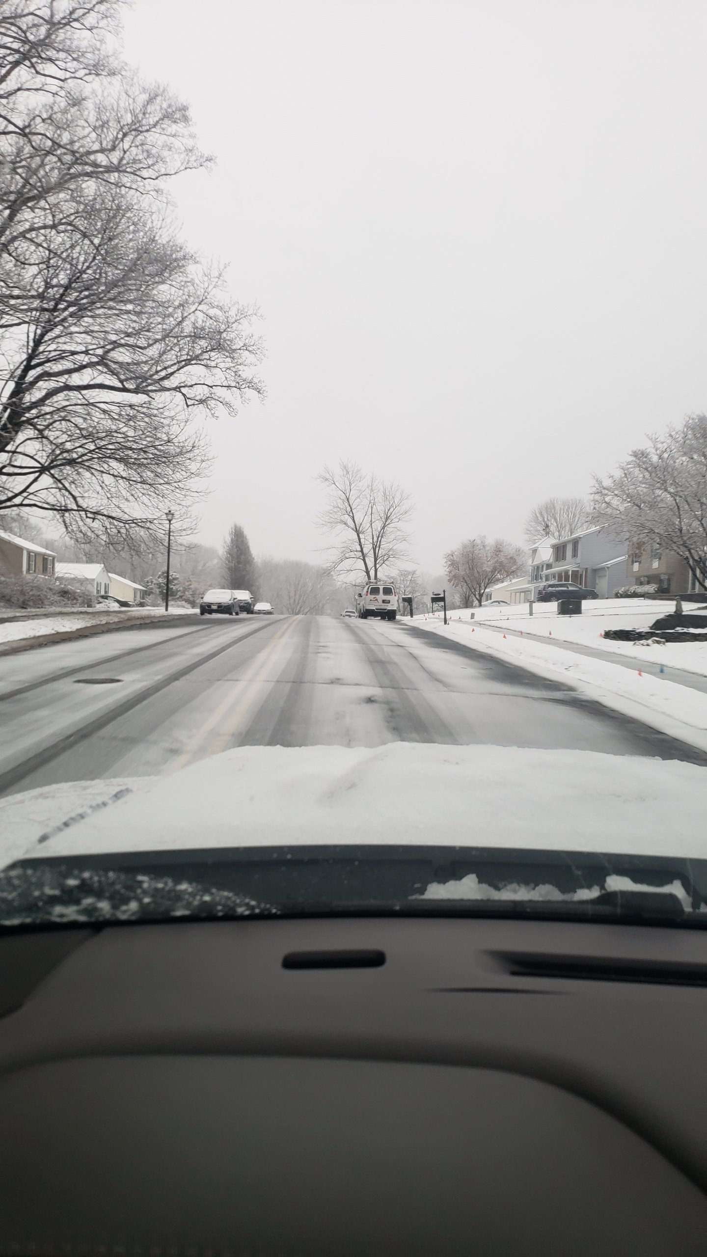
.NEAR TERM /UNTIL 6 AM MONDAY MORNING/...
Low pressure over the Carolinas will makes its way northeastward
off the Virginia coast tonight. Precipitation is tapering off
from west to east this evening, with the bulk of it aligned
along and east of the Blue Ridge. Warmer air aloft won out this
afternoon and evening with the rain/snow/sleet line shifting
further northward than projected, crossing into north central
Maryland and extreme northern Virginia. The 00z IAD upper air
sounding measured a warm nose between 800-850mb, with a max temp
of 3.4C at 825mb. The warmer air and northward shift of the mix
line resulted in lower snow totals. A cold rain has prevailed
to the south and east into the metros, as temperatures this
evening are in the low to mid 30s.
-
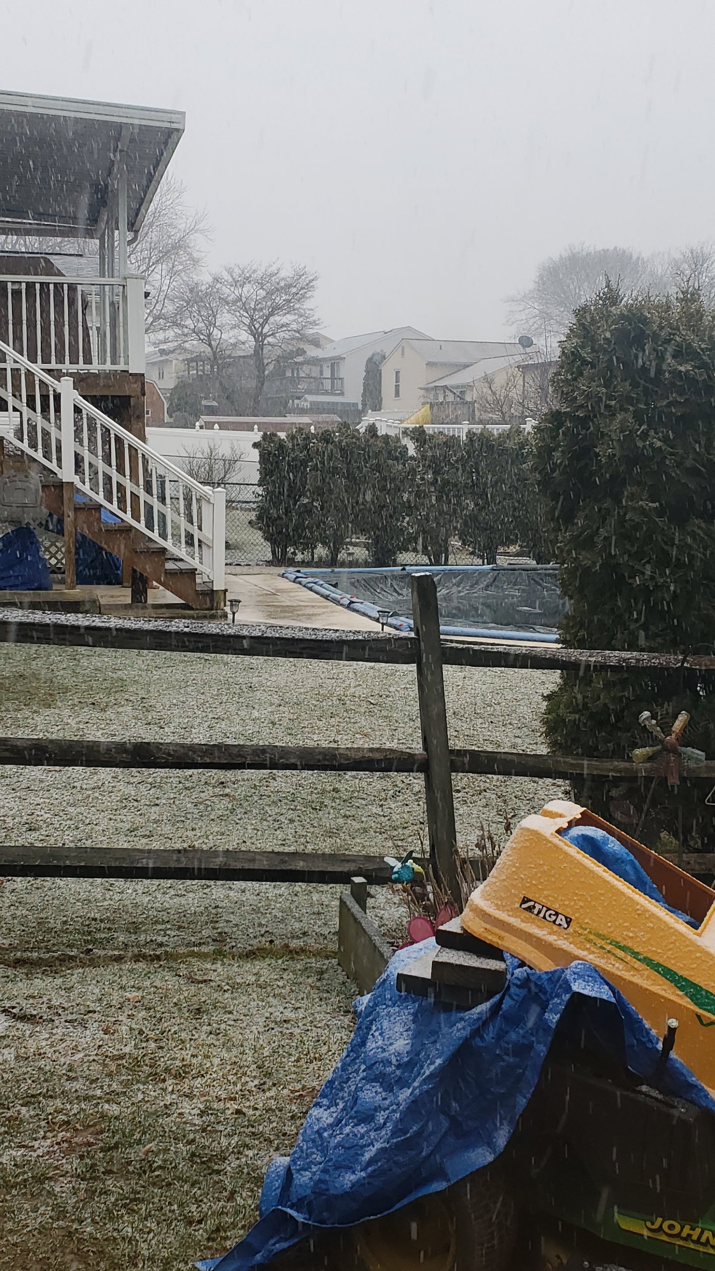
32 degrees and monsooning go figure
It is a icy mess out on the roads tho sleet-frz rain
-
Its dumping sleet right now lol 32.0
-
R/S line has pretty much stopped and has started advancing back south some
-
Well it went from snow sleet to rain and now back to sleet 32.0
-
Just now, ForestHillbilly said:
Interesting. Sleet / rain mixing in North of Bel Air in Forest Hill.
-
Sleet and snow in bel air now curious if the warm layer goes away
32
-
 1
1
-
-
Lwx lowered yet increased my warning lol. Go figure
Winter Storm Warning
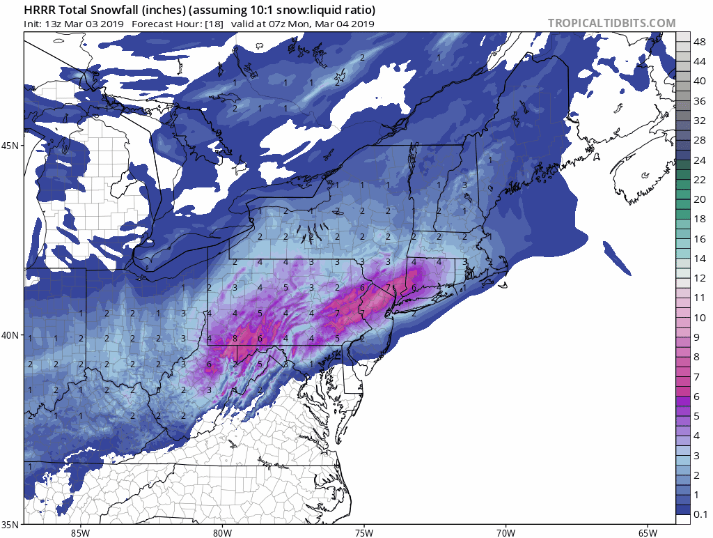
URGENT - WINTER WEATHER MESSAGE
National Weather Service Baltimore MD/Washington DC
508 PM EST Sun Mar 3 2019

MDZ006-507-040615-
/O.CON.KLWX.WS.W.0007.000000T0000Z-190304T0900Z/
Northern Baltimore-Northwest Harford-
508 PM EST Sun Mar 3 2019

...WINTER STORM WARNING REMAINS IN EFFECT UNTIL 4 AM EST MONDAY...

* WHAT...4 to 7 inches of snow expected. Snow may mix with sleet
  and rain at times this evening.

* WHERE...Northern Baltimore and Northwest Harford Counties.

* WHEN...Until 4 AM EST Monday. Snow will be heaviest between 5
  PM and 10 PM this afternoon and evening, with snowfall rates
  around one inch per hour expected. The snow may mix with sleet
  and rain at times.

* ADDITIONAL DETAILS...Travel will be very difficult due to snow
  covered and slippery roads.

PRECAUTIONARY/PREPAREDNESS ACTIONS...

A Winter Storm Warning for snow means severe winter weather
conditions will make travel very hazardous or impossible. If you
must travel, keep an extra flashlight, food and water in your
vehicle in case of an emergency.

When venturing outside, watch your first few steps taken on
steps, sidewalks, and driveways, which could be icy and slippery,
increasing your risk of a fall and injury.

&&

$$
-
-
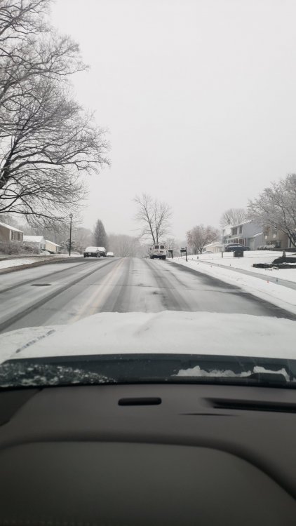
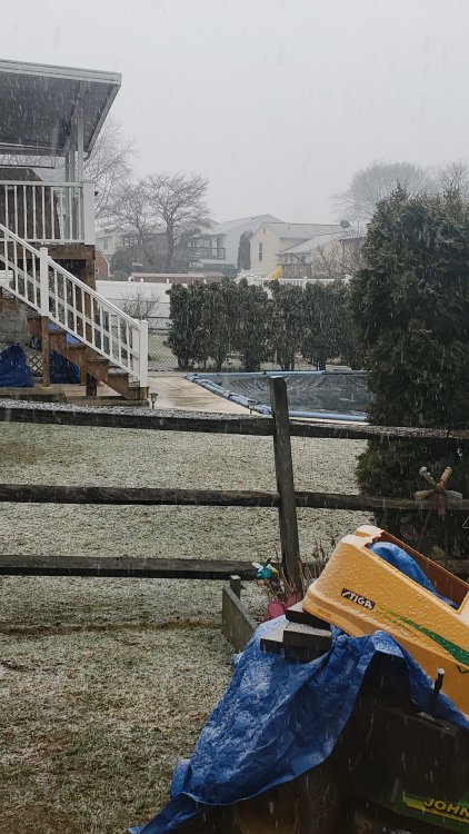
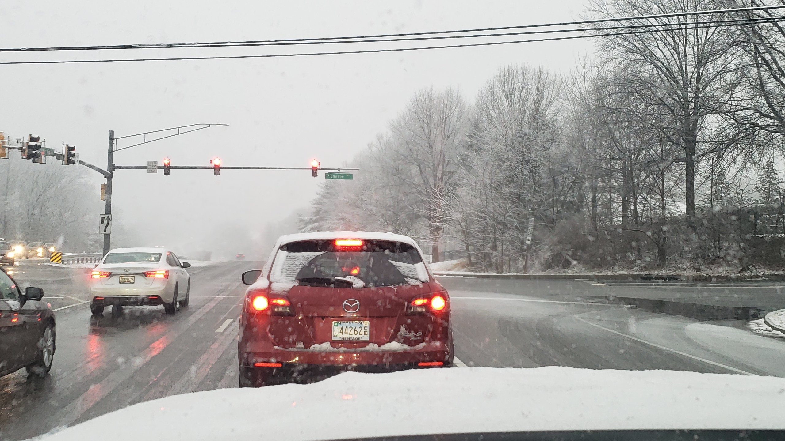
Roads caved

-
2
-
-
-
It's really dumping here in bel air roads are caving
-
Headed back up soon definitely over a inch in bel air.
-
2
-
-
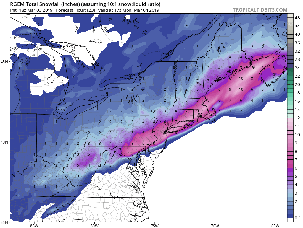
Rgem never turns NE or NMD to sleet all snow and it actually increased from 12z

-
Improving big big time
-
2
-
 1
1
-
-
3 minutes ago, BaltimoreWxGuy said:
Wow. Extremely impressive. I think when most people say it won’t accumulate much they are talking about roads, pavement etc.
Sticking to the sidewalks ect. There is about 8 pages of sun angle and its gonna be to warm bs. I'm not even home this is middle river
-
All the people saying it wont accumulate......
-
2
-
-
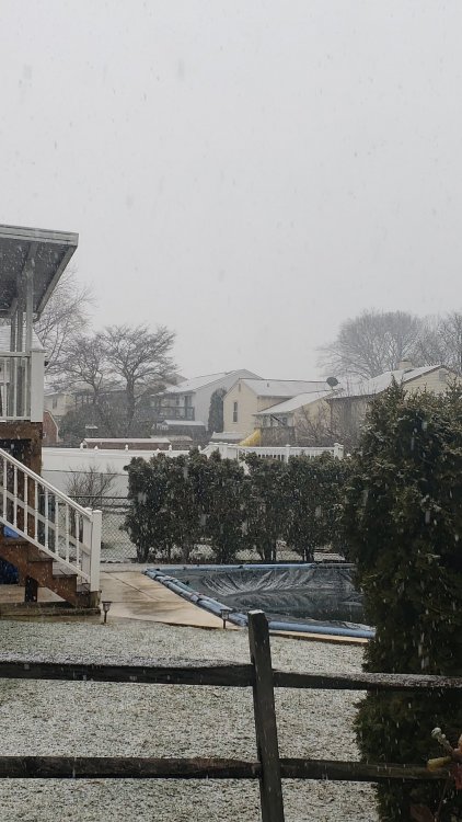
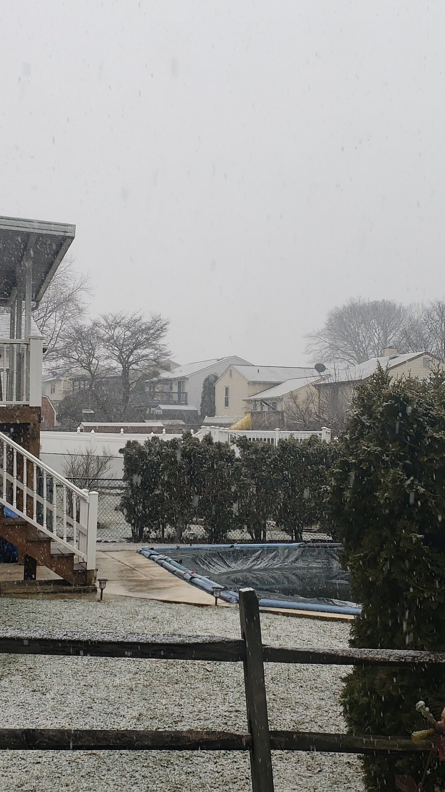
Snow is accumulating even here in middle river roofs and grass are white
-
1
-
-
It's coming down now for sure once the sun goes down this will pile up.
-
1
-
-
Nice band setting up in nmd
.gif.f42f200b546b6f68ff5627a5f48f30be.gif)
-
The temp falls area wide are pretty impressive honestly 5-9 degree fall in one hour
-
Temps responding very quick down to 35.4 in bel air from 39
-
Keep on heading south
-
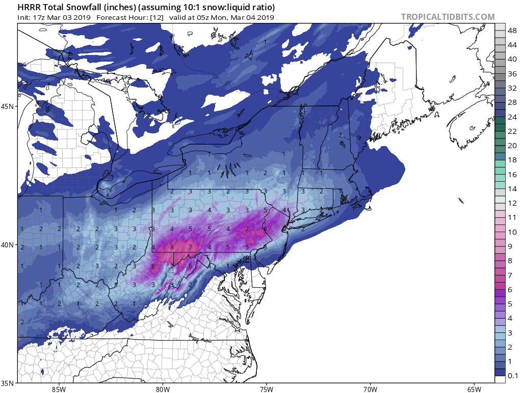
Hrrr is finally catching on to the heavy rates later. Continually getting colder and colder
.png.c3e0263a8c45c9a0977a8e113fecb6e7.png)


March Banter 2019
in Mid Atlantic
Posted
#buildthewall
Last I checked it's a free country and building a wall isn't political it's common fuxking sense.
And btw it's free speech something that liberals dont believe in unless it's okay for them and them only. Hence the label snowflakes.
Wanna change my screen name go ahead and change it to #dontbeabitch
It's pretty crazy to change someone's screen name because you dont like it but welcome to 2019. Its political if you make it political