Gosnow
-
Posts
44 -
Joined
-
Last visited
About Gosnow

-
Central PA - Winter 2020/2021 Part 2
Gosnow replied to MAG5035's topic in Upstate New York/Pennsylvania
Crop it or reduce the resolution of your photo. Yeah the limit is 1.95 mb. -
Central PA - Winter 2020/2021 Part 2
Gosnow replied to MAG5035's topic in Upstate New York/Pennsylvania
Ty Millville for putting in the extra effort for us back here. Always loved reading your thoughts on what was happening. I hope you end up in one of your choices for forecast area. -
Central PA - Jan 31 to Feb 2 Winter Storm
Gosnow replied to MAG5035's topic in Upstate New York/Pennsylvania
Light snow in Lititz. The storm that keeps on giving. -
Central PA - Jan 31 to Feb 2 Winter Storm
Gosnow replied to MAG5035's topic in Upstate New York/Pennsylvania
Beautiful snowy day in Lititz. Keep it coming.
-
Central PA - Jan 31 to Feb 2 Winter Storm
Gosnow replied to MAG5035's topic in Upstate New York/Pennsylvania
Quick question? Lancaster showing wintry mix keeping down amounts. Do the thermals support that? Also with the globals showing high amounts in lsv nws seems to believe the lower values from other models. Is it better to be conservative from their pt of view when there is a difference? Thanks in advance for any replies. -
Central PA - Jan 31 to Feb 2 Winter Storm
Gosnow replied to MAG5035's topic in Upstate New York/Pennsylvania
I'll buy that for a dollar! -
Central PA - Jan 31 to Feb 2 Winter Storm
Gosnow replied to MAG5035's topic in Upstate New York/Pennsylvania
17 inches snow 1.3 inch precip -
Wet here with what looks like some melting sleet on the deck. No snow that I saw, but as others have said, it could have been overnight when the 25 or so flakes fell.
-
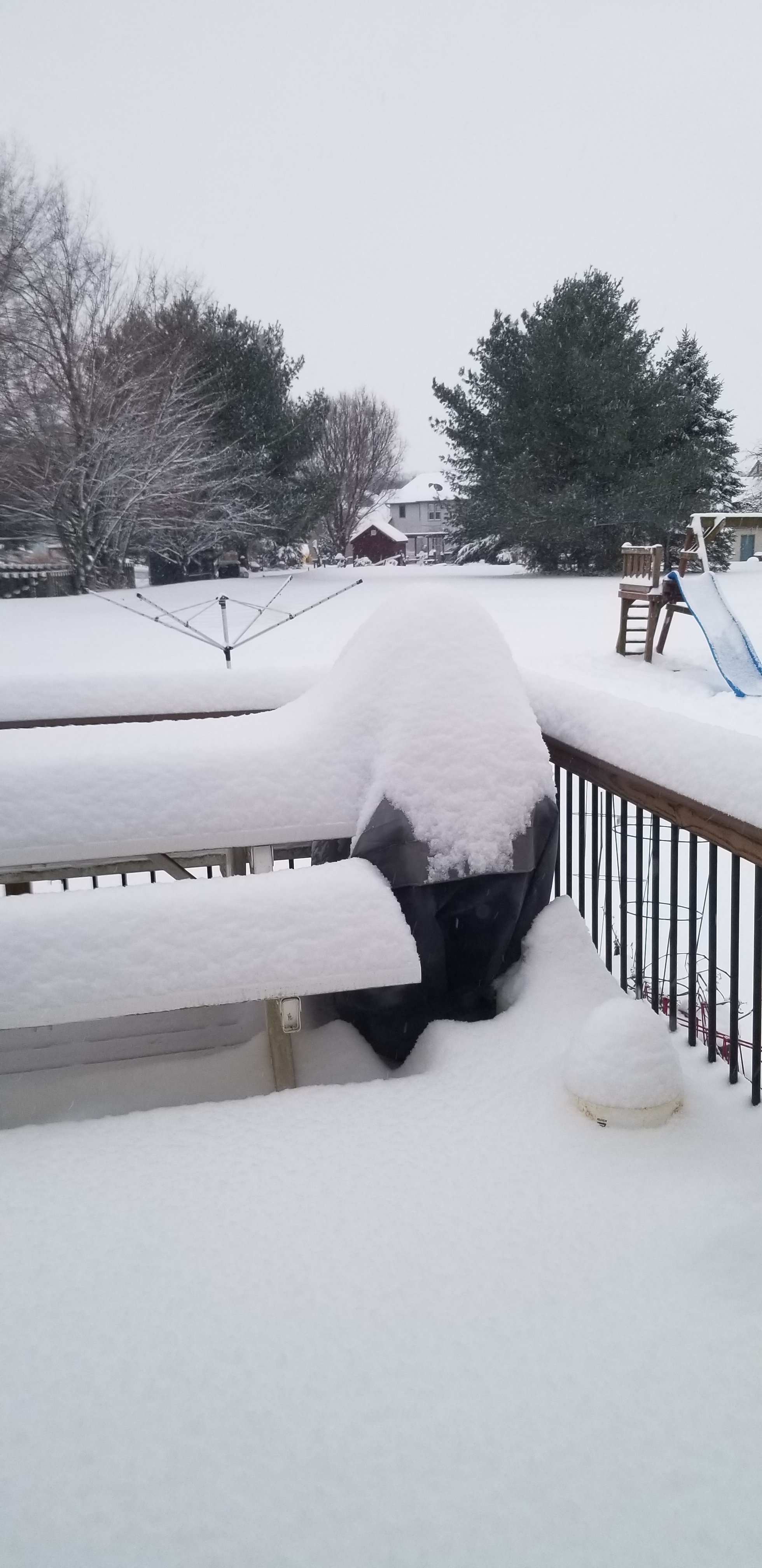
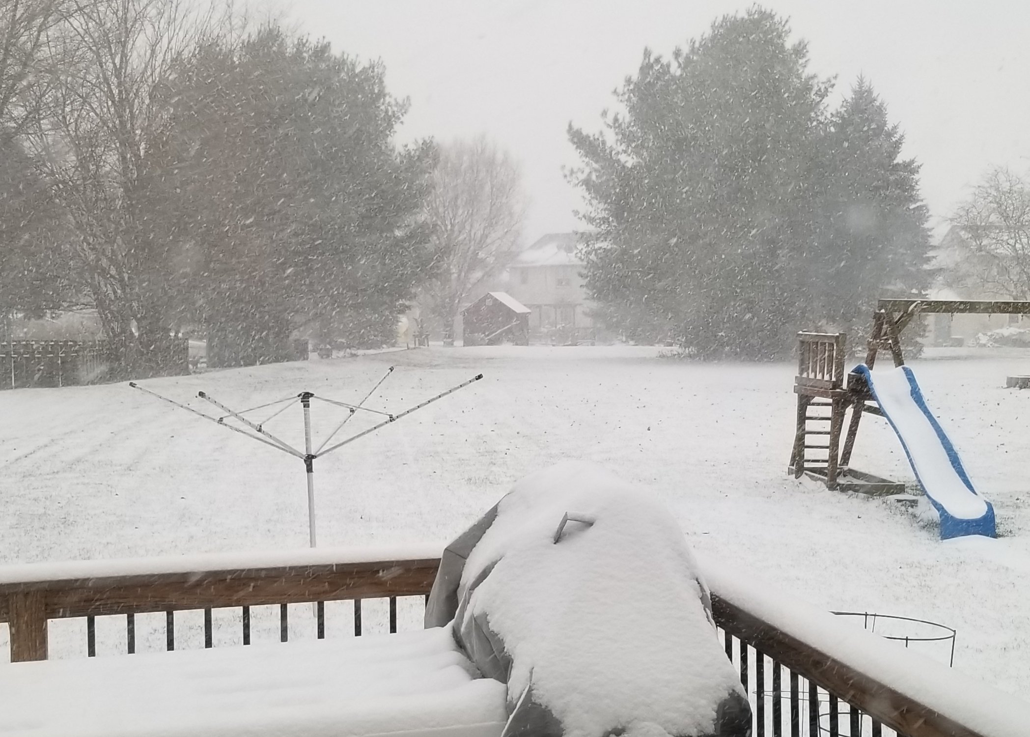
1/27 what could go wrong.
-
December 16 2020 CTP Snowstorm Disco and Obs
Gosnow replied to pasnownut's topic in Upstate New York/Pennsylvania
Heavy snow lititz northern lanco. No mix i see. Beautiful sight.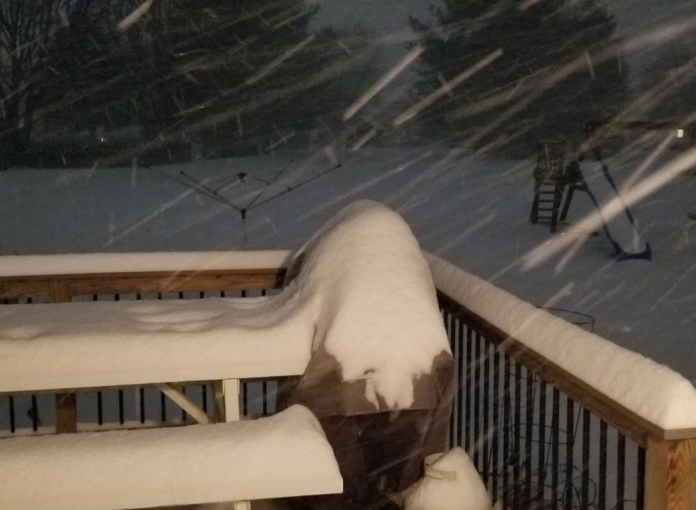
-
December 16 2020 CTP Snowstorm Disco and Obs
Gosnow replied to pasnownut's topic in Upstate New York/Pennsylvania
From lititz in northern lanco.
-
December 16 2020 CTP Snowstorm Disco and Obs
Gosnow replied to pasnownut's topic in Upstate New York/Pennsylvania
This is what in Lanco we call our wishful thinking..... after many beverages of choice. -
Just wanted to say: Here on the forum we wait for snow, For all of us it makes us glow. Which is what was needed during this year, To bring us all some laughs and cheer. And while not certain of how much we get, All of us hope white and tons of it. But I really think what is so much fun, Is sharing the love of snow on here with everyone. So enjoy it and let it bring you cheer, Along with all your special beverages I hear. And when this snowstorm is finally done, Let us look forward to tracking the next one. Enjoy all!!!!!!
-
I think i saw someone wanting thundersnow? From state college afternoon discussion. This target area will see a one-two (maybe even three) punch of warm advection heavy snow later Wednesday afternoon and evening, followed by a period of peak CSI-banded heavy snow with the potential for Thunder snow later Wed Evening through a few hours after midnight as the nose of a strong 50-60 kt easterly 850 mb jet and 130 kt upper jet focuses hefty uvvel and slantwise instability near and just to the NW of I-81.
-
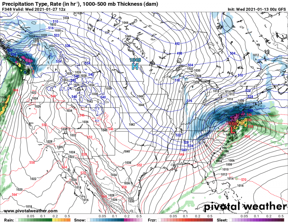
I like the expansion of greens throughout PA.