
fluoronium
-
Posts
205 -
Joined
-
Last visited
Content Type
Profiles
Blogs
Forums
American Weather
Media Demo
Store
Gallery
Posts posted by fluoronium
-
-
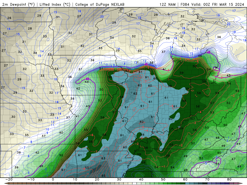
Yeah it's the 84hr NAM, but GFS is onboard too. It's something to watch at least.-
 1
1
-
-
PIA set the all time February and winter record high AGAIN yesterday, with the temp plummeting 61F over the 14 hours. Insanity.
I chased yesterday and busted on the dryline, but was able to get a distant view of one of the tornadoes in the suburbs.
-
1
-
-
Peoria, IL got to 77F today, smashing the all time high temperature for both February and met winter overall.
Chase mode activated for tomorrow. As they say, you don't get that kind of warmth in winter without somebody paying for it!
-
1
-
-
Scored a nice surprise 3" of snow with the system that came through yesterday. Plus, I saw the IL tornado on the 8th, so I'm pretty happy with how this month has gone so far.
-
1
-
-
4 hours ago, CheeselandSkies said:
We ready to kick off the 2024 severe weather discussion thread on February 6th?
 Although, there have been tornadoes in northern IL in early January (2008), and in mid-December in northern Wisconsin (2021), so anything is possible.
Can't forget January 3rd in IL and January 16th in IA just last year either.
Models certainly have grabbed my interest for Thursday, although dews look pretty marginal. It's too bad about the gulf getting swept right before this.-
1
-
-
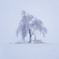
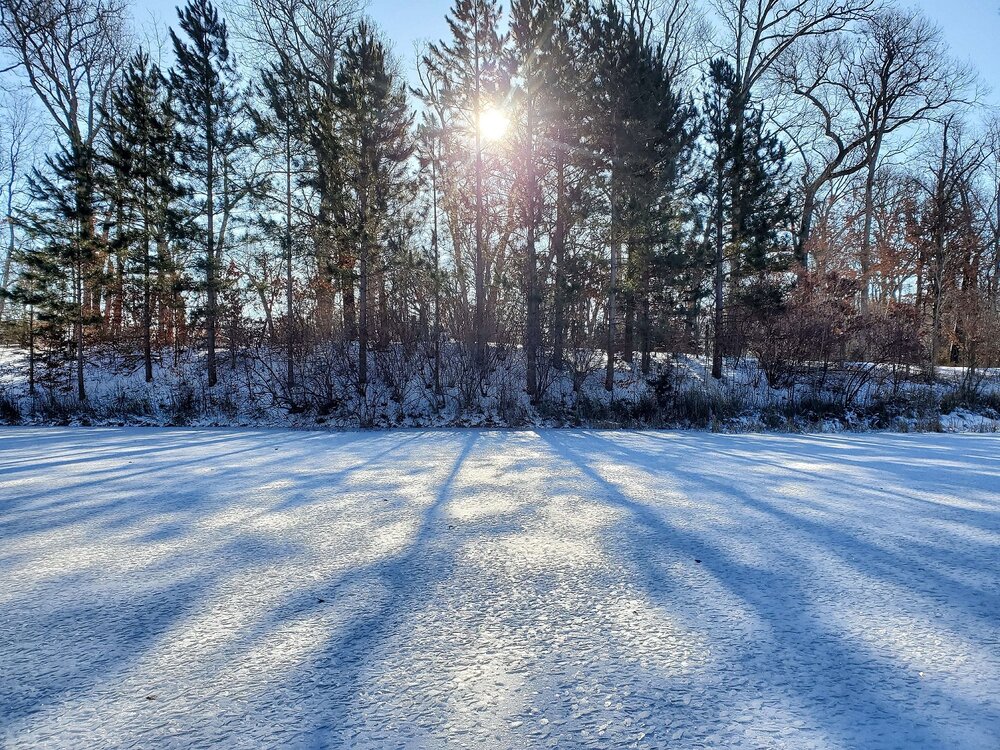
It's been a pleasant stretch of wintry weather recently. Nothing crazy, but the glacier on the ground is nice, and it's been refreshed frequently with light snows or at least snow that gets blown around. It sure beats some recent winters.
-
interesting scaly ice crystals forming on my pond in the cold snap
-
4
-
-
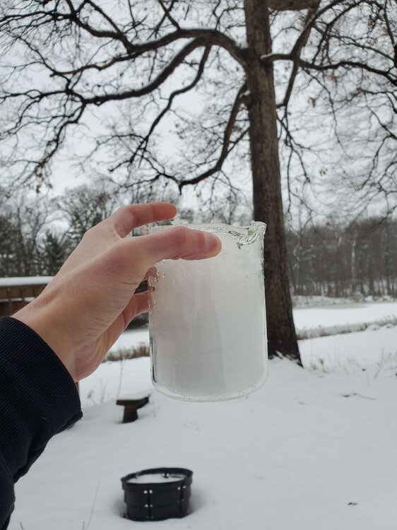
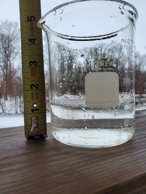
I just took a core of my 5" of snowpack. 1.4" liquid equivalent! Snow to liquid ratio of 3.6. This is some of the densest snow I've ever seen.
-
7
-
-
I got at least 3" out of the morning band. A pleasant surprise
-
1
-
-
29 minutes ago, Radtechwxman said:
I would love if tonight overperformed like hrrr is showing here. Esp since it screws me mostly on back end precip
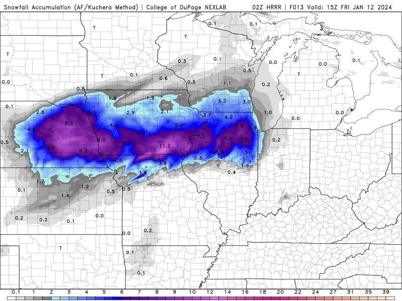
HRRR is our only hope left lol
-
 1
1
-
-
I could be looking at a bombing January low traveling well to my SE, only to have it nuke my modest snowpack right before the arctic blast hits.
This hobby is stupid.-
2
-
-
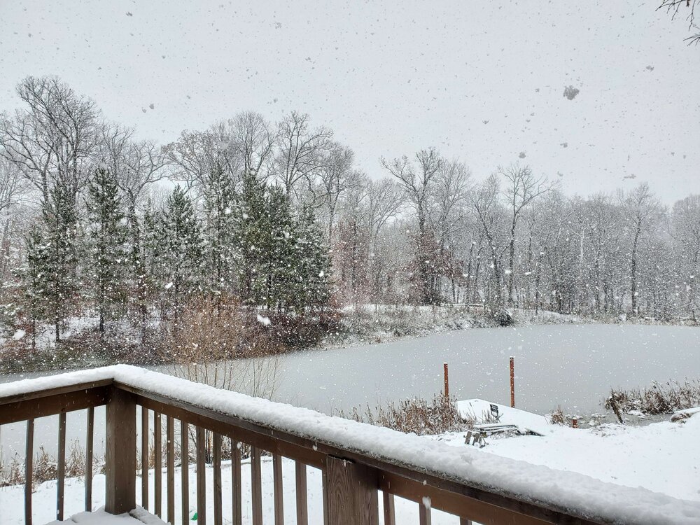
Raining snowballs now. These things are massive. Not the widest I've seen, but they are very dense and barely icier than slush.
-
7
-
-
Only squeezed out an inch of slush last night, even though there are substantially higher reports nearby. Looks like the backside snows might make up for the dud WAA band however.
Snowing now, even though models had it switching to rain here by now. -
23 minutes ago, StormChaser4Life said:
I'm having the same issues so I feel this
It switched back to snow here (near Metamora) and it's sticking pretty well now. Hopefully it can stay this way for the rest of the night.
-
1
-
-
Precip started as snow here, then switched to a mostly rainy mix. Models had all snow for me at this point

-
NAM went from being the bastard child to the golden child for me on this event. A nail biter for sure.
PIA might be flirting with a January record low MSLP. Record is 980mb and HRRR gets down to 981mb. -
Maybe the NAM isn't so crazy with the northern solutions seeing how the GFS continues to creep north.
-
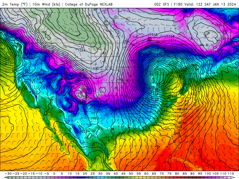
It's weird to see such a lack of cold air to the NW of such a strong January low. Now I personally love wet snow with low ratios, but I fear getting rained out on some of it.
I told myself I wouldn't get so involved in winter model watching after the December 2022 bust here, yet I've been looking at every model run for days on this storm lol -
969mb low in IL. that's probably the most bonkers GFS run I've ever seen for winter weather in my area
-
1
-
-
August 6th was the craziest tornado intercept of my life. I was probably a bit too bold following it so closely from the north, however I never lost my storm awareness and in return I got some incredible views.
-
8
-
 1
1
-
-
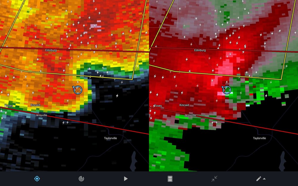
Yesterday was an awesome chase for me!
I was on a few supercells earlier in the day that tried to produce but struggled in the limited low level shear. I kept hopping to the SE to catch newly developing cells as the ones to the NW got washed out. Eventually I hopped on a big supercell near Jacksonville, IL that was producing a spectacular lightning show.
At first, the cell looked outflow dominant but kept cycling with periods of strong inflow. As it started to undergo a merger with several other cells, the RFD winds began SCREAMING while a nice wall cloud carved out of the base. I decided to take a risk and go for a northern view as I figured it was now or never for tornadogenesis. I positioned myself on the north shore of Sangchris Lake without a single other chaser in sight. Sure enough, the storm planted a BEAST tornado and I got to watch it until the blinding RFD blocked my view. What an amazing experience!!
-
8
-
-
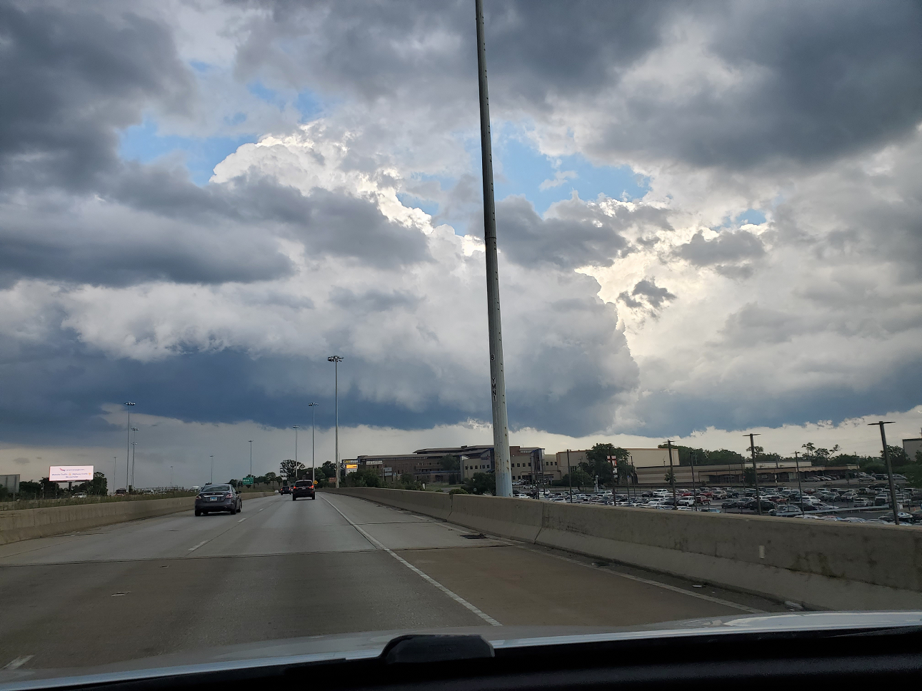
This little cloud has an ongoing high end EF1 tornado in this pic! I've never seen such a tiny little tornadic supercell!
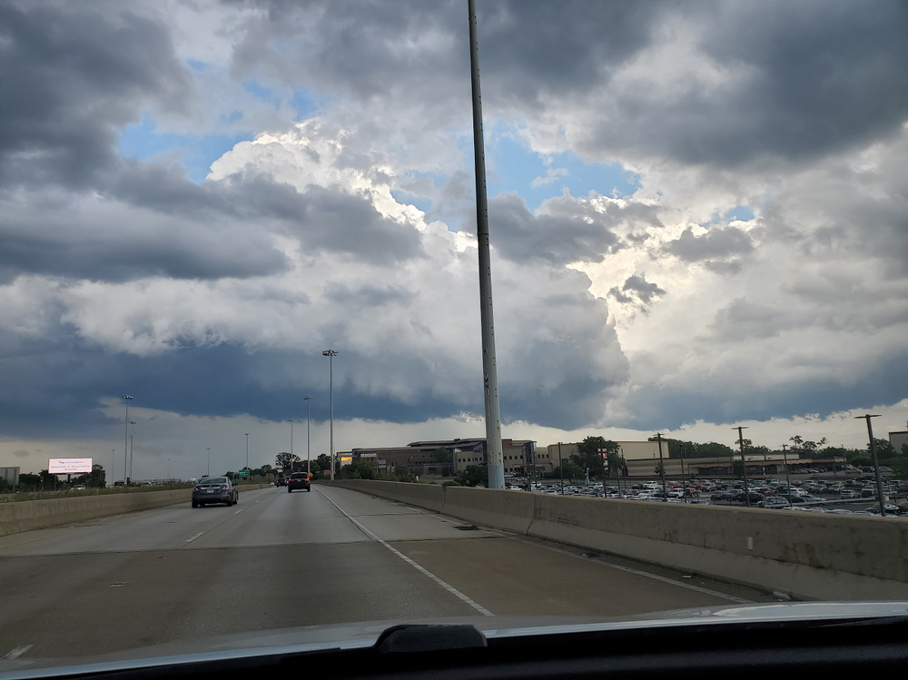
Yesterday was a frustrating chase overall, but I'm glad I was able to get a view on this glorified cumulus cloud inside the concrete jungle. I ended up very close to the Elgin tornadoes but I couldn't get a good view due to all the buildings and trees.
-
7
-
-
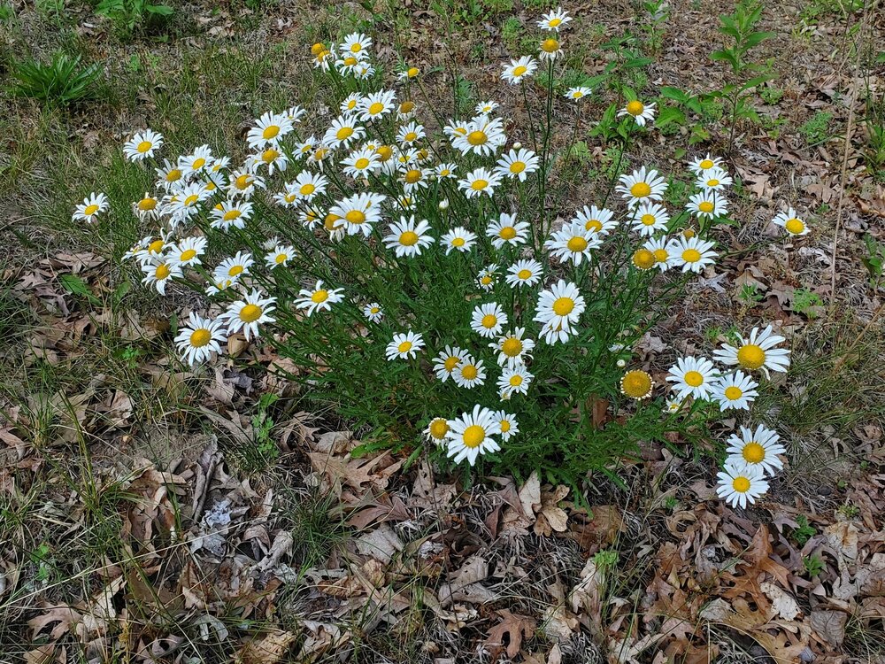
The drought has been murdered in my backyard. I've gotten 5.5" of rain since the derecho on the 29th, including an unexpected 2.5" last night. Unfortunately most of my bareroot tree and shrub plantings were killed in the drought but at least it relieves me from watering the trees that survived for the time being.
-
My grass is cooked but tougher plants have been showing up in its place.
-
1
-


March 2024 General Discussion
in Lakes/Ohio Valley
Posted
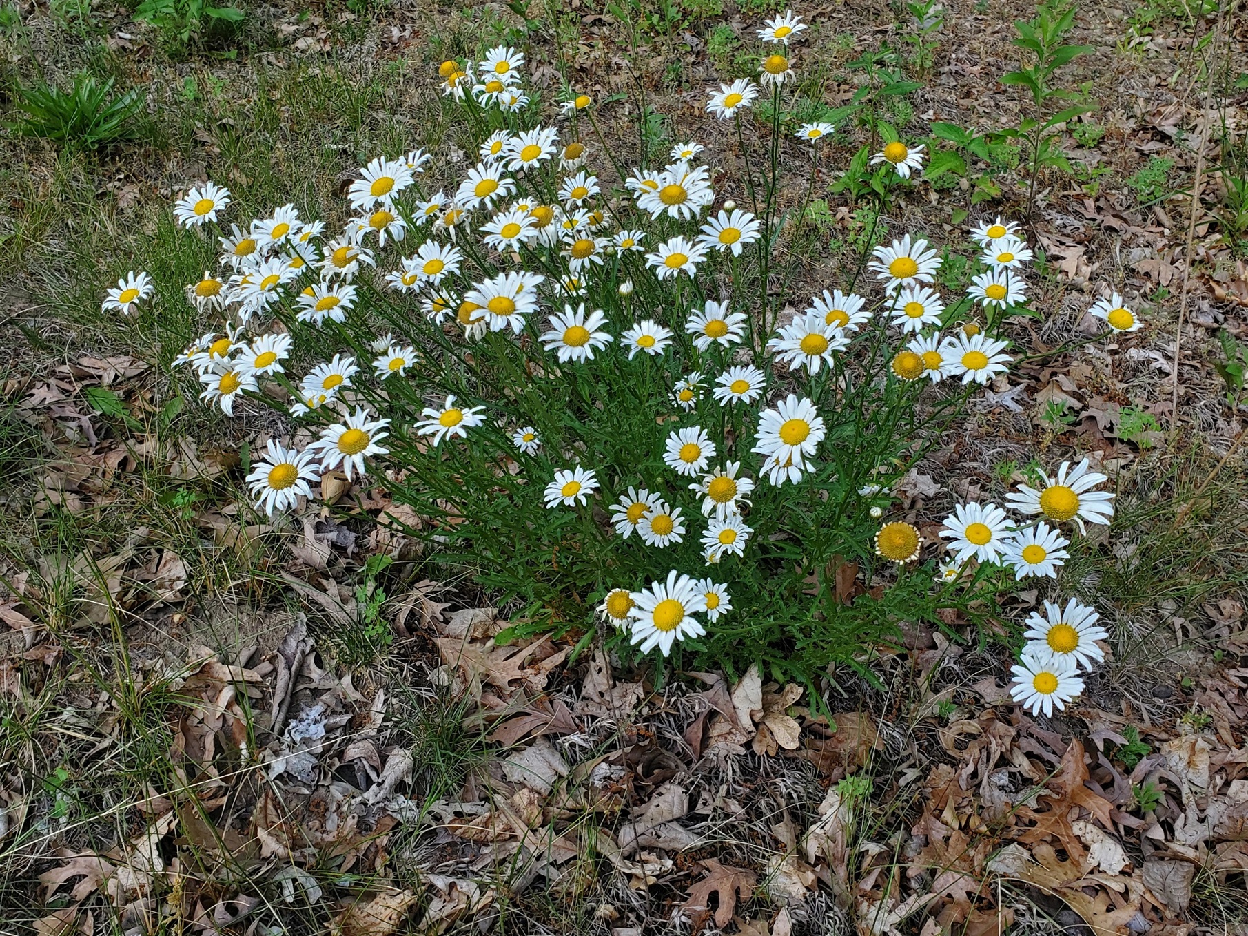
Incredibly early start to spring here. Flowers are blooming weeks ahead of normal and the grass greened up within the first week of the month. I'm actually thankful for the current cool spell that has set in as it should slow things down a bit. Fruit crops will take big losses in a seasonable April freeze if growth gets much further ahead.