TampaMan
-
Posts
622 -
Joined
-
Last visited
Content Type
Profiles
Blogs
Forums
American Weather
Media Demo
Store
Gallery
Everything posted by TampaMan
-

Richmond Metro/Hampton Roads Area Discussion
TampaMan replied to RIC Airport's topic in Mid Atlantic
The climate, the wind, several variables. I'm not an expect, I just imagine this isn't going to perform the way it's portrayed. Just a gut feeling. -
Richmond Metro/Hampton Roads Area Discussion
TampaMan replied to RIC Airport's topic in Mid Atlantic
ULL looks like it is not happening anymore. -
Richmond Metro/Hampton Roads Area Discussion
TampaMan replied to RIC Airport's topic in Mid Atlantic
After further in-depth evaluation looking at models and the current radar on my PC, out West it does seem to be drying up. I'm not so sure even if the coastal does push moisture that it will make it up this direction. We are in a very thin line for room for error right now. All TV Stations have potential to be bust, even NBC12. We will know more within the next hour on what will happen. -
Richmond Metro/Hampton Roads Area Discussion
TampaMan replied to RIC Airport's topic in Mid Atlantic
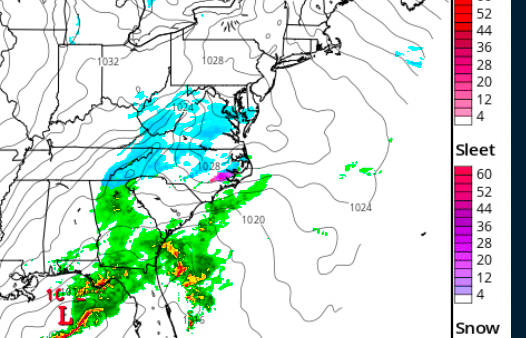
IEM :: Current & Historical IEM NEXRAD Mosaic Loop Imagine this happening randomly. (Stolen from storm thread). -
Richmond Metro/Hampton Roads Area Discussion
TampaMan replied to RIC Airport's topic in Mid Atlantic
I think we will hit 3 inches. -
Richmond Metro/Hampton Roads Area Discussion
TampaMan replied to RIC Airport's topic in Mid Atlantic
I don’t think VB will be getting those totals depicted on the maps. They could but I’m very doubtful. I’d say they are more in line to get 5-6 inches. -
Richmond Metro/Hampton Roads Area Discussion
TampaMan replied to RIC Airport's topic in Mid Atlantic
3 inches is very much a decent event for RVA considering the last 5 winters. -
Richmond Metro/Hampton Roads Area Discussion
TampaMan replied to RIC Airport's topic in Mid Atlantic
For those worried about the radar take a look at the current hours on the HRRR and active radar. In about 2 hours we will see the backfilling.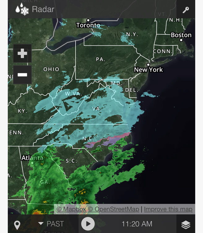
-
Richmond Metro/Hampton Roads Area Discussion
TampaMan replied to RIC Airport's topic in Mid Atlantic
Even my non treated neighborhood roads are melting. This morning at 7 am they were covered good. -
Richmond Metro/Hampton Roads Area Discussion
TampaMan replied to RIC Airport's topic in Mid Atlantic
Seems like it’s melting on roads somehow. -
Richmond Metro/Hampton Roads Area Discussion
TampaMan replied to RIC Airport's topic in Mid Atlantic
I have about 3/4 an inch here in Henrico. -
Richmond Metro/Hampton Roads Area Discussion
TampaMan replied to RIC Airport's topic in Mid Atlantic
If you look at the radar there are now better bands to our north and west. -
Richmond Metro/Hampton Roads Area Discussion
TampaMan replied to RIC Airport's topic in Mid Atlantic
Latest HRRR is feeding more moisture into our area. Expect at least another 4 or 5 hours of snow. -
Richmond Metro/Hampton Roads Area Discussion
TampaMan replied to RIC Airport's topic in Mid Atlantic
It is starting to fill in all together should start pushing NW slightly as well. 3-5 is a good estimate for Richmond. -
Richmond Metro/Hampton Roads Area Discussion
TampaMan replied to RIC Airport's topic in Mid Atlantic
It should pick him here in the next hour or so and continue to do so for the next 5-6 hours. -
Richmond Metro/Hampton Roads Area Discussion
TampaMan replied to RIC Airport's topic in Mid Atlantic
Precip is incredibly light. We may have issues if that’s the case. Seems like it’s taking forever even for .5. -
Richmond Metro/Hampton Roads Area Discussion
TampaMan replied to RIC Airport's topic in Mid Atlantic
The 13z doesn’t run far enough out to show it. It’s coming over the WV border at the end of that run. -
Richmond Metro/Hampton Roads Area Discussion
TampaMan replied to RIC Airport's topic in Mid Atlantic
I don’t think those are lazy. They are far better than NBC12s map. WTVR has way too much for RVA. -
Richmond Metro/Hampton Roads Area Discussion
TampaMan replied to RIC Airport's topic in Mid Atlantic
This was always going to happen. -
Richmond Metro/Hampton Roads Area Discussion
TampaMan replied to RIC Airport's topic in Mid Atlantic
Starting to break up out west. We really need that to backfill or we will be in trouble. Dry slotting will be an issue I fear. -
Richmond Metro/Hampton Roads Area Discussion
TampaMan replied to RIC Airport's topic in Mid Atlantic
I went to work to grab my laptop now I’m home. Woo! -
Richmond Metro/Hampton Roads Area Discussion
TampaMan replied to RIC Airport's topic in Mid Atlantic
Edit picture to make smaller -
Richmond Metro/Hampton Roads Area Discussion
TampaMan replied to RIC Airport's topic in Mid Atlantic
-
Richmond Metro/Hampton Roads Area Discussion
TampaMan replied to RIC Airport's topic in Mid Atlantic
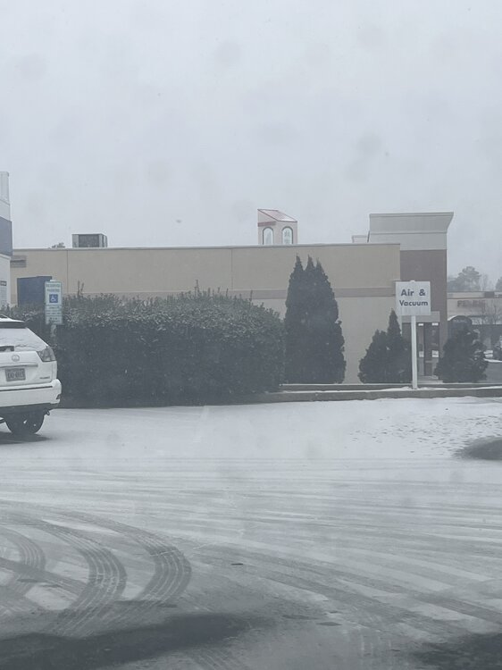
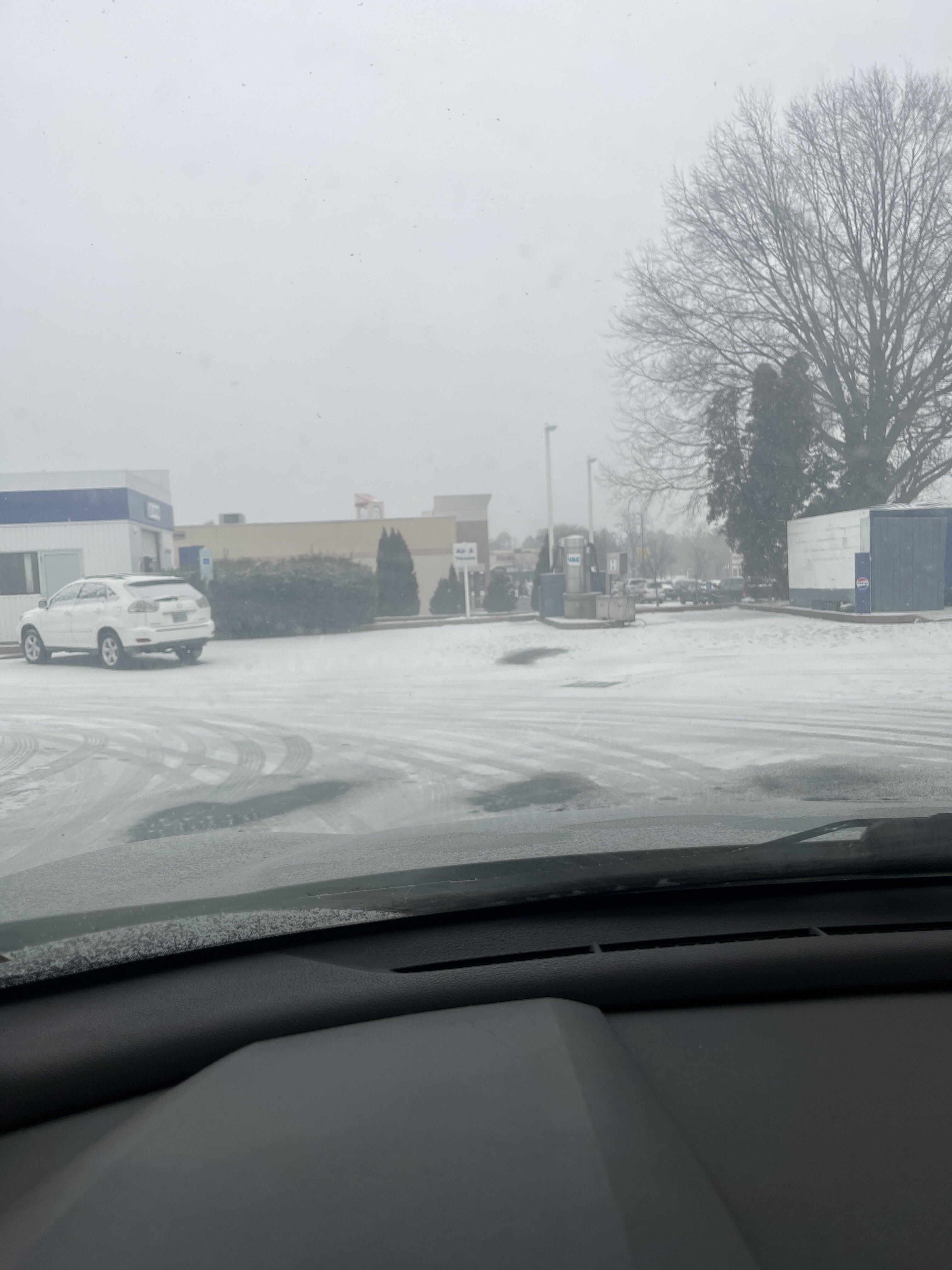
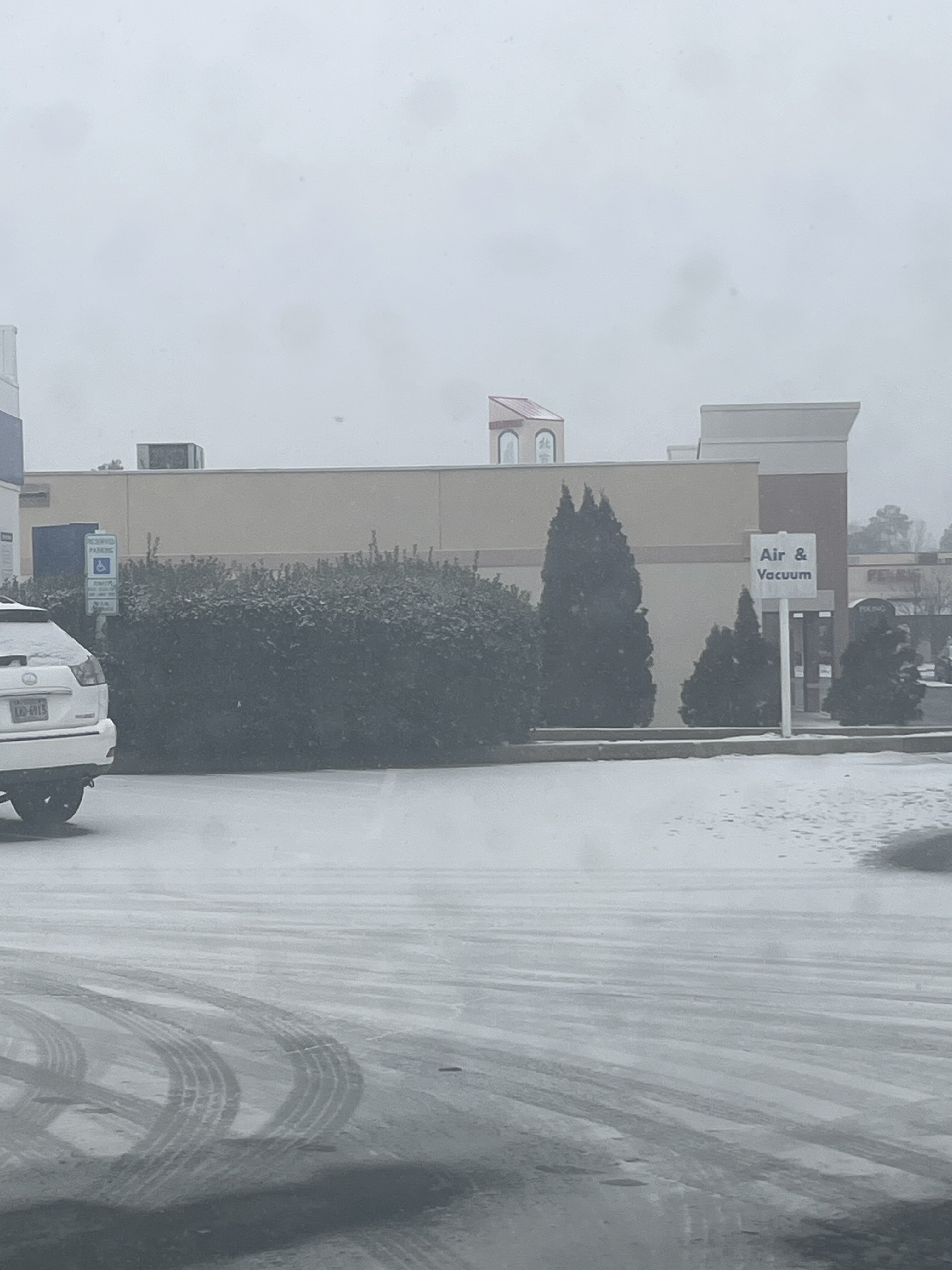
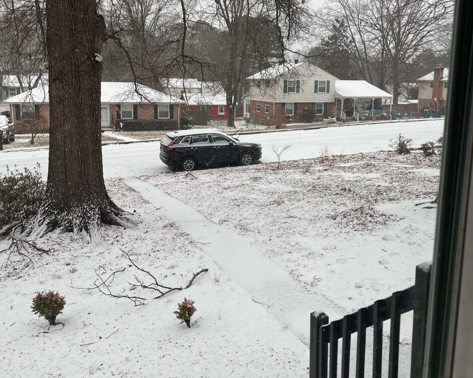
Henrico, VA 8:32 am. Roads caved quickly and are getting piled on rapidly. We need better band sets up quickly.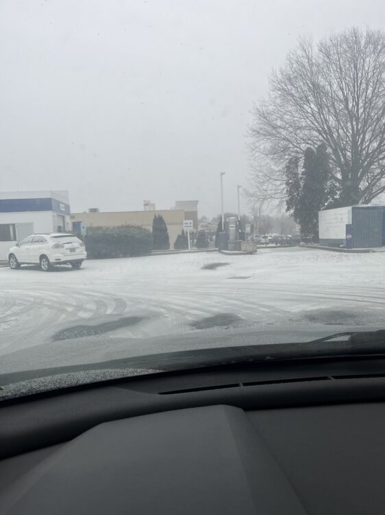
-
Henrico, VA 8:30 am. Snow started earlier than anticipated.