

BNAwx
-
Posts
284 -
Joined
-
Last visited
Content Type
Profiles
Blogs
Forums
American Weather
Media Demo
Store
Gallery
Posts posted by BNAwx
-
-
9 minutes ago, jaxjagman said:
those are some huge flakes..lol
Not too shabby for a sneak-up event.
-
 1
1
-
-
Just switched over in Hermitage. Looks like some pretty hefty returns moving in from the northwest.
-
3
-
-
7 minutes ago, *Flash* said:
Pouring snow in White Bluff. Silver dollar sized flakes. About a half inch on the ground in only 15 minutes.
What’s your current temp?
-
I would say the 17th - 20th period is definitely one to watch.
-
2
-
-
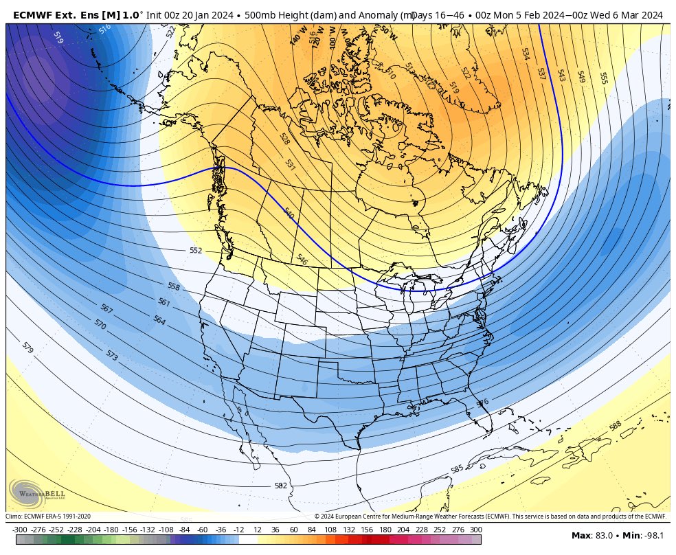
We’re obviously heading into a mid-February to mid-March 1960 kind of pattern.

I wish…
-
3
-
-
Nashville had a nice winter storm on Valentines Day of 2021. Arctic front pushed through and changed rain to freezing rain then changed over to sleet. Probably had close to 2” of sleet before finally changing over to snow. Snow accumulated to around 3” - 4”. I’m hedging my bets that we’ll be tracking again by Valentines Day this year.
-
6
-
-
1 hour ago, tnweathernut said:
This will work……..

Marvelous March incoming!
-
1
-
-
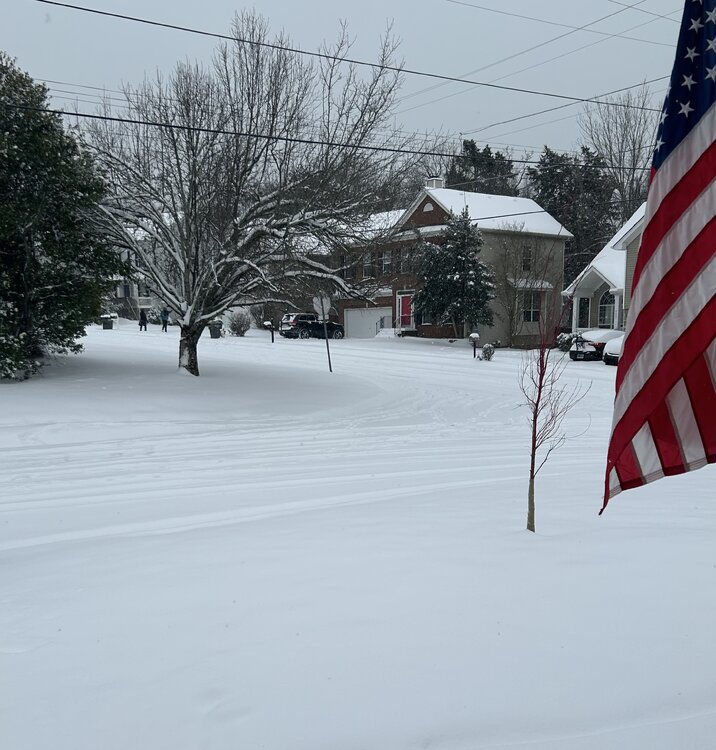
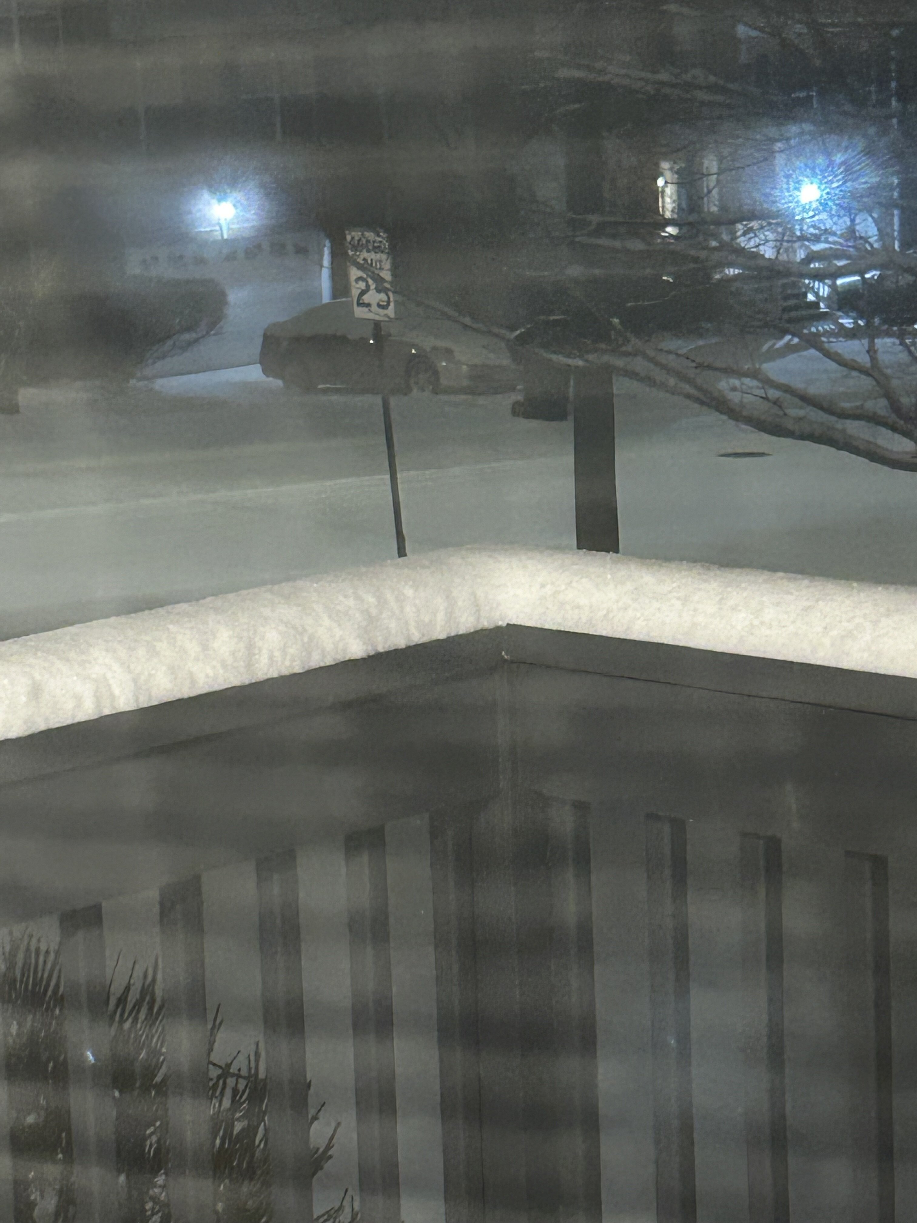
Measure 7.5” in three different locations. Looks like maybe one last heavier band is about to roll through.
-
13
-
-
Heavier returns picking up again west of Nashville and moving this way. About to go do another measurement.
-
4
-
-
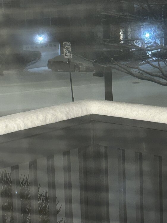
Not the best pic, but here’s more deck action…
-
14
-
-
10 minutes ago, Silas Lang said:
Do any of you feel insane when it snows? Here I am, at 12:14 staring out the window, while everyone else is asleep.
Yes. But I’m the nut that will stare at the floodlights until my eyes cross just waiting for that first flake.
-
6
-
 2
2
-
-
Returns west of Nashville have really deepened over the last little bit.
-
7
-
-
Right at 2 inches here in Hermitage. Gonna be a fun night!
-
9
-
-
Tiny flakes making it down in Hermitage just east of Nashville.
-
7
-
-
You know it’s been a good few hours of modeling when you have to go back 3 pages of posts to catch up where you left off the night before.
Good times!
-
7
-
-
6 minutes ago, John1122 said:
I wouldn't be surprised to see the Euro and the Canadian look similar at this point. The solutions are literally all over the map across all modeling.
That’s why this is such a great hobby. I’ve experienced both “the thrill of victory and the agony of defeat” within 24 hours of an event. 24 hours worth of modeling is an eternity sometimes.
-
2
-
-
42 minutes ago, Carvers Gap said:
Lawd….
-
2
-
-
5 minutes ago, Matthew70 said:
I will take 3-6” anytime any day in the winter. So many not happy it’s not showing a foot. Not here just other places. That amount with the temps will be bad enough. It won’t melt. If we get a lot more then it will cripple the area with the temps coming behind it.
There’s a reason Nashville has rarely witnessed a 12”+ snowfall. Too far west to get prime snowfall from a Miller A out of the gulf and no elevation to enhance lift. There’s more reasons I’m sure. We’re more likely to get to that total from a well placed upper level low.
-
2
-
-
WAAAY too much time left to get attached to any solution. This is about the time models do indeed get wonky with systems or lose them altogether. Any scenario is in the table right now. The only thing I can comfortably say is it’s gonna get chilly.
-
2
-
-
Nice ridge popping out west…
-
1
-
-
Things to do:
Fix the carburetor on my generator before next week….
-
7
-
-
Wouldn’t be surprised to see some clipper action pop up on modeling after the passage of the system on the 15th & 16th. That’s some stout cold coming down.
-
4
-
-
5 minutes ago, Carvers Gap said:
With any of those looks (on the bright side), somebody in the forum is getting ice/snow.
And if you like dynamic systems, these next couple of weeks will be your jam.
-
5
-
-
10 minutes ago, tnweathernut said:
Just looking at the operational 18z vs the ensemble at 500 at hour 180 (truncation). See if you can spot the differences.
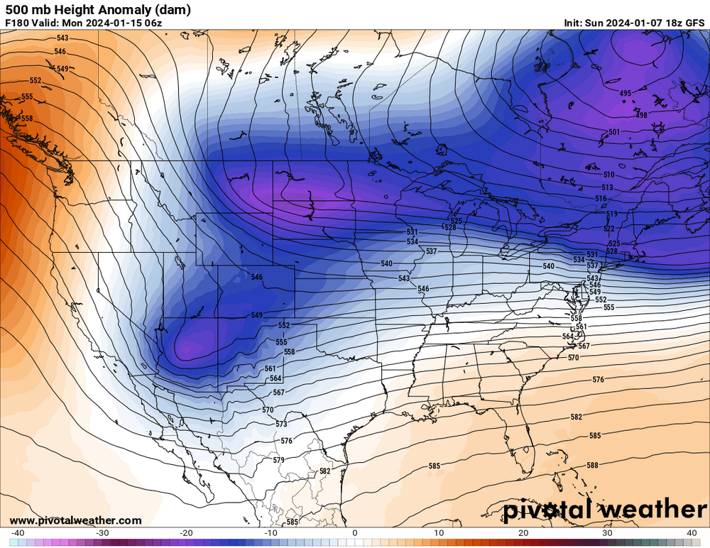
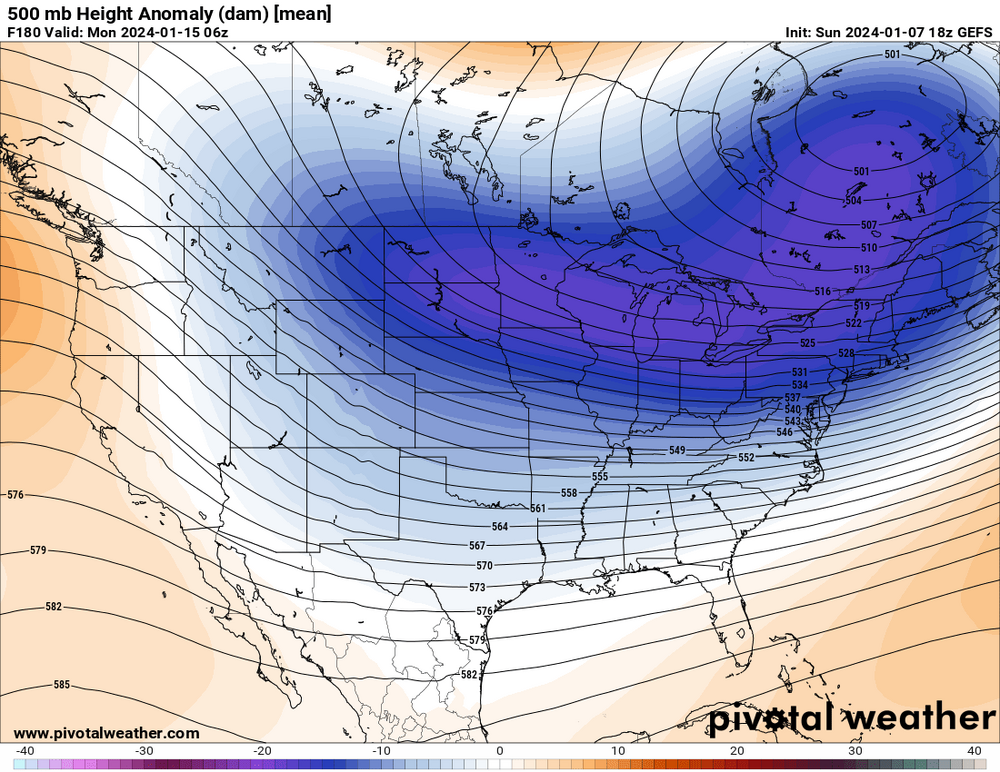
Doesn’t look like the EPS has that energy diving into the southwest. The GEPS looks like it was TRYING to do the same as the GEFS but doesn’t get there. Like Carvers said, we’re still over 7 days out and who knows exactly how this storm plays out. Fun to watch though…
-
2
-


February 2024 mid/ long range
in Tennessee Valley
Posted
I wonder if the model mayhem this winter has been due to the constant pressure the strat PV has been under for what seems like the entirety of the winter season. This year just seemed anomalous to me in that regard but maybe it’s not as unusual as I think it’s been.
One thing about this hobby is just when you think you’ve got a decent understanding of how everything “should” work, Mother Nature throws you a Mariano Rivera cutter….