

EastKnox
-
Posts
162 -
Joined
-
Last visited
Content Type
Profiles
Blogs
Forums
American Weather
Media Demo
Store
Gallery
Posts posted by EastKnox
-
-
It’s not often that the roads get white before the grassy areas.
.-
 1
1
-
-
Now that the first big threat of the season is here, the social media "weathermen" are posting clown maps all over the place to get more likes and shares. On top of that, the general public has a more favorable view of these guys than they do real meteorologists - mainly because these guys start posting 10 day snow maps and the real Mets don't talk totals until 96 hours or less from the event.
Am I the only one that really gets annoyed with these guys?
-
2
-
-
Most of my sweet corn got blown over by the storm last night. Luckily, I was planning on harvesting today anyways, but I'm gonna have to clean the stalks - I've presold them to people in my neighborhood. Turns out that corn stalks for decorations are more valuable than the corn itself. My hickory cane corn survived with only a few stalks blown over. They just started silking so hopefully I'll be wind free for a few more weeks.
-
59 minutes ago, Carvers Gap said:
Looks like we are back to BN for a 2-2.5 weeks beginning tomorrow.
I sure hope we score something. If I'm going to pay these high heating bills, I'd like some snow to go with it. I've had 4 dustings thus far.
-
4
-
-
6 hours ago, Holston_River_Rambler said:
Here is the ideal vort map evolution for east TN, IMO:
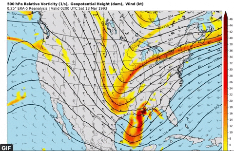
There have been some runs that looked close to that, but too far east, for the most part. But they were in that territory with 960 lows off of Hatteras.
I could watch that phasing all day long.
-
2
-
-
4 hours ago, PowellVolz said:
They still trying to figure out how their dusting to an inch ended up 2-4” in Knox Co.
.In their defense, I did only see a dusting in East Knoxville. Three in a row like that. Hoping this next one is money for me.
-
This thread will probably start winding down, but it happens to be the most "replied to" thread for a single storm in the 9 pages that I can browse back to 2013. Nice to see the activity. I hope we get a storm big enough to top 2k on a single storm thread.
-
3
-
-
I'm hoping those bands in west knox make it to the other side of 75 and give me something out east.
-
1
-
-
I'm just hoping for a white coating at this point. This first storm to usher in the favorable period was always going to be a question mark. I'm hoping we come away with something pretty and score on some more traditional storms(if there is still such a thing) soon.
-
1
-
-
The sun is poking through the clouds in Knoxville.
-
1
-
-
3 minutes ago, Kasper said:
Where the heck is @Carvers Gaphe usually eats these damn things lol
Not recently, he read that these things are high in bust potential.
-
1
-
 2
2
-
-
3 minutes ago, Holston_River_Rambler said:
Considering the issues with the valley, I think MRX should be an "upper-air equipped" forecast office. Unless something has changed, I don't think that is the case.
-
6
-
-
9 minutes ago, bearman said:
It is always curious to me how MRX makes their decision to issue winter weather warning products. They always err on the side of caution when it comes to severe weather events like tornadoes and issure many warnings that never pan out. It seems like this can cause people to often disregard these warnings but with winter events they seem much more hesitant to pull the trigger. Maybe it is an issue of scale of impact?
Severe weather products such as outlooks and watches are issued by the SPC in Norman, OK. MRX tends to elaborate a bit, but won’t stray from SPC guidance. MRX is responsible for warnings, but there is already severe weather occurring at that point.
-
1
-
-
7 minutes ago, Carvers Gap said:
Right now, if the 0z NAM is correct, I am not even sure I get very much precip of any kind.
Now I'm just hoping for some clear skies so I can get out the telescope.
-
2
-
1
-
-
9 minutes ago, Carvers Gap said:
Man, I have set the bar at 1" of snow. LOL.
7 minutes ago, Windspeed said:9 minutes ago, Carvers Gap said:Man, I have set the bar at 1" of snow. LOL.Haha yeah but we've already had some 1 and 2 inchers. I'll set the bar at 3" and be let down. lol..
5 minutes ago, dwagner88 said:That’s my threshold for every event. The situation is dire down here.
I've received about 0.5" for each of the last storms. My bar is set at 0.75". I'm throwing at party at 1".
-
4
-
-
40 minutes ago, PowellVolz said:
MRX now upping totals in the valley. Kiss of death.
.Yup. I should go ahead and put my Monday morning plans back on the calendar.
-
1
-
2
-
-
The problem with these systems is that a 50 mile shift in a synoptic feature can mean a big change somewhere. It's not unheard of for a change to happen that isn't modeled (such as the positions of ULL or MSLP, or speed). It's those kinds of changes that have robbed us in the past - and have also led to unexpected surprises. The MRX jinx is real too. I'm hoping for one of those to happen to get enough snow to sled in East Knoxville. I'm not building up my kids' hopes though.
-
3
-
-
3 minutes ago, John1122 said:
I assume it's some in house graphics. He just had the big L going almost over Memphis to Nashville to Cincy.
Broadcast stations used to use the paid RPM model "in-house" but I think it was retired. Wonder if it was replaced or most broadcast mets relying upon the stuff we look at.
-
1
-
-
Looks like a line of echos picking up intensity about to enter Knox County.
-
1
-
-
And yes, could I take a 500mb trough, with some negative tilt on the side?
-
4
-
-
My birthday is Jan. 25th. Every year, the only gift I wish for is a 6"+ snow. We've not had a good setup for years even close, so we'll see, but if a storm is progged for around the 25th, just know that I have a jinx there. I might help everyone out by going on a Caribbean vacation for my birthday.
")
-
2
-
-
9 minutes ago, PowellVolz said:
No reports of any rain or mix north of 40 in the valley and CC on RadarScope shows that well. We have talked for days that interstate 40 was the line.
.I literally live a few hundred feet from I-40 in east Knoxville....I've had mostly snow and sleet with little rain mixed in throughout the day...just not heavy enough rates to accumulate. The current changeover to snow is now getting the top of the grass white and I'm down to 34 degrees as well. So, I'm thinking I might be snow only for the duration of the event.
-
1
-
-
First flurries are falling in east Knoxville at my home near the I-40/Asheville Hwy interchange. No mixing thus far.
-
1
-
-
Just now, bearman said:
Here in West Knoxville we can’t seem to penatrate the dry air. Looks like we should be geting good snow. I rember a time when we were supose to get a heavy snow and we ended up without a flake because dry air was never overcome. Hope that does not happen.
I don't think that will be the case this time unless the whole system dries out...but it doesn't appear that will happen.
1/10-1/12 Southern Slider
in Tennessee Valley
Posted
An OBS thread has been started as well.