

HKY1894
-
Posts
190 -
Joined
-
Last visited
Content Type
Profiles
Blogs
Forums
American Weather
Media Demo
Store
Gallery
Posts posted by HKY1894
-
-
Just now, Buddy1987 said:
Anyone have obs in Kannapolis/Hickory/Greensboro? Heavier echoes traversing through there.
Nothing falling currently in hickory but evap cooling underway I’m sure.
-
 1
1
-
-
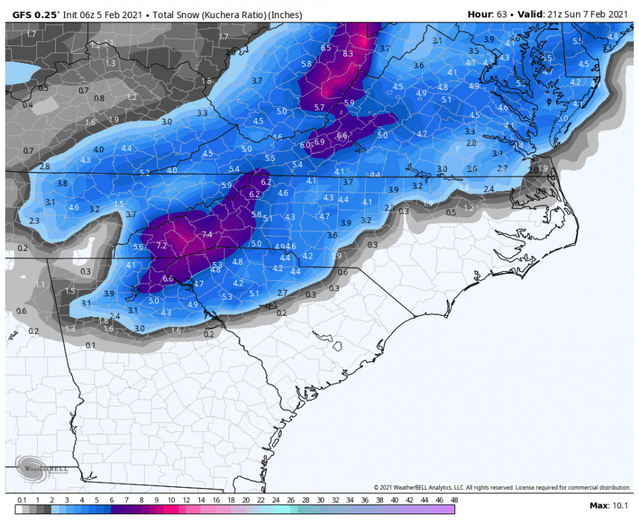
The trend for this storm has been interesting. Wasn’t looking good yesterday but model trends for last 3 cycles have all been positive! I’m happy sitting in Lenoir for this one just hoping for 2-3 inches.
-
1
-
-
Euro QPF almost doubled from 6z run wow
-
Every model at 6z is big improvement from 0z cycle. Great trends The gfs looks great
-
1
-
-
10 minutes ago, Orangeburgwx said:
Run-to-run change from 12z to 0z, 2m temps

Sent from my LGL322DL using Tapatalk
Most of this is due to evap cooling because of more expansive precipitation field but still great trend.
-
1
-
-
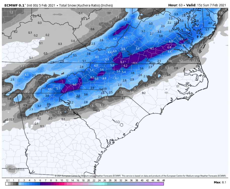
Thermals much better on euro! The QPF also increased markedly on NW side of storm. Couldn’t ask for a better euro run.
-
BOOM!
-
1
-
-
-
ICON is a crush job for western areas
-
Models are so erratic right now it’s best not to get emotionally invested. The trend for the upcoming weekend threat has been incredible. Still not confident in the outcome of that and it’s less than 72 hours out! At this rate won’t be surprised if it turns into an apps runner.
-
2
-
-
22 minutes ago, WXNewton said:
RGEM not amped like the NAM, but it's trending NW and stronger each run, maybe we can find a happy medium on the models.

NAM was much closer to reality on the big storm last week, so we have that in our favor. NAM has actually preformed pretty well this winter overall. Was too aggressive on the early January storm but otherwise solid. The gfs also did well in final 72 hours leading into Eastern nc snow event so encouraging seeing that trend better.
-
1
-
-
6z gfs also trending that way. Hopefully we see euro start to fold in today’s cycles
-
1
-
-
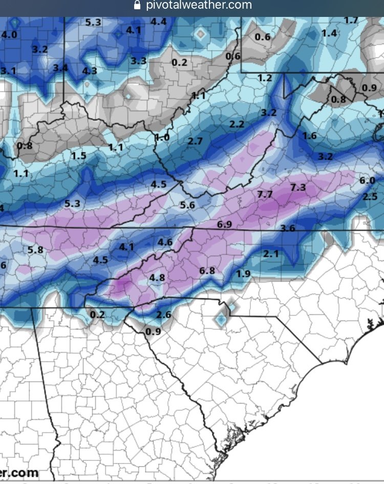
Para gfs at 6z is big hit for this Sunday

-
3
-
-
1 minute ago, StantonParkHoya said:
Can you please stop with the imby’isms. Everything you say is western this or mountain that.
The whole western part of the state is not in his backyard.
-
6
-
 2
2
-
-
3 minutes ago, wncsnow said:
GFS is trying for Sunday. It's pretty close to something decent for western areas
This winter it has consistently trended northwest from day 5 and under in most events. I honestly don’t hate where gfs is right now
-
1
-
-
Anybody with access to euro control/ensembles from 12z? Interested to know how they looked for both threats
-
CMC is interesting for Monday morning as well this run same as RGEM.
-
1
-
-
8 minutes ago, Grayman said:
Next week?
Yes Sunday
-
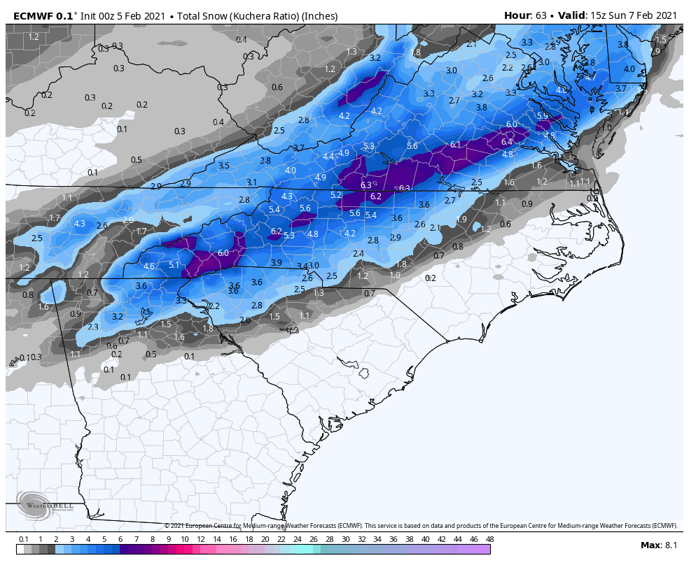
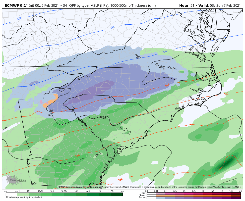
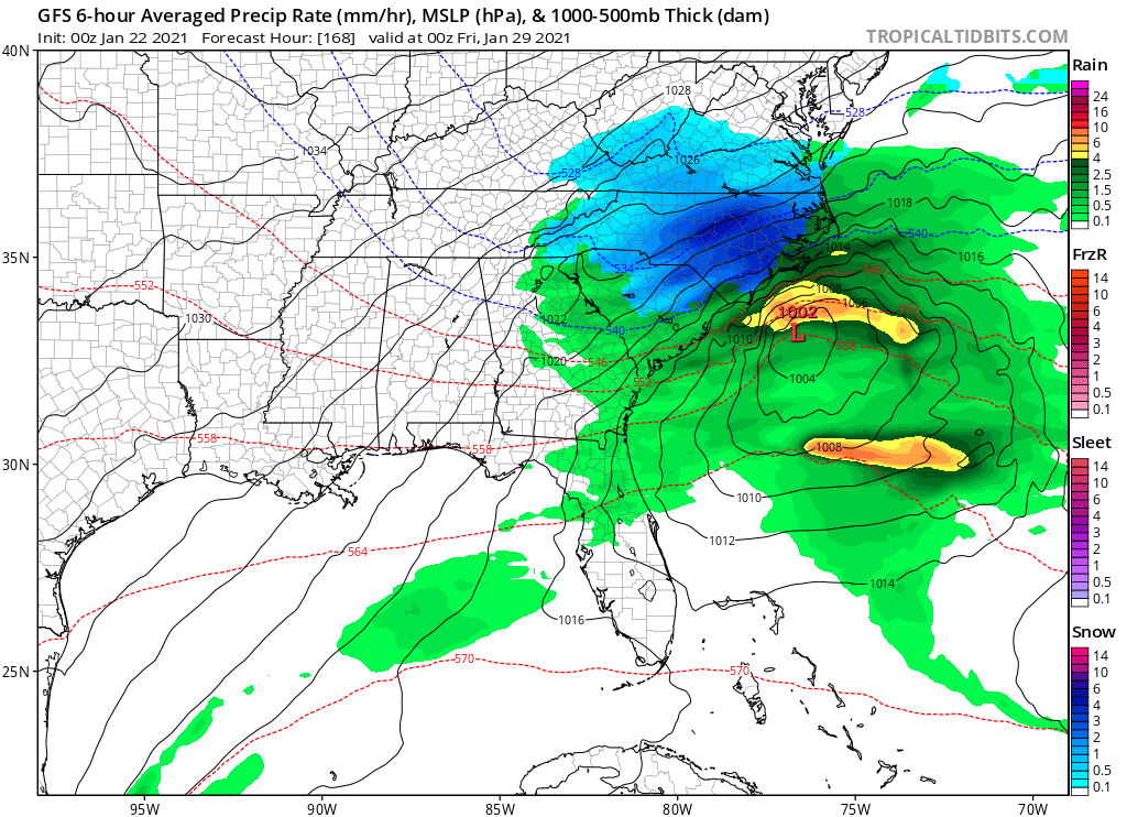
Big hit on 0z Euro for western NC
-
0z gfs para looks good
-
1
-
-
-
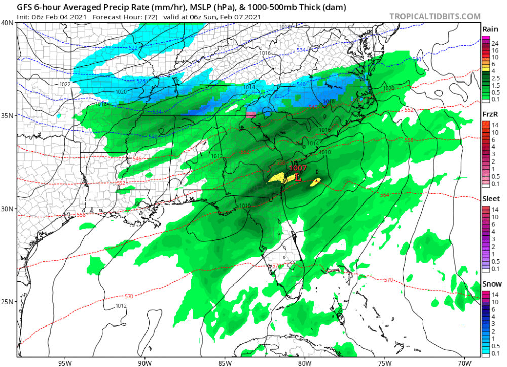
This is first storm all season that the gfs v15 has honked about. It was never gung go on the event in early January. This storm has higher potential than anything we’ve seen all year. Hopefully it’s not northern mid Atlantic that cashes in instead of us.
-
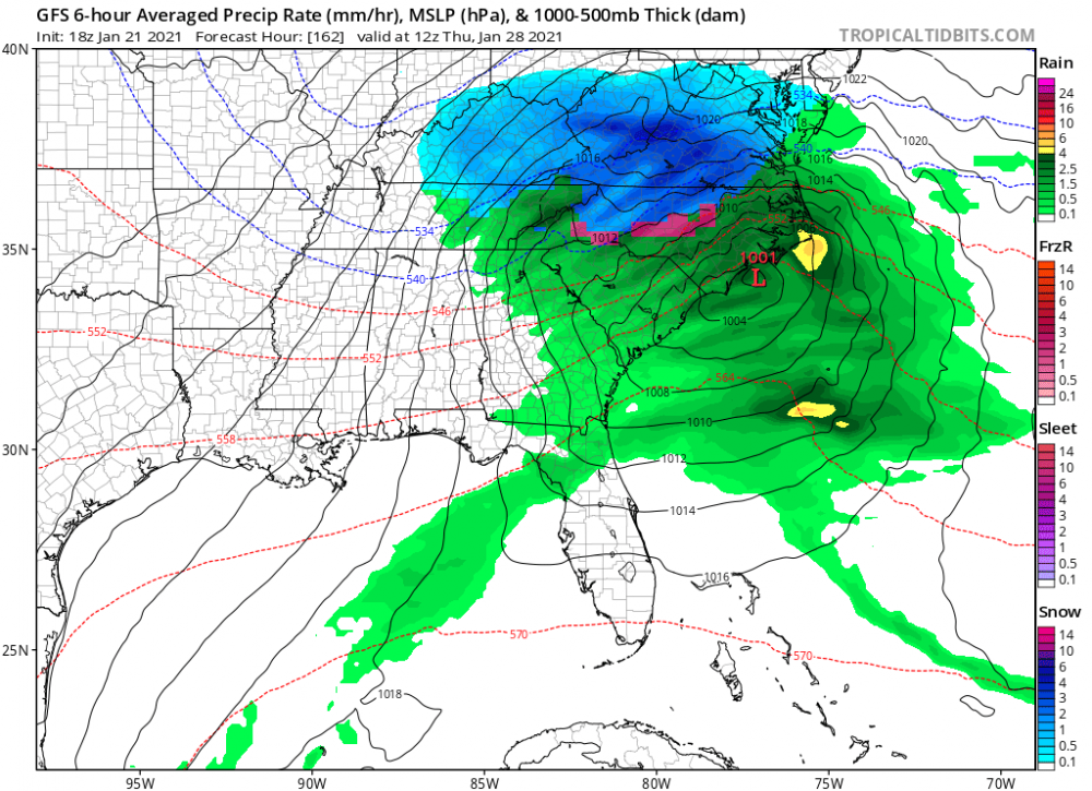
Happy hour delivered. The storm bombs out after this as well NE NC gets rocked
-
1 minute ago, AirNelson39 said:
Radar depiction is showing all snow but a heavy rain/sleet/snow mix southern Caldwell County. Thought it would have changed fully by now in these heavier bands.
The warm nose will decrease when low level flow changes. Warm nose is always always stronger than models indicate though
-
1
-


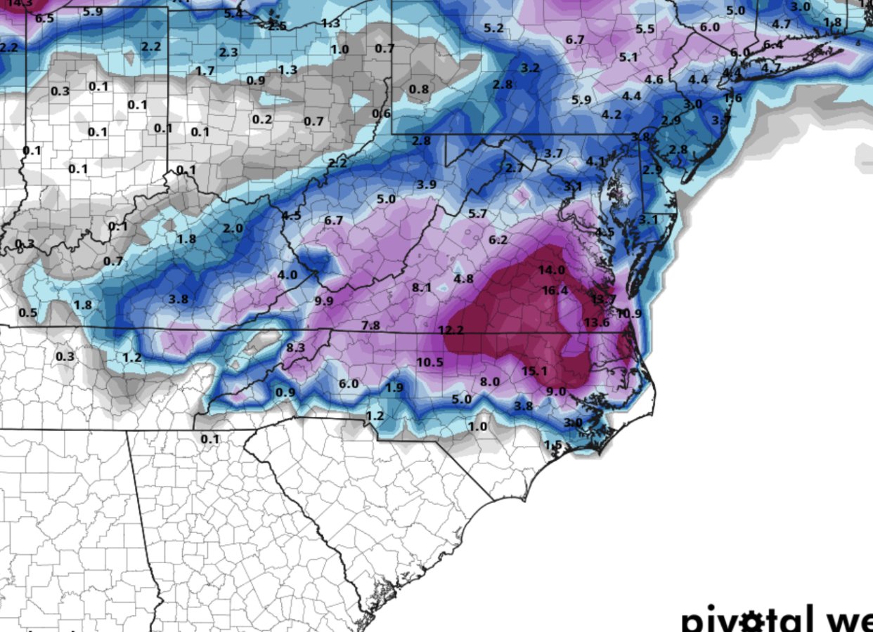

February 18-19 MAJOR Ice Storm Threat
in Southeastern States
Posted
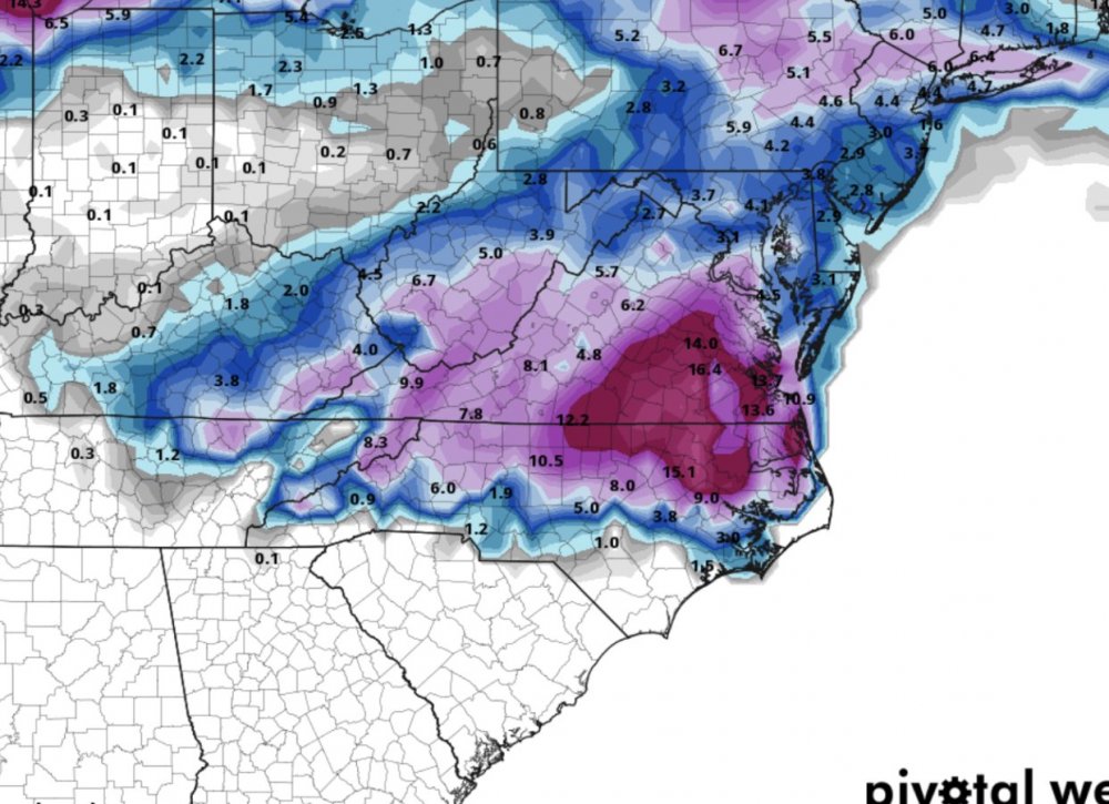
18z HRRR is a crush job along the escarpment in northern mountains as well as big ice amounts from hickory to gso. Hope QPF is overdone as depicted is devastating
.