finnster
-
Posts
122 -
Joined
-
Last visited
About finnster

-
Yes this is a definite concern for many of us. Hoping for a turn for the better in our weather pattern but who knows when that might be
-
Is this extreme pattern a result of weather modification or solar geoengineering projects gone awry? Just asking for a friend . I'm only aware of smaller weather mod efforts like cloud seeding done years ago,, but you have to wonder. I mean, the high temperature records broken this winter, and especially this latest heat wave, are smashing records not just breaking them.
-
Unreal for March at that elevation!
-
Looking at the bigger picture of what's causing these massive high pressure systems (which we've seen happen repeatedly the last ~6 months or so) and the extreme high temperatures and high temperatures, I'd be interested in ideas about when or if this pattern might break down. It seems we're just stuck in it indefinitely, but at some point things HAVE to change, right? What I read is that a weak La Nina has been in place (now fading) and has resulted in a persistent western high pressure ridge being placed perhaps further east than 'normal'. But have we not seen similar patterns many times before that didn't result in such extremes? It seems like we're in uncharted territory now - with the possible exception of the Dust Bowl years which obviously none of us were around to experience . Thanks in advance for your thoughts....
-
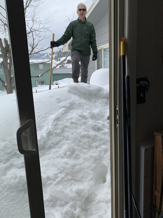
Just sharing some eye candy from March 14, 2021 - this pic is out our patio door. We're in the foothills northwest of Fort Collins. 40"+ from this one storm and 120" for that season. Man how things have changed in just 5 years - sad.
-
Good to hear! We're in the foothills not too far from you as the crow flies. We've picked up some snow as well this month. Unfortunately every bit of moisture we get is quickly sucked up by the un-ending wind. I've lost track of the severe wind events we've had this past fall/winter; we've had our power knocked out 4 or 5 times.
-
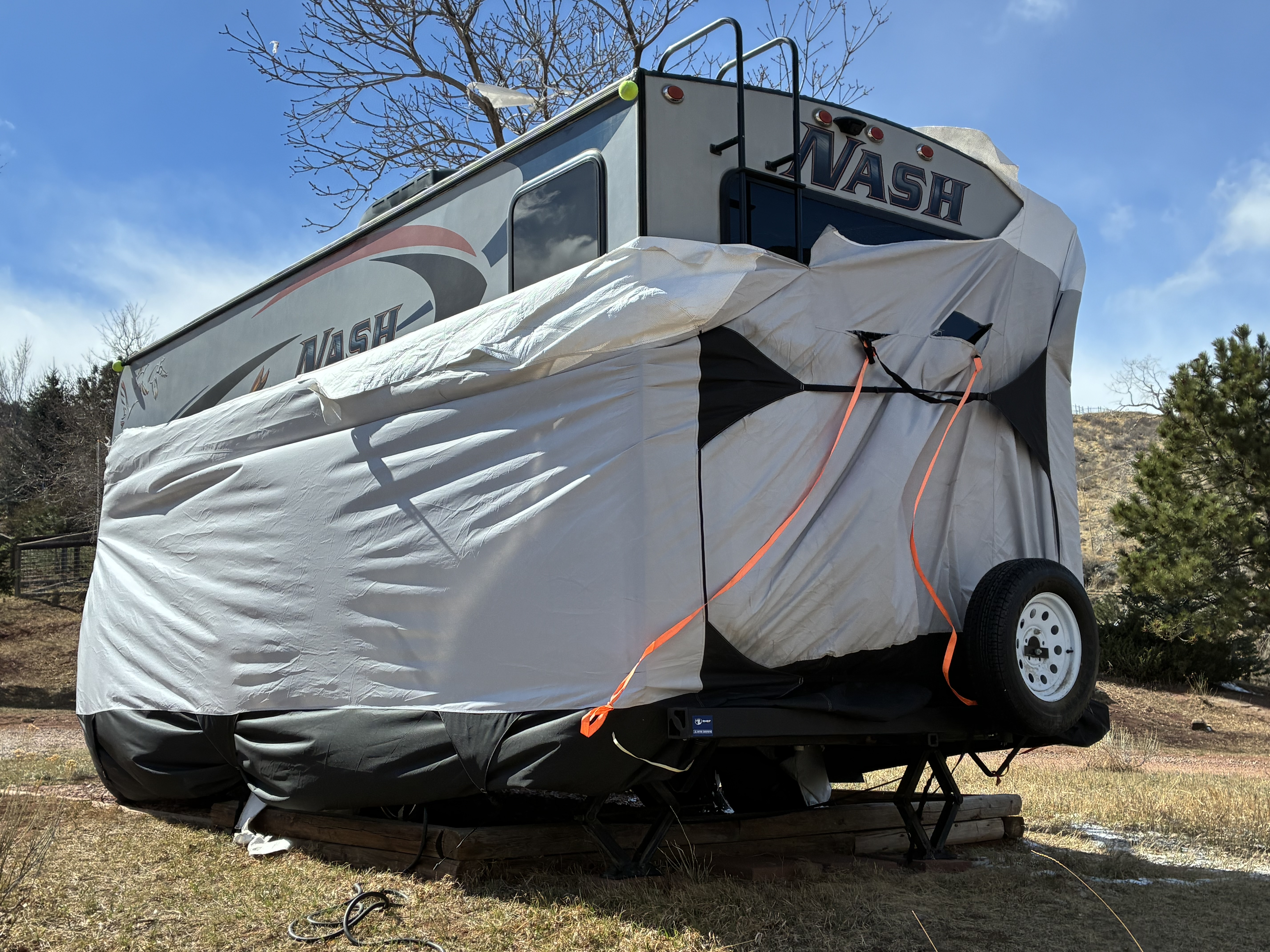
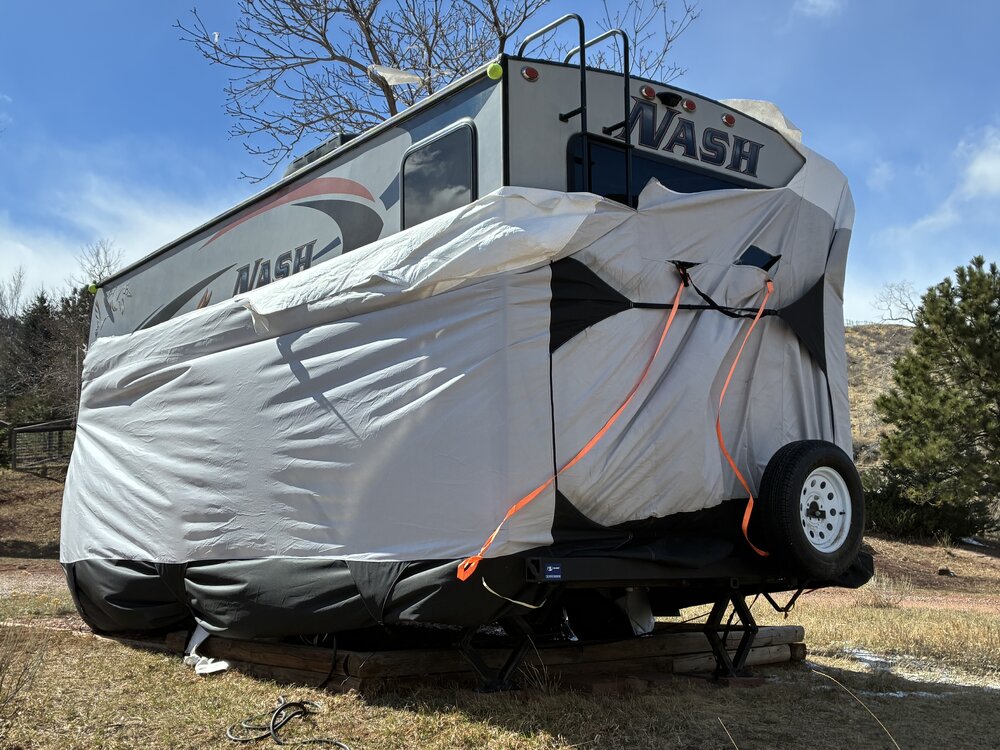
We live in the foothills west of Fort Collins and you can add about 5 mph to what Fort Collins had. It kinda tore up our trailer cover, that had previously survived fierce winds the past several years. Oh well the damage could have been worse - our house and trailer are still standing .
-
-
Thanks Chinook for the link to the paper. As I recall it took some time to break out of that pattern that became entrenched in 1976-77.
-
Thanks for the post - hope you're right about some snow in a few days. Anything would be welcomed (except more windstorms ;-(
-
This fall/winter in Colorado so far reminds me a lot of 1976-77. That was another brutally dry winter here. One big difference I see is that the '76-77 dry spell did not go on and on. In fact the winter of 1979-80 was the snowiest recorded in Fort Collins. And the decades of the 1980's and '90's were pretty awesome for weather buffs on the front range. Once we hit the year 2000 it seems we've been in and out of drought frequently for 25 years. Anyway, sure hope we see some decent snow at some point this winter/spring - to get some semblance of a snow pack. At this point we're stuck in a weak La Nina and those are generally not good for Colorado and the surrounding region.
-
About 8" here in foothills NW of Fort Collins with good moisture content. A blessing indeed!
-
You'd think just from dumb luck we'd stumble into a storm one of these days....
-
We received 0'" at our location (Bellvue NW of Fort Collins). Thought we'd at least get something MEASURABLE but nada. So still no precip. in Nov. and 40+ days since any was recorded. Brutal...
-
tacoman - thanks very much for your post, and good information you shared. I probably went off the deep end a bit due to my frustration over the anemic pattern we've been in. I hope you're right that it changes soon!