

rowjimmy73
-
Posts
96 -
Joined
-
Last visited
Content Type
Profiles
Blogs
Forums
American Weather
Media Demo
Store
Gallery
Posts posted by rowjimmy73
-
-
1 minute ago, BornAgain13 said:
18z EPS Clown?
Don't have it but man the zr output for danville is lights out.
-
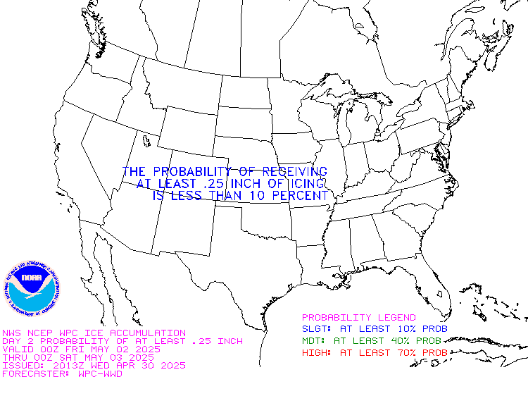
Wow this is lights out from these guys. Day 2 High Risk of .25
-
pretty sure the lowes has already been cleaned out post weekend icefest. at this point its gonna be about hunkering down and staying warm would be my guess. why cant we have a deeper cold layer and all snow for a change
-
 1
1
-
-
unless we can keep the warm layer away, i do not like those temp trends where im at. starting to hope its sleetfest instead anything but more freezing rain.
-
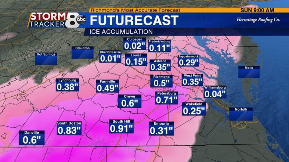
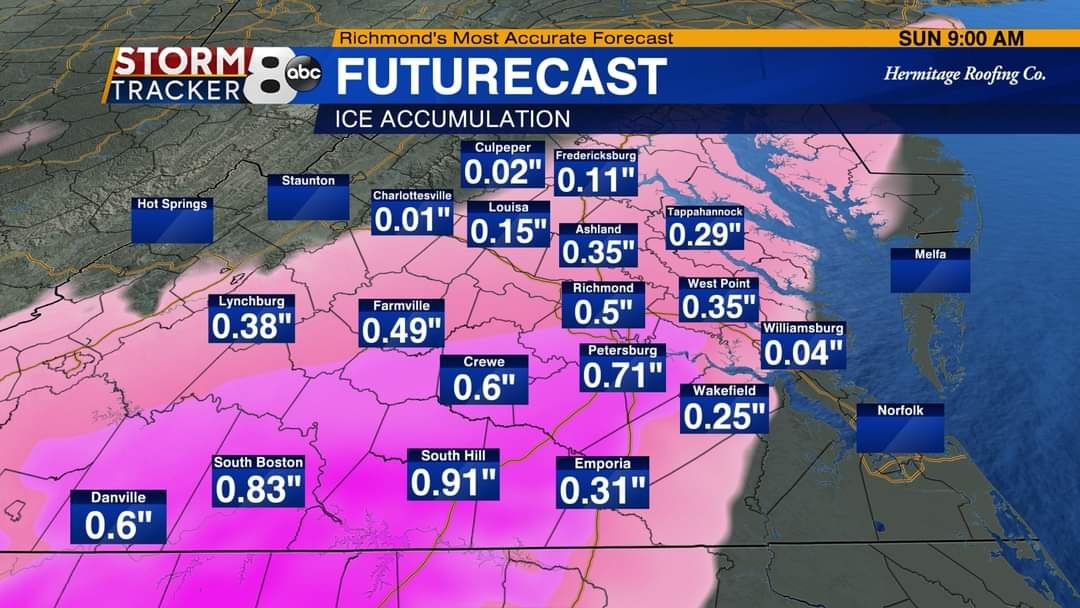
those wpc percentages for danville are just lights out, i mean how much more ice and tree damage etc can southside take this week?
. Happy Birthday to me thursday!
-
No matter how you slice it danville again in the crosshairs. Strong signal from what I've seen so far.
-
Just now, BornAgain13 said:
By 6 Am , the HRRR already has us getting over 1/4" of ICE
im watching it closely. keeps dp's down arounbd 28/29 in southside, going to be a verifiable skating rink in the am if so.
-
hrrr loves southside
-
15 minutes ago, BornAgain13 said:
Met out of Richmond shared this updated map for tomorrow. That's definitely ICE STORM WARNING CRITERIA if right
Sent from my SM-N981U using Tapatalk
if thats correct, lights out here in danville.
-
1 minute ago, Avdave said:
The last 2 pages have been free of pastings, puking snow, hammered, crushed, etc. See a pattern here
i think plenty of people will wish they were hammered and might even end up puking once its all over lol
-
2
-
 1
1
-
-
1 minute ago, Disc said:
.thumb.png.eb948834e4758f224215bddf35daaba5.png)
I'll take thagt inch in kdan. just the right kinda snow, easy on the eyes and melt away without help lol.
-
Just now, BornAgain13 said:
1 of Danville biggest was December 2018. The city got 15" , where I live NW of there got 17" or so.... Miller A's usually produce 4-8" or 6-10" around these parts... sometimes their is mixing involved... now for the storm coming up, I dont believe Danville or up my way will reach that much, maybe 2-4" is a good guess from me.
i'll continuely take the inch or 2 at a time and call it a winter. considering our yearly average in these parts, its a win. 2018 was the best snow ive experienced in years, such a quiet day, my daughters bday and just ripping snow. only other thing i've seen greater was pd2 and feb 83 in nj. Real live thundersnow!
-
so since ive only been in this region for a little over 4 years, ill ask the danville area folks.....when when nws blacksburg refers to miller a's as the biggest winter weather producers in this area, how big are they talking? i mean i know it wont be dec 2018, which was a nice treat, but how big do storms get in this region ie. danville biggest one day snow total. im very curious (sorry for slightly off topic but the morning discussion mentioned this so i was musing on it)
-
12 minutes ago, ILMRoss said:
Doubt many people will like this euro run. sorry folks. we may be playing catchup again for the time being
only to watch it trend back in the 3 day range? that seems to be a current trend anyway. lots of volatility, be glad it isnt the market lol
-
Just now, BornAgain13 said:
Geez , the 12k NAM gave me 0.98 ZR , even if that's cut in half , someone help me lol
i know. half of that puts us in the dark and out of school for a long time. i fear this would be a michael length outage and hope its not. time to load up the cooler with ice in prep.
-
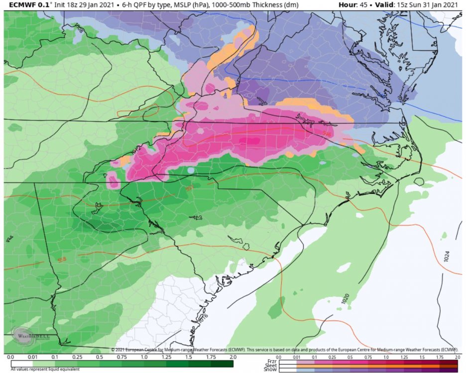
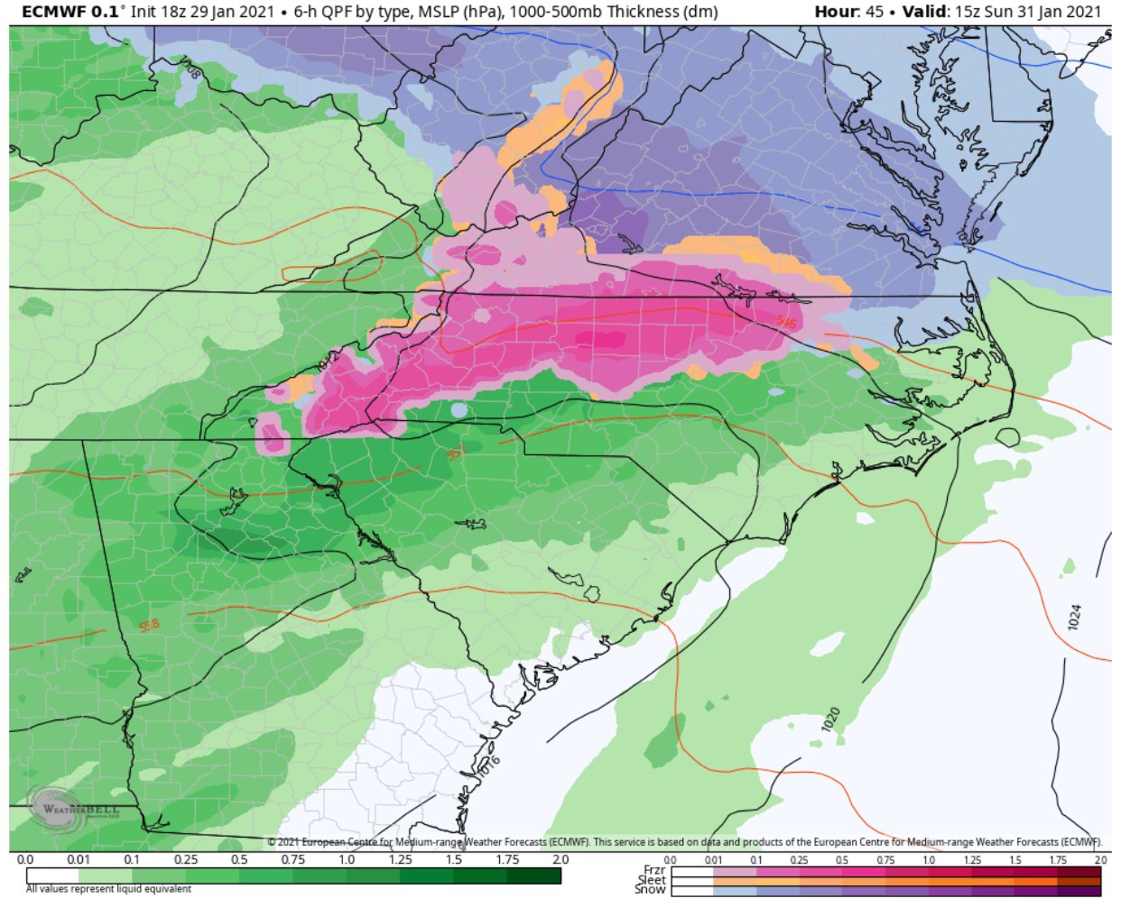
1 hour ago, jjwxman said:
FWIW the 18z Euro, seen below, was 2-3 degrees colder than the 12z run. Kinda out of it’s range at this point, but worth noting.
aint nothin finer than a good ol fashioned sleet storm here in danville by the looks of this.....
-
2 minutes ago, BornAgain13 said:
This is where I am at... very close to hardly nothing and a lot...

Sent from my SM-N981U using Tapatalk
you and me both. im just south and it really wouldnt take much wiggle room to get hit pretty bad now would it?
-
im hoping for a clear evening or at least part of it. also hoping cold over performs today and we dont get to the 51 they say we should. every degree helps.
go wedge go!
-
1 minute ago, Buddy1987 said:
@BornAgain13 NASTY ice forecasts back to back NAM runs for us. .60” and higher. Even half of that would not be good for the area.
given im just south of him hows this look down kdan way? hoping its not so intense
-
7 minutes ago, BornAgain13 said:
The Mid Atlantic will not like the GFS
i know its kuchera but ill take 4 fantasy inches lol. i stil think its gonna be cold nuff to eek out some ice of merit. even ther gfs at 12z is still 6 hours of frozen just enough to cause issues in the hillier parts of pitts county and danville if it plays out.
again this is all new to me , 35 years of nj winters and 9 florida, these last four have been a learning experience
-
2 minutes ago, ILMRoss said:
Two things to keep in mind:
-There is some scientific backing behind "hi-res models do better with CADs", which at face value can scan as a weenie-ism sometimes. Hi-res models will have a much more detailed rendering of the apps and topography in general- as it turns out when forecasting a topographically-induced weather event, having the topography rendered as accurately as possible is important!
-I have never, in 9 winters of lurking and posting through this board, seen ZR qpfs be accurate. They are almost always inflated. The only legitimate ice storms I can really remember that mildly panned out were all in 2014.
im 4 years into southern winters and have never seen one here in danville either. ive heard about them from a friend and they dont sound fun at all. that being said i see wpc has us between .10 and .25 realistically towards the lower end. hoping the high presses a bit more since i stocked up on batteries and foods.
-
30 minutes ago, BornAgain13 said:
Allan put his 1st call map out about the ICE, showing significant icing in some areas...
icy that is for us man....
-
so looks like all we can say for sure is some frozen stuff here. kinda jealous i wont be back at my folks in cnj...they getting plastered. bring on whatever we get tho im game.
-
7 hours ago, WinstonSalemArlington said:
A boy can dream

wouldnt that be a nice start down here in danville.
.png.9167e205dfbe45e3f3aaed4edd66bfc5.png)
Jan 15-16 Winter Storm
in Southeastern States
Posted
im hoping that is true too, it would keep powerline accretion down let alone anymore trees into my yard from the neighbors lol.