Jump to content

ChrisBray

Members
  • Posts

    18
  • Joined

  • Last visited

Everything posted by ChrisBray

  1. Kinda shocked no one is talking about this. While the most likely scenario is nothing popping until after dark near the WI/IL border, and probably second most likely is an MCS just chugging through the target area ruining everything, there could very well be a few storms popping in/near the prime warm sector in NC/NE IL, possibly due to a leftover boundary from overnight. I'll probably head out to chase this one given the juicy hodographs and CAPE I'm seeing on every model
  2. As of now, the NAM has quite a nice setup for Tuesday around the quad cities area.
  3. Starting to eye Iowa/MO/IL on Tuesday. Last few GFS/GEFS runs plus 12z euro have some nice parameters in place (40-50 knots bulk, 20knots LL shear, 3000ish SBCAPE)
  4. Finally some signs of life this weekend. NAM likes saturday in Iowa, Sunday in Illinois. Let's see what happens.
  5. I'm not going to cherry pick NAM soundings, but with a little help this could be a nice event. Good Cape/dews and sufficient shear. Kinda weak surface low, hopefully winds back more in the warm sector. Will definitely be out there!
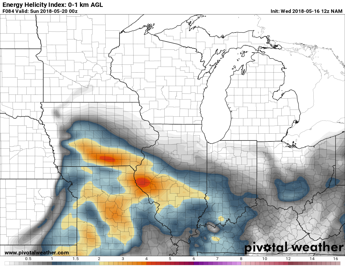
  6. First NAM run for Saturday in range, and it actually agrees with 6z GFS with Iowa/MO having some impressive parameter space. (Yes, I realize its 84 hour nam, but this agreement at least gives something to watch for)
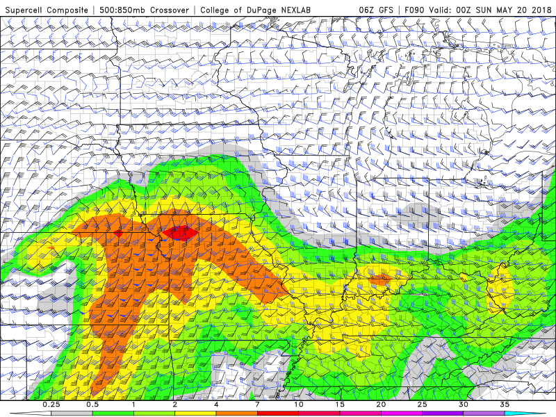
  7. Take this FWIW but latest NAM has this around 25 miles south of Valpo on Wednesday evening Will be interesting to see if NAM keeps trending out of Illinois for this event. Low levels look amazing, its upper levels and bulk shear that aren't so hot.
  8. Hope you all are enjoying this week. Looking bleak for the foreseeable future.
  9. Regarding Today, it is interesting the SPC has that 5% tornado extended way across Illinois, but yet they don't really address the storms that pretty much every model fires across E IA/W IL this afternoon. Based on the wind profiles I am seeing, I have to imagine that percentage is based on the overnight squall line that fires in Kansas today?
  10. Been eyeing N IL/E IA for some possible warm front action, but NAM is very inconsistent with Euro and other CAMs in regards to what exactly will happen. Looks like overall there are some nice parameters in place, but week surface pattern and possible height rises due to wave timing have me concered.
  11. https://www.metabunk.org/debunked-patents-as-evidence-of-chemtrails-geoengineering-existence-operability-or-intent.t3704/page-2#post-213606 Please read more.
×
×
  • Create New...