
pbrussell
-
Posts
272 -
Joined
-
Last visited
Content Type
Profiles
Blogs
Forums
American Weather
Media Demo
Store
Gallery
Posts posted by pbrussell
-
-
Friendly reminder to keep discussion on individual storms locations precise as possible given how many there will be. Radar sites perhaps as well. The crosbyton cell at lbb looks like it’ll need a tor warning soon
-
 2
2
-
-
3 minutes ago, AfewUniversesBelowNormal said:
Bust day coming up.. look at the radar interference
Please use /s to indicate sarcasm. You’ll confuse everyone
-
 1
1
-
-
1 minute ago, Drz1111 said:
Mean storm motion 240 at 35kts? Spicy, and consistent with modeling for the last day or so. Not much margin for error chasing today.
Let’s not forget the flash flooding that will likely make many roads impassable. And it’s gonna be busy. And the storms are gonna move fast.
I know the pros are pros but today is anything but safe
-
Kind of wish there weren’t two different threads ongoing with this event. It’s already hard enough to keep up with what’s unfolding. Regardless, folks may consider moving to the new thread to consolidate things. I know I don’t want to be flipping back and forth three hours from now
-
4
-
-
12 minutes ago, SandySurvivor said:
the tornado threat from sandy was more serious than this setup

-
1
-
-
My basement is likely going to turn into a swimming pool during this outbreak. Trying to come up with a way to add jacuzzi jets and maybe I’ll duct my heater straight into the water to make it a hot tub.
Outbreak watch Party at my place. Bring your speedos and cheap beer and perhaps some inner tubes.
-
1
-
-
4 hours ago, OUGrad05 said:
It's certainly interesting D4-D8 that's for sure. I'm not sure what to make of the D8 language. Obviously potential is there, but we've all seen systems just go to crap and sometimes evaporate that far out. This "feels" different given the magnitude of the data supporting the current forecast and wording.
Right now it's one day at a time for me, I'm not really analyzing models run-by-run at this juncture and don't plan to until we're within 3 or so days of each respective day on the outlook. Just simply too much movement, too much possibility for significant change that far out.
I will say I've not seen a pattern like this and models falling in line like this for so many repeated days in a long time, if ever. A big part of me says the system looks so good right now its bound to downtrend from here.
Soundings for Mon/Tues are just nuts.It’s a plains setup, so it will downtrend.
-
Time to get out the 1995 fully loaded red dodge truck with liability only insurance.
also probably time to make a dedicated thread
-
Got some storms at kict trying to do their thing too. Looks like they are riding some kind of boundary
-
Looks like the plainview cell is either in the middle of a split or cell merger. Can’t tell which
-
5 minutes ago, jojo762 said:
It is a beast on KMAF
The National Weather Service in Midland has issued a
* Tornado Warning for...
North central Pecos County in southwestern Texas...* Until 515 PM CDT.
* At 425 PM CDT, a severe thunderstorm capable of producing a tornado
was located 15 miles north of Fort Stockton, moving east at 20 mph.HAZARD...Tornado and baseball size hail.
SOURCE...Radar indicated rotation.
IMPACT...Flying debris will be dangerous to those caught without
shelter. Mobile homes will be damaged or destroyed.
Damage to roofs, windows, and vehicles will occur. Tree
damage is likely.* This tornadic thunderstorm will remain over mainly rural areas of
north central Pecos County, including the following locations...
Imperial.Isn’t there always a massive supercell down there doing it’s own thing?
-
3
-
-
These radar sites normally have this much contamination? Velocity has been awful on all of them
-
1
-
-
Most interested in the plain view cell as it’s pretty discrete and moving up into the more highly sheared environment
-
Here come the warnings.
-
Best looking storms atm are a band of supercells at kddc. One in particular looks to have pretty good inflow and some broad rotation
-
50 minutes ago, Indystorm said:
BULLETIN - EAS ACTIVATION REQUESTED
SEVERE THUNDERSTORM WARNING
NATIONAL WEATHER SERVICE TOPEKA KS
731 PM CDT MON MAY 6 2019
THE NATIONAL WEATHER SERVICE IN TOPEKA HAS ISSUED A
* SEVERE THUNDERSTORM WARNING FOR...
FRANKLIN COUNTY IN EAST CENTRAL KANSAS...
NORTHEASTERN ANDERSON COUNTY IN EAST CENTRAL KANSAS...
SOUTHEASTERN OSAGE COUNTY IN EAST CENTRAL KANSAS...
* UNTIL 815 PM CDT.
* AT 730 PM CDT, A SEVERE THUNDERSTORM WAS LOCATED 4 MILES EAST OF
WILLIAMSBURG, MOVING SOUTHEAST AT 45 MPH.
THIS IS A VERY DANGEROUS STORM.
HAZARD...80 MPH WIND GUSTS AND HALF DOLLAR SIZE HAIL.
SOURCE...TRAINED WEATHER SPOTTERS.
IMPACT...FLYING DEBRIS WILL BE DANGEROUS TO THOSE CAUGHT WITHOUT
SHELTER. MOBILE HOMES WILL BE HEAVILY DAMAGED. EXPECT
CONSIDERABLE DAMAGE TO ROOFS, WINDOWS, AND VEHICLES.
EXTENSIVE TREE DAMAGE AND POWER OUTAGES ARE LIKELY.
* LOCATIONS IMPACTED INCLUDE...
OTTAWA, GARNETT, WELLSVILLE, CENTROPOLIS, POMONA, RICHMOND,
WILLIAMSBURG, QUENEMO, GREELEY, PRINCETON, LANE, RANTOUL AND POMONA
LAKE.
I’ve been watching that storm all night. It has been nasty and is still going strong
-
And of course the lone supercell in the high planes is producing. See cheyenne radar site. Classic reflectivity presentation
-
Embedded supercell city in ks. Some of them appear to be producing some nasty hail
-
3 minutes ago, 1900hurricane said:
It's not a true event until there is an isolated cell somewhere deep in Texas deviantly moving to the right.
Very strong ducks fly together v with her too
-
2 minutes ago, jojo762 said:
Believe they are talking about the cell west of SGF... which has had strong rotation for a while now.
Looked strong but broad to me. Anyway.
-
1 minute ago, J_Prothro said:
PDS on SW MO warning
Velocity must not be telling the whole store there. The reflectivity scans sure have been nasty though
-
There’s a few flying v’s at Kfdr heading toward okc that I wouldn’t sleep on
-
The storm around Springfield mo is the next one to go
-
2 minutes ago, JMT417 said:
Now TOR warned
Given the radar hole this one is in, I would not be surprised if this one is producing. Pretty mean reflectivity scans on it

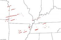
MAY 20, 2019 High Risk
in Central/Western States
Posted
Definitely looks suspect. Shame it’s in such a radar hole