
pbrussell
-
Posts
263 -
Joined
-
Last visited
Content Type
Profiles
Blogs
Forums
American Weather
Media Demo
Store
Gallery
Posts posted by pbrussell
-
-
3 minutes ago, Calderon said:
Looks like we’re getting circulation handoff as it’s approaching Rockford.
.Yup. And we saw what that earlier cell merger did. Looks like another merger is about to take place as well
-
TDS on it now
-
This has got to be a violent, major league tornado. Definitely don’t see radar images like this often
-
This looks like it’s shaping up to be a very long day. Hopefully not a precursor of things to come for folks in the path.
We could be looking at the event of the year here.
-
Iowa’s blowing up
-
 1
1
-
-
Whelp. Everything’s going crazy now. Hello llj
-
4 minutes ago, jpeters3 said:
There were several more impressive ones a week and a half ago in MS, and another one last weekend in MS.
2 minutes ago, Buckeye05 said:Lol no
I love Internet forums. Sorry guys
¯\_(ツ)_/¯
Just thinking about the last time I watched a supercell cycle and produce violent tornadoes as long as this one has. Chapman is what came to mind
-
Pretty big tds there. This supercell is the most impressive storm I’ve watched since chapman ks. Perhaps more impressive?
-
I mean it’s not the tri state tornado... but it’s definitely a long track supercell beast.
-
Just now, MUWX said:
Velocity signature is much weaker now
But the reflectivity...
-
Prettiest storm I’ve watched in a while
-
1 minute ago, Snowstorm920 said:
The radar presentation of that cell is amazing currently
That’s a big league supercell right there
-
Couplet getting tight again
-
Hail core has diminished a smidge as well. Not sure if she’s cycling or dying. We shall see
-
Looks like we are having some cell Merger here. This is looking less and less like two separate storms
-
Keep an eye on the supercell trailing the main storm. We are getting a hook echo on that one
-
There’s a tiny little supercell in leesburg al with a couplet/potential tds that is unwarned at the moment
-
The lead supercell has weakened by a twinge and it looks like the circulation is beginning to occlude
-
Southern supercells couplet is beginning to Max out
-
It looked like it was going to cycle for a second before it hit soso. That town is in big trouble
-
1 minute ago, lilj4425 said:
If you live in Bassfield, it the first tornado didn’t completely flatten your house then the second one will. Crazy.
That storm has a reflectivity donut hole now
-
Radar signatures don’t get much better than this. This is an extremely scary storm
-
Watching the cell blowing up north of Philadelphia ms
-
Looks like there is a tds with that southern Texas storm. At 1:24 am...
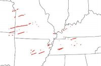
Severe Event March 25th 2021
in Southeastern States
Posted
Reflectivity is hinting that the storm is about to split apart