NIUmetGF
Meteorologist-
Posts
100 -
Joined
-
Last visited
Content Type
Profiles
Blogs
Forums
American Weather
Media Demo
Store
Gallery
Everything posted by NIUmetGF
-
Alaska/Western Canada obs and discussion
NIUmetGF replied to patrick7032's topic in Central/Western States
PABR 272353Z 05015KT 2SM -SN BR FEW009 BKN015 OVC030 00/M02 A2993 RMK AO2 SNB32 SLP134 P0000 60000 4/001 T00001022 10000 21017 $ Barrow has an inch of snow on the ground. Possibly a chance for the higher elevations in Anchorage (as in where people live, not the peaks) has a chance to see some snow on Thursday morning. -
Alaska/Western Canada obs and discussion
NIUmetGF replied to patrick7032's topic in Central/Western States
http://www.twitvid.com/8PBIZ Fog rolling into the airport here. -
Alaska/Western Canada obs and discussion
NIUmetGF replied to patrick7032's topic in Central/Western States
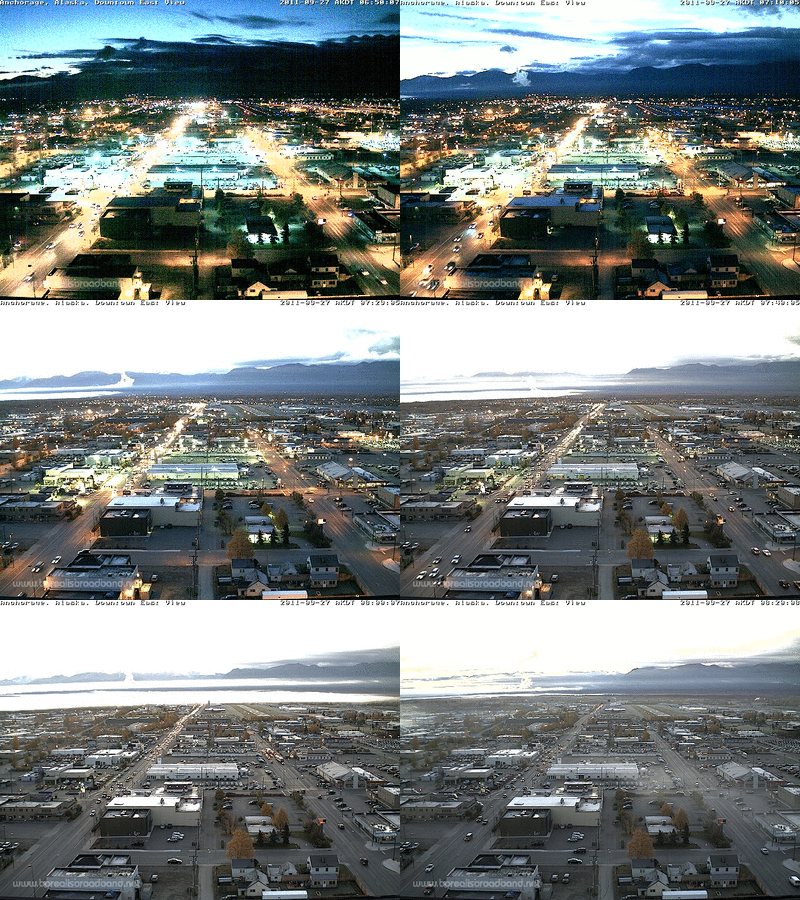
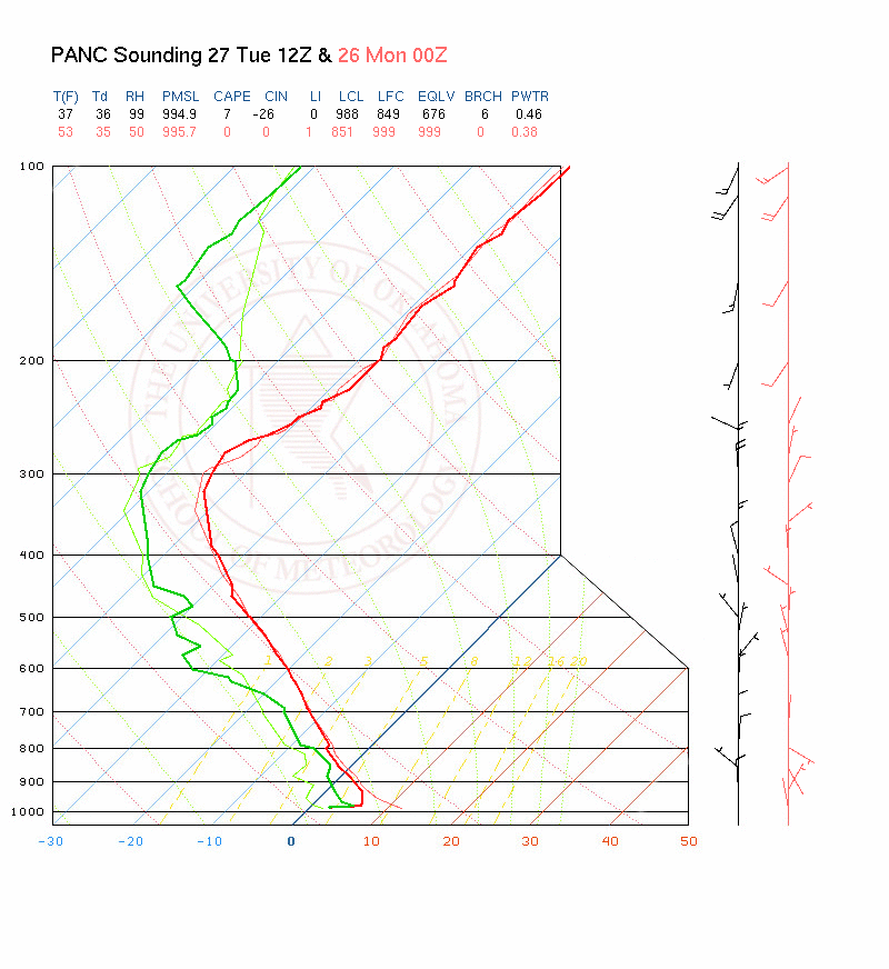
Fog rolling into northeast Anchorage. 12Z sounding, though there was no fog here at the time. Freezing level down to 3500. Weak convection has been firing off the mountains the past couple afternoons with snow at the peaks. -
Alaska/Western Canada obs and discussion
NIUmetGF replied to patrick7032's topic in Central/Western States
http://www.jma.go.jp/en/gms/smallc.html?area=3&element=0&time=201109220230 Check out the remnants of Typhoon Roke get pwned by the westerlies -
Alaska/Western Canada obs and discussion
NIUmetGF replied to patrick7032's topic in Central/Western States
I think were talking about 2 different systems. I was reference in the developing low in the Northeast Pacific. -
Alaska/Western Canada obs and discussion
NIUmetGF replied to patrick7032's topic in Central/Western States
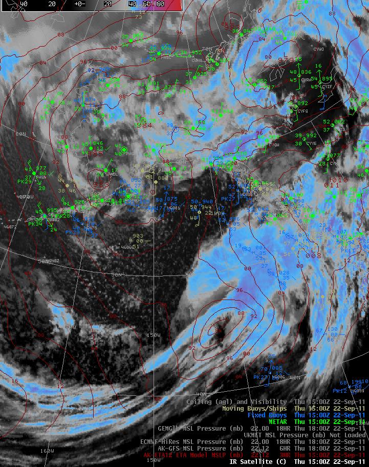
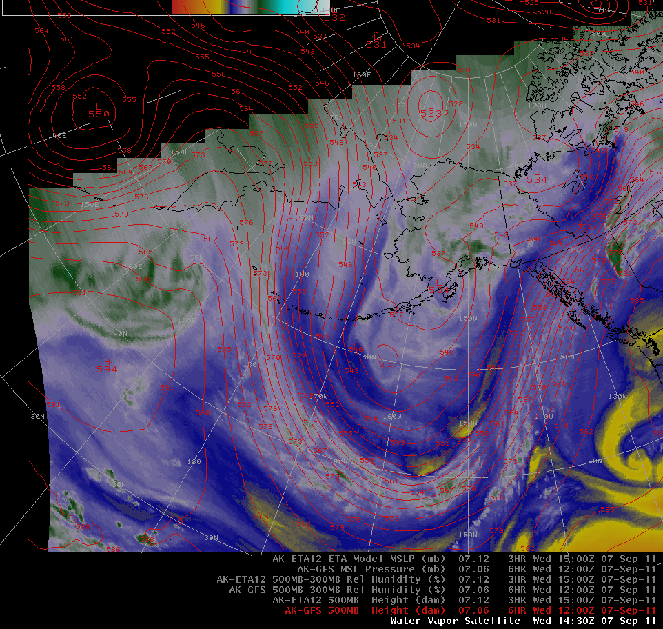
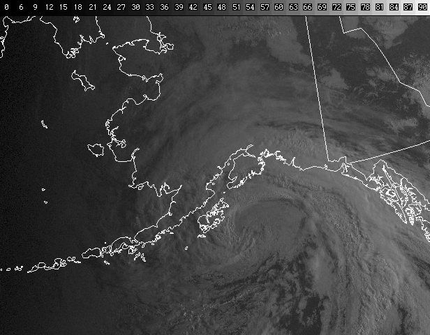
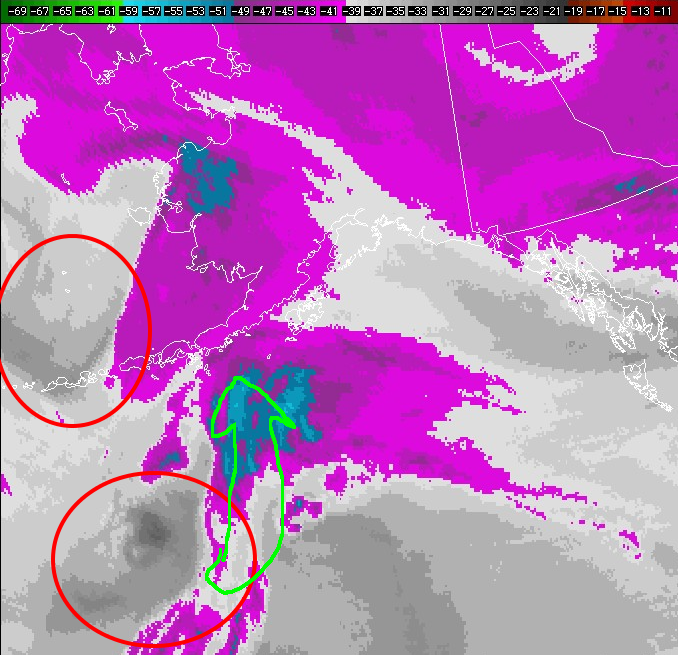
It is well known that models struggle with rapid cyclogenesis events. The model guidance performance with the developing system has been erratic with the depth/placement/timing of the system approaching the AK Panhandle. Even this morning as the low is taking shape, and the models seem to have converged on a solution. Looking at the satellite can give us hints on how the models are actually doing. Looking at the IR at 15Z today with the nam12 mlsp overlaid it appears to me as if the surface low is too far south and should be 3 degrees or so further north and maybe a little east. With a developing/mature cyclone the surface low is located to the east of the 'cusp' (the dry intrusion) in the satellite imagery. -
Alaska/Western Canada obs and discussion
NIUmetGF replied to patrick7032's topic in Central/Western States
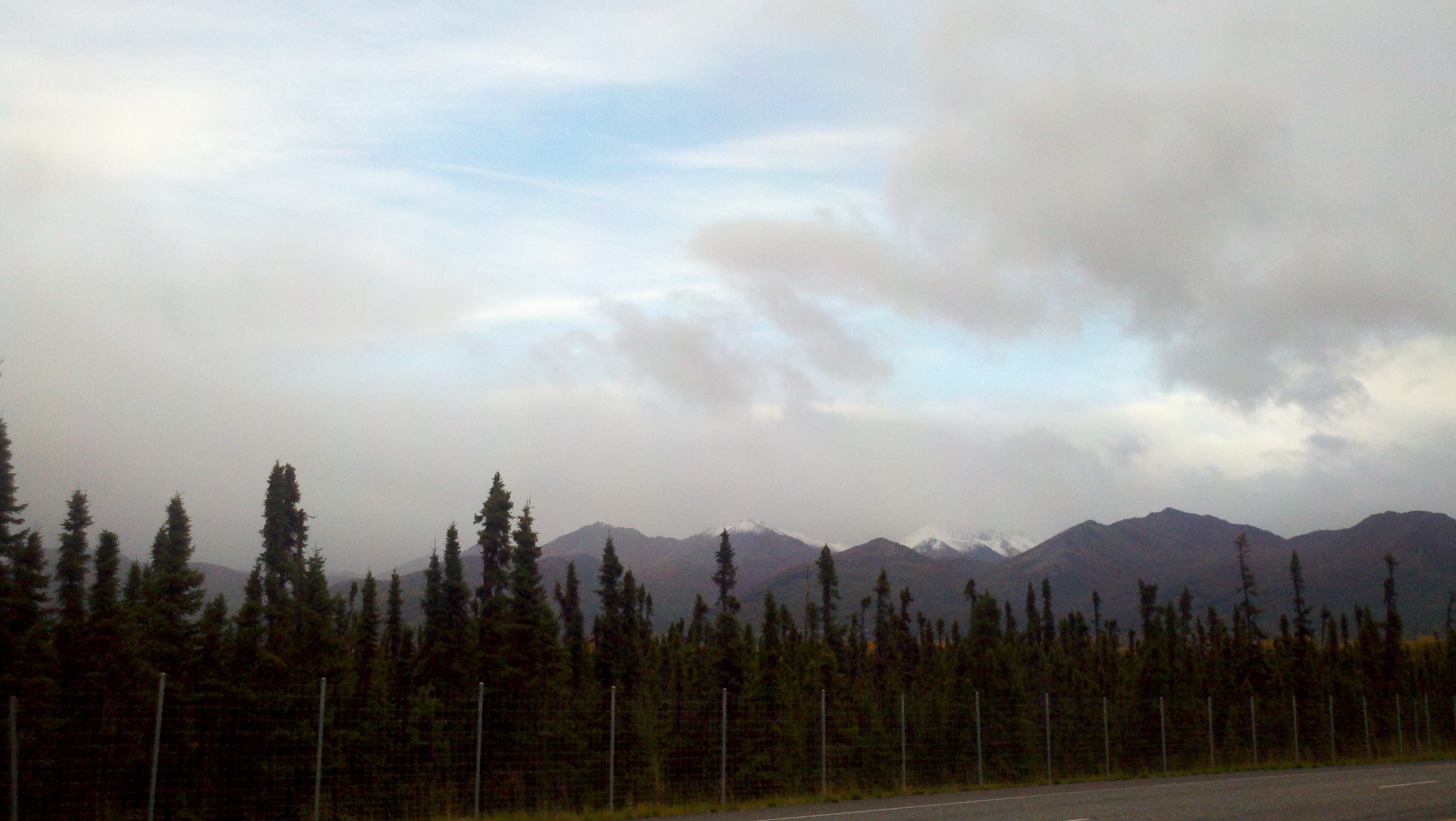
We got our first real termination dust on the front range the other night. The closest peaks to Anchorage didn't get much, they are only around 4000-4500 ft, but directly behind there are some 5000-5500 peaks which did get hit. Freezing level on today's 12Z sounding was 5200ft. Winter is coming. -
Alaska/Western Canada obs and discussion
NIUmetGF replied to patrick7032's topic in Central/Western States
Not for sure till I can go through my pics with a topo map but I think that is a good estimate -
Alaska/Western Canada obs and discussion
NIUmetGF replied to patrick7032's topic in Central/Western States
-
Alaska/Western Canada obs and discussion
NIUmetGF replied to patrick7032's topic in Central/Western States
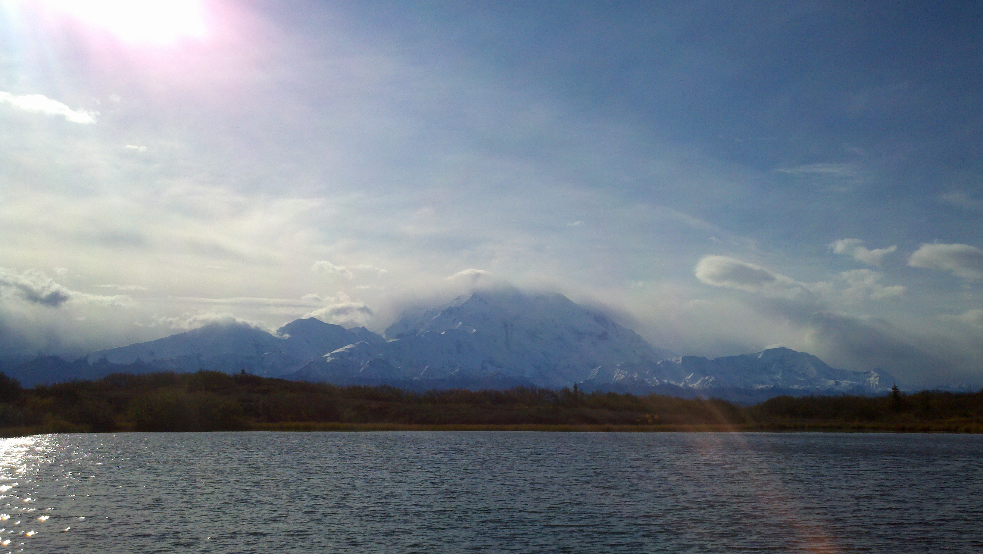
Heading up to Denali National Park when I get off work this evening! Should have some good pics to post, weather will be good, just a question of having a clear view to 20,000. -
Alaska/Western Canada obs and discussion
NIUmetGF replied to patrick7032's topic in Central/Western States
Cool satellite animation of the lava dome building on Cleveland volcano. http://www.avo.alaska.edu/image.php?id=40772 -
Alaska/Western Canada obs and discussion
NIUmetGF replied to patrick7032's topic in Central/Western States
MTBLANC.... here are some publications from Environment Canada about region specific weather you may be interested in looking at. http://www.navcanada.ca/NavCanada.asp?Language=en&Content=ContentDefinitionFiles/Publications/LAK/default.xml -
Alaska/Western Canada obs and discussion
NIUmetGF replied to patrick7032's topic in Central/Western States
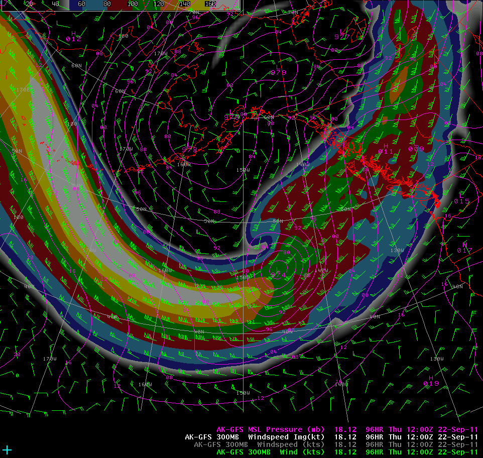
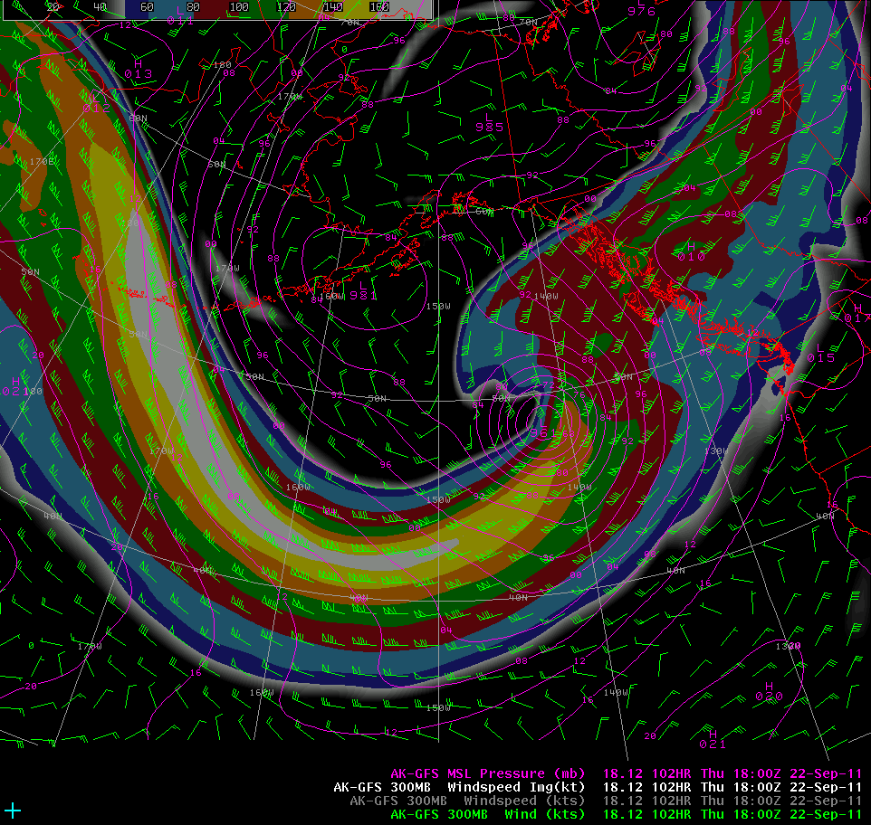
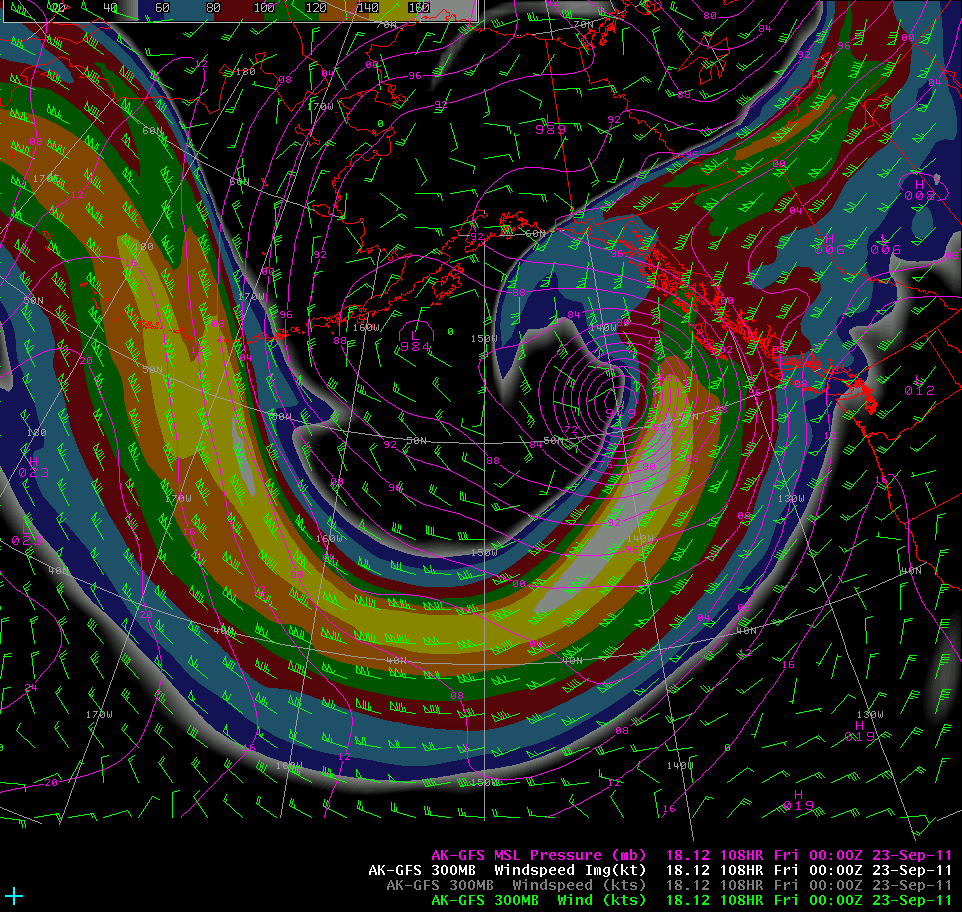
170-180kt East Asian jet punching into the long wave trough gonna make for an interesting situation end of week. Euro doesn't keep the jet quite as strong as it rounds the base of the trough, or show the upper jet coupling that the GFS does. Either way should be a decent system. GFS bombs it out as the jet nose interacts. -
Alaska/Western Canada obs and discussion
NIUmetGF replied to patrick7032's topic in Central/Western States
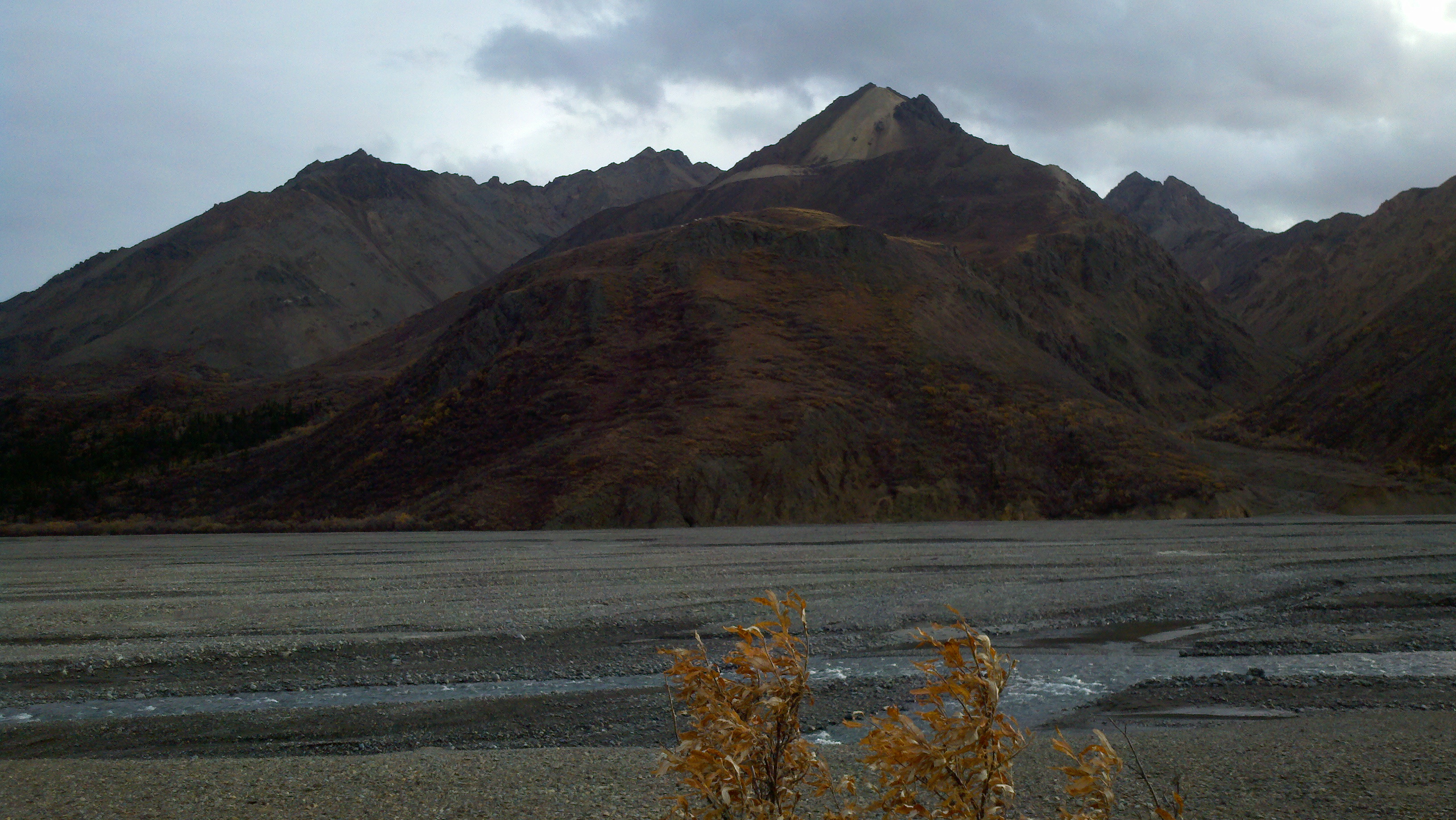
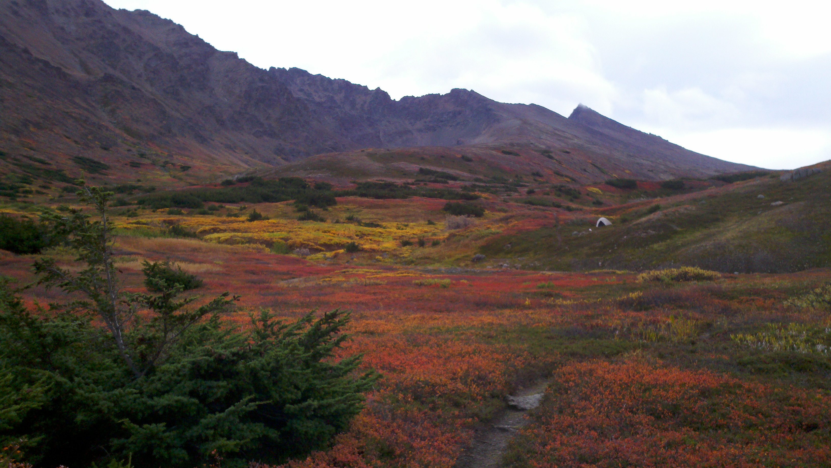
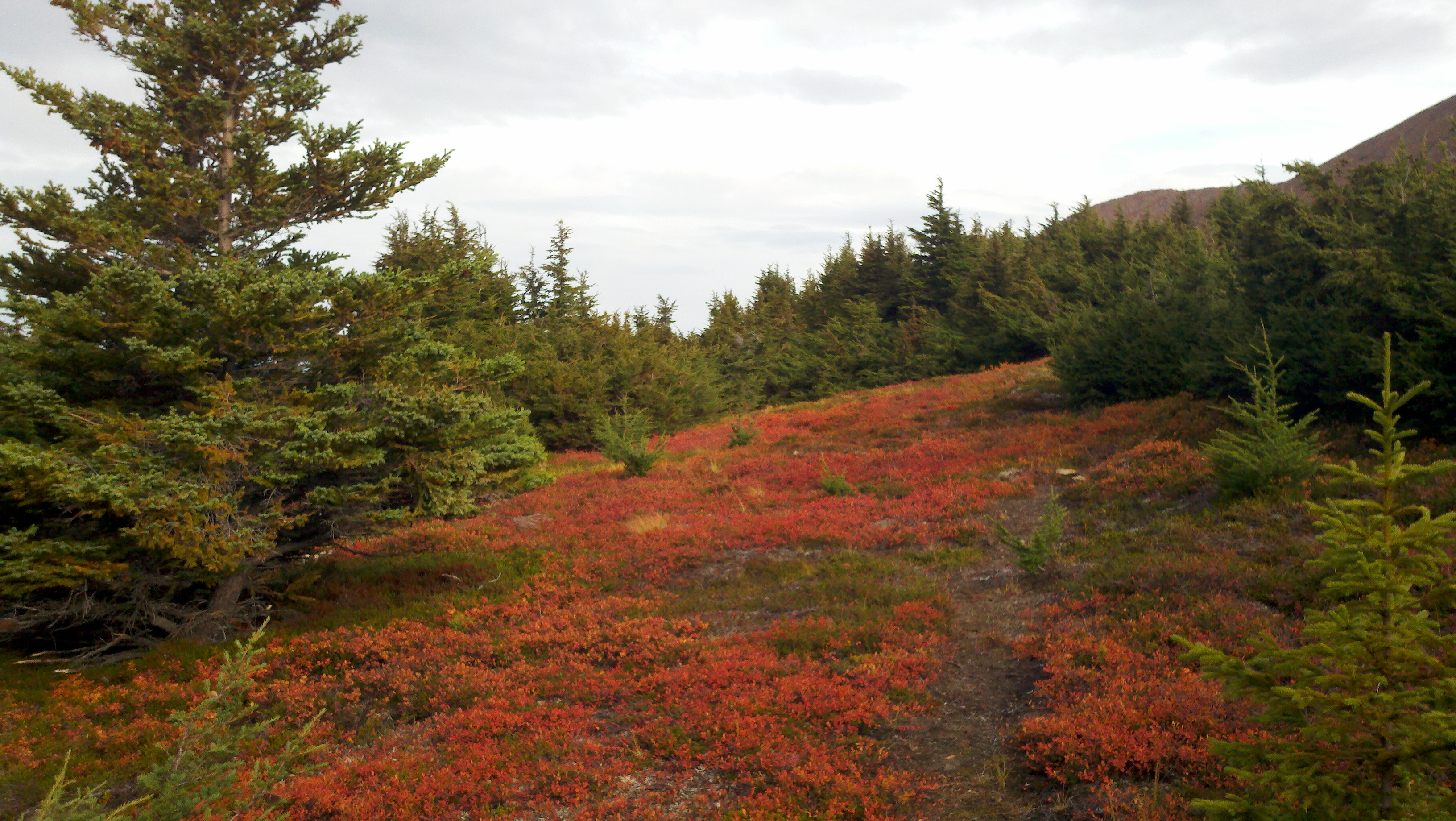
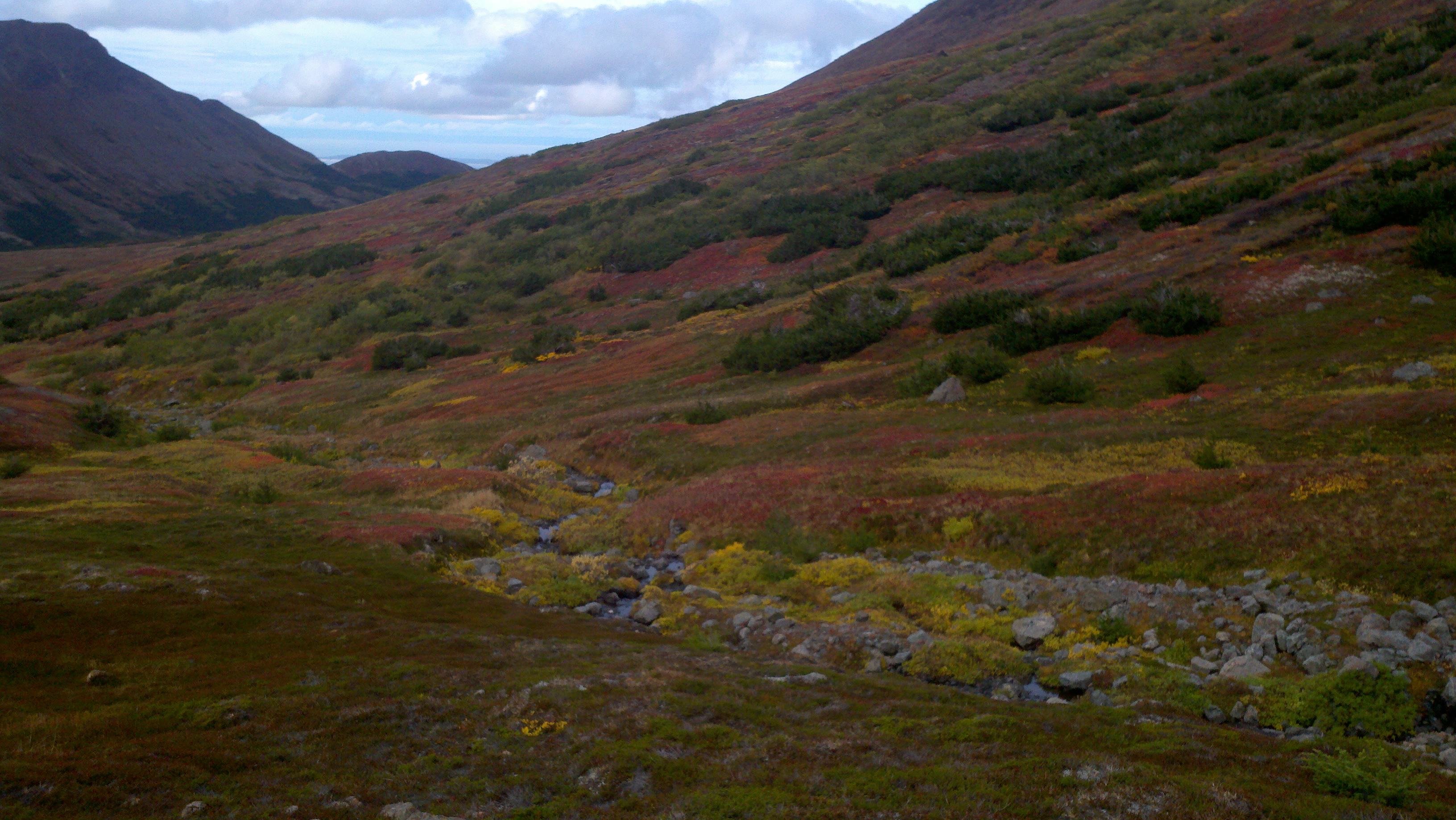
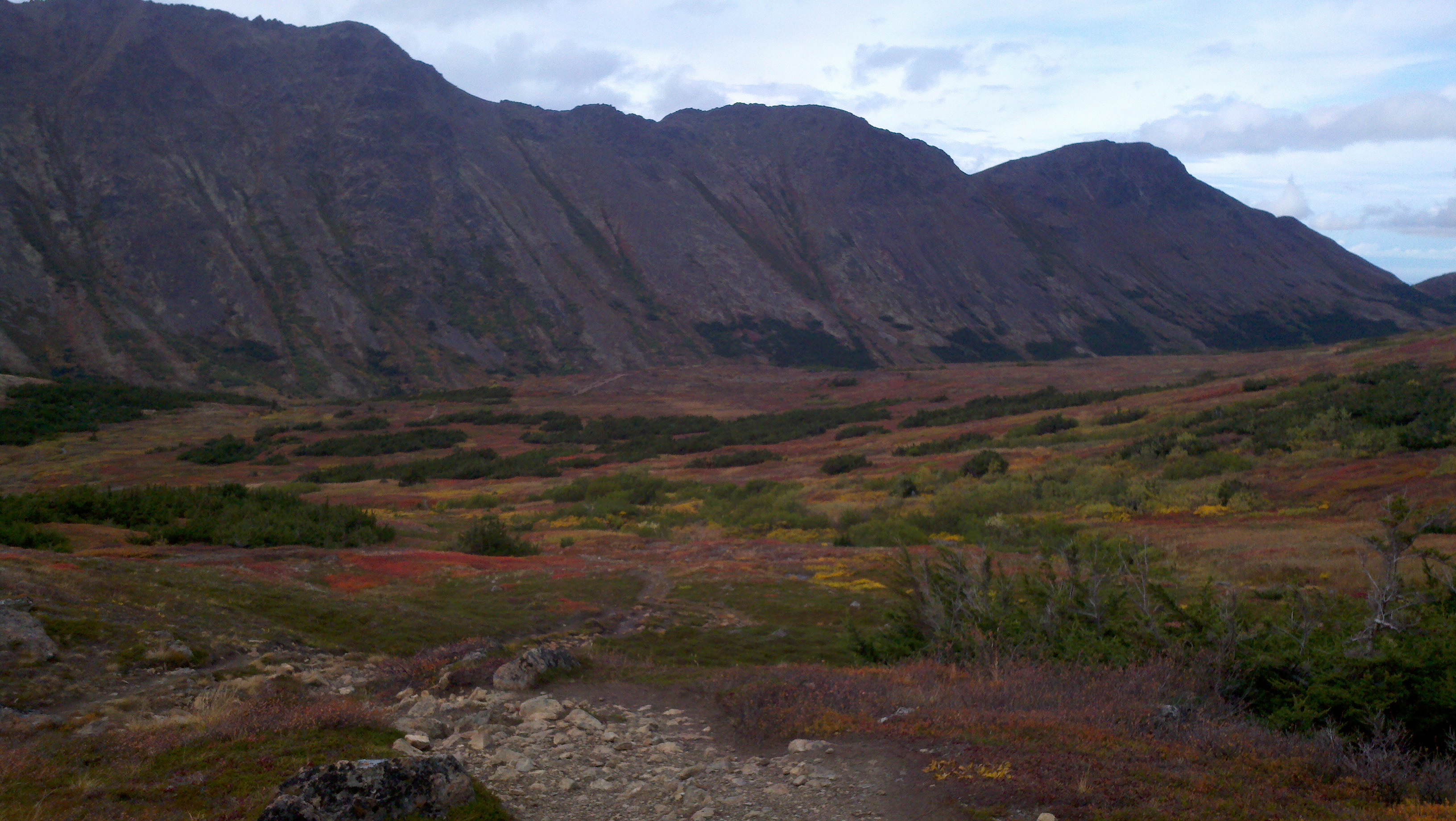
A couple pics from my hike today. Even though the deciduous trees are mainly turning only yellow around town, the lower mossy foliage has plenty of color to go around. -
Alaska/Western Canada obs and discussion
NIUmetGF replied to patrick7032's topic in Central/Western States
Wow, looks like we may be on the cold side of climate here. That is one thing I haven't looked into yet here. -
Alaska/Western Canada obs and discussion
NIUmetGF replied to patrick7032's topic in Central/Western States
I went on a glacier cruise at the end of last month and happened to go on one of the best days of late summer (the benefits of being a meteorologist I guess). Check out the pics here... http://mtlawsonwx.wordpress.com/2011/09/16/glaciers-galore/ -
Alaska/Western Canada obs and discussion
NIUmetGF replied to patrick7032's topic in Central/Western States
Here in Anchorage we are losing 5 minutes 39 seconds per day. That adds up fast, it actually feels "normal," in a midwestern sense that is. -
Alaska/Western Canada obs and discussion
NIUmetGF replied to patrick7032's topic in Central/Western States
A little bit more going on in the next week 617 FXAK68 PAFC 121149 AFDAFC SOUTHCENTRAL AND SOUTHWEST ALASKA FORECAST DISCUSSION NATIONAL WEATHER SERVICE ANCHORAGE AK 500 AM AKDT MON SEP 12 2011 ANALYSIS AND UPPER LEVELS UPPER LEVEL PATTERN FEATURES A LARGE BROAD TROUGH CENTERED NORTHEAST OF THE KAMCHATKA PENINSULA STRETCHING SOUTHEASTWARD ACROSS THE BERING AND ALEUTIANS. AN UPPER RIDGE STRETCHES FROM THE PANHANDLE THROUGH THE CHUKCHI SEA. A LARGE UPPER LOW SPAWNING FROM THE PINCHED OFF REMNANTS OF LAST WEEKS HIGH AMPLITUDE TROUGH CHURNS NORTHWARD INTO THE GULF OF ALASKA AND IS BEGINNING TO PHASE WITH LARGER TROUGH TO THE WEST. THE INTERACTION OF THESE FEATURES WILL BE THE FOCUS FOR WEATHER ACROSS THE SOUTHERN GREAT LAND FOR THE SHORT TERM. AT THE SURFACE...EACH OF THE UPPER LEVEL FEATURES SPORTS A SURFACE REFLECTION...A BROAD LOW PRESSURE COVERING MOST OF THE BERING SEA WITH OCCLUDED/COLD FRONT FROM SAINT PAUL ISLAND INTO THE NORTH CENTRAL PACIFIC. A UPPER 980MB LOW MOVES INTO THE GULF OF ALASKA BRINGING RAIN TO THE SOUTHERN MAINLAND. A SURFACE RIDGE STRETCHES FROM NORTHWEST TERRITORIES INTO THE CENTRAL INTERIOR. MODEL DISCUSSION GUIDANCE IN RELATIVELY GOOD AGREEMENT WITH THE UPPER LEVEL SYNOPTIC FEATURES THROUGH THE SHORT TERM. THE GULF UPPER LOW WILL BECOME AN OPEN WAVE AND PHASE WITH THE BERING SEA TROUGH MOVING NORTHWARD INTO THE INTERIOR. THE LARGE UPPER LOW OVER KAMCHATKA WILL DRIFT OVER THE CENTRAL BERING BY MIDWEEK WITH A TROUGH EXTENDING ACROSS THE AKPEN INTO THE GULF OF ALASKA. THE SURFACE LOW IN THE GULF WILL ASSIMILATE INTO THE BROAD AREA OF TROUGHING FROM BRISTOL BAY TO THE AKPEN. DETAILS BECOME MUDDLED AFTER MIDWEEK FOR THE EXTENDED FORECAST BUT GUIDANCE AND DEVELOPING PATTERN SUGGESTS A BROAD UPPER LOW OVER THE BERING WITH EMBEDDED BAROCLINIC DISTURBANCES IN THE FASTER WESTERLY FLOW SOUTH OF THE ALEUTIAN CHAIN MAKING FOR AN ACTIVE WEEK. SHORT TERM FORECAST SOUTHCENTRAL ALASKA...INCREASING CLOUDINESS AND RAIN SPREADING NORTHWARD INTO THE INTERIOR AS THE GULF OF ALASKA LOW MOVES NORTHWARD. COASTAL AREAS WILL SEE THE BRUNT OF THE PRECIPITATION WHILE SHOWERS WILL BECOME DOMINANT ON THE NORTH SIDE OF THE CHUGACH. SOUTHWEST ALASKA...INCREASING CLOUDS FROM THE AKPEN THROUGH THE YUKON DELTA. CHANCE FOR RAIN INCREASES THROUGHOUT THE DAY FOR THE BRISTOL BAY AREA SPREADING NORTHWARD TO THE KUSKOKWIM DELTA REGION BY THE AFTERNOON. BERING SEA AND ALEUTIANS...GUSTY SOUTHERLY WINDS WILL BEGIN TO SLACKEN THIS MORNING. AREAS OF LOW CLOUDS AND FOG WILL PERSIST ACROSS THE CENTRAL BERING. RAIN WILL CONTINUE MAINLY FOR THE EASTERN ALEUTIANS AND BRISTOL BAY REGIONS. THE NEXT SYSTEM WILL BEGIN TO MOVE INTO THE WESTERN ALEUTIANS BY EARLY TUESDAY MORNING. LONG TERM FORECAST BY LATE WEEK THE UPPER LEVEL PATTERN WILL FEATURE A BROAD UPPER LEVEL LOW PRESSURE CENTERED IN THE VICINITY OF THE PRIBILOF ISLANDS ENCOMPASSING MUCH OF THE BERING SEA. THE ENHANCED WESTERLIES TO THE SOUTH OF THE TROUGH WILL HARBOR DIFFICULT TO TIME DISTURBANCES MOVING FROM THE ALEUTIANS INTO THE GULF OF ALASKA. DETAILS OF THE FORECAST WILL BECOME CLEARER WITH TIME BUT THE ACTIVE WEATHER FOR SOUTHERN ALASKA LOOKS TO CONTINUE. AER/ALU WATCH/WARNING SUMMARY PUBLIC... MARINE... FIRE WEATHER... MTL SEP 11 -
Alaska/Western Canada obs and discussion
NIUmetGF replied to patrick7032's topic in Central/Western States
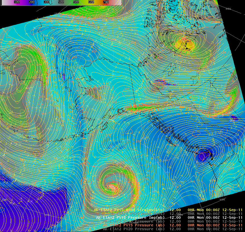
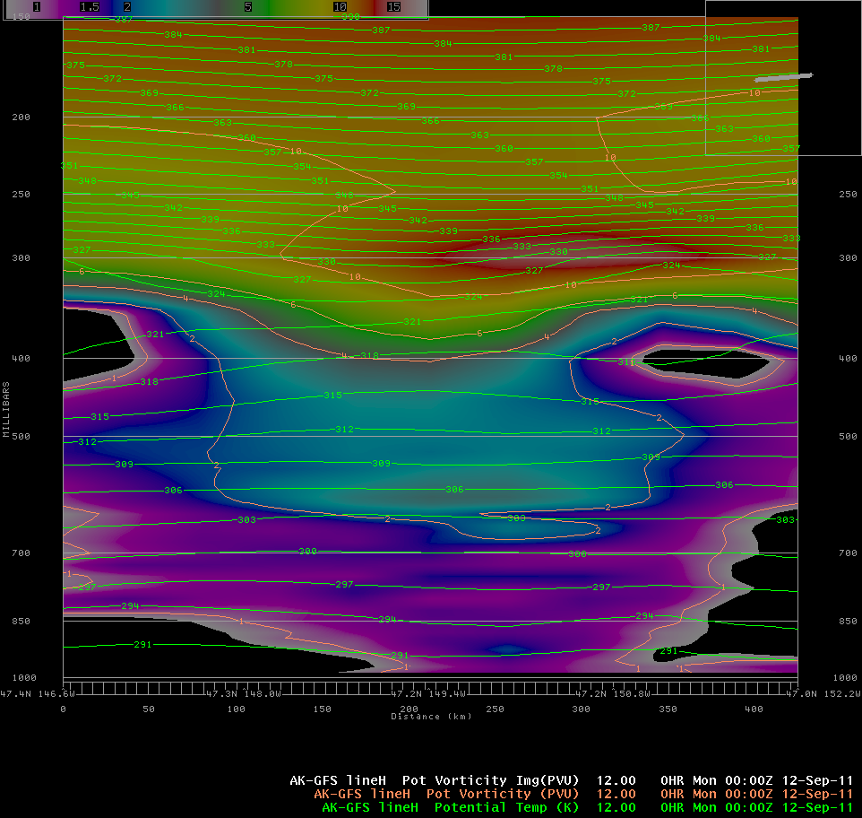
The 00z NAM run from last evening showed the dynamic tropopause (1.5 potential vorticity surface) on the "cinnabun low" all the way down to 936 millibars. One heckuva stratospheric intrusion. The upper low is what is left of last weeks high amplitude trough after being pinched off by ridging to the northeast and the incoming WAA across the Aleutians. I couldn't get a X-section from the ETA but the GFS shows the gist of it quite well.... -
Alaska/Western Canada obs and discussion
NIUmetGF replied to patrick7032's topic in Central/Western States
Here's some remarks you don't see too often... from Fairbanks PAFA 110353Z COR 16003KT 6SM -RA BR SCT013 BKN040 OVC055 08/07 A3015 RMK AO2 SLP217 OCNL WATERFOWL ALQDS P0001 T00780067 -
Alaska/Western Canada obs and discussion
NIUmetGF replied to patrick7032's topic in Central/Western States
Good to know. I didn't know it was gonna scrap the formatting until I posted it. -
Alaska/Western Canada obs and discussion
NIUmetGF replied to patrick7032's topic in Central/Western States
Pretty boring disco today.... FXAK68 PAFC 101252 AFDAFC SOUTHCENTRAL AND SOUTHWEST ALASKA FORECAST DISCUSSION NATIONAL WEATHER SERVICE ANCHORAGE AK 500 AM AKDT SAT SEP 10 2011 .ANALYSIS AND UPPER LEVELS... COMPLEX SPLIT UPPER FLOW PATTERN EXISTS TODAY WITH EMBEDDED DISTURBANCES IN THE WESTERLIES OVER THE NORTHERN TWO-THIRDS OF THE STATE. LINGERING HIGH AMPLITUDE TROUGH THAT BROUGHT CLIMATOLOGICALLY COOL AND WET WEATHER TO MUCH OF SOUTHERN ALASKA CONTINUES TO GET PINCHED OFF AS RIDGING BUILDS ACROSS THE ALEUTIANS AHEAD OF THE NEXT DISTURBANCE. AN EMBEDDED SHORT-WAVE TROUGH BRINGS THE THREAT OF RAIN TO THE KUSKOKWIM DELTA REGION THIS MORNING. AT THE SURFACE...RIDGING BUILDING WESTWARD ACROSS THE NORTHERN GULF OF ALASKA. .MODEL DISCUSSION... MODEL GUIDANCE IS IN GOOD AGREEMENT SYNOPTICALLY FOR THE SHORT TERM AS AN UPPER LEVEL LOW DEVELOPS FROM KAMCHATKA PENINSULA AND EAST THIS WEEKEND. MODELS ALL SIMILAR WITH A MID-970MB LOW IN THE NORTHWEST BERING SEA. A WEAKENING SURFACE LOW WILL MOVE INTO THE GULF OF ALASKA BY EARLY MONDAY MORNING IN THE LOW 990MB RANGE. AS THE UPPER LEVEL JET PUSHES SOUTH OF THE ALEUTIANS AN ELONGATED TROUGH WILL STRETCH FROM EAST ASIA THROUGH THE CENTRAL ALEUTIANS WITH AN EXTENSION INTO THE GULF OF ALASKA. .SHORT TERM FORECAST... SOUTHCENTRAL ALASKA...CONSIDERABLY DRIER WEATHER FOR MUCH OF THE AREA WITH RELATIVELY WEAK FLOW ALOFT. PARTLY CLOUDY TO PARTLY CLEAR CONDITIONS WILL EXIST. DRY CONDITIONS LOOK TO CONTINUE THROUGH THE WEEKEND UNTIL AN UPPER LEVEL DISTURBANCE PUSHES INTO THE GULF BRINGING RAIN TO MAINLY COASTAL AREAS EARLY NEXT WEEK. SOUTHWEST ALASKA...A WEAKENING SHORT-WAVE TROUGH MOVING ONSHORE IN THE YUKON DELTA REGION BRINGS AREAS OF RAIN TO THE KUSKOKWIM DELTA IN THE MORNING AND MOVING INTO THE KUSKOKWIM VALLEY/MTS FOR THE AFTERNOON. GENERALLY CLOUDY CONDITIONS WILL CONTINUE FOR MUCH OF THE SOUTHWEST INTERIOR AND BRISTOL BAY REGIONS. BERING SEA AND ALEUTIANS...UPPER LEVEL DISTURBANCE AND ASSOCIATED FRONT PUSH ACROSS THE CHAIN FROM WEST TO EAST BRINGING PERIODS OF RAIN AND GUSTY SOUTHERLY WINDS THIS WEEKEND. .LONG TERM FORECAST... FOR THE EXTENDED PERIOD A BROAD UPPER LEVEL LOW WILL BE ANCHORED OVER THE BERING SEA BRINGING GENERALLY CLOUDY CONDITIONS WITH RAIN SHOWERS. AS DISTURBANCES ROTATE AROUND THE FRINGE OF THIS TROUGH PERIODS OF UNSETTLED WEATHER CAN BE EXPECTED FOR COASTAL REGIONS OF THE SOUTH CENTRAL AND THE GULF OF ALASKA. .AER/ALU...WATCH/WARNING SUMMARY PUBLIC...NONE MARINE...132 150 170 172 179 180 185 FIRE WEATHER...NONE MTL SEP 11 -
Alaska/Western Canada obs and discussion
NIUmetGF replied to patrick7032's topic in Central/Western States
Been off for a few days and sick to boot, hence the lack of posting for this beast..... Talk about high amplitude! -
Alaska/Western Canada obs and discussion
NIUmetGF replied to patrick7032's topic in Central/Western States
Getting some river valley fog to the north of you, MTBLANC it seems. A little easier to see with animation. -
Alaska/Western Canada obs and discussion
NIUmetGF replied to patrick7032's topic in Central/Western States
First round of an interesting active pattern coming up today. Pardon the crude drawings. Northern Pacific shortwave going to phase with the southeastward moving Bering Sea trough and deepen as the warm moist air wraps under the cold core. Sensible weather effects here in South-central Alaska most notably will be the increased precipitation with onshore flow in coastal regions and a strong barrier jet as the flow is blocked by the Chugach Range. This will increase the surface ridging as the surface low moves into the northern Gulf to die. The stable WAA regime prevents the flow from moving over the terrain and turns it westward. In winter these events are exacerbated by cold air in the interior which will flow out of the mountain gaps.

