

Wurbus
-
Posts
551 -
Joined
-
Last visited
Content Type
Profiles
Blogs
Forums
American Weather
Media Demo
Store
Gallery
Posts posted by Wurbus
-
-
GFS absolutely clobbers the southern valley from Chatt to Lenoir City.
-
 4
4
-
-
Wow, looking at it more closely, it drops 8 inches in 3 hours from the 18 to 21 hour. Almost 3" an hour rates. That would definitely overcome the ground temps quickly!
-
1
-
 1
1
-
-
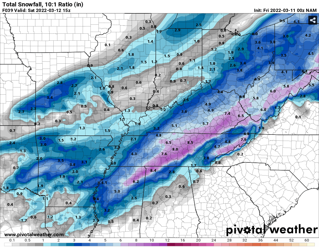
I approve the RGEM's output. Still can't post screenshots but it has almost 10 inches in Knoxville when ratio'd.
-
2
-
-
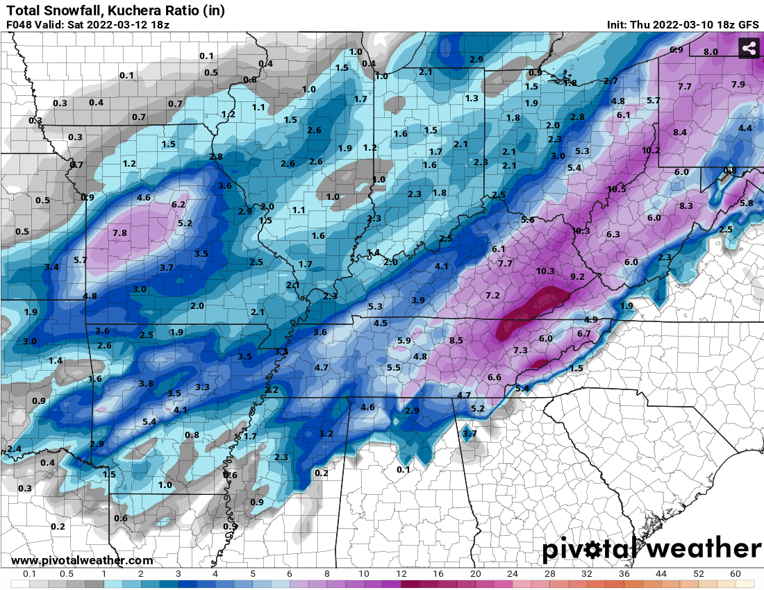
Canadian just rocked the plateau. 12"+ in some spots.
-
3
-
-
Won't let me post pics again, but 03z RAP was pretty robust for KNX and the plateau.
-
Surprisingly, looks like the GEFS mean came done slightly for almost everyone from 18z.
-
Anyone else notice that glob of pink that starts in Arkansas and travels all the way up to Pennsylvania? Looked like a long track super-cell of snowmaggeden under that thing.
-
3
-
-
-
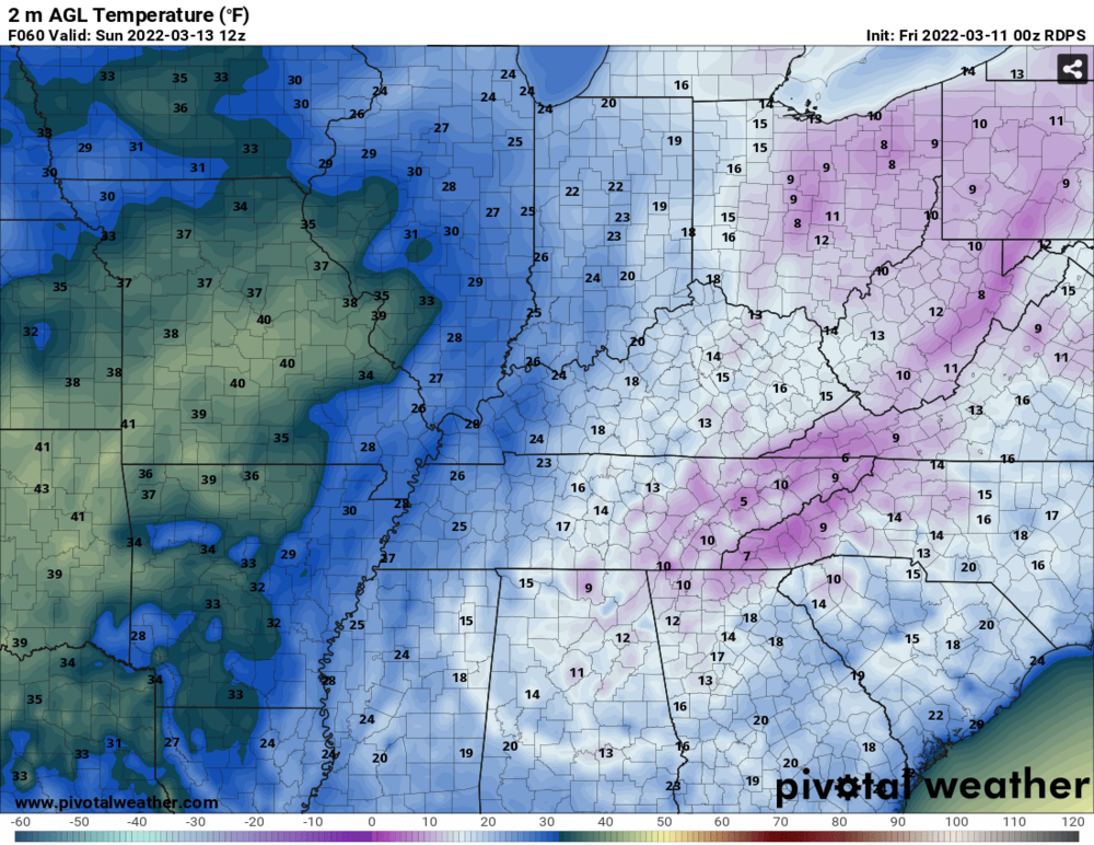
Knoxville is the coldest place on the entire map.
-
1
-
-
This looks like a reasonable run to me. Plateau & Mountains get plastered and a general 2-4 inches up through the valley.

-
1
-
-
2 minutes ago, Silas Lang said:
Is it just me, or is the changeover happening quicker on the NAM? Comparing run to run the snow line keeps trending east quicker.
I think it is to. The sleet/mix line is noticeably thinner on this run compared to the 18z.
-
Low pressure isn't as amped as the 18z run, but still looks to be a good track.
-
Live look at all of us waiting on the NAM to finish.

-
3
-
-
Looking at KNX, the mean held steady, but much more agreement between 5-7 inches and the lowest member is 1.17.
-
2
-
-
I feel like a broken record, but the 21z SREF went up again for the plateau & SE KY. Slight uptick for KNX it appears.
-
4
-
 1
1
-
-
WBIR is showing what I thought MRX would show earlier.
-
1
-
-
GEFS Mean. Pretty big increase along SE KY/Western Virginia

-
1
-
-
That dark red streak might require a blizzard warning in northern mid-TN and SE KY
-
1
-
1
-
-
Ratio'd totals

-
2
-
3
-
-
-
I'll take this look all day long.

-
1
-
1
-
-
2 minutes ago, PowellVolz said:
.I'm actually shocked!
-
2
-
 1
1
-
-
I think NAM is going to be juiced. Already a 997 low in central Alabama at 36
-
MRX is going to say 1-3 for the valley with locally heavier amounts and issue a WWA and call it a day. I'd be surprised if they issue anything more than that today. They might even wait and let the night crew issue it.
-
2
-


March 11th-13th Winter Weather Event. Winter's last gasp?
in Tennessee Valley
Posted
Where has Jeff been? He has been awfully quiet with the potential of Chatt getting some snow.