

Wurbus
-
Posts
551 -
Joined
-
Last visited
Content Type
Profiles
Blogs
Forums
American Weather
Media Demo
Store
Gallery
Posts posted by Wurbus
-
-
It's far out there and probably won't happen, but happy hour delivered for East TN, NC, & VA.
-
 2
2
-
-
Way out there, but 12z GFS has snow along the gulf coast in early March. That would be impressive! Adding to an already historic winter there.
-
2
-
-
I wound up with about 1.5" here in Knoxville. Roads are mostly fine, but could be a mess late tonight and early morning if moisture is still lingering.
Also wanted to mention if you look at the US winter map warnings, there is extreme cold warnings down all the way from Manitoba to southern TX, except for southern half of South Dakota. Kind of odd they didn't issue any there, similar to the Chattanooga area not receiving a WWA until this morning.-
1
-
-
Yeah. Someone mentioned earlier about all of the bad signals for East TN and I agree. These types of systems typically just don't perform well here.
-
2 hours ago, PowellVolz said:
Interesting from the SREF Plumes….
BNA 2,75” average, .3” qpf
TYS just a hair below 3” but the qpf is .4” 75% snow, 25% liquid.
if Knox area gets .4” qpf, I feel pretty good about 2” or so, obviously assuming it’s right.Don't look at the 9pm plumes for Knoxville. Mean cut in half to .2 qpf
-
 2
2
-
-
Just took a look at the SREF's and ,unsurprisingly, it appears the greater valley has mixing issues. Not 100% sure it will happen, but it does happen as energy transfers around here quite a bit.
-
1
-
 1
1
-
-
19 minutes ago, Matthew70 said:
So the CMC has a cold bias. Plus is it ever right?
Look at it this way.....The CMC is due to be right once.
-
2
-
 3
3
-
 1
1
-
-
I wound up with 3.1" the past 2 days. Was a weird event because it basically rained for 48 hours straight, but it was mostly light-moderate rain. The highest rate I had was only .38" an hour.
-
 1
1
-
-
20 minutes ago, fountainguy97 said:
BIG CAD signature on most models around the 210 timeframe. I don't think Eastern areas like these setups at all. Warm straight up the gut of the valley.
Euro AI has it as well. Warm nose straight up the Eastern valley while everyone around us looks to be snowing.
-
I've been waiting for a dishwasher to be scheduled for delivery for a week and half now. They called today and scheduled it for Feb 14th, so I bet we get a snow on the 13th or 14th.
-
3
-
1
-
-
ICON was a big nothing burger for the Tuesday system. Suppressed to all hell and doesn't get a good phase. Even had some snow south of New Orleans in the gulf lol
-
1
-
 2
2
-
-
Yeah, GFS has to be out to lunch at this point
-
1
-
-
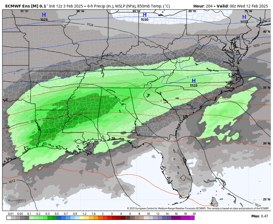
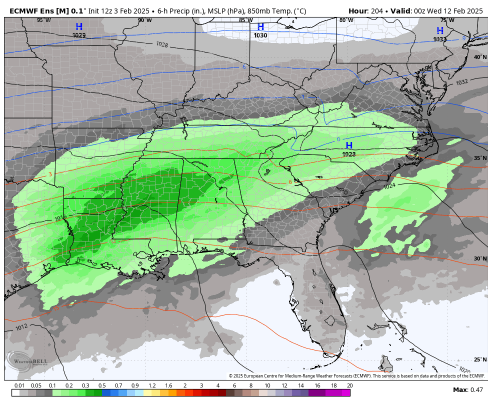
CMC/ICON is going to be similar, but the CMC is more juiced. Kuchera snowfall maps are going to be off the charts from TX to NC.
-
2
-
-
The difference between the GFS & CMC at 120 hrs is staggering at the 500mb level.
-
2
-
-
ICON did come north compared to 0z and really hammers mid-southern MS, central AL/GA, SC, & Eastern NC. Some light snow makes it up to 40.
-
1
-
-
19 minutes ago, housemtnTN said:
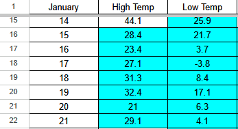
I believe so. Last January we definitely did after that snow. It was single digits at night for what, 4 or 5 days??
My weather station recorded 5 nights with single digit lows and one below 0 night.
-
5
-
 1
1
-
-
I measured 3 1/2 inches in several places with a solid layer of freezing rain in the middle of it that I had to punch through. If it wasn't for that, I think I would have wound up in the 4-6 forecast.
-
4
-
-
Same for me as well. I have a nice light freezing rain at 27 degrees
-
4
-
-
dry slot moving up through Knoxville now
-
I just measured a little over 2 inches in several spots. I'm reduced to a fine pixie dust at the moment. Been sitting at 26 degrees for several hours now.
-
3
-
-
Definitely ripping snow now in Karns/Cedar Bluff area.
-
3
-
-
I'll take whatever E18 is cooking up. Not often you see the yellow & oranges stretching down into TN.
-
2
-
1
-
-
Another banger run for GFS incoming. CMC was also good and both models seem hellbent on bringing the polar vortex down after the 22nd. Not sold on that since they were also signaling that feature a few weeks ago, but if we can keep the pattern going, that is a win in my book.
-
4
-
-
1 hour ago, midwoodian said:
Can you post a pic?
.This was the full run. All of the additional snow after the current event was post 200 hours, so should be taken with a grain of salt.

-
5
-
Spring 2025 Med/Long Range Discussion
in Tennessee Valley
Posted
I wound up having 3 storms roll over my house and got 3.12" yesterday. That is more than I received during the entire month of June (2.72"). My yard was starting to bake in the Summer heat but this should help it out for at least a week.