

caviman2201
-
Posts
1,836 -
Joined
-
Last visited
Content Type
Profiles
Blogs
Forums
American Weather
Media Demo
Store
Gallery
Posts posted by caviman2201
-
-
Me coming in to see if anything's on the horizon...

... and seeing the thread in its current state
-
 3
3
-
 12
12
-
-
5 minutes ago, WVsnowlover said:
First flakes let's go!
Lies. 3z HRRR says you don't see anything until after midnight.
-
1
-
-
FWIW, the 02z HRRR sim composite reflectivity for 03z looks nothing like current reality over SE PA, MD and NOVA


-
1
-
-
5 minutes ago, stormtracker said:
Lwx hates me

actually that’s a pretty good map if i were forecasting.
I feel you I live right next to BWI...

-
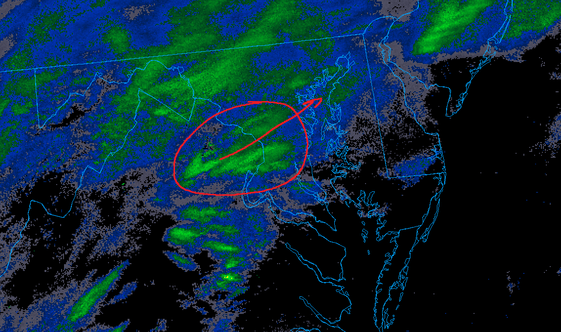
Lot of models have wanted to paint this band of much lighter precip over Baltimore for several runs now and its really showing up on the HiRes stuff too... makes me a bit nervous.
I seem to remember a storm a few years ago that did this "crab claw" thing and it became a big joke on here but it really did screw people inside the claw-
 1
1
-
-
2 minutes ago, Eskimo Joe said:
lol at the "Extreme" line... gee I wonder which winter that was with a huge increase in Dec and another in early Feb... hmmmm lol
-
18z GFS looks better to me through 27...
-
13 minutes ago, WinterWxLuvr said:
Anyone see the bullseye?
Canaan?

-
8 minutes ago, stormtracker said:
My kids' Banjo recital is tomorrow...should I cancel?
only piccolo should be canceled I thought this was well established
-
1
-
-
2 minutes ago, Ji said:
Hopefully the snow sticks in the snowI'm worried about the January Snow Angle melting it all on contact
-
1
-
-
Ukie precip distribution has been so weird last couple runs
-
1
-
1
-
-
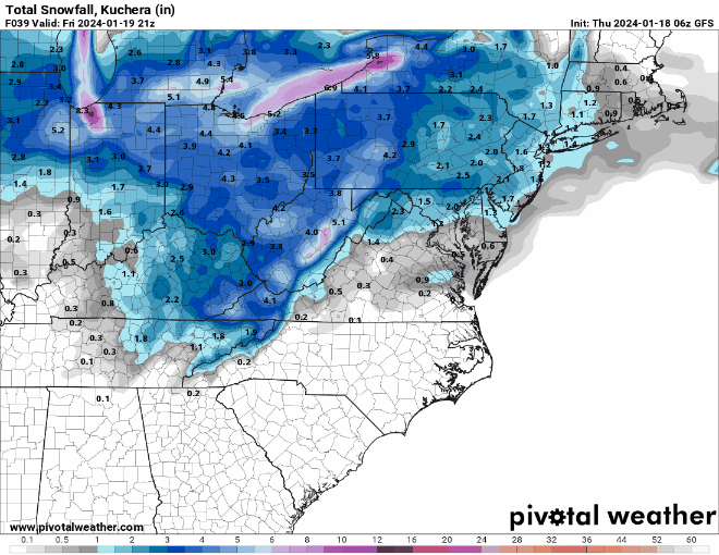
Sorry if it was posted last night but the Ukie snow map cracked me up... cartopper for everyone except La Plata and that one particular house on that one particular hill... lol

-
6
-
-
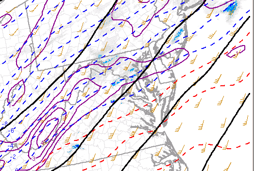
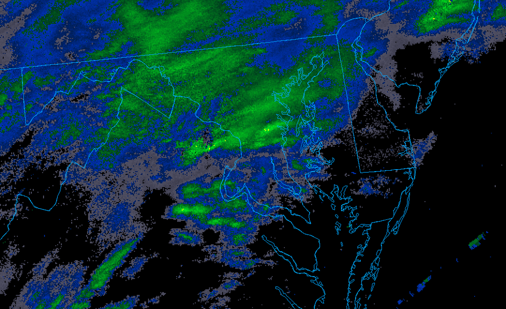
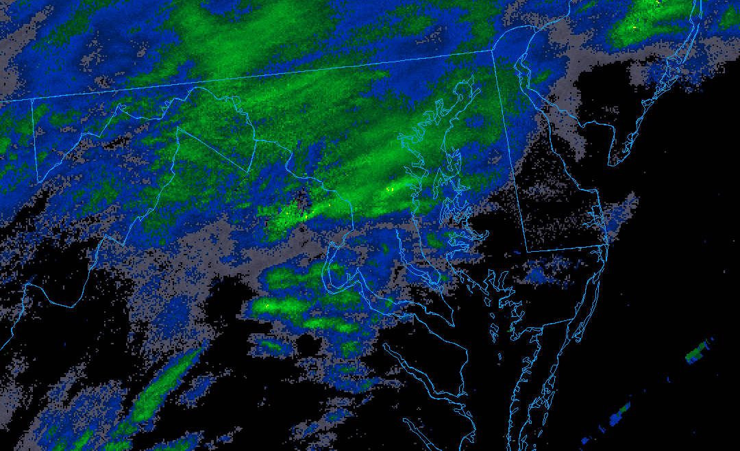
Radar has really popped last couple frames over central MD... that 850mb fronto is putting in some work
-
4
-
-
7 minutes ago, KAOS said:
Bring it home. I would say we had a little over 4 inches in Pasadena (21122). After compaction and sun angle...closer to 3 inches, more or less.
Same - I'm just north of you about 5mi E of BWI and just measured 3.75 on concrete w/ compaction... so I have to imagine at least 4.5 has fallen
-
nice little band establishing itself along and SE of the fall line moving NE as well... looks like everyone might cash in for the next hr or so...

-
4
-
-
13 minutes ago, midatlanticweather said:
A little more in some spots on another NWS update!
Me, in Glen Burnie... asking that yellow to come to Papa... so close...

-
1
-
-
7 minutes ago, pazzo83 said:
I think we'll have light to mod snow all night. Very light returns overhead and we still have light snow here.
I was kind of thinking the same thing... HRRR has 2m RH at >90% pretty much all night. To me, thats pixie dust at worst
-
Just now, IUsedToHateCold said:
My final obs of the night - measured a hair under 4 inches here. Still some light flakes coming down, temperature 28.
And my final thought of the night.
When it snows, this place is like a giant party and we're all drunk. Except, without a drop of alcohol. We're all drunk on the fucking snow.
Good night. I know I'll be seeing you all here tomorrow.

-
3
-
5
-
-
1 minute ago, weathercoins said:
MoCo and PG closed I think? They all will by morning
Ah you're right... weird that WBAL's closing page doesn't have either... guess i need a new source
-
I'm shocked none of the school districts have pulled the trigger yet... at least not in MD to my knowledge
-
1 minute ago, IUsedToHateCold said:
I've been following since AmWx (2006 or so?). I think if you're into this type of thing, you're into it for life. I don't think any of us are going anywhere...
Nights like tonight remind me of the radio shows which were the nerdiest thing ever but damn if you didn't feel like there were other people like you... while everyone else was bemoaning and whining about the impending snow. Still can't believe someone as smart and respectable as Wes was willing to join us on some of those
-
3
-
-
2 minutes ago, MillvilleWx said:
I am NEVER leaving this forum
The best part was I read it like it was a real update until I saw it... just about spit my drink everywhere...
Where did that dude go anyway? Is he still reporting heavy standing water? Flash flooding?
-
2
-
-
8 minutes ago, stormtracker said:
Oh shit! Sterling updated again!!
District of Columbia[EXCEPT GEORGETOWN]Prince Georges-Anne Arundel-
Northwest Montgomery-Central and Southeast Montgomery-
Northwest Howard-Central and Southeast Howard-Rappahannock-
Fairfax-Arlington/Falls Church/Alexandria-Northern Fauquier-
Western Loudoun-Eastern Loudoun-Northern Virginia Blue Ridge-
Northwest Prince William-
1028 PM EST Mon Jan 15 2024

...WINTER STORM WARNING IN EFFECT [EXCEPT GEORGETOWN] UNTIL 10 AM EST TUESDAY...

* WHAT...Heavy snow, possibly changing to light freezing rain or
  freezing drizzle along the Interstate 95 corridor toward
  morning, except in Georgetown, where rain will turn to light rain. Total snow accumulation of 4 to 6 inches and ice
  accumulations of a light glaze. In Georgetown, rain will be up to .40 inch.

* WHERE...Portions of central Maryland, The District of Columbia [Except fucking Georgetown]
  and northern Virginia.

* WHEN...Until 10 AM EST Tuesday.
one for the ages... losing my shit

"Except fucking Georgetown" will be in every DC snow forecast from now until the end of time... its one of those 'board moments' that sticks-
3
-
1
-
-
7 minutes ago, DDweatherman said:
Great post and good commentary. The band moves generally NW over the burbs to Mt. PSU crew in the early AM hours and there is absolutely influence from the h5 jet. Starting to see more and more influence in the short term hi res models. I think places north of Baltimore from Westminster over to Bel Air could cash in big time since they'll get both parts of the storm.
You're saying Mt. PSU and Mappyland find a way to jack? Say it ain't so...

Late Feb/March Medium/Long Range Discussion
in Mid Atlantic
Posted
Its an insurrection!
May as well throw fuel on the fire...