
Chinook
-
Posts
9,465 -
Joined
-
Last visited
Content Type
Profiles
Blogs
Forums
American Weather
Media Demo
Store
Gallery
Posts posted by Chinook
-
-
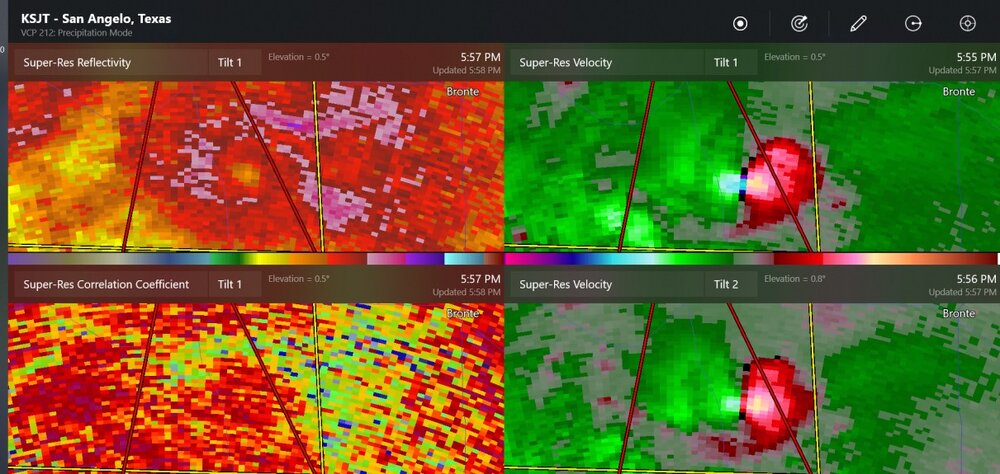
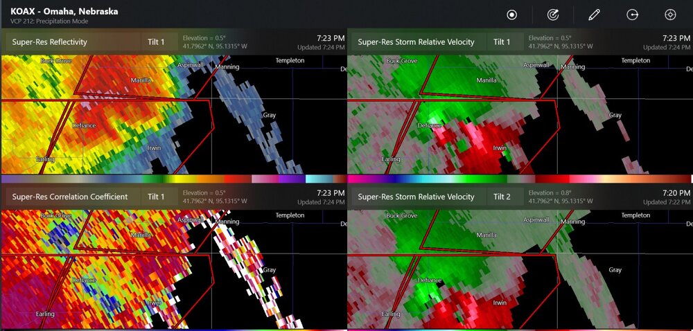
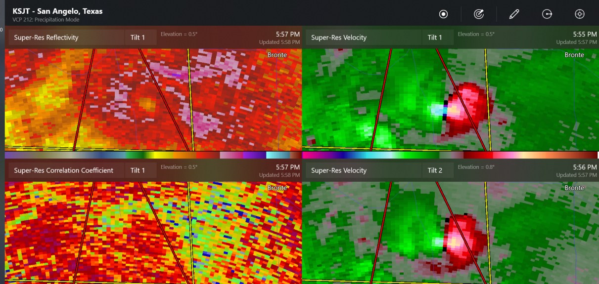
even KTLX and KICT radars can see the TDS, lowered correlation coefficient, on the Hominy tornado.
-
 1
1
-
-
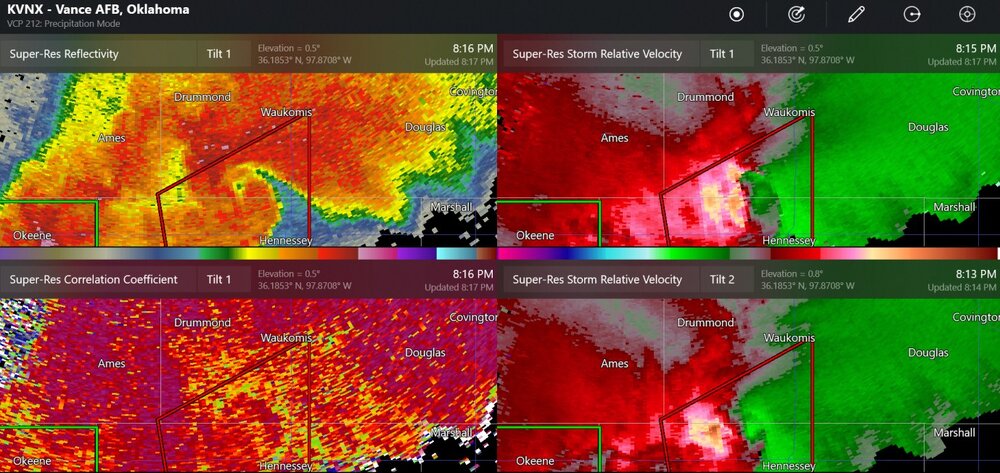
This is a possible rain-wrapped tornado near Hennessy Oklahoma. The wind damage report from Lacey says there could have been tornado damage.
-
2
-
-
19 minutes ago, Toothache said:
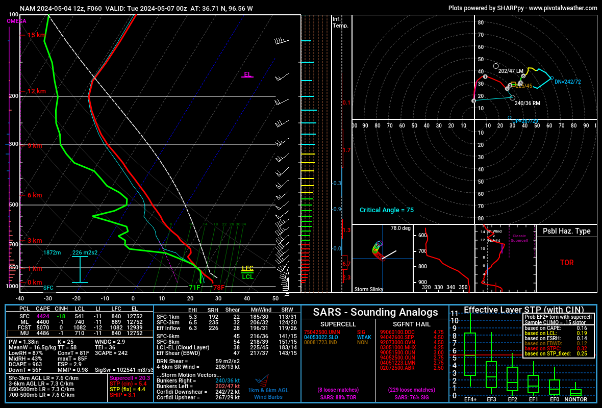
Anyone ever see STP values of 25 before?
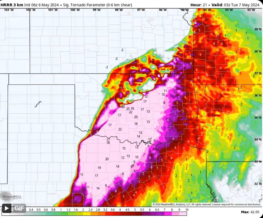
I am seeing forecast soundings of STP (effective) of 14.7 to 15.7 on the most recent HRRR valid for 03z (same as shown). I think that's maybe about 1 or 2 more than I've ever seen on a model sounding.
-
3
-
-
5 hours ago, Quincy said:
Models are trending faster with the lead shortwave ejecting across Kansas/Nebraska. In fact, guidance suggests that large scale forcing may reach western Kansas by 15-18z with early convective initiation.
This solution causes a cold front to rapidly overtake the dryline. The result favors a linear storm mode across Kansas and possibly even into northern Oklahoma.
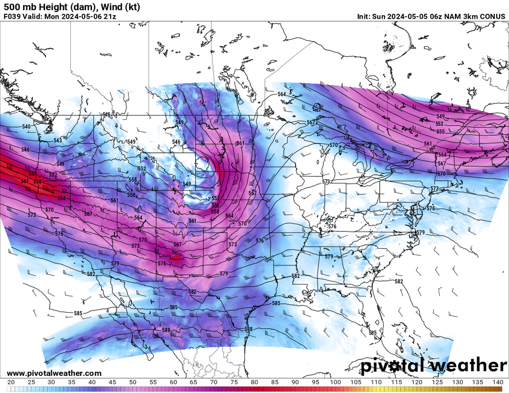
Farther south is a different story. If you look at the 6z 3km NAM, notice how another belt of enhanced upper level flow stretches from New Mexico into West Texas. This flow is more westerly as opposed to southwesterly up north. The forcing across the southern High Plains/western Oklahoma area is later than up north, arriving closer to 21-00z. Forecast soundings across central Oklahoma in this time frame show residual capping as somewhat warmer mid-level temperatures are noted.
This solution would delay convective initiation until late afternoon. With that said, forcing timed more favorably with peak heating, along with a westerly component to the upper level winds, suggests a more discrete storm mode.
To quickly recap, the trend favors quick shortwave ejection across the Central Plains with a more linear storm mode there. There’s a split emerging in the flow across the southern High Plains, favoring a secondary, more discrete supercell thunderstorm risk over the Southern Plains.
In my mind, the question is, does this trend continue? If not, the snapshot in time favors an ominous risk across southwestern into south-central Oklahoma and far northern Texas from late afternoon into the evening. It places Oklahoma City on the fringe of the greatest threat and the timing would likely fall just after sunset. Linear storm modes are favored to the north, while at least isolated supercell development is probable to the southwest/south.
If the trend continues, you could see the primary threat area get booted down toward the Red River and northwest Texas. That would be better for Oklahoma, especially OKC metro.
I’ll be watching trends closely today. I’m not a fan of the current progs, as they place a significant severe threat close to Oklahoma City, after dark. There’s not a ton of time left, so the next few model runs will be critical.
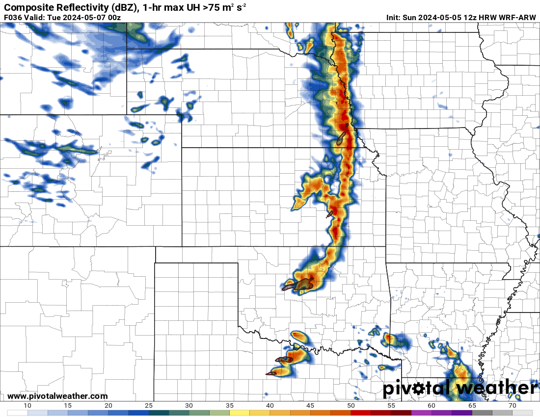
oh you mean linear like this? I guess this raises the chances for severe winds

-
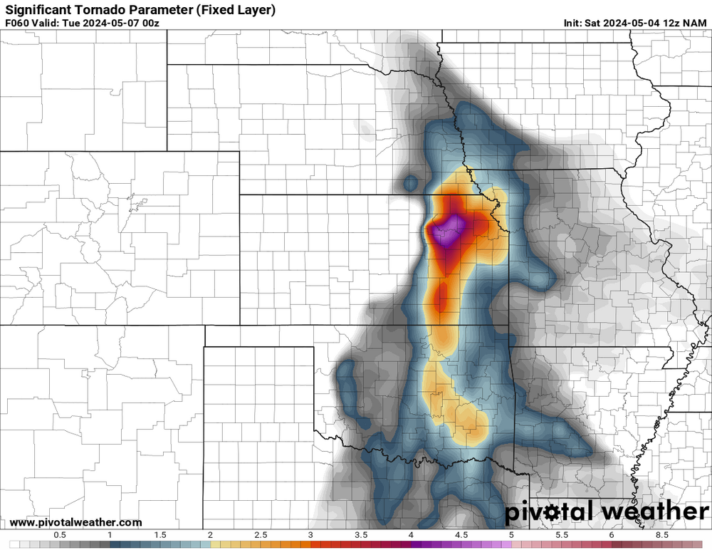
I think parameters will be very high for tornadoes on Monday night. The models show a small cap in place. Lifting condensation levels should be quite low in Oklahoma with higher dew points. As usual, the ramp-up in lower level winds will occur at night to possibly increase chances of tornadoes.

-
2
-
-
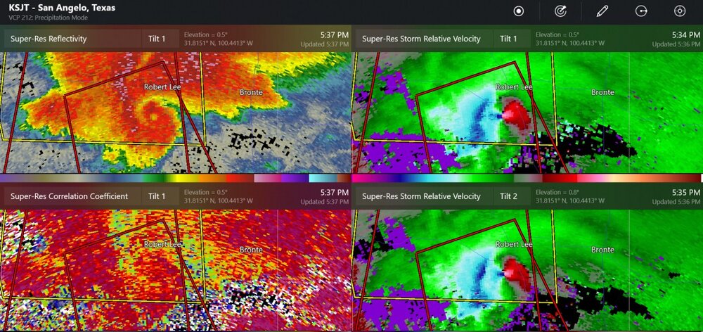
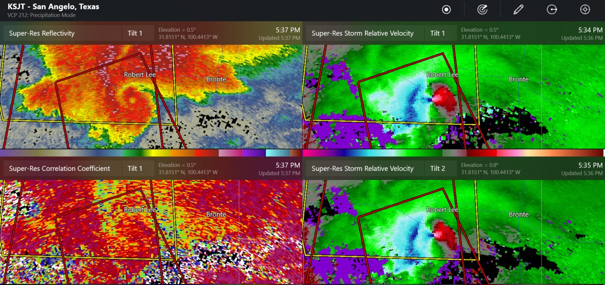
large tornado south of Robert Lee Texas a little while ago
-
1
-
-
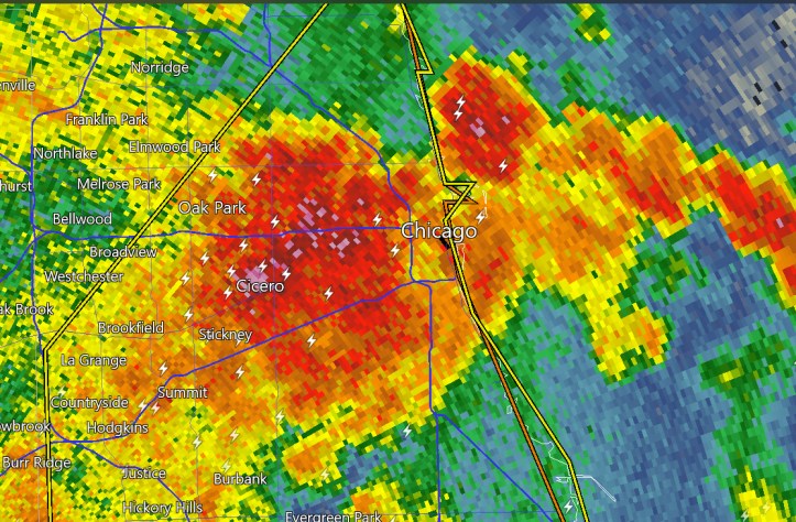
lightning and heavy rain coming in to downtown
-
1
-
-
welcome to May in the Plains
Quote...A TORNADO WARNING REMAINS IN EFFECT UNTIL 430 PM CDT FOR CENTRAL
DONLEY COUNTY...At 415 PM CDT, a confirmed tornado was located near Clarendon, moving
east at 15 mph.-
1
-
-
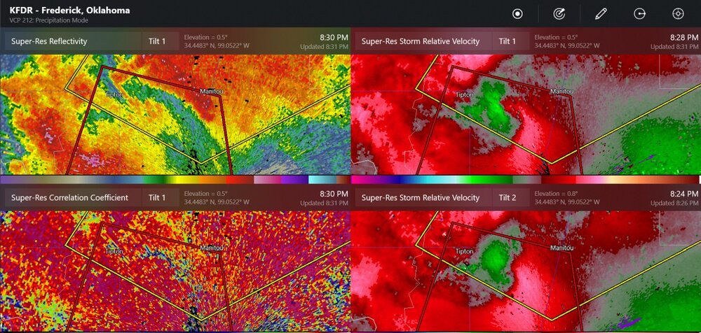
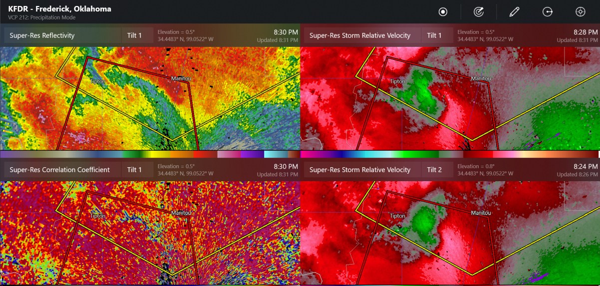
confirmed tornado warning at Frederick Radar
-
possible tornado at Perry
-
up to 3" hail in SW Oklahoma
-
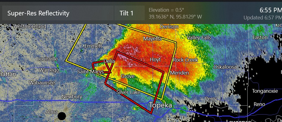
new tornado warning next to Topeka
-
maybe Kansas is going to be our hot spot tonight
-
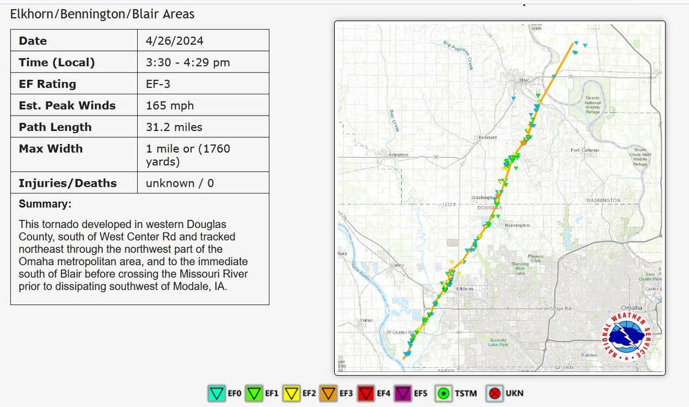
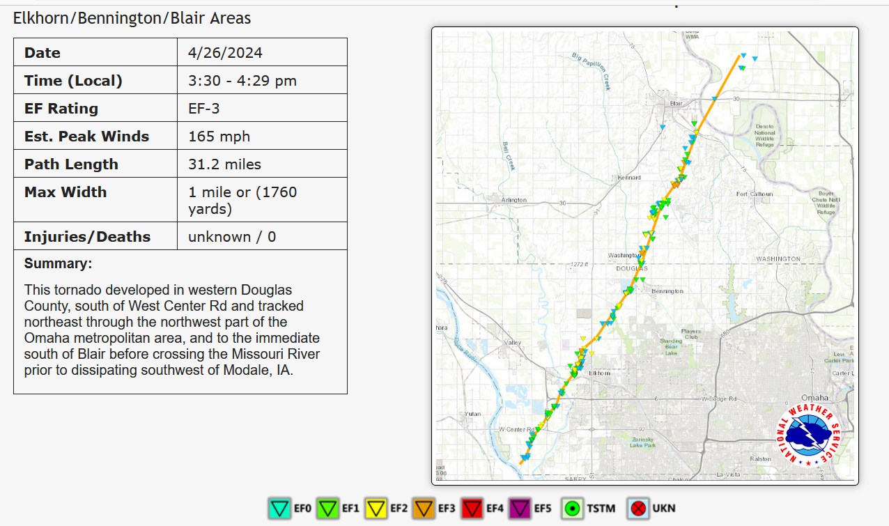
Only EF -3 for one of the largest ones near Omaha
-
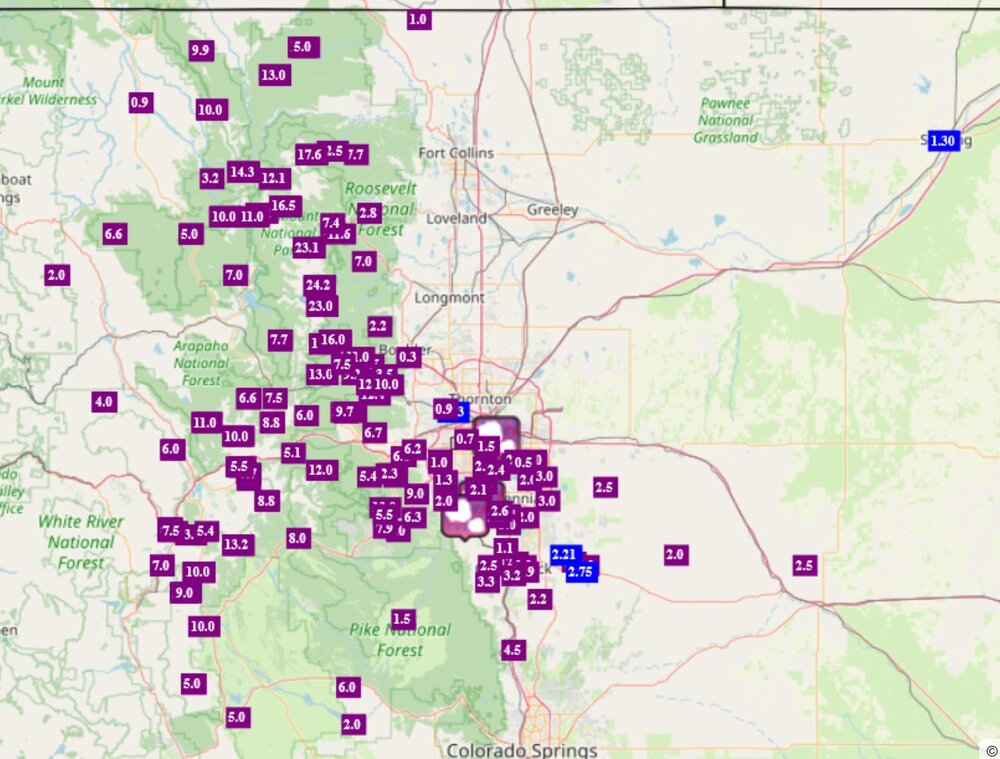
heavy snow amounts of 10" to 24" at the National Park
-
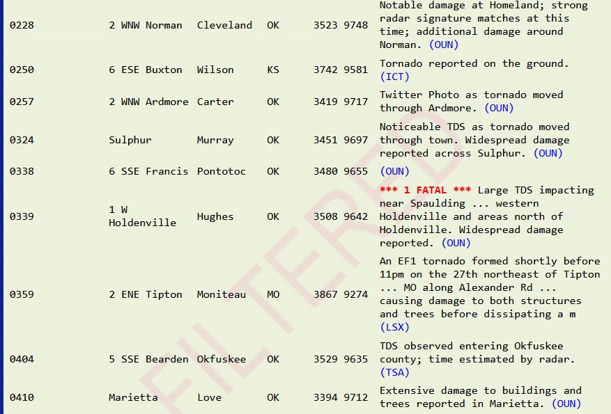
Yesterday was pretty notable for the late-night redevelopment of tornadoes
this is only a partial list of the later night tornadoes
-
possible tornado in Wisconsin
-
the storm by Hobart Oklahoma looks like it could get going and stay isolated
-
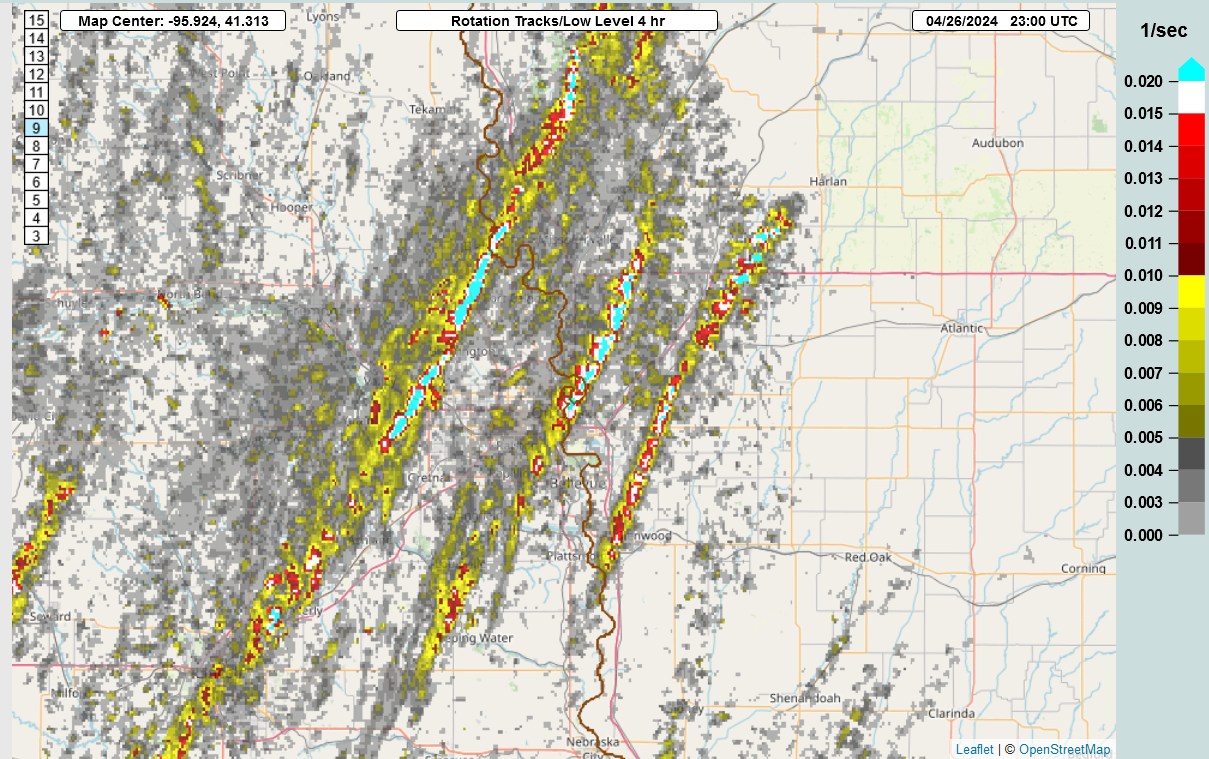
Low level rotation tracks in a 4 hour window yesterday

-
 1
1
-
-
we've already got tornado warnings in W Oklahoma
-
one of the latest tornadoes tonight
-
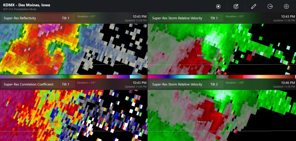
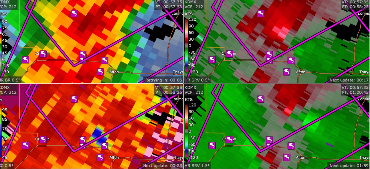
I went out tonight and I didn't look at my computer since 8:15. But I left my GRLevel3 on, and it saved data. I discovered this cluster of 7 tornadoes. (8:57PMEDT) I have no idea how 7 tornadoes happened here near Afton Iowa. And, by the way, there are 95 tornadoes on SPC storm reports.

-
1
-
1
-
-
Just think, there's an entirely new storm system tomorrow, with (currently) 10% hatched tornado risk in tornado alley
-
might be two tornadoes in the parent storm


5/6-5/9 Severe Threats
in Lakes/Ohio Valley
Posted
Tomorrow looks like there might be some small tornadic supercells for OH/IN, like near me