
Jim Martin
-
Posts
2,469 -
Joined
-
Last visited
Content Type
Profiles
Blogs
Forums
American Weather
Media Demo
Store
Gallery
Posts posted by Jim Martin
-
-
-
-
-
-
-
-
-

From the NWS in Cleveland Area Forecast Discussion this evening.
-
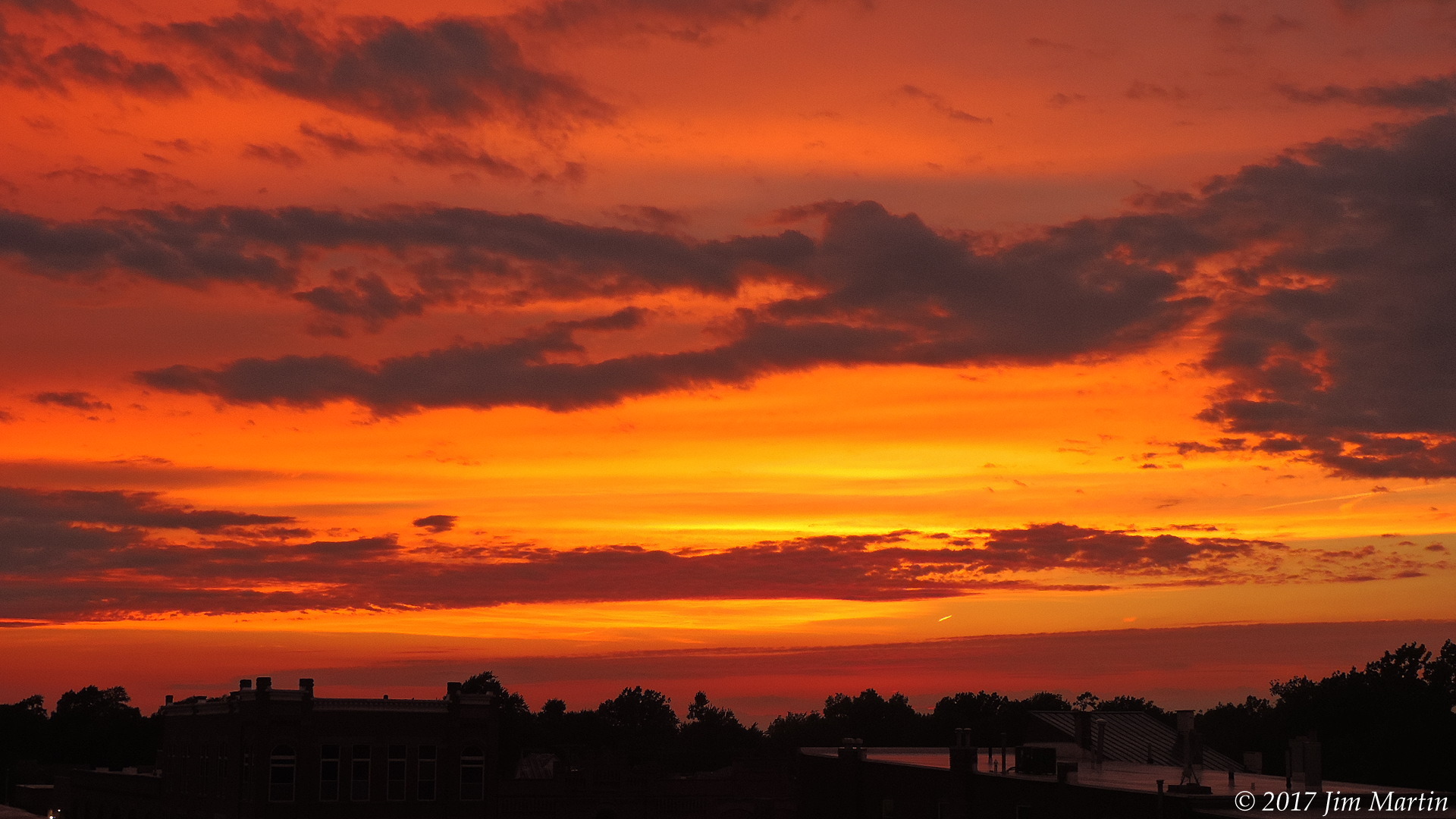
Sunset this evening in downtown Findlay.
")
-
 4
4
-
-
-
-
BULLETIN - EAS ACTIVATION REQUESTED
Tornado Warning
National Weather Service Chicago/Romeoville
801 PM CDT Fri Jun 25 2021The National Weather Service in Chicago has issued a
* Tornado Warning for...
Northwestern Iroquois County in east central Illinois...* Until 845 PM CDT.
* At 800 PM CDT, a severe thunderstorm capable of producing a tornado
was located near Danforth, moving east at 15 mph.HAZARD...Tornado.
SOURCE...Radar indicated rotation.
IMPACT...Flying debris will be dangerous to those caught without
shelter. Mobile homes will be damaged or destroyed.
Damage to roofs, windows, and vehicles will occur. Tree
damage is likely.* This tornadic thunderstorm will remain over mainly rural areas of
northwestern Iroquois County, including the following locations...
Danforth.Including the following interstate...
I-57 between mile markers 285 and 290. -

Going to need Noah's Ark if this keeps up...
-

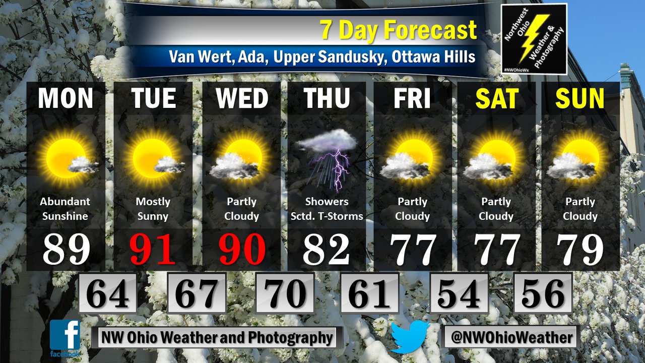
Plenty of rain to come as well for NW Ohio.
-
-
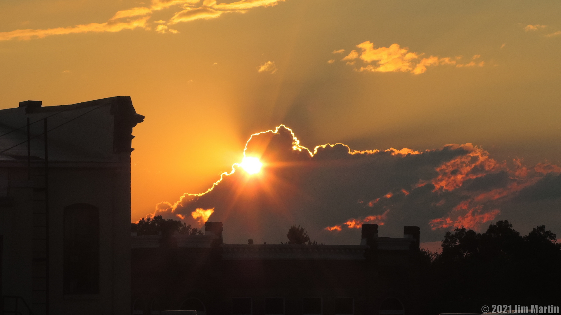
Sunset this evening.
-
5
-
-
4 minutes ago, HillsdaleMIWeather said:
Could these storms tonight help set down additional outflow boundaries for the stuff tomorrow?
I was thinking the same.
-
Storms to the northwest looking from downtown Findlay tonight.
-
41 minutes ago, HillsdaleMIWeather said:
Surprise Severe Thunderstorm Watch time!

-
-
-
-

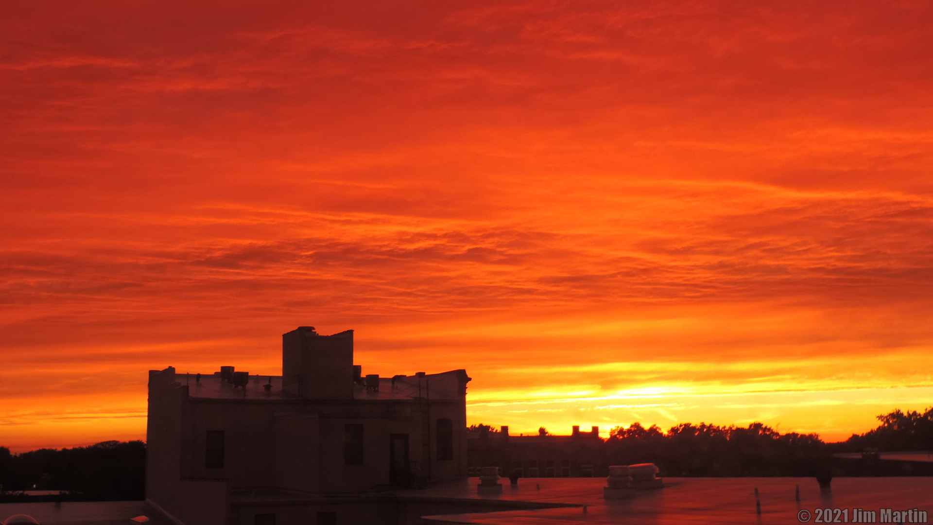
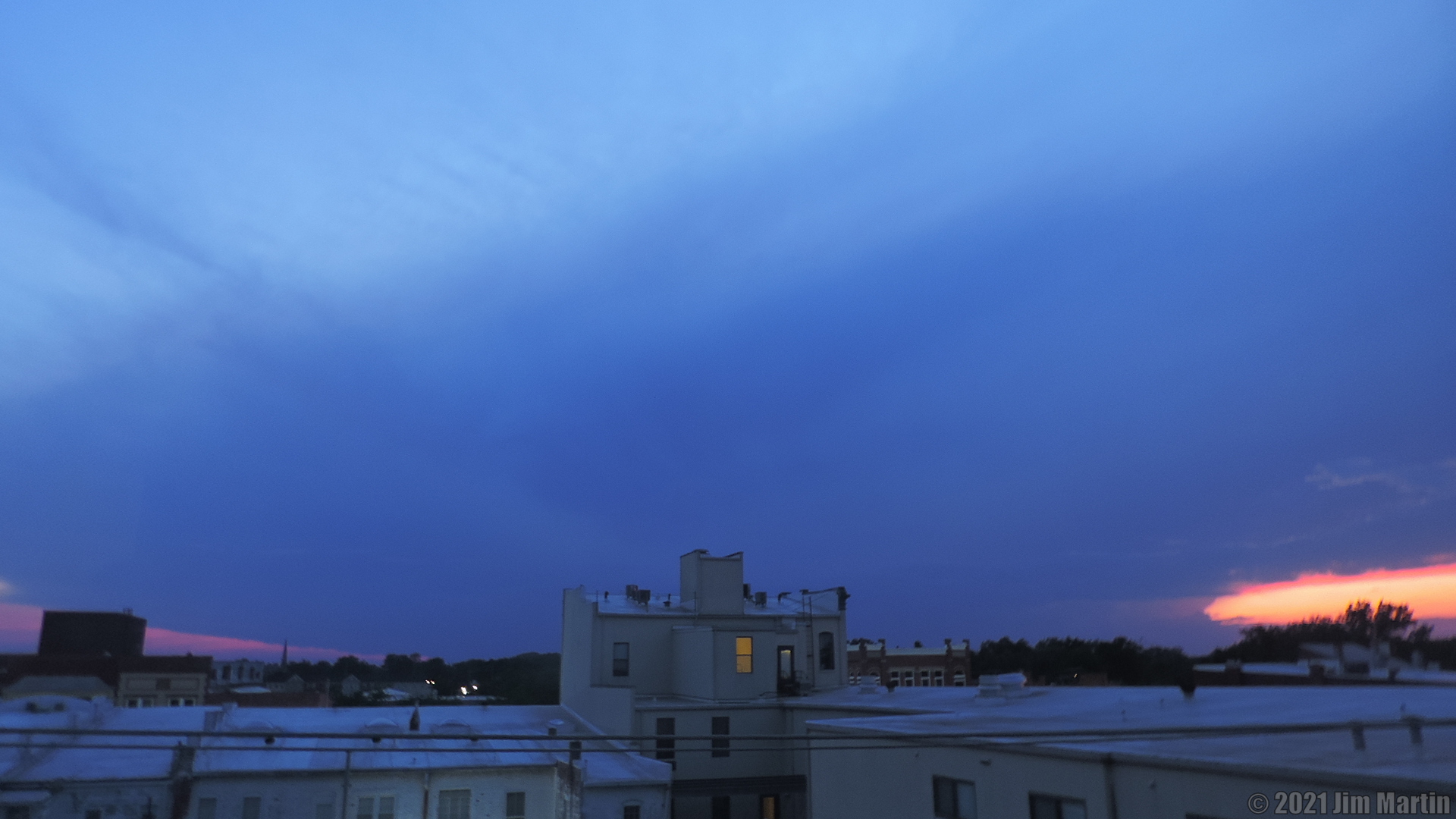
Sunset this evening.
-
6
-
-
July 2021 General Discussion
in Lakes/Ohio Valley
Posted