

cae
-
Posts
1,511 -
Joined
-
Last visited
Content Type
Profiles
Blogs
Forums
American Weather
Media Demo
Store
Gallery
Posts posted by cae
-
-
1 minute ago, psuhoffman said:
This was one of the worst gradients I can remember with 10” about 30 miles south of me and 2.5” here.
I think I've seen worse gradients around here. They're just usually sloped the other way.
")
-
 1
1
-
-
2 minutes ago, Steve25 said:
To be honest, as frustrating as it is to compare our 4-6 inches to the 8+ inches others are getting, I still would never call this storm a dissapointnent! For the majority of the week we were saying 1-3 inches was the best bet. Most of us made out better than that and had enough snow to shovel and go out and enjoy.
I agree. We ended up with about 4.5" here. Sure, it would have been nice to have more. But we ended up doing better than I expected just a couple of days ago, and there was plenty of snow for sledding, snowball fights, etc. And everything looks great.
-
 1
1
-
-
5 minutes ago, notvirga! said:
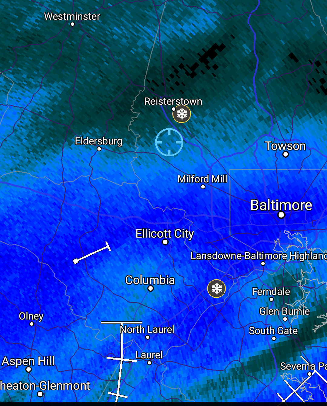
A frustrating day in Owings Mills. Life on the edge.
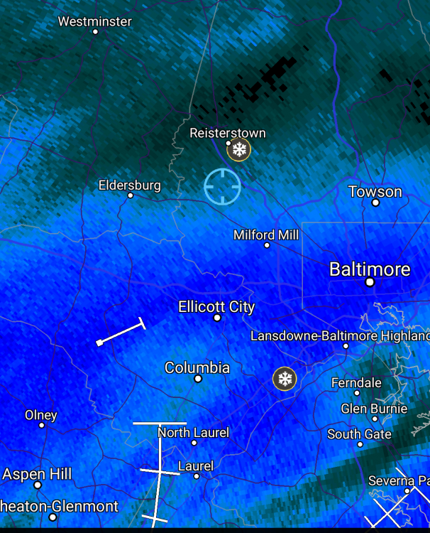
I'm in Towson. It looks like I should be on the edge of that band, but there's not a flake in the sky.
-
3 minutes ago, Fozz said:
So painfully close, but up here north of 695 it's flurries, even though I'm in the dark green.
Heh. I'm inside the beltway, but I'm somehow still in the light green. The HoCo-MoCo death band is for real.
107 pages in the obs thread for this storm and 104 in the model discussion threads. Good ratio.
-
1
-
-
Snowing nicely again here. Biggest flakes of the day. About 4.5".
-
3.8" in Towson. Very light snow still coming down.
-
This is probably the last RGEM ensemble update for this storm. It stuck with the same general idea, but now with more snow.

I figured out how to get probability plots for the whole storm rathern than just 24-hour chunks. I have to plot total precipitation, not just qpf as snow. I'm not going to show the 5mm plot, because at least 90% of ensemble members show everyone in this region getting at least 5mm of precip. Even PSU. Here's the 15 mm plot.

Not all of that will fall as snow.
-
4
-
-
On 1/1/2019 at 6:20 AM, Fozz said:
I did a Python analysis on Baltimore's precip totals, just cause I felt like it, and it turns out that 2018 single-handedly wrecked the normal distribution. Precip totals are now skewed to the right. Sometimes one extreme outlier is all it takes.
Baltimore's final total of 71.82" is over 4 standard deviations above the long-term pre-2018 average.
From what I can tell, nobody knows the appropriate probability distribution for precipitation data. It appears to vary by region. The normal distribution isn't widely used because it allows for negative precipitation values and underestimates the probability of large totals. The gamma distribution is widely used, but it too can underestimate the probability of extreme events.
January 12-13th Cold Smoke Obs and Nowcast
in Mid Atlantic
Posted
I just posted the model discussion write-up.
The short story is that the FV3 and 3k NAM did well. My favorite map that I generated is probably this one, showing calculated ratios for yesterday's snow from snowfall analysis and precip analysis.