

HIPPYVALLEY
-
Posts
32,949 -
Joined
-
Last visited
About HIPPYVALLEY

- Birthday 07/15/1968
-
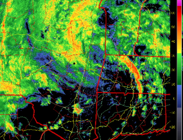
 Jeezuz, storms just keep popping up north of Brattleboro and sliding right down the valley. Pouring again.
 -
Picked up another .25” in Greenfield.
-
5.2” in Greenfield.
-
5.5” and raining again. Yeah, the frogs were crazy tonight walking the dog.
-
It’s been a boring summer, but today was some of the heaviest sustained rain bands I’ve ever seen. So that was kind of neat.
-
Greenfield has gotten that much in the past 15 minutes.
-
Fak’ dumping!
-
Holy downpour! Make that 3”+ now.
-
2.8” at mi casa.
-
Greenfield around 1.25” now.
-
Just got .20” in about 10 minutes.
-
Always in warm months, never in cold months.
-
It's going to be some very specific corridors of haves and have nots.
-
Double IPAs will do that to you.


