
February 18th 2019 - President's Day Snowstorm Map

Entry posted by USCAPEWEATHERAF ·
1,191 views
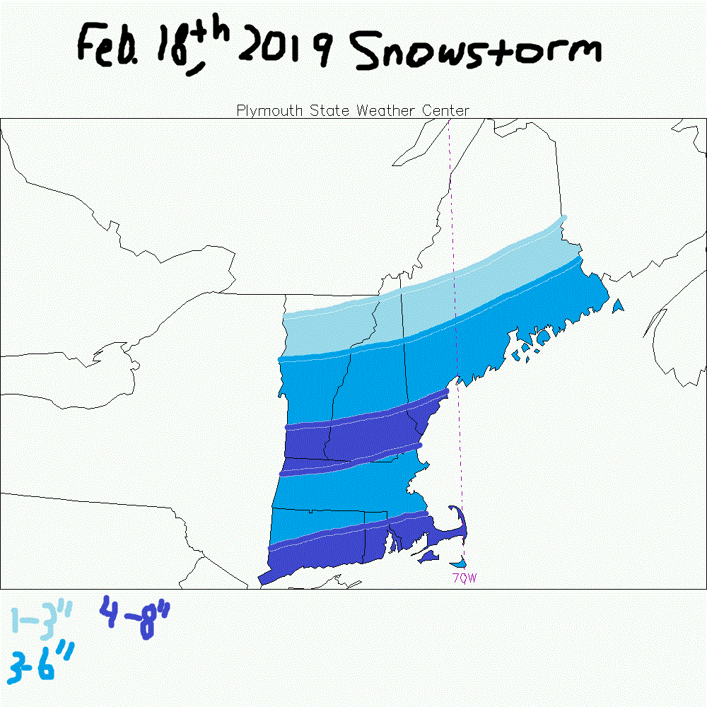
Latest models in agreement for up to 8" snowfall amounts for the south coast of CT, RI and SE MA tomorrow night into Monday. Heaviest snows appear to occur between 12 am-midnight Monday to 12 pm noon time Monday for most of Southern New England. Coastal low development, secondary low potentially stronger than modeled currently could become a bigger impactful storm in future runs where 10" amounts could become possible, but right now, not smart to forecast over 8" of snow in bands. One band appears to develop over the VT/NH/MA border from the I90 pike northward and then I90 pike southward another strong band of lift in the DGZ could produce snowfall rates of 1"+/hour. Winds should not be much of an impact until later Monday afternoon as the secondary low bombs out over the open ocean waters as it will take 24-36 hours from 1000mb to 950mb over and east of New Foundland, Canada. Right now, the potential is this storm is strongest of the winter for the region.
1 Comment
Recommended Comments
Create an account or sign in to comment
You need to be a member in order to leave a comment
Create an account
Sign up for a new account in our community. It's easy!
Register a new accountSign in
Already have an account? Sign in here.
Sign In Now