
President's Day Snow Map Updated

Entry posted by USCAPEWEATHERAF ·
1,168 views
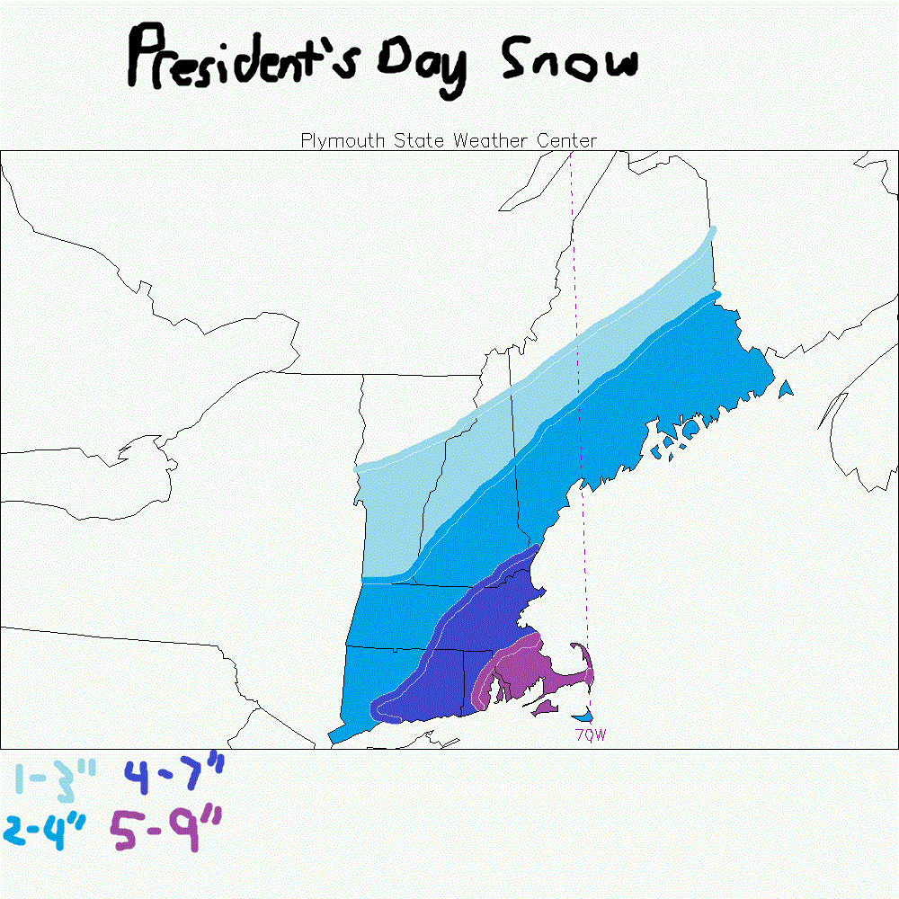
Snow is beginning just on either side of midnight tonight into the rest of the day on Monday. Models have upped the moisture produced by our secondary low with a max of around .50 to 1.00" of QPF from CHH westward to Plymouth, MA. Winter Storm Watches issued for SE MA, RI and Cape Cod. The Islands of Block Island, RI, Martha's Vineyard, MA and Nantucket, MA will see 2-4" with potential for rain mix with the snow. Widespread Southern New England amounts of around 3-6", 6-12" the closer you are to the eastern MA coastline. Areas towards the I90 pike area southward could see upwards of 4-6" while north of the pike see 2-4". Areas west of Springfield, MA could see enhancement from the Berkshires as easterly winds pile up against the mountains. This area could see bands of 4-6". The Map does not reflect this threat at the moment. Secondary low explodes as it moves east of ACK. Could bring surface winds gusting to 30mph as the storm pulls away to the east on Monday afternoon.
0 Comments
Recommended Comments
There are no comments to display.
Create an account or sign in to comment
You need to be a member in order to leave a comment
Create an account
Sign up for a new account in our community. It's easy!
Register a new accountSign in
Already have an account? Sign in here.
Sign In Now