
Snow Chances Monday Night and Tuesday

Entry posted by thunderman ·
1,775 views
Sorry I have been MIA over the last couple of weeks ... I spent the holiday with fiancee in PA (btw, the 12/29 storm was fun!) and then caught some kind of crud/flu that I have been fighting since the first of the year. This upcoming "event" is actually the most I have looked at anything weather-wise since the new year.
Anyways, there are some rumblings of a potential snow or mix event for the Monday night and Tuesday time frame. Precip is expected Monday Night and Tuesday with a secondary wave behind a cold front that will cross the region Sunday Night. The air mass ahead of the front is obviously not very supportive of wintry weather ... with highs progged to creep into the lower 70s in some spots.
Even behind the front though, really cold air fails to make it into the Western VA/NOVA areas ... therefore I wouldn't get to excited about this "event". Low level thicknesses across most of western and northern VA would support frozen precipitation, however a warm layer above that (h8-h7) would support an IP/zr/rasn type of event. Marginal surface temps should help to mitigate any onset-zr threat. North of I-66 looks to be the best for enough cold air for snow, however decent precipitation may struggle to make it this far north. Overall, I would expect this event to be characteristic of Early November or early spring than mid January.
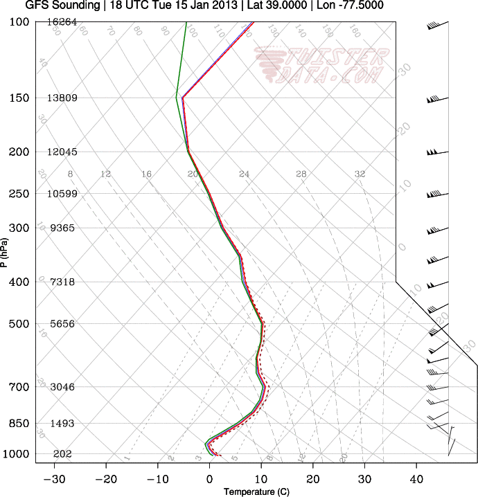
GFS sounding near Leesburg, VA:
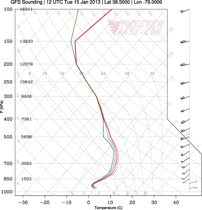
GFS sounding around Harrisonburg, VA:
0 Comments
Recommended Comments
There are no comments to display.
Create an account or sign in to comment
You need to be a member in order to leave a comment
Create an account
Sign up for a new account in our community. It's easy!
Register a new accountSign in
Already have an account? Sign in here.
Sign In Now