
Massive Nor'easter Forecast Snow Map and Wind Map

Entry posted by USCAPEWEATHERAF ·
1,864 views
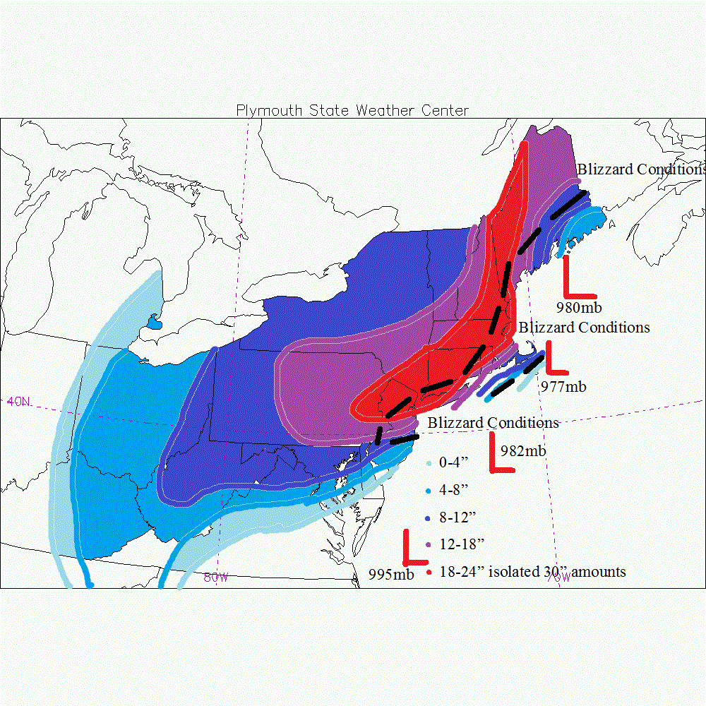
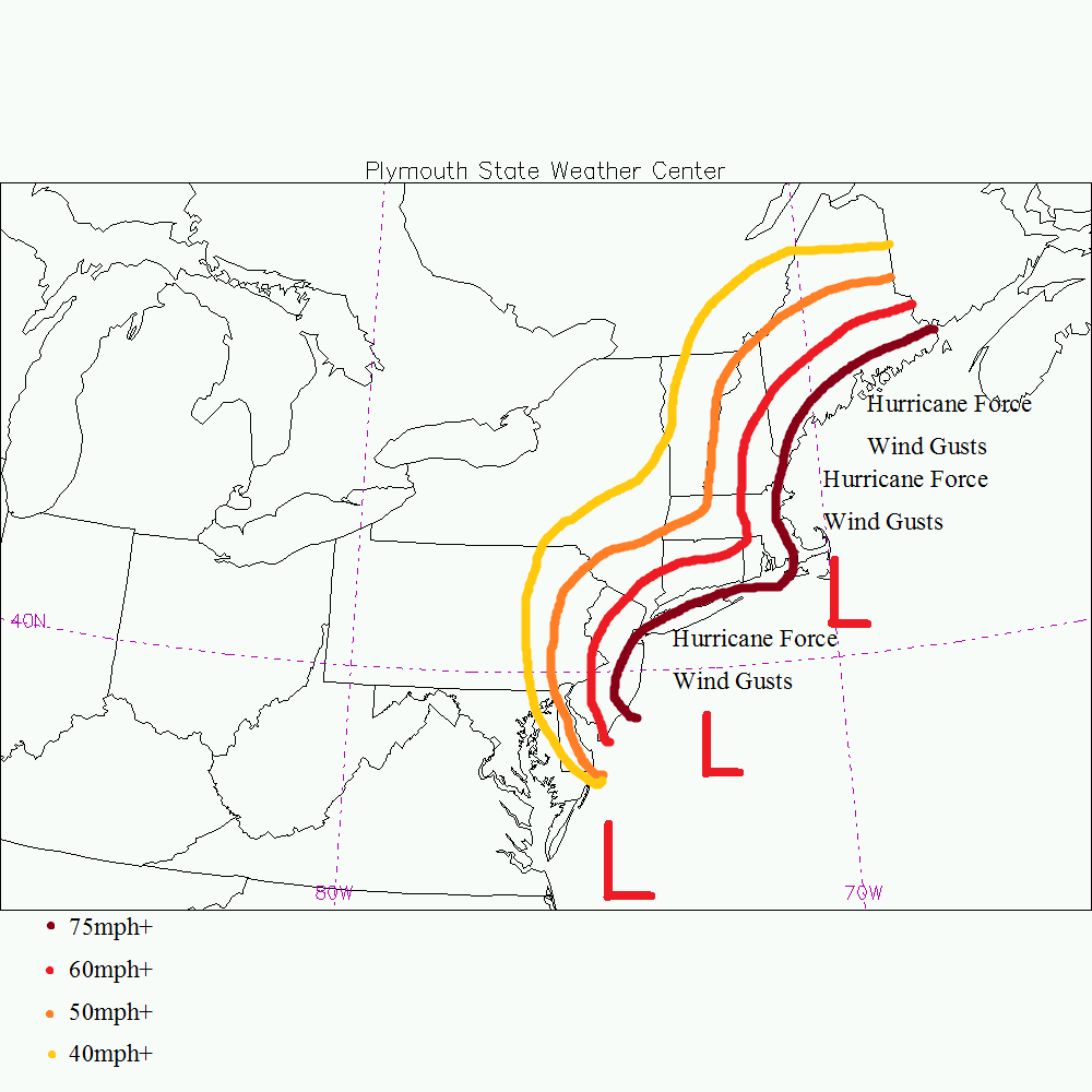
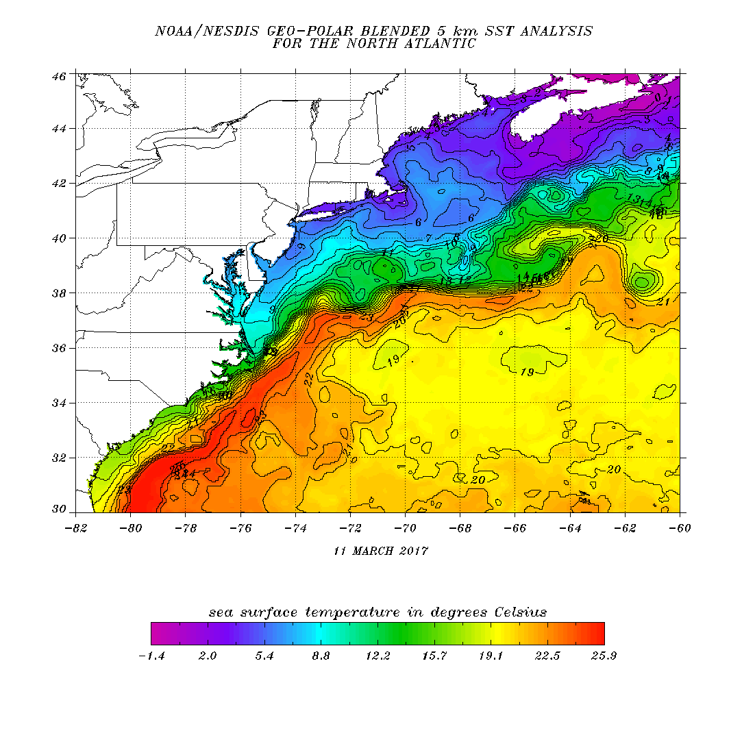
A major nor'easter/blizzard is imminent. Blizzard of 2017 is on its way. The northern piece of energy has made a US landfall over NW US at 18z yesterday afternoon or evening and this is the energy that we have been waiting for a sampling of and now that we got models adjusted stronger with the southern vort max and northern vort max. Now there are three jet streams involved. The northern jet stream (AKA Arctic jet stream), southern stream (Pacific Jet) and the sub-tropical jet which situates over the gulf of Mexico, providing the system with a GOM low pressure center and moisture. Ok lets get down to the gist of the models. Models are somewhat different still in their handling of QPF, and storm track as well as intensity and they differ on degree of phasing between all three jet streams. The models have trended stronger with the pacific jet stream energy disturbance over the northern Plains now. this swings southeastward, and depending upon how far south it gets will help determine which model is correct as well as which storm track is correct. On water vapor imagery, one can see a distinct area of vorticity spinning in the atmosphere, this is our southern stream (Pacific jet ) disturbance. With its own moisture source from the Pacific and the Rocky Mountains not doing much to stop the moisture from entraining into the Northern PLains is dumping a good to decent amount of snowfall over the northern Plains towards Detroit, MI. this energy is being forced to the southeast by a large arctic jet gyre or upper level low pressure system diving southward into the Great Lakes tomorrow morning. This trough carries our southern stream disturbance up the east Coast combining with the GULF OF MEXICO energy and low pressure center combined to bring a singular coastal low pressure center that will be rapidly deepening as it head north-northeastward up the East Coast. This earlier phase now expected to happen by most guidance models, is actually allowing the system to track more offshore rather than up the NYC harbor. Benchmark track or Cape Cod track is the final question that needs to be answered. I am going with a forecast mix of the GFS/EURO/NAM models. Using the NAM for QPF output based upon the GFS progressiveness bias in these circumstances in which the storm is allowed to slow down due to the phasing of jets in which the large upper level low phases into the southern stream disturbance and slows it down before departing. I think the low will move from the benchmark to about just east of ACK and CHH producing a mix of rain/snow for coastal Cape Cod and Islands therefore I have Nantucket in the 0-4" range and Harwich to Bourne in the 8-12" range, Chatham will likely see less with 4-8" of snow. the GFS produces a ton of moisture but it falls over the ocean, this is bound to move over land, but where will help determine who gets how much, for now I will leave the 18-24" isolated 30" amounts in banding in the position it is in now. Temperatures tonight will be in the low teens once again. Tomorrow afternoon highs will be near 30F and lows will be near 20F, I don't see how a low 40s ocean warms an arctic air mass with a northerly component to the wind field over Cape Cod, but regardless my forecast carries a mix over Cape Cod therefore only about 8-12" will fall before the changeover. Thunder snows and intense snowfall rates will be likely before the changeover occurs if it does at all. the GFS is all snow except for about a changeover briefly of about .2" of QPF as rain. That shouldn't matter much. the other aspect to this storm is the wind damage and blizzard conditions. I think blizzard conditions are likely even for Cape Cod and the NWS will likely issue a blizzard warning for us instead of a winter storm warning. Hurricane force winds are likely for Cape Cod, Cape Ann and Nantucket and all along the NH and Maine immediate coastline. Also Downeast ME sees only a few inches given that the low tracks west of them bringing in warm air off the ocean from the southeast. Thank you
0 Comments
Recommended Comments
There are no comments to display.
Create an account or sign in to comment
You need to be a member in order to leave a comment
Create an account
Sign up for a new account in our community. It's easy!
Register a new accountSign in
Already have an account? Sign in here.
Sign In Now