jgf Posted January 11, 2016 Share Posted January 11, 2016 So, what I want to do is this: 1) import a raster file - an image 2) in a layer over the raster image, i want to draw a vector field manually based on my interpretation of the image. the vectors will be velocities - say wind speed and direction at a level.., ocean current speed and direction at a level..and so on. 3) i want to save the vector field as a GRIB file, with whatever headers and attributes are needed for the GRIB file to be opened and viewed by commonly used GRIB-viewing programs. Is there any way I can do this? Link to comment Share on other sites More sharing options...
jgf Posted January 11, 2016 Author Share Posted January 11, 2016 obviously.., the program in which i create the vector field doesn't necessarily need to be the same program in which i create the GRIB file. In other words, maybe I could import the image, draw a vector field, and then maybe save it as a text file, or something.., in one program. And then, perhaps, I could open the text file and convert it to a GRIB file in another program. Link to comment Share on other sites More sharing options...
seabreezelou Posted February 10, 2016 Share Posted February 10, 2016 Sorry to say, but I am fairly certain there isn't a way in which to do this. GRIBs require gridded data, so spatially information has to be set to some pre-determined grid. GRIB files are really nasty to deal with indepth. Now, you could use some program (my experience is with GrADS) to open some gridded data, where you could perform a gridded analysis, now that could be turned into a GRIB. Link to comment Share on other sites More sharing options...
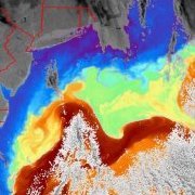
jgf Posted February 13, 2016 Author Share Posted February 13, 2016 i understand what you are saying about needing to start with vectors on some grid. in principle, it is possible to start with a hand drawn vector field, with the vectors drawn at a "random" spacing, and then transform that vector field into one with vectors on some regular grid. One way would be to fit the hand-drawn field to a function, and then evaluate the function at regular intervals. I actually already have a program that does most of what I am trying to do - it's just that the vector drawing part of it is very clunky, and it will only make an ocean current grib, it will not allow me to make a wind speed and direction grib. with this program, there are two options for the initial vector field: one is to georeference a raster image and then manually draw the vectors over it based on interpretation of the raster image. the program then converts the vector field to a grib. the grib is at a regular spacing, so somewhere the transformation from random spacing to regular spacing is being done. the second option is to import a text file of vector magnitude and direction, and the program will convert it to a grib. all the text files i have used have been at regular spacing. as i said, my main problem is that the vector drawing routine - the part where i hand draw the vectors over the raster image is too clunky and slow to work well. So, one thing that would be a big help, would be if I could just find good software that would let me import the raster image and draw vectors on a layer above the raster image, and then save the vectors field as a text file - lat, lon, u and v.., or some other format. then i could use the program i have to create the grib from the text file - i would at least be able to make ocean current grib files i have been unable to find any software that will allow one to hand draw a vector field Link to comment Share on other sites More sharing options...

Recommended Posts
Archived
This topic is now archived and is closed to further replies.