Search the Community
Showing results for tags 'possible small areas ff'.
Found 1 result
-
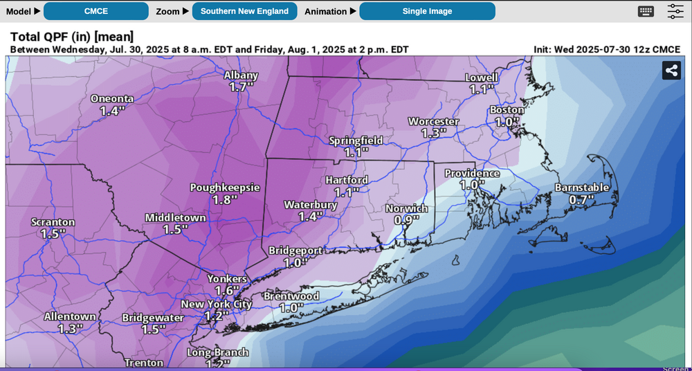
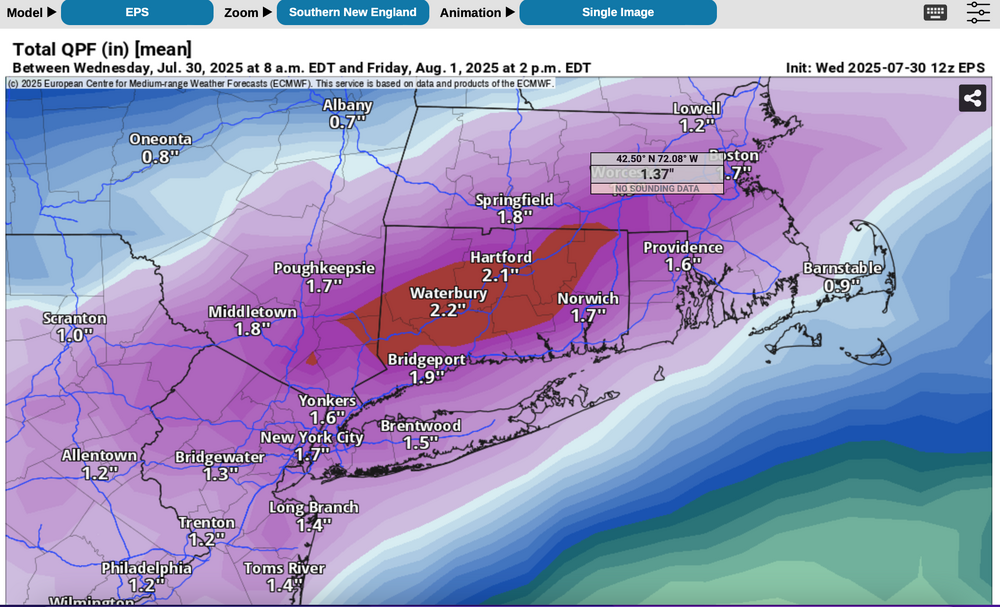
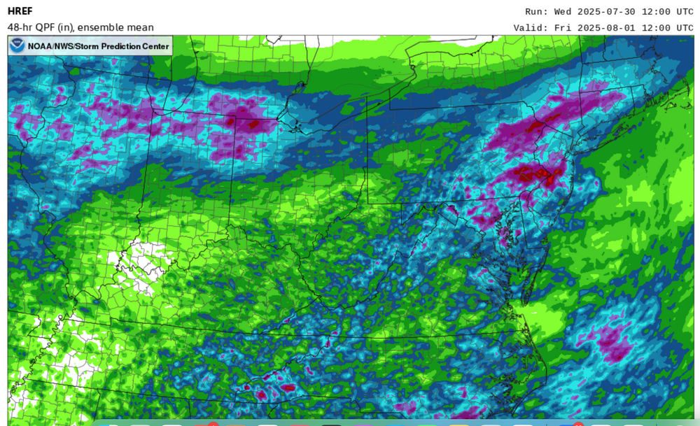
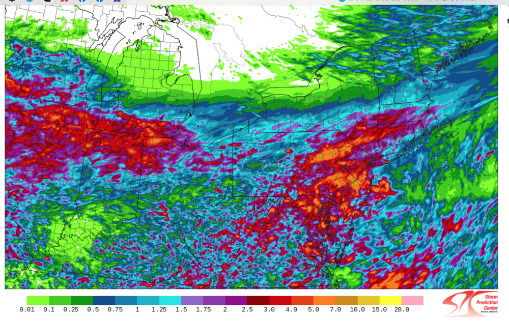
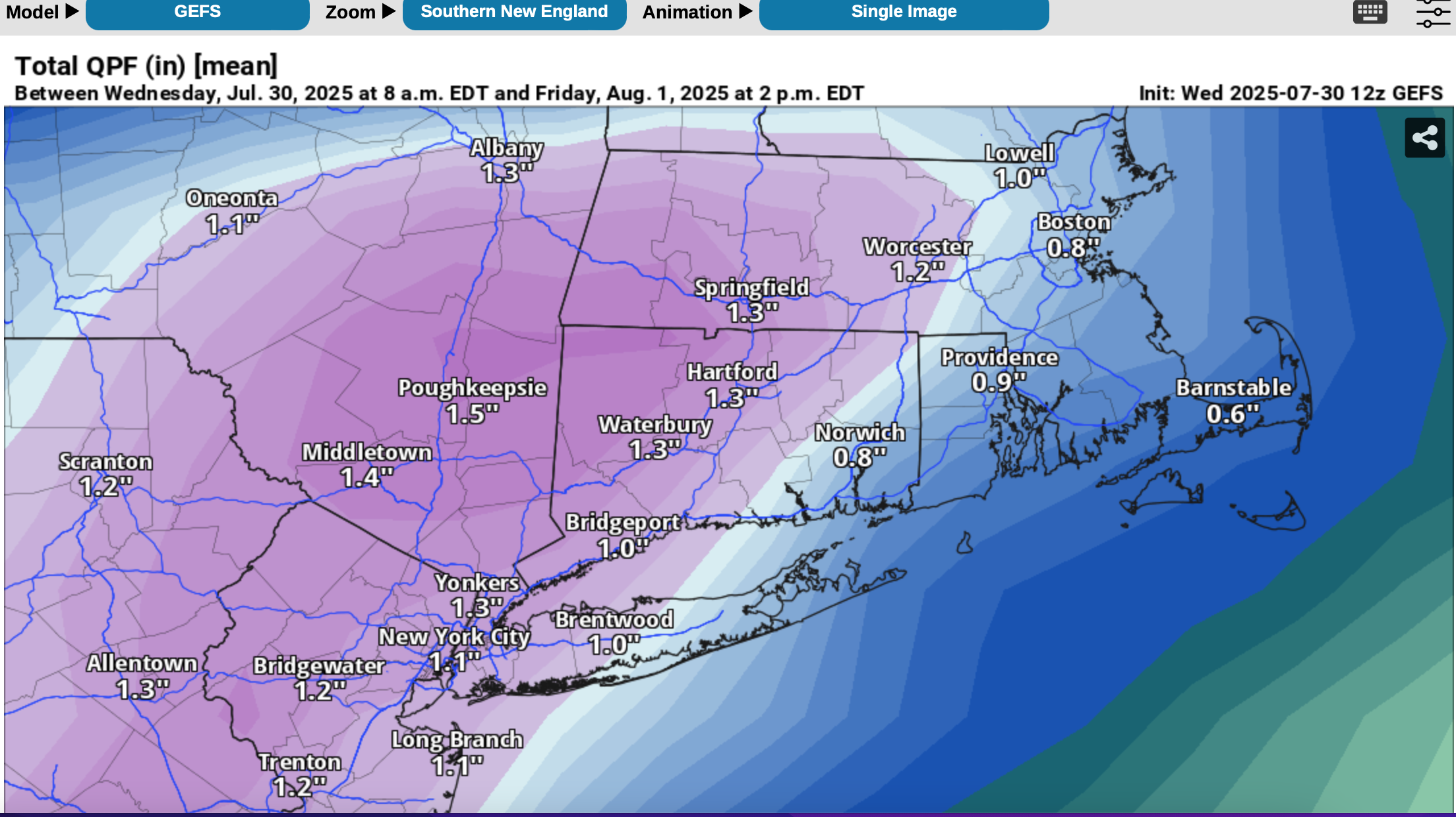
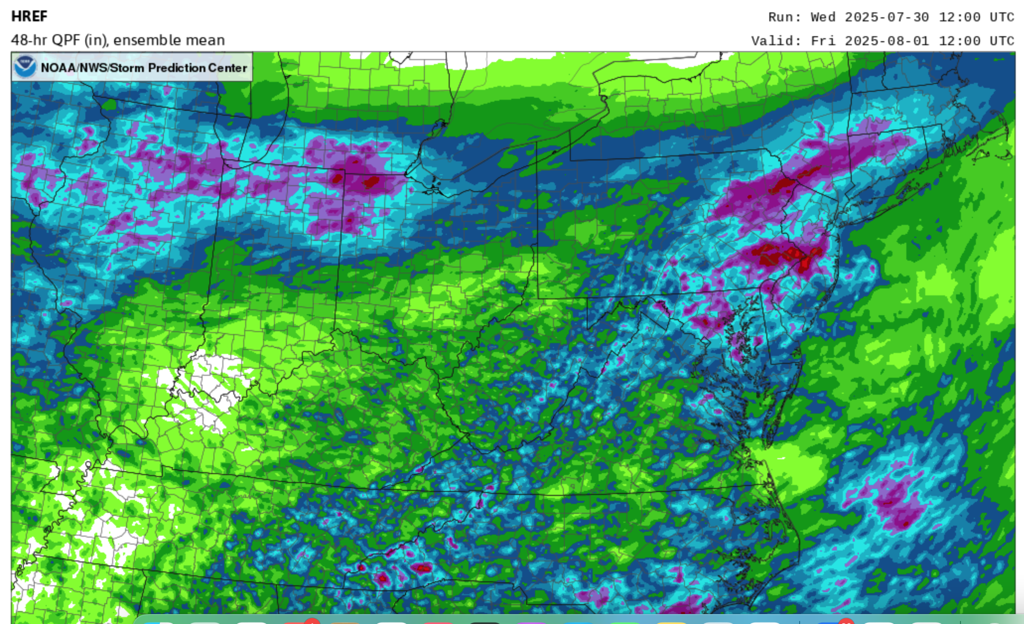
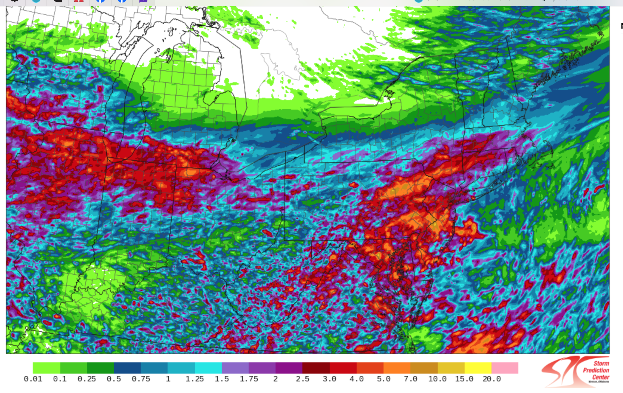
 Follow NWS warnings-statements. A flood watch has just been issued by the NWS for a portion of the NYC subforum. I'd prepare for some delays Thursday-Thursday evening, possibly a few detours. If a road is flooded, don't cross it---turn around-done drown. Not worth the risk. We dont know where exactly 4+" of rain should occur but the potential exists as a slow moving frontal boundary possibly ends as a near northeast gale for LI. Plenty of PWAT (1.5"+) along with the RRQ of a strong confluence zone 5h-3H et across northern Maine-the Maritimes causes large scale overrunning of the southward sagging frontal boundary Thursday-Thursday night when the bulk of the heavy rain occurs. For now, it appears the region from I78 northward is vulnerable to excessive short fuse runoff but the HREF added graphic shows the isolated 7+ inches POTENTIAL(browns from the legend) just south and west of our NYC subforum. Nevertheless, this should be a somewhat interesting 48 hour period. For reference have added the 12z Wed 7/30 ensembles CMCE, EPS, GEFS as well as the 48 hour MEAN rainfall from the SPC HREF ending 12z Friday with magenta 1.5"+, and the MAX potential rainfall from the HREF which suggests isolated 7-possibly 10" but primarily southwest of the NYC subforum. See legend but dont take location verbatim and. dont necessarily believe 7+ can occur. Antecedent conditions are not excessively wet so large rivers are not likely to flood, but small streams, especially near urban areas could see overflow Flash Flood response.