Search the Community
Showing results for tags 'feedback welcome'.
Found 1 result
-
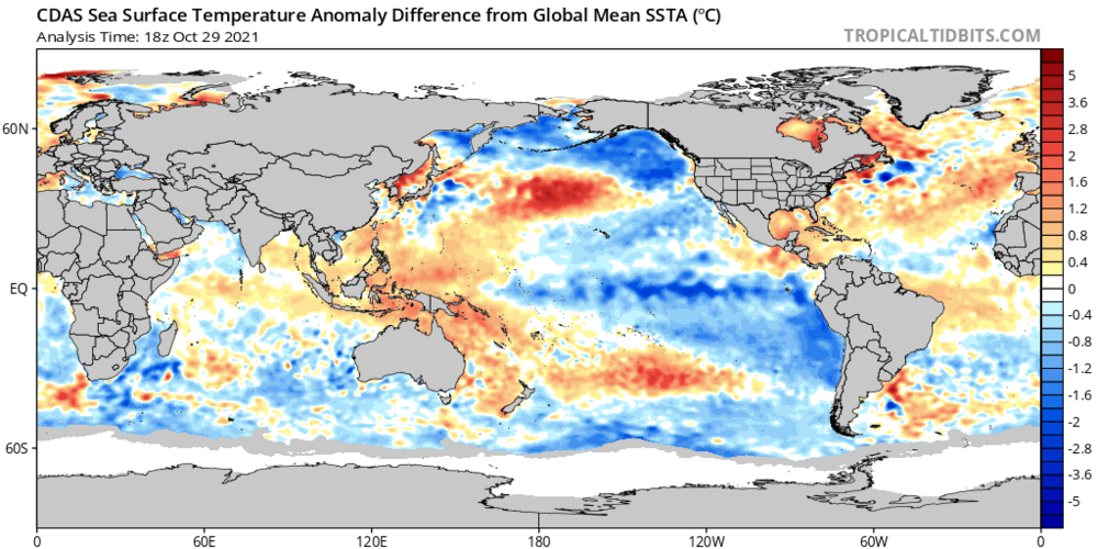
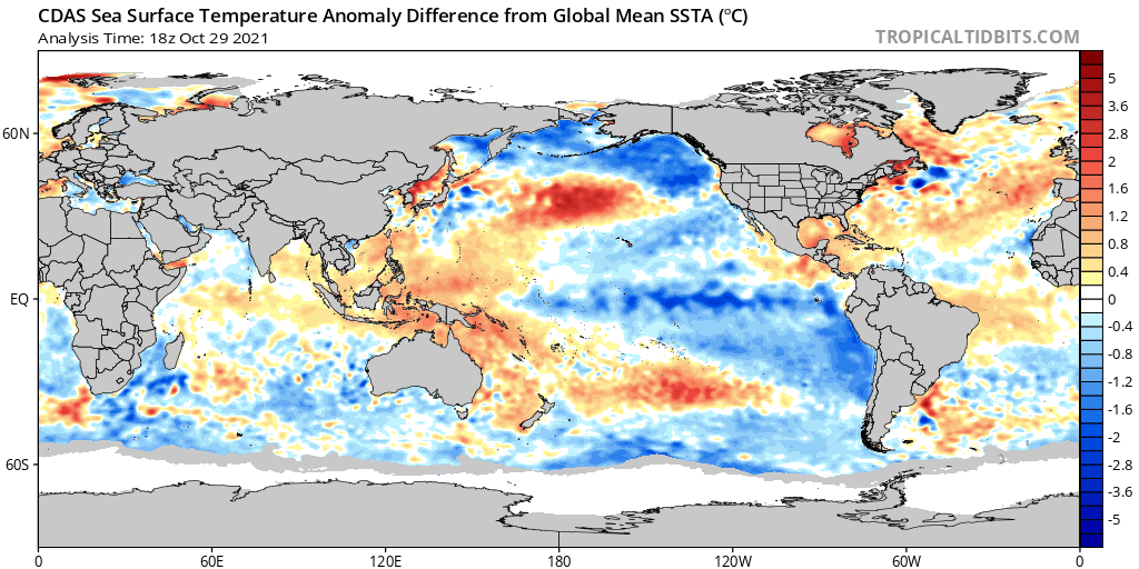
After a strong start to the 2020-2021 winter, winter ended (late Feb) due to the polar vortex rapidly increasing in strength, leading to a snowless March in New England. This year, we have some mixed signals. - warm waters off the east coast - basin wide La Niña (strength is a big wild card, my forecast is -1.2 to -1.6, moderate to strong) -warm waters near the north pole - the entire pacific has rapidly cooled off, a much different look than the past few winters -polar vortex is expected to be weak in mid December on the models -warm blob in the pacific is smaller than it has been, but it is there and fairly far west -Siberian snow cover is average to below average With the recent shift in guidance from a weak polar vortex in November to a strengthening polar vortex in November and weak polar vortex in December, the timeline for our windows of opportunity have shifted. Due to the polar vortex and warm waters off the east coast, I do not believe there will be snow from November to early to mid December in Southern New England outside of the Berkshires. The pattern in my opinion will be quite unfavorable, and we are going to have to kick the can to later in December. However, we will be wasting shit climo anyways with the unfavorable pattern, by mid December with the weak polar vortex in place combined with the favorable ssts for North Atlantic blocking, I expect there to be a window of opportunity from the 3rd week of December, to early Feb. There is a strong signal for blocking to develop, however I do not think the blocking will be as strong as it was last Jan, due to the limited Siberian snowcover advance. Then we have our next strongest pattern driver, which in my opinion will be La Niña. Some years, Enso is kinda just there while other factors dominate the pattern, this year I believe the main drivers will be polar vortex and La Niña. I am forecasting a moderate to strong La Niña (-1.2 to -1.6), and I do believe it will be a major pattern driver due to other atmospheric measures besides the temperature in the Enso region itself reflecting La Niña (SOI index, the MEI index, the entire Pacific cooling off ect). Many snow weenies (besides myself) are probably going to panic and think “Moderate to strong La Niña dominating the pattern, winters going to suck!” That is not necessarily the case, the 2010-2011 winter had a strong La Niña, and it was very well coupled to the atmospheric pattern. In my opinion this winter will ultimately come down to a battle between the polar vortex and the La Niña, with a much weaker pacific jet than we have had recently. The northern branch will likely dominate, and when combined with North Atlantic blocking in that late Dec to early Feb window, the entire pattern will be amplified with the northern stream digging fairly far south in the middle of the country, causing a low to develop and cut up into Ohio or even as far west as Wisconsin in some cases, which happens in La Niña. Without blocking this would be VERY bad, but blocking will turn these would be rainstorms into slow moving Miller Bs that undergo rapid cyclogenesis due to the contrast with warm ocean temps and the Arctic air in place, courtesy of the polar vortex. I do think we will get 6-10 chances in this time frame, with the room for error being higher due to the amplified jet stream making it easier for the northern branch to phase with whatever leftover energy there is near the gulf (that said, I’m expecting 2-3 hits) Unfortunately, I do think the polar vortex will recover and start deepening in Feb, when combined with the North Atlantic blocking disappearing and La Niña in place, I do believe we will probably see a trough in the west. It sucks, but even the best winters can’t be wall to wall, even 2014-2015 we wasted December and the 1st half of January before the polar vortex took over and we got buried. This part of the forecast is where things get very tricky. Will there be another polar vortex disruption (right now, I am not seeing any signs of a split like last year for the 1st polar vortex event)? If there is, that could cause March to get wild, with the potential for us to see 60s and 70s in mid Feb going to blizzard conditions in early March. The QBO being negative from what I have read makes the polar vortex more susceptible to being displaced or split. I do not expect a split in the first half of winter, I expect the vortex to weaken, but not enough to cause a split. mid Feb to early Mar however, I believe we have a high probability of seeing a split or displacement. Summary- Boston Nov- +2 to +4, 0 inches of snow Dec- 0 to +2, 10-15 inches of snow Jan- -3 to -2, 40-45 inches of snow Feb- +4 to +5, 0-10 inches of snow Mar- -4 to -2, 20-25 inches of snow Dec-Jan total: temps- average to slightly above Snowfall- 70-85 inches analogs ranked from best to worst 2017-2018 (on roids), 2010-2011, 2012-2013 (bad timing w/ big feb and weak Jan, but like it for March and the high ceiling blizzards), 2020-2021