Search the Community
Showing results for tags 'blowout tides'.
Found 1 result
-
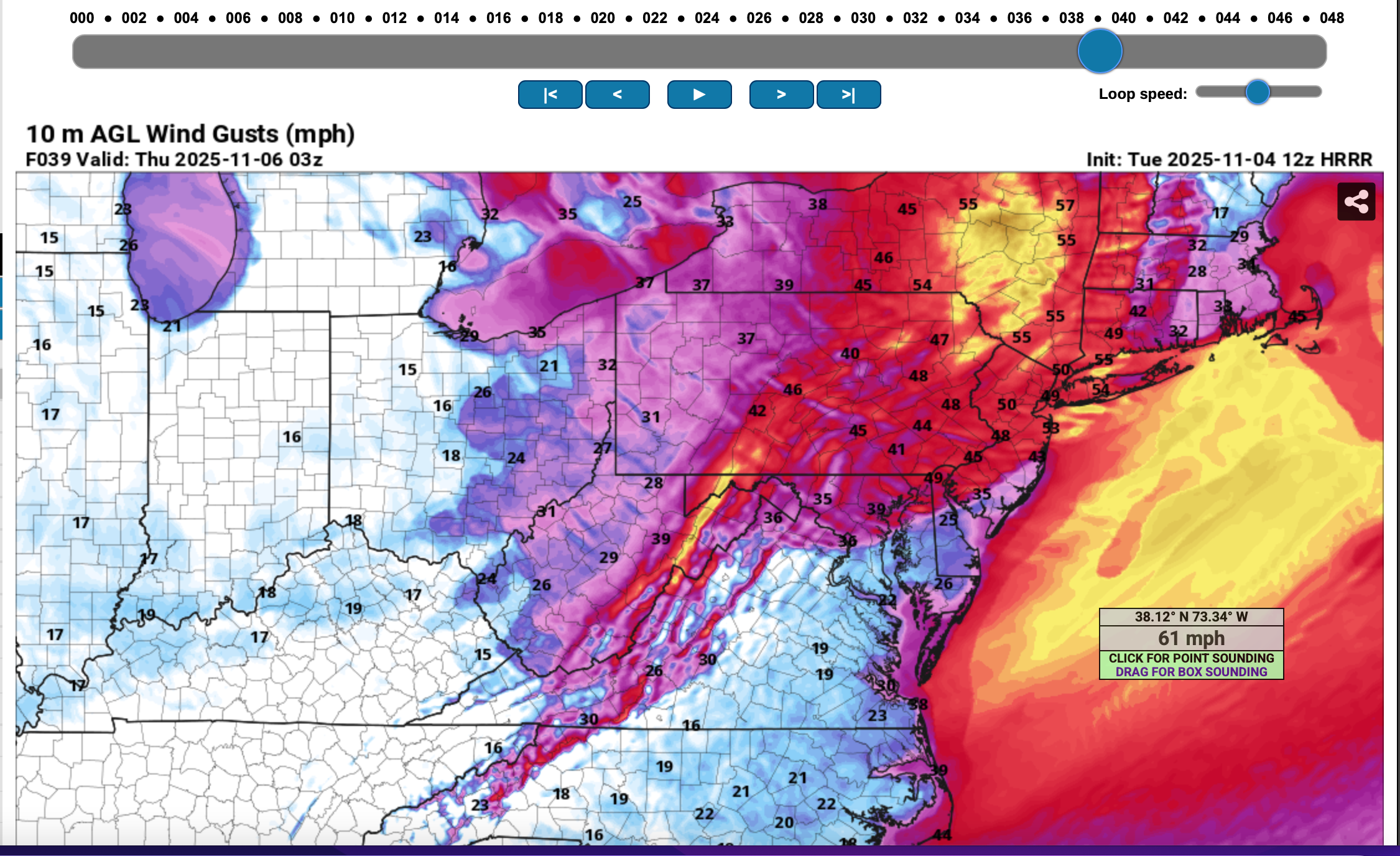
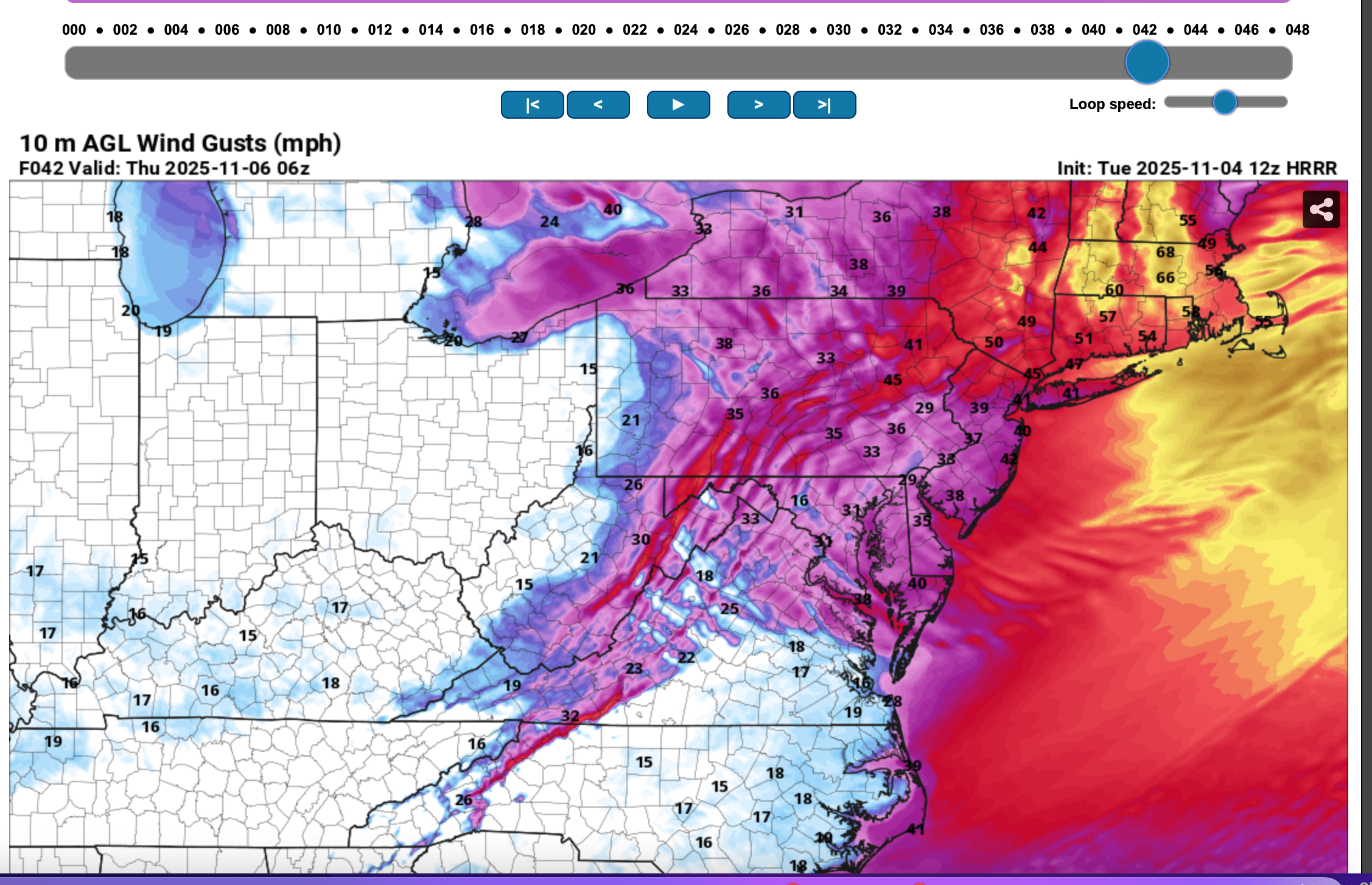
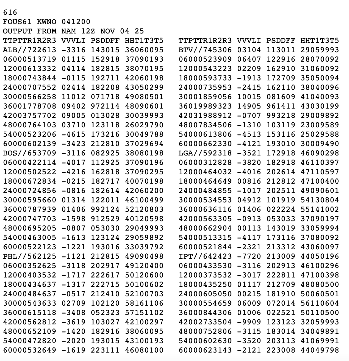
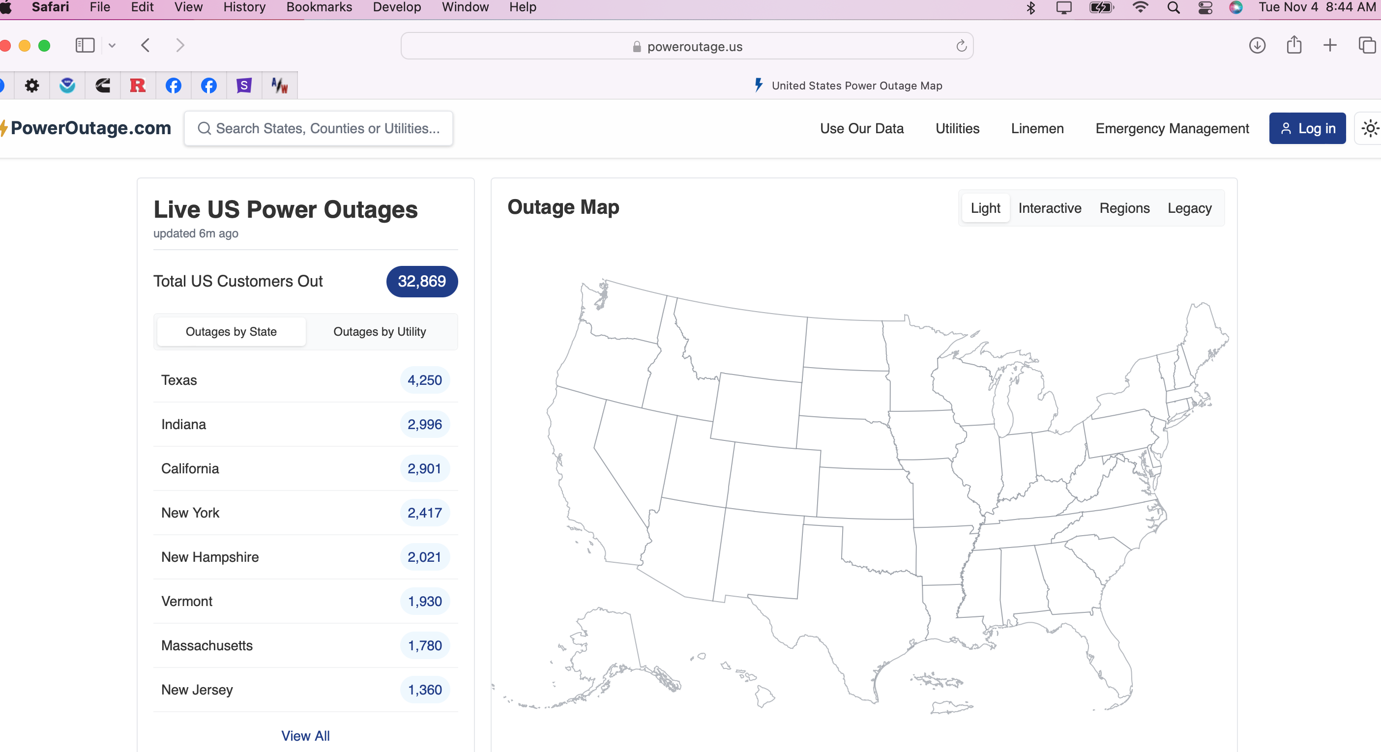
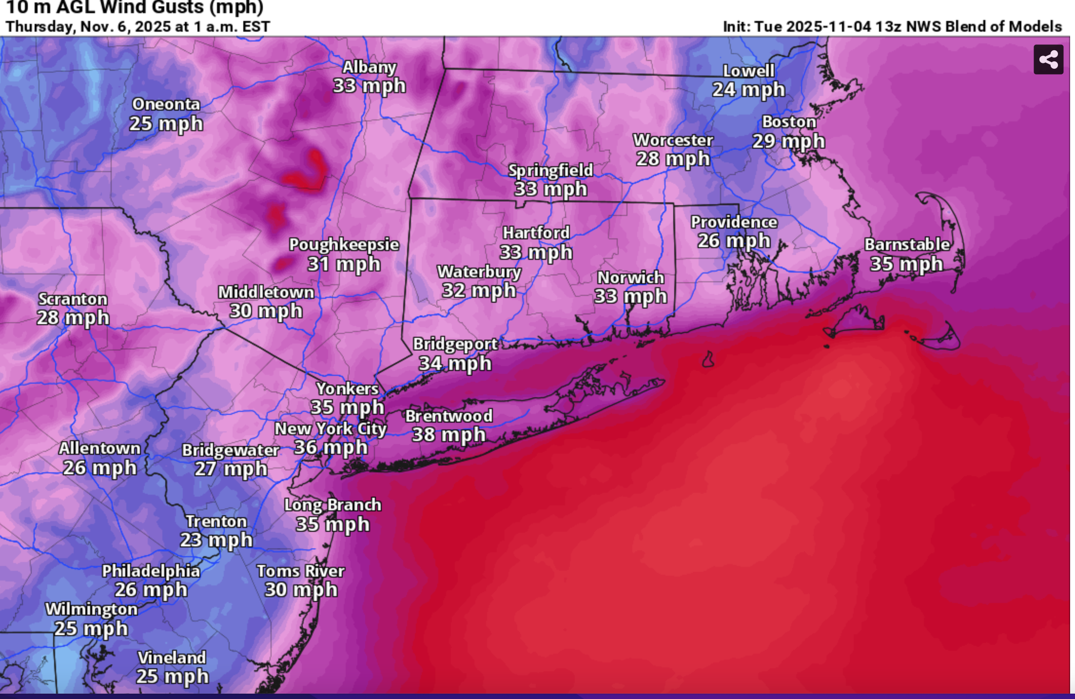
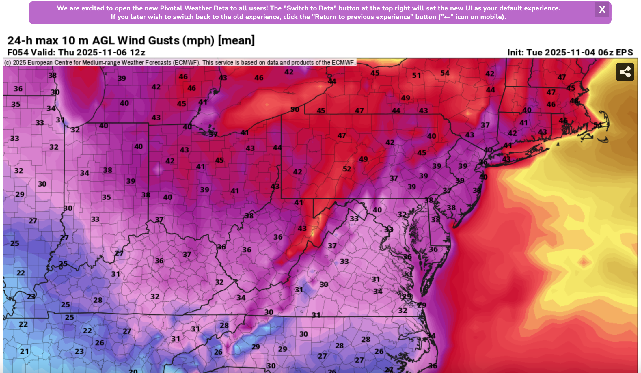
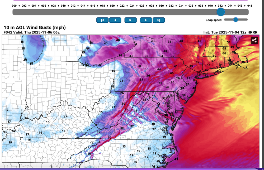
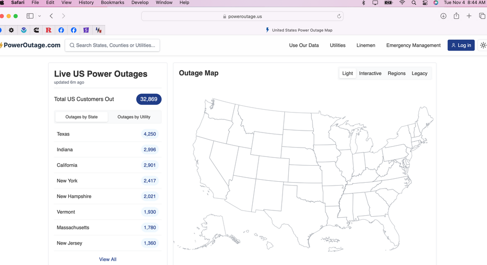
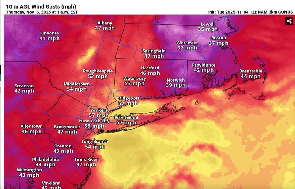
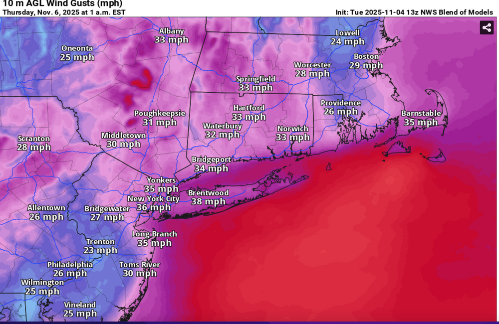
 Please follow whatever NWS OKX PHI ALY and BOX issues on the coming Wednesday night wind and tides. From our subforum standpoint have tagged wind damage for Wednesday night's brief but significant wind event associated with a 55-65KT 850 MB Cold Air Advection jet overhead. No guarantees, so the worst case 12z/4 HRRR and NAM suite max wind gusts should be 5 MPH too high but nevertheless, we should see more power outages than this morning (attached), and I expect at least a few night time -Thursday morning detours travel delays due to downed tree branches especially ridges and through NYS-CT. This will impact air travel for arrival departures Wednesday evening possibly into Thursday morning. Lapse rates look unstable for a few hours Wednesday evening up to at least 900MB, with strong subsidence drying in the wake of the Wednesday evening cold frontal passage adding to momentum transfer. A 12 hour 500MB HFC of over 150M amplifies in its east-southeast trek across NYS into New England Wednesday evening, briefly increasing the nw 850MB jet behind it to 65 kt or a bit higher. PA/NJ look to be on the southern fringe of the greatest impact which should be NYS and New England. It's an early call so no guarantees but I think its worth an eventual wind Watch or Advisory. I expect at least half the airports in the NYC metro area to hit at least 40 kt, possibly reaching 50 KT? Wind gust potential diminishes rapidly in our NYC subforum area by dawn Thursday. BLOWOUT Tide Thursday morning?: There is a chance that parts of the east facing coasts at just after midnight Thursday morning's LOW tide cycle will see a blow out tide less than -1.6' MLLW because of this brief period of wnw wind. Added HRRR max gusts at 10P/5 and 1A/6, the 12z/4 FOUS with my own personal trigger of 27KT BL wind as a threshold of wind event concerns, the 844AM today power outages with the relatively light sub 40KT gusts. Then I added the 3K NAM sampler max wind gusts, the more conservative Blend Of Models wind gust forecast and the the EPS marginal advisory wind gust modeled prediction. 1058A/4


- 68 replies
-
- 5
-

-

-
- wind damage
- power outages
- (and 1 more)