
mjwise
-
Posts
445 -
Joined
-
Last visited
Content Type
Profiles
Blogs
Forums
American Weather
Media Demo
Store
Gallery
Posts posted by mjwise
-
-
2 hours ago, DaveNay said:
Rural DeKalb county is basically shut down today. Road crews can't keep up with the drifting. The cold is brutal.
I have heard reports of stranded and abandoned vehicles in rural areas and that blizzard conditions prevailed overnight.
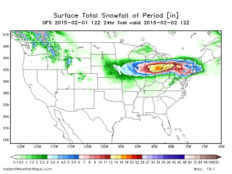
ETA: Bottomed out at -14 at the airport, still -10 as of the 2pm observation. This will be my personal coldest daytime temp since January 1994 (-12) assuming we don't gain more than 5 degrees or so. For fun, I took an snow core yesterday from a relatively undisturbed part of my front yard and I measured 2.2" of liquid in ~12" of base.
-
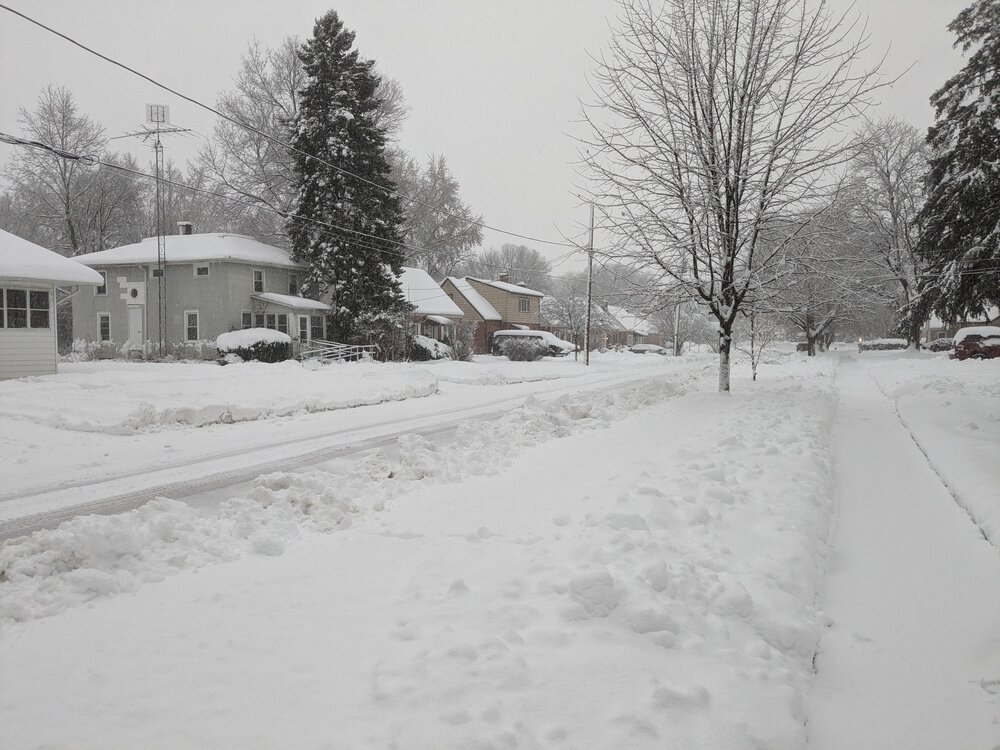
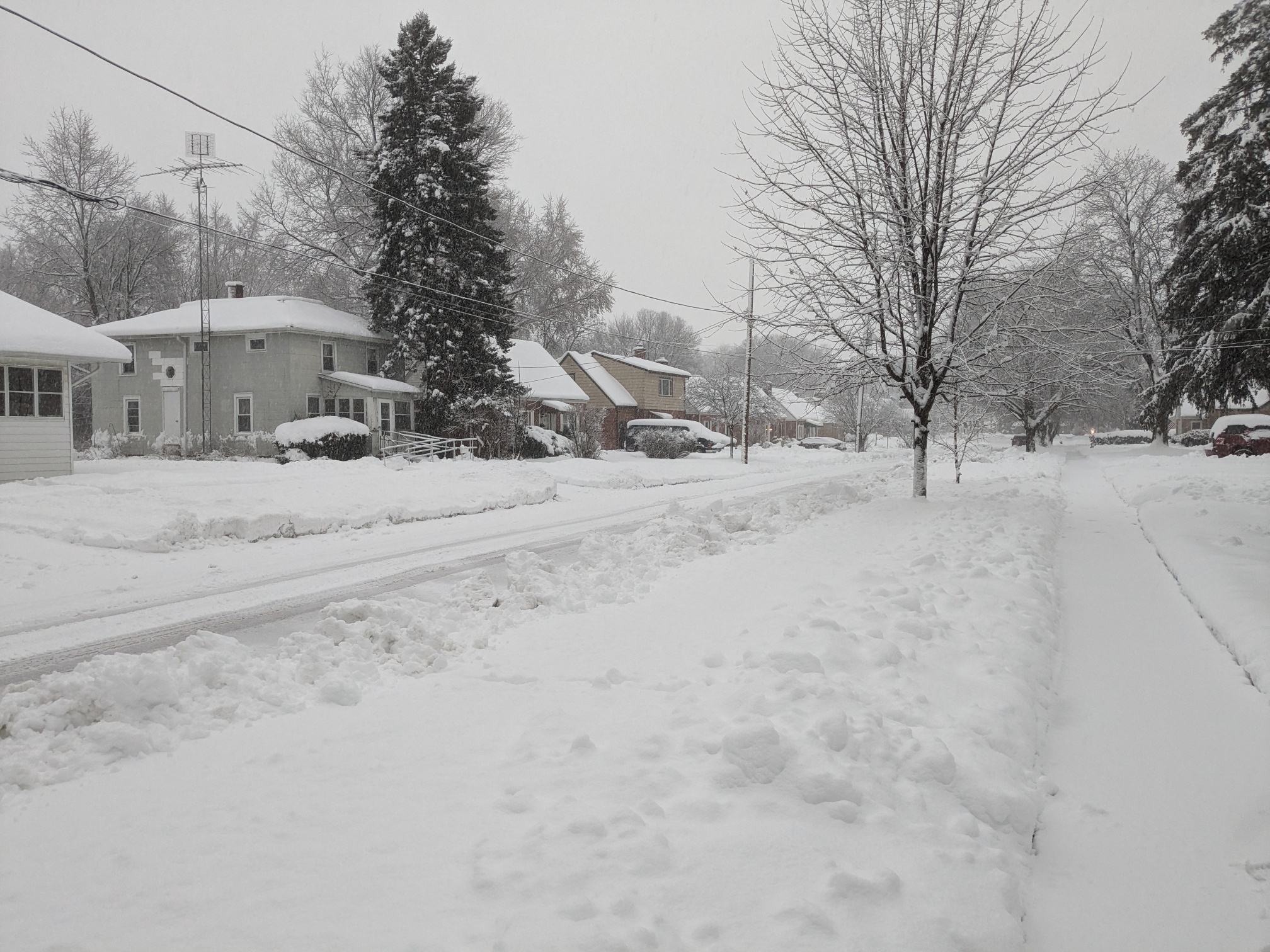
Here's what it looks like at street level here before it gets dark. I don't have measurements, but our total compacted depth (all gained in the past week) is ~12". The bottom 2 inches was thick crust I needed to punch through.
It's been all snow except for about 30 minutes of mixed SN/IP at about 8:30am.
Sorry I didn't get a morning shot - buildings were plastered with snow from the weenie band but then temps went to 33 and most of it melted off the sides of buildings.
-
 6
6
-
-
2 minutes ago, mimillman said:
SREF is a joke btw. ORD mean was at 5” this AM. 11” now
A not insignificant number of SREF members had rain getting all the way up to Madison for at least some of Friday in earlier runs today. QPF hasn't changed much, it was just running a blowtorch earlier.
-
1 minute ago, Stebo said:
Probably bad. Even if the weather is better by then the plane that was supposed to be there may not be.
Middle 3rd of the country is pasted with wind advisories or high wind watches. I haven't seen so many issued for some time. Air travel is going to be rough at best the next few days even outside of places that get snow.
-
10 minutes ago, Radtechwxman said:
18z hrrr real special. Explosive deepening and says hello rain for a good chunk of us
Only about a 350 mile movement on the slp location versus the 12z run, where it was making for Wisconsin via Dubuque when the run ended...
-
 3
3
-
-
1 hour ago, SchaumburgStormer said:
I had mentioned this in another thread, but the 12z GFS has ORD below zero for 60 straight hours, and under freezing until at least 1/25.
The Euro is on board with that. The run ends below zero again.

-
15 minutes ago, sbnwx85 said:
I can’t believe I have to post this meme every winter.
Even within 24 hours it and the SREF are dodgy. As late as the 15Z run on Monday, the majority of the SREF members still said it would be a rain event on Tuesday afternoon in Dekalb. I put no stock in it 48 hours+ out.
-
1
-
-
On 1/7/2024 at 10:49 PM, cyclone77 said:
Been focusing so much on the storm systems kinda forgot about all the cold coming down for next weekend and beyond. The western sub may have a hard time getting above zero for highs Sunday the 14th. Good chance at -teens early the following week. Gonna be a cold slap in the face after the recent warmth we've had going back through December.
Whatever snow falls across the sub will be around for awhile it seems.
The 12z Euro has us subzero for 72 hours straight here - Sun morn to Wed morn. The cold is not quite as sharp on the GFS but longer lasting with single digits starting late Sat. night and that or colder extending the sensible length of the run from there. Even the EPS shows us falling into negatives during the day on Sunday.
-
1
-
 1
1
-
-
1 minute ago, Roger Smith said:
Is there a list of top Chicago snowstorm amounts on 1-d and 2-d basis? I know 1-26/27-1967 is tops but what does the top ten look like?
-
 1
1
-
-
4 minutes ago, Chicago916 said:
NAM says shift the WSW southeast in Illinois. Maybe NAM is just being NAM though but some other CAMs also are trending this way. Fingers crossed in the city.
LOT agrees and just added Lee-Ogle-DeKalb-Kane-Lake-LaSalle to the WSW.
-
1
-
-
Up to a likely final total of 5.61" for the month in DeKalb and 9.24" for MJJ. 2.32" for the 24 hour stretch between early Friday morning and late Friday evening. May and June were dry but not as dry as points north and west have been.
3 90's for the year to date (6/24, 7/27, 7/28).
-
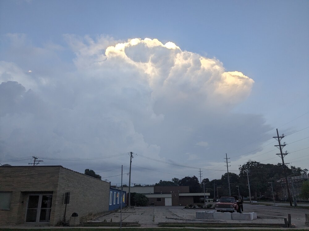
Here's a photo of the sun setting on the western side of the Kane county supercell before the main show last night.
-
1
-
1
-
-
This is the most lightning I've seen in years. Tons of cg strikes.
Eta: hail!
-
SPC mesoanalysis is really off the charts in northern illinois area. 6.5kJ/kg SBCAPE, 5kJ/kg MLCAPE, LI -12, with swath of 2.1 inch PWAT aligned parallel with the convection. The only thing that could be a little stronger is shear. It's rare when you get a high end wind and potential high end flooding event out of the same complex.
-
1
-
-
22 hours ago, CheeselandSkies said:
Dunno if I ever recall seeing 500mb heights exceed 600 dam before, even on a GFS fantasy range forecast. Usually the highest I see is 594.
It happened in the middle of July 2013 over the GL/OV. (Link - all the images are unfortunately dead) 850 temps were relatively pedestrian though so it was just an "average" heatwave when it happened.
-
1
-
-
2 hours ago, Chambana said:
That’s insane. I haven’t had a 83 dew since summer 2011.
Dekalb ASOS just clocked an 83 dew at 7:35pm. I went out for a casual walk and arrived home soaked (and not from rain!).
-
A gross 87/80/102 at the airport here. I think this is the first 80 degree dewpoint for DeKalb this year.
-
Looking hazy and intermittently smoky on the surface on the smoke HRRR for Northern Ill starting Sat morning all the way through Sun.

-
2
-
-
The SPC is a believer at least...
https://www.spc.noaa.gov/products/md/md1506.html
Mesoscale Discussion 1506 NWS Storm Prediction Center Norman OK 0305 PM CDT Wed Jul 12 2023 Areas affected...Northern Illinois and far southern Wisconsin Concerning...Severe potential...Tornado Watch likely Valid 122005Z - 122130Z Probability of Watch Issuance...95 percent SUMMARY...A tornado watch is likely across northern Illinois and possibly southern Wisconsin by 21Z. DISCUSSION...The air mass is recovering rapidly across northern Illinois in the wake of the morning MCS. An EML, advecting eastward amid 40-50 knots of mid-level flow has cleared out cloud cover and allowed for surface heating across eastern Iowa and northwest Illinois. Temperatures in this area have warmed into the low 80s with dewpoints remaining steady, or even climbing slightly, into the low 70s. Temperatures remain in the 60s across northern Illinois, but expect this warm front to lift quickly northeast through the evening as a result of surface heating north of this front and strengthening low-level flow in response to the deepening surface cyclone across eastern Iowa. Additional heating, combined with cooling temperatures aloft ahead of the approaching shortwave trough should result in 1500 to 2000 J/kg MLCAPE by this evening across northern and northeast Illinois. This instability will be co-located with a strong, veering wind profile (sampled by the 20Z LOT VWP). Expect a similar wind profile (featuring 200+ m2/s2 0-500m SRH) to remain along the outflow boundary/composite front through the evening. Supercells are expected to form along this boundary as ascent increases ahead of a digging mid-level shortwave trough and within the left-exit region of the upper-level jet. Southerly winds ahead of the surface low will provide sufficient low-level streamwise vorticity for a tornado threat. However, any storms which remain along or slightly north/east of the boundary, where more backed surface winds will be present, should ingest much higher SRH and will pose a greater tornado threat and even the potential for a strong tornado. In addition, large hail and damaging wind gusts will be possible. A tornado watch is likely by 4pm to cover this threat. ..Bentley.. 07/12/2023 -
On 7/10/2023 at 5:30 PM, cyclone77 said:
Today was the 21st 90+ day at MLI for the year.
That's a crazy stat to me. We have had 1 90 so far this summer, a 90 on 6/25. Granted, we have gotten 89'ed 5 (!) times, but still, even despite being ~300 feet higher, less urbanized and at a slightly higher latitude, I wouldn't expect that contrast between two sites separated by a <2 hour drive.
-
3 hours ago, Powerball said:
100s aren't happening for Palm dude's part of the country as long as those Canadian wildfires rage on.
The GFS is also mixing to about 650-700mb to get that absurd surface output. It advertised that last year too, at time frames a lot sooner than 300hrs+, and it didn't remotely pan out then either. Whenever GFS 2m temps are spitting out 110+ in the midwest or GL, it's because it's got some broken mixing scheme going on.
-
1
-
-
DeKalb actually ended the month below normal per NOWData - at -0.2, month high was 90 on 6/25. We got 89'ed a hilarious 5 times, including four days in a row (6/1-6/4). Precip was 50% of normal.
-
1 hour ago, SolidIcewx said:
That defo band is no joke
Reminiscent of the August 11, 2014 Detroit flood event. Near tropical airmass + mild/moderate baroclinicity results in weak, diffuse, ambling surface low that can produce impressive rainfall. They tend to be poorly modeled. The ECMWF saw it for the most part but the GFS and NAM were clueless.
1.25" in Dekalb today. Most rainfall in a day in the last 3 months.
-
1
-
-
On 4/12/2023 at 9:01 PM, CheeselandSkies said:
July 1995 is one of those rare weather months that stands out in my memory. At the time we lived in a house with two window A/C units, one in the living room and one in my parents' bedroom which they didn't like to use because they didn't trust the wiring up there (1920's house with one two-prong outlet per bedroom, except the master which had two, my dad upgraded all the wiring on the first floor but never got around to the second before we moved out). I don't think nine-year-old me wore a shirt outside of school all month. Fans going full blast in every room and almost nightly thunderstorms. Good times.
I spent the middle of July 1995 at a summer camp in an unair-conditioned dorm in southwest Ohio. It was a miserable week. We would take cold showers (well, as cold as they could get, which wasn't very) every night to get any kind of relief.
-
1
-

January 13-17 (and beyond?) Cold Wave
in Lakes/Ohio Valley
Posted
Just hit 0 here. We were at zero or below for 72 hours. If we don't nudge up to 1 here, we'll end up with about an 84 hour run at 0 or less.
ETA: Hit 1 degree after exactly 72 hours of zero to subzero temps.