
blizzardof96
-
Posts
1,565 -
Joined
-
Last visited
Content Type
Profiles
Blogs
Forums
American Weather
Media Demo
Store
Gallery
Posts posted by blizzardof96
-
-
Looks like ~3" here in kingston with a glaze of ice underneath. YYZ reporting a 6" storm total although I suspect many parts of the city are above that. Considerable blowing and drifting as well.
-
1 minute ago, snowstormcanuck said:
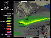
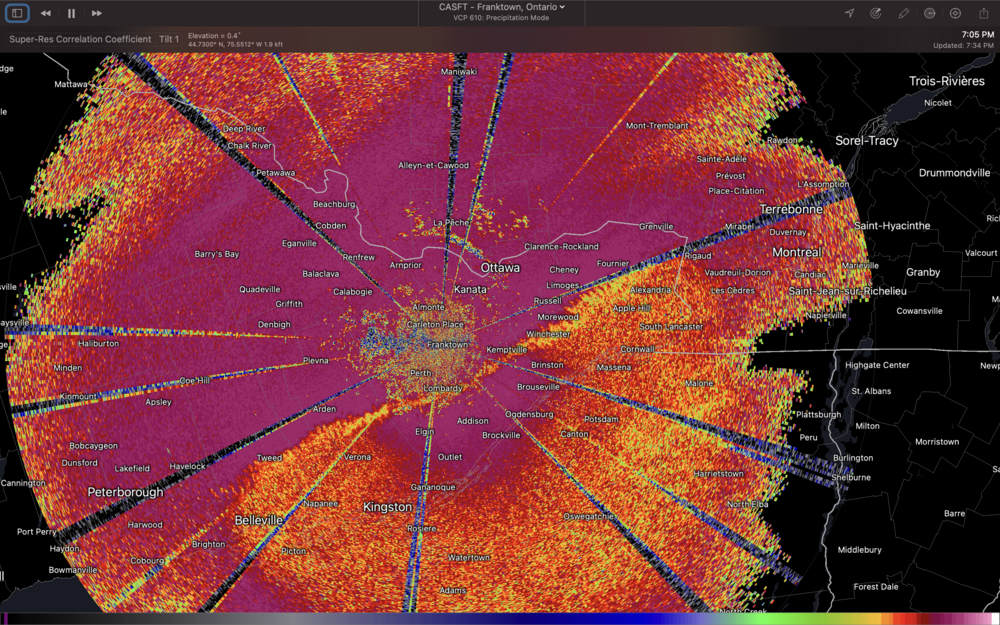
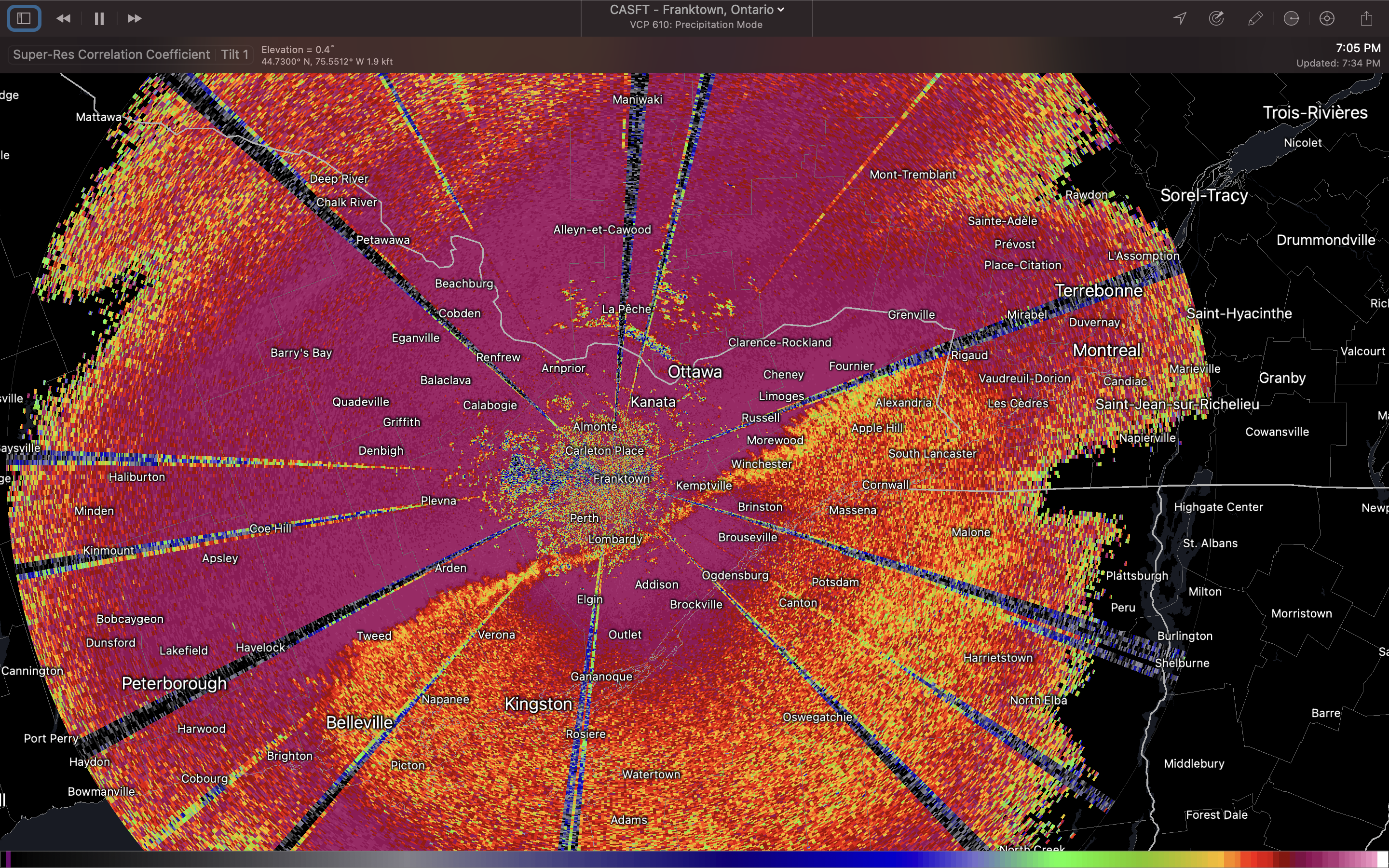
Just started exploring the correlation coefficient feature on RadarScope. Great for these mixed pcpn events.
It was bang on this afternoon with the timing of the GTA changeover. Very helpful for these events.
-
Pouring rain here in Kingston with snow being reported in Ottawa. Mixing line located from north of Belleville - Perth - Kemptville, expected to push southeast over the next few hours. Expecting a fairly decent amount of PL before changeover to snow.
-
-
18 minutes ago, snowstormcanuck said:
Interesting. Looks like they're going to do this piecemeal. Seems like a watch is at least warranted NE of that zone.
Something that popped into my head that is kind of interesting. My first memory of posting on this forum was with the Feb 7/8 storm in 2013. Crazy to think that it's been over 9 since since then and that we still interact from time to time on this forum. Time flies.
-
 1
1
-
-
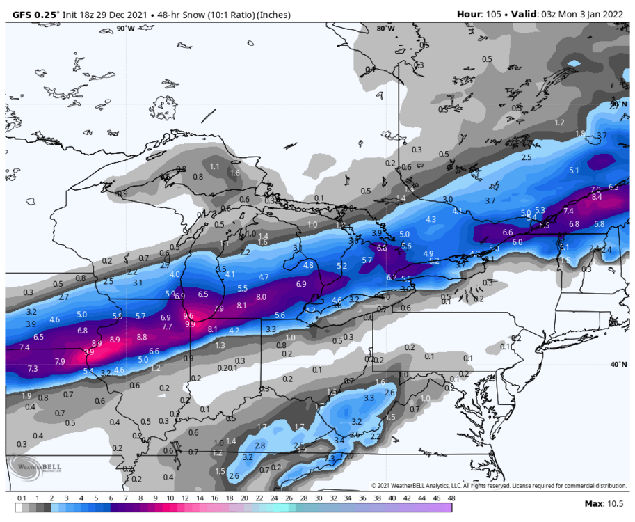
18z 3kNAM big hit for GTA with amounts near 10". Low tracks ~990mb through Erie, PA always seem to get it done around here.
-
2 minutes ago, snowstormcanuck said:
Interesting. Looks like they're going to do this piecemeal. Seems like a watch is at least warranted NE of that zone.
Agreed. I think they'll either issue WSWs or snowfall warnings for areas further east into GTA. Probably coming out this afternoon or into tonight. They are always hard to predict though, lol.
-
EC has hoisted winter storm warnings for SW ON, extending from Windsor-Sarnia-London-St Thomas
-
Fairly good model consensus on 6-10" for the GTA with 401 bullseye
-
3
-
-
Measured 18" at my place. Downsview recorded the same amount.
Everybody in the neighbourhood agreed that was the most snow they have ever experienced by far. Never seen anything like it before in Toronto.
-
5
-
-
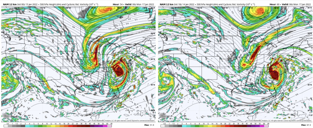
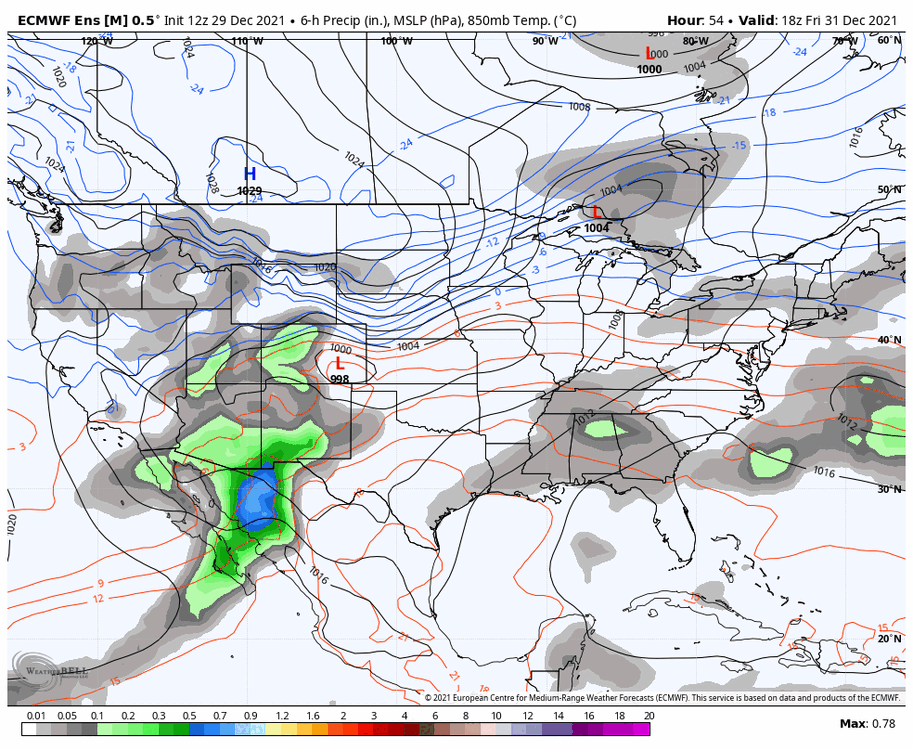
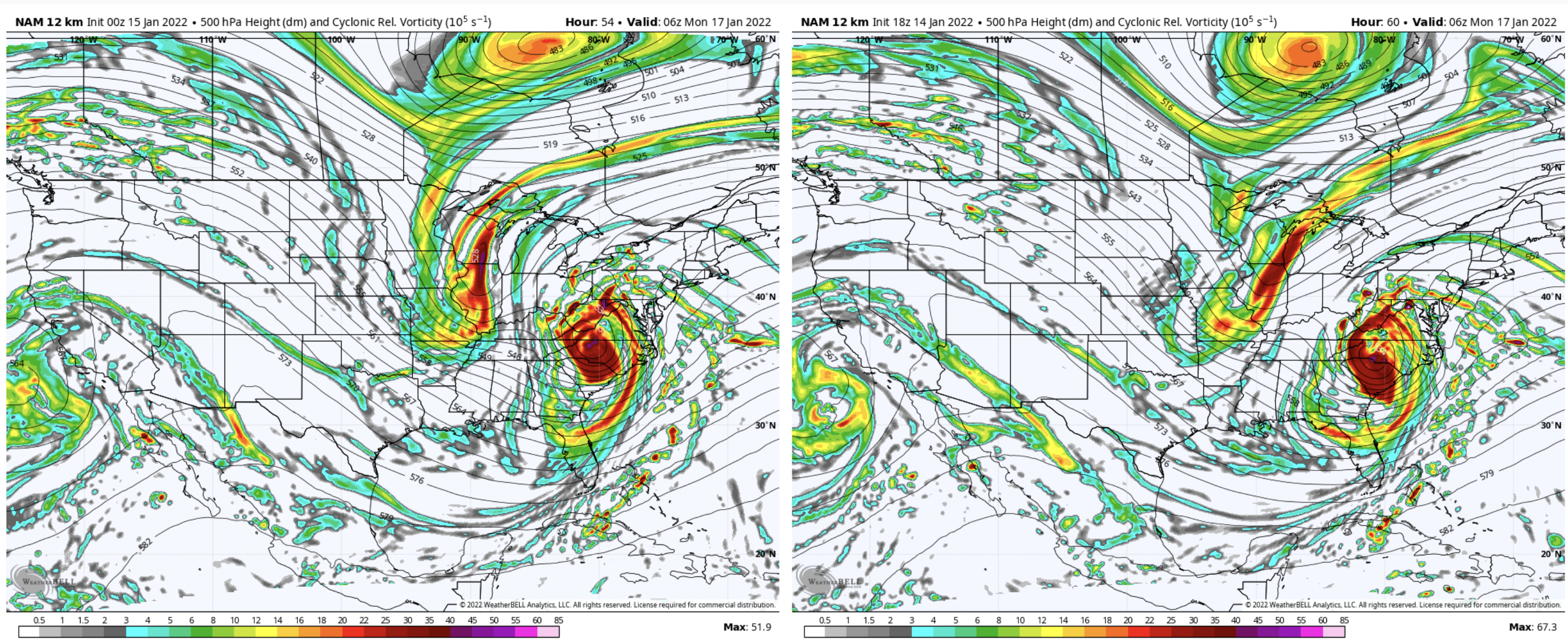
Can see the differences in the energy over the plains. 0z NAM (left) vs 18z NAM (right).
-
 1
1
-
-
8 minutes ago, DeltaT13 said:
I’ve never seen Toronto get crushed so if it’s going to somewhat miss me I’d love to see them score a big one. It’s takes a really wild setup for that to happen with a huge return interval.
For Toronto, since 1855:
Number of 24"+ events 0
Number of 20"+ events 4
Number of 18"+ events 7
Number of 15"+ events 21
Number of 12"+ events 46
% chance of seeing a 12"+ snowstorm in a snowfall season 28%
15"+ 13%
18"+ 4%
20"+ 2.5%
24"+ RARE
-
1
-
-
Just now, Owensnow said:
Thoughts on NW Camp?
I am near Leamington, ON
Tough to say at this point. Small changes in the strength/positioning of the plains vort is resulting in practical changes to the low track. This alters the position of the deformation zone. Recent runs have been trending a bit further south/stronger with the plains vort... leading to more phasing with our cutoff low. Under this scenario (eg 18z ECMWF), the heaviest snow band tracks a bit further NW through GTA etc. Another plausible scenario is something like the 18z NAM which is a bit less phased with the low track further east. Future runs (starting with 0z tonight) should help clarify things and build consensus... hopefully.
-
Fingers crossed that we get into that deformation zone in Toronto
-
2
-
-
~1.7" recorded at YYZ. About 3" at my place in north Toronto. Most of the city seems to have received between 2-3".
-
12 minutes ago, Snowstorms said:
The trend seems to be weaker and further south right now. A large portion of the energy gets wrapped up further south into a potential secondary low. We'll see what tonights runs yield. I agree with the bold, it is ridiculous. Any reason why you feel we are seeing such high volatility among the models?
5-10cm does seem like a good bet for now. At the very least it should bring us closer to 50cm (20") for the season.
Edit: Must be tough for meteorologists like yourself to issue a proper forecast right now.
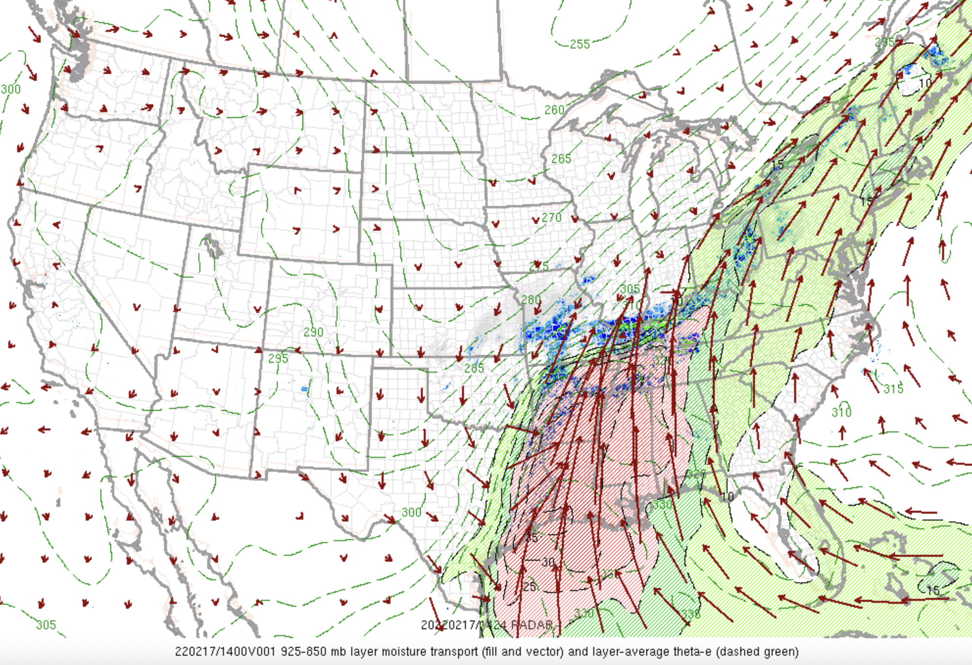
Synoptically speaking, what we have is a weakening vort max ejecting into the plains. As the vort max moves northeast, it is getting elongated/weakened by the confluence zone/upper jet across the Great Lakes region. With the confluence zone in place, the plains energy is quite limited in how far north it can track and how strong it gets. These weak systems can be subtle which the models will rarely handle well. With a better defined low, the models have better legs to stand on from a physics perspective.
Very similar setups with a plains wave ejecting towards Great Lakes confluence zone occurred last winter on a few occasions, and the models similarly performed poorly up to the final moments. Surface low peaks in intensity near the western Ohio river before deformation snow band weakens gradually as it moves east through MI and ON.
In addition to these factors, slight changes in the upstream trough across the four corners region can make a difference in how the vort max ejects/tracks. These differences can also alter the orientation of the leading wave from neutral/positive/negatively tilted.
-
7
-
6
-
-
1 hour ago, Chicago Storm said:
If you take a look a loft, we’ve seen some noticeable changes the past few days, and you can see why we’re at the point that we are.
With placement of the PV lobe in Canada, the ridge is has trended flatter and confluence has increased across the northern Great Lakes into the Northeast.
Additionally and the bigger change has been the trough orientation and individual wave/disturbance trajectory/interaction has changed across the West, before and after ejection of the main wave. Much less positive interaction and less phasing as well. (At one point a few days ago, some guidance had multiple waves well phased, with the main wave ejecting into the Plains amped and negative tilt).

.Any thoughts on the 12z HRRR track?
-
1 minute ago, Snowstorms said:
@blizzardof96 Not feeling confident yet on snowfall amounts across the GTA. RDPS is south and weak, NAM 3km is north while the GFS/HRRR are nudged in between. The difference is more notable on the vort maps and the trough orientation and dig. At least we can be certain it'll most likely end up as snow lol.
I think 5-10cm as of now would be a reasonable call.
Here's the spread in model snowfall output for YYZ. The variation is pretty ridiculous given the fact that snow is expected to start falling in just over 30hrs from now. I agree, I think 5-10cm is reasonable for the GTA. Some communities across S ON may see 10-15cm but too early to know where/if that might set up. I'm not convinced that we see a whiff south like the ECM/RDPS are showing -- they may be overcorrecting.

-
1
-
-
35 minutes ago, Snowstorms said:
I agree. 18z runs were much cooler and much snowier for us (10-15cm). Let's hope that holds serve for 00z tonight. Nice overrunning event. The blocking doing a number on keeping this storm from amping up more but it'll do. I'd assume models are playing catch up with those cold NNE winds? Thermals should cool pretty quick so I'd imagine snow ratios would become better and better as the precip continues to fall.
Ya, I agree with the bolded. We may start off as a bit of light rain. What will probably happen is that as the main deformation band moves through on Saturday evening, precip rates should be heavy enough to cause low level temps to fall below freezing rather quickly. Once that happens, temps won't recover as winds are locked in a NE direction.
-
1 hour ago, Snowstorms said:
@blizzardof96 Latest RDPS is cooler than 06z for the GTA. However, 850's and sfc temperatures are quite marginal. I agree it will start as rain though but how quickly it transitions over is the real question. Those cold NNE winds can be underestimated by models sometimes so perhaps we could cool down rapidly. Might be a long light snow event after the initial thump moves through.
Still not overly optimistic yet. But I'm thinking 4" away from the Lake and <5cm (2") near the Lake.
Yep, the rain/snow transition time will be key. That will be dictated by the track of the surface low. A spatial mean of the 12z GFS/GDPS/RDPS/UKMET/6z ECMWF supports a general 5-10cm south of the 401 and 10-15cm north of the 401. Will see if that holds and whether model consensus starts to build over the next 24-36hrs. I think your forecast is a pretty good starting point with some room to increase if consensus builds.
-
1
-
-
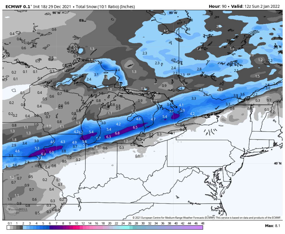
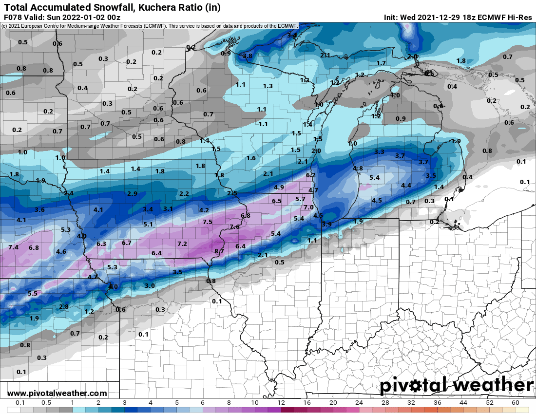
4 minutes ago, ILSNOW said:
18z Euro

Through hour 90
-
1
-
-
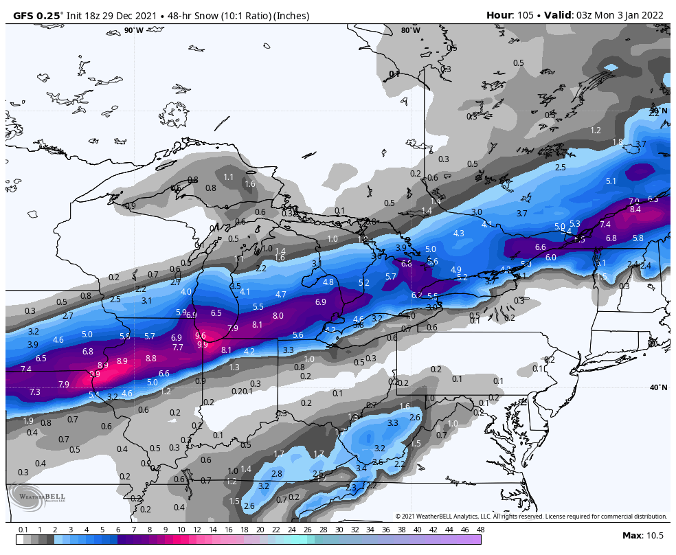
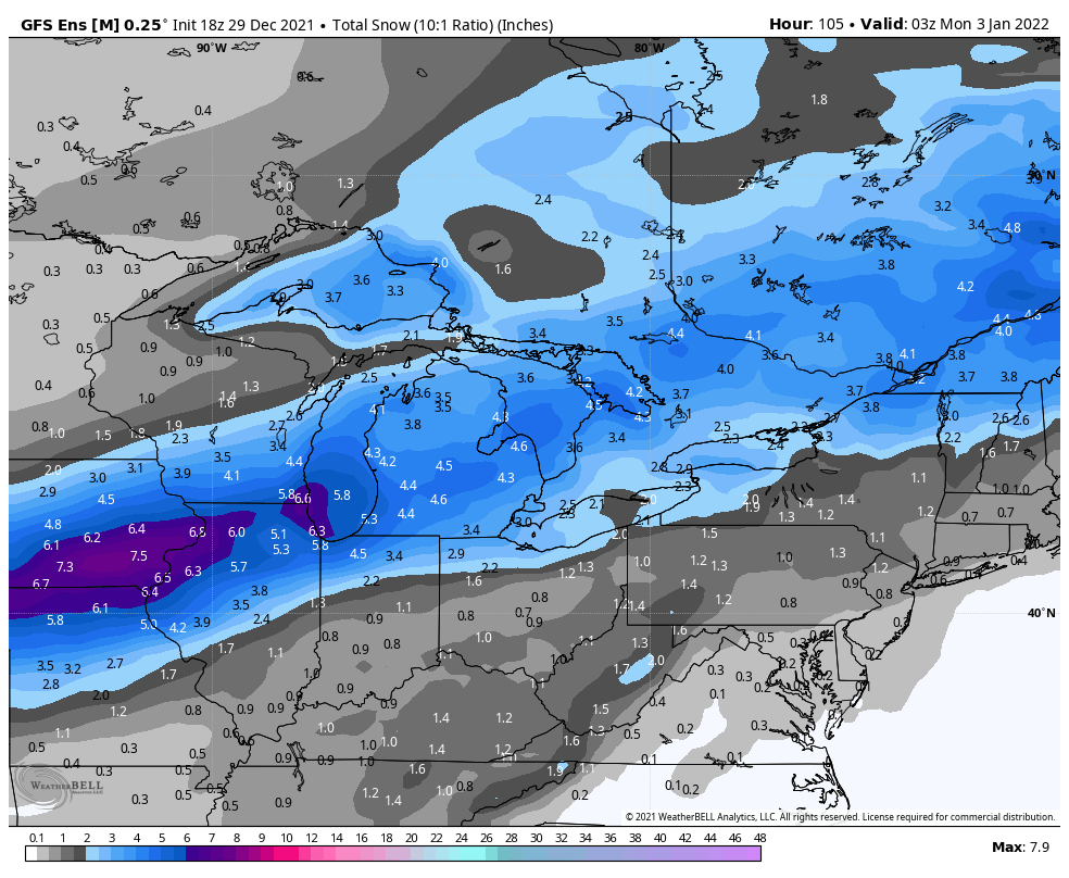
Here's a look at 18z GFS and GEFS snowfall

-
2
-
-
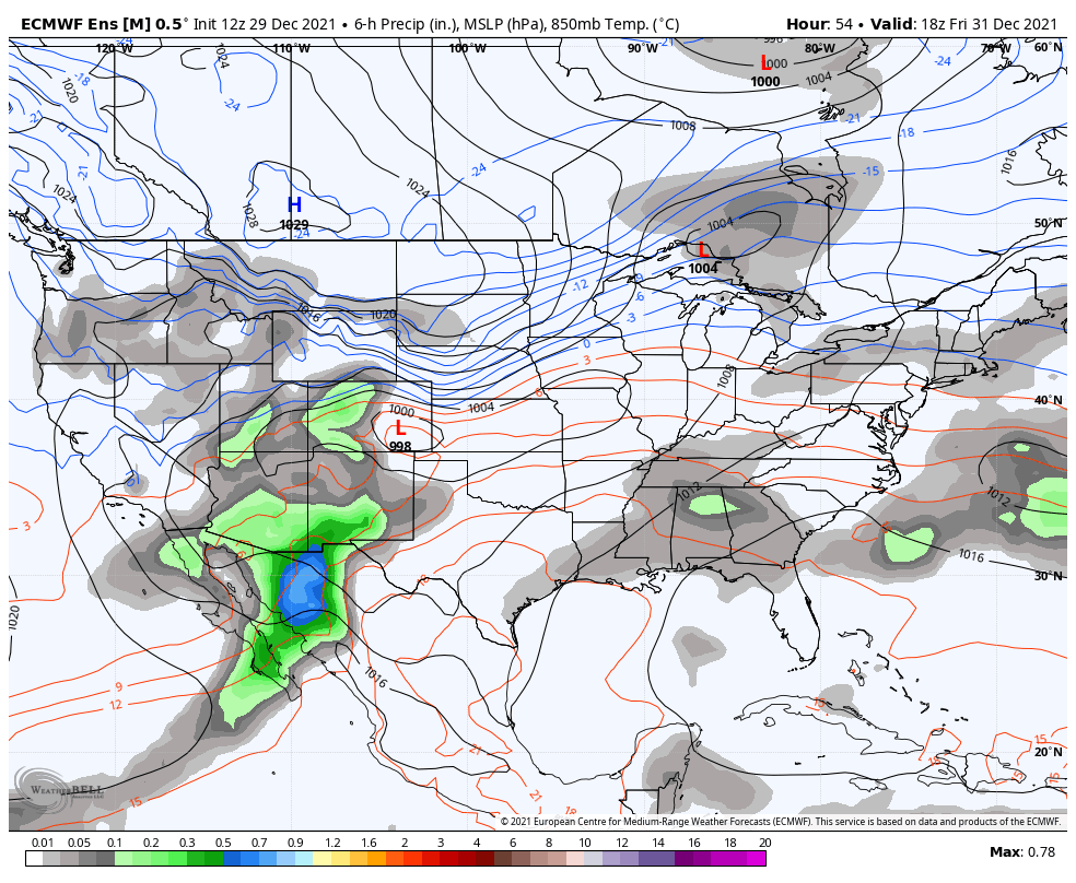
12z EPS
-
1
-
-
50 minutes ago, Snowstorms said:
Looks decent for our area too. Might start as rain but could transition over rapidly.
Agreed. If the 12z GFS/ECMWF surface low tracks are close to being correct, we see the front move through on Saturday which ushers in NNE winds at the surface --- continuing through Sunday. That is a recipe for quite a bit of frozen precip across the GTA (snow-freezing rain-ice pellet mix).
-
1
-

Feb 16-17th Winter Storm
in Lakes/Ohio Valley
Posted
Interesting. I think you're right. Looking at the YYZ daily data they have 13.4cm recorded on Feb 17th. Good chance that YYZ recorded more than 1.6cm past midnight.