

Scuddz
-
Posts
2,955 -
Joined
-
Last visited
Content Type
Profiles
Blogs
Forums
American Weather
Media Demo
Store
Gallery
Posts posted by Scuddz
-
-
I missed you too...

-
 1
1
-
-
I saw the Mapgirl ALEET on twitter and I. AM. HERE. FOR. IT.
-
 5
5
-
6
-
 2
2
-
-
"Ripping fatties" as the kids say near arundel mills 1"+ in the cars and adding up quick in this band
-
Success. Flizzard and happy kids in Hanover.
-
3
-
-
1 minute ago, WxUSAF said:
Track is west but it’s also colder. If you’re forecasting by 10:1 snow maps you’ll like the euro. 925 stays below freezing west of 95. 850 freezing gets up toward the M-D line so sleet for much of us for a time. I’d take the euro in a hot second.
Seconded. If I can end the event without the grass poking through, it's a win.
-
3
-
-
I'm fully aware I'm irrationally reasoning my way into being optimistic, but I'm questioning how this mornings runs are losing the surface so badly with NE winds in place.
-
1
-
-
10 minutes ago, nw baltimore wx said:
I’m not expecting anything today and am watering the garden after a dump run this morning, so maybe I get surprised this afternoon. Also, water here is silly cheap, but a sprinkler isn’t the same as rain water.
I just put down fertilizer that is not supposed to be rained on for 24 hours, so, expect some downpours.
-
2
-
-
Can I just say, we did not take into account this type of situation when I agreed to let my in laws move into the basement....
-
12
-
-
So, what's new around here? How many folks got banned after this winter?
-
1
-
-
I just need somebody to know the massive amount of willpower it has taken me the past few days NOT to tweet this from the big account...
-
2
-
2
-
-
1 hour ago, mappy said:
pfffft what do you know about mapping ice.
More than I ever wanted to, that's for sure
-
1
-
-
8 minutes ago, SENC said:
About that Image going around?
huh, NO a Satellite CANNOT, "SEE" and take a clear Image picture, as posted on the Storm Mode thread..
(Showing the flooded parts of the Island)..
Sorry ya'll are DUPED again..
Most satellites can't.
As the graph (below) shows, clouds reflect visible and infrared light quite well. In fact, visible light (approx. 0.4-0.7 microns in length) is more than 70% reflected by clouds! That means the light can't penetrate the cloud on the way down to earth, let alone penetrate the cloud on its way back up (satellites look down at angles ranging from 0-30 degrees) in order for the sensor to capture it.Congratulations on googling "can satellites see through clouds"
However, active sensors like sentinel and radarsat use active radar that doesn't interact with water vapor and can see through to the earth's surface at a very high resolution (1M - 100M) which is why they can used to chart polar sea ice, land use, etc.
edit: Dick
-
9
-
-
Damn, I've missed this place...
-
1
-
2
-
-
1 minute ago, C.A.P.E. said:
I might go straight for the DFH 120

I've got a couple versions of Bourbon county stout I've been hanging on to for a bit, might decrease the stock by 1 today.
-
2
-
-
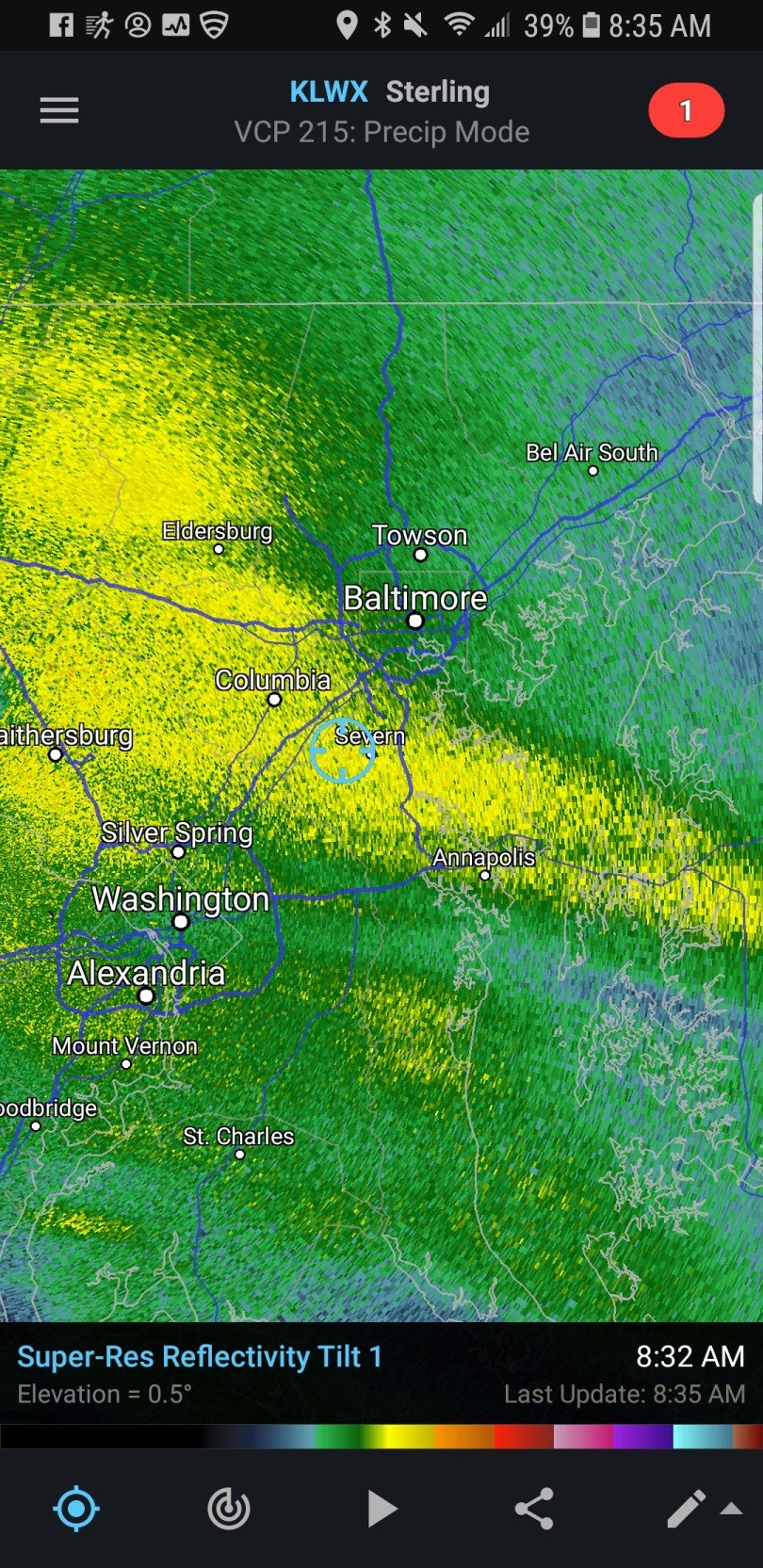
2 minutes ago, BaltimoreWxGuy said:
Anybody got a mesoscale report? Where’s the 850 line and such?
Lynchburg-ish
700's the one to worry about, looks to be north of Charlottesville.
-
Windows have matched the paint for about 20 min now. vis <<1/4 mile and just ripping. Last of the grass shoots have disappeared.
-
1
-
-
Daddy likey

-
5
-
1
-
-
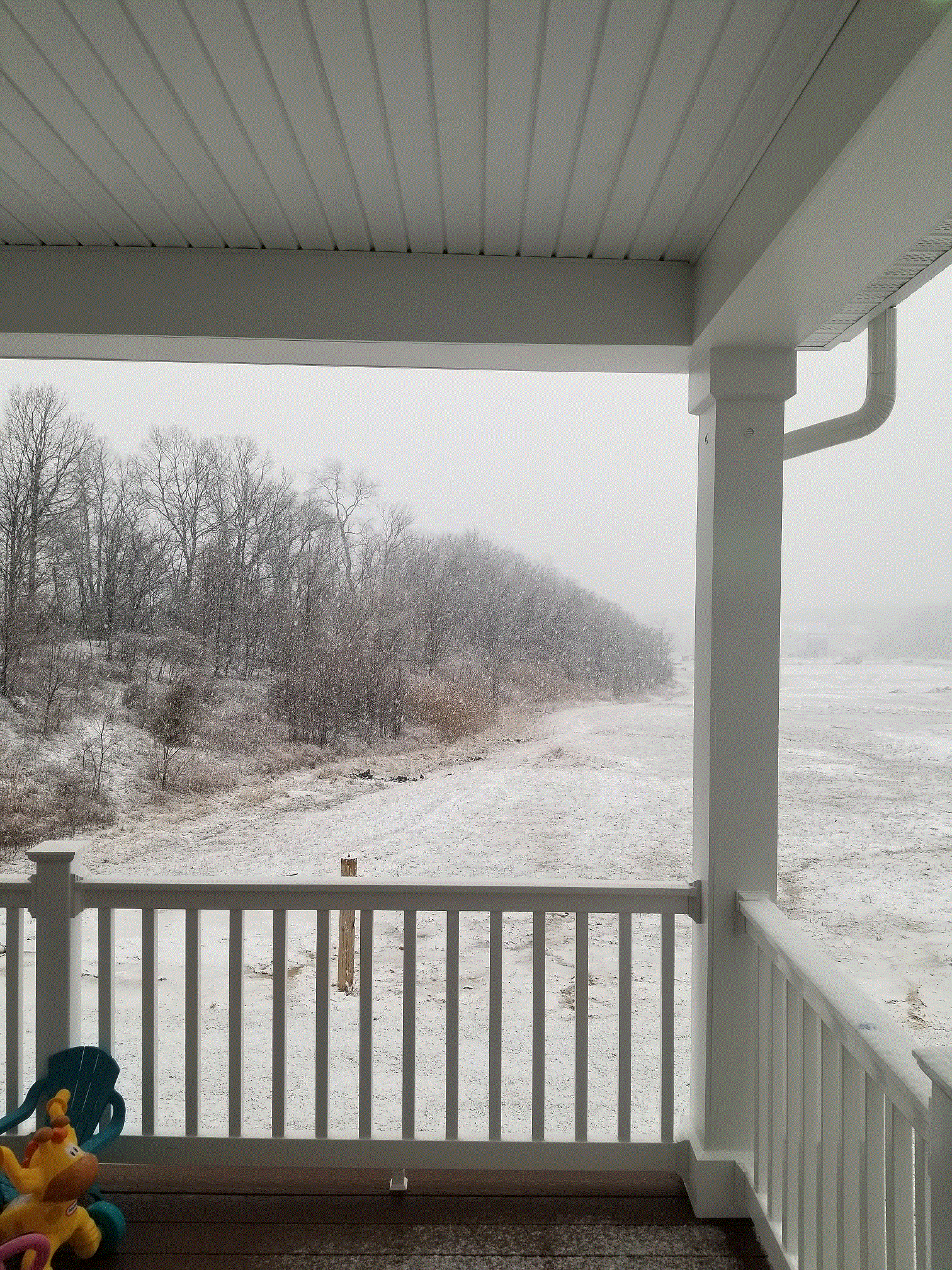
There's normally a row of townhomes back there, <1/4 mile away.
-
3
-
-
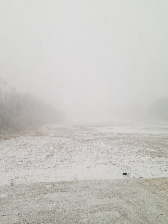
Flakes started about 645 here. Quickly dropped to less than 3/4 mi vis and have a nice coating on the grass already. Little lighter now but still coming down pretty good. - Hanover, MD
-
1
-
-
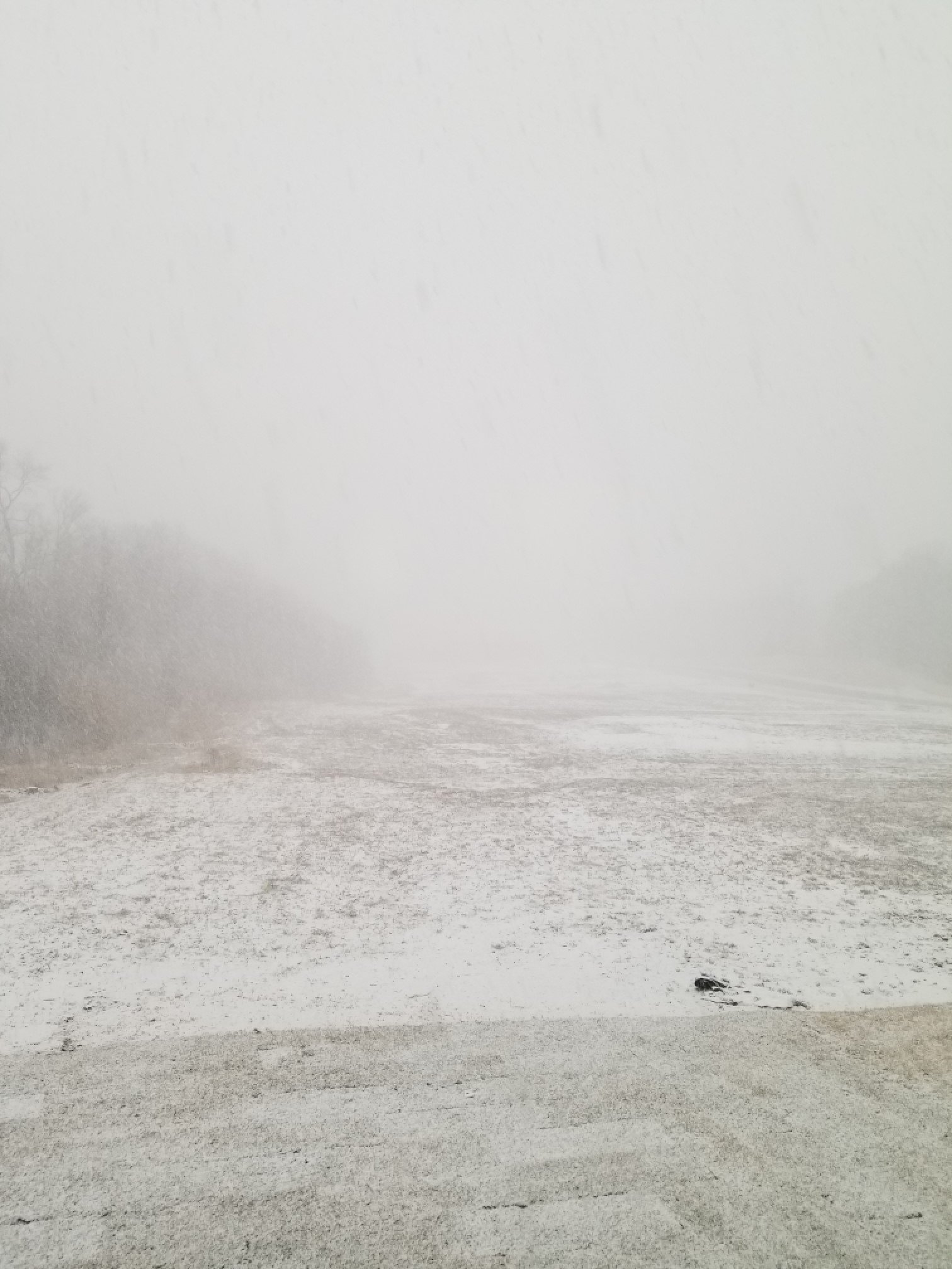
Back home in Hanover and we're at MDT + roads just starting to cave and a solid coating on the ground. Interstates looked like parking lots from the over/underpasses.

-
1
-
-
Just now, WxUSAF said:
Yyyyeeesassss talk dirty to me
Don't get excited. It's not sticking yet, just white rain
-
Pouring snow in Columbia now, dropped from 38 to 35
-
2
-
-
Radar says it's snowing, window says no. Saw some small flakes earlier in Ellicott city taking kiddo #1 to the dentist
-
3 minutes ago, SandySurvivor said:
Parts of South Jersey are barren pine forests and look how costly Sandy was. The fact that this section of Florida is swampland means nothing.
I still don't think the surge is going to be as bad as Sandy but the size of this storm and rainfall will make up for that
What a great point, I had not considered that. Carry on, you're clearly adding a tremendous amount to the discussion here.
January Banter 2021
in Mid Atlantic
Posted
My neighborhood facebook group is a nightmare right now with this storm. I've been here two years and not announced myself as a meteorologist to anyone I don't hang out with regularly. I might have to this time.