

tacoman25
-
Posts
4,958 -
Joined
-
Last visited
About tacoman25

-
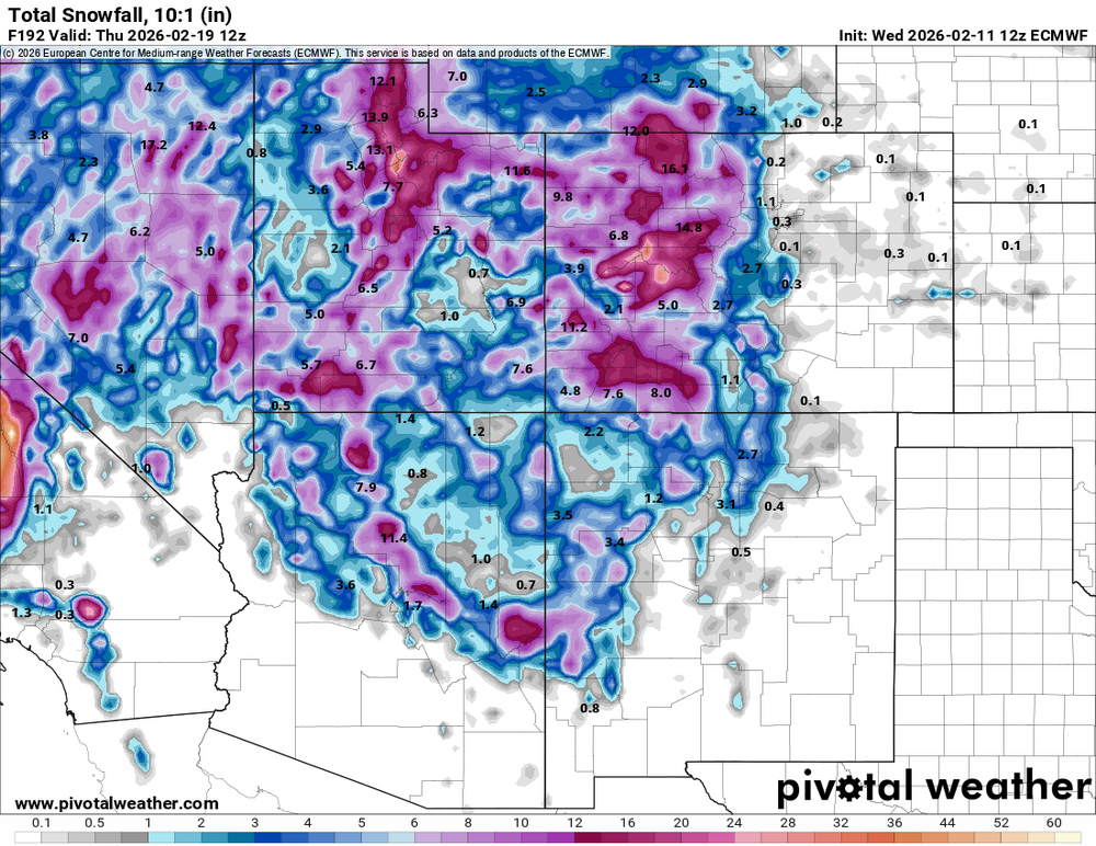
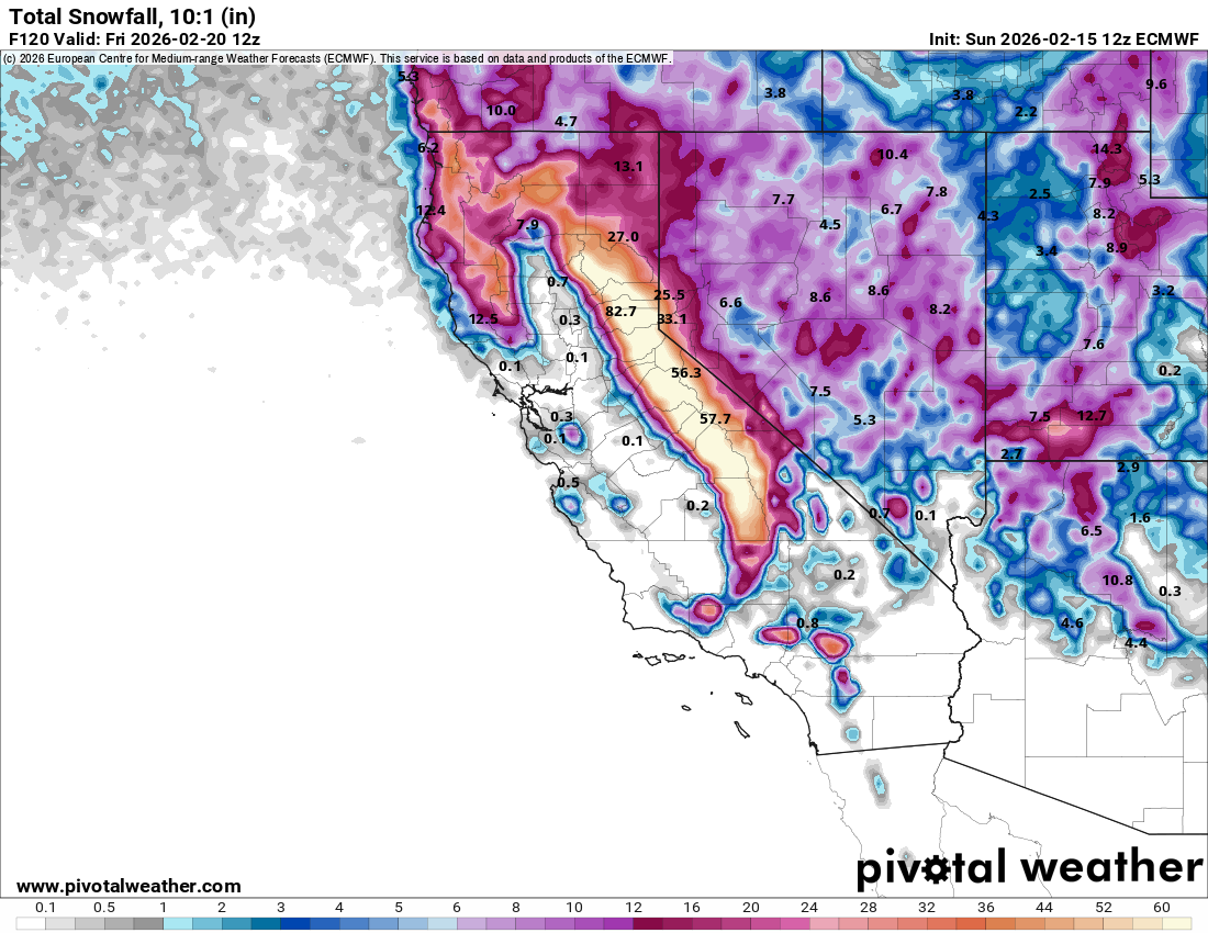
The Sierras are about to get pounded.

-
Yeah, the mountains could desperately use the pattern change.
-
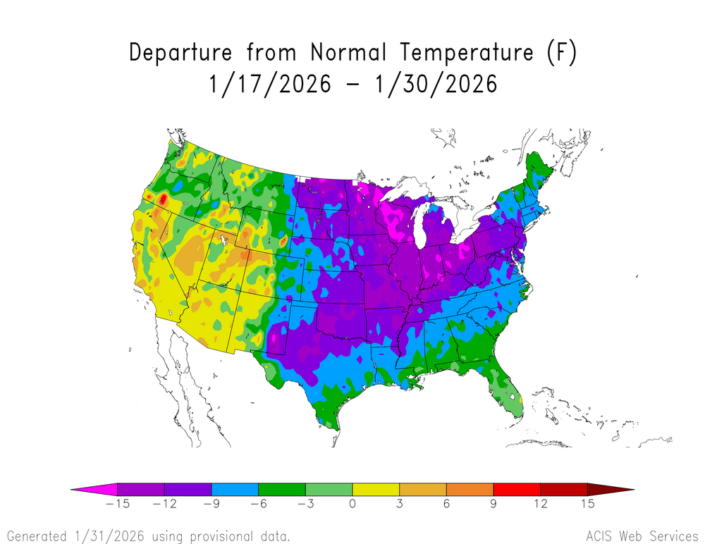
Last couple weeks was actually below normal here, first time this fall/winter we've had such a period. Obviously not nearly as cold as they were in the Midwest and East. But the overall winter pattern has been very similar to 1980-81, also weak -ENSO and dominated by ridging west/cold east.
-
Picked up 1.5" in a couple hours here. Pretty dramatic temp drop too as the front came through around 2:30. Went from 26 to 13 in about an hour. Still snowing decently even though radar doesn't show much.
-
Phoenix's expanded UHI is clearly skewing their numbers towards more record warm months. Flagstaff is currently not close to their warmest Jan on record, which was 2003.
-
Yeah, bummer we don't have anything big to track here, but I'm just grateful we've finally turned the corner on the nearly unabated torch that the first half of winter brought. The next week has really trended colder from how it looked a few days ago. Now hopefully we'll get a little more snow to go with it.
-
Got a little over an inch here. At 13" for the season. I believe 2010-11 was similarly sad for snowfall at this point. Have to admit, it was the East's turn.
-
Looks like we get a little snow tonight.

-
Mmmk. Live by the sword, die by the sword. If you want to count on AGW driving monthly anomalies, you also have to account for when a Feb 2021 happens. FWIW, I think a top 5 warmest January in the U.S. is highly unlikely. Just looking at the blocking in AK.
-
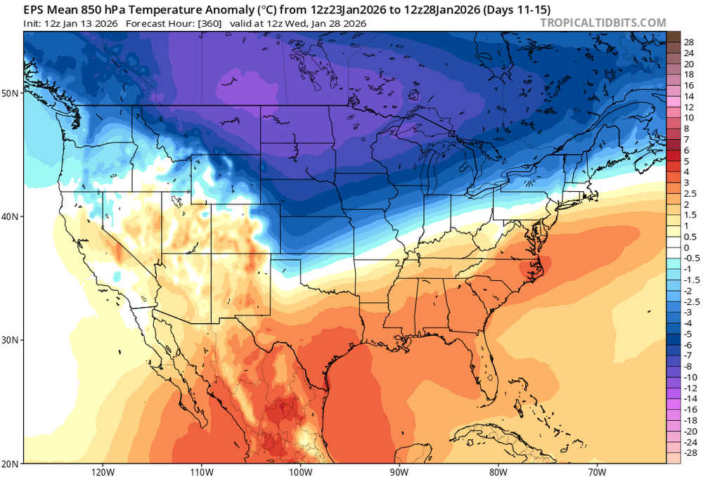
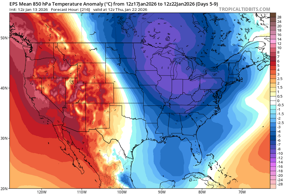
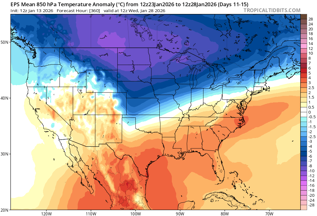
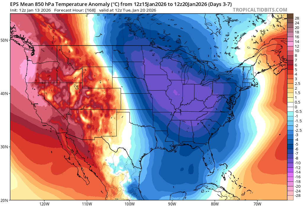
Very warm pattern to start the month, but that's about to change. AK and the Yukon are finally warming up, and that means colder air finally allowed to spill down into the lower 48 again. Map will look much different in 10 days.

-
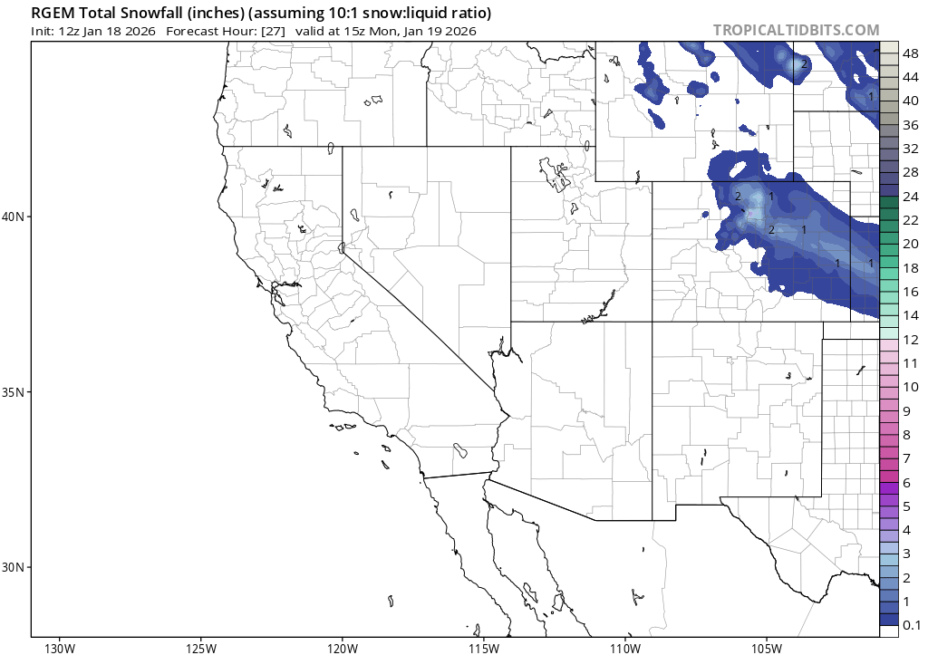
That's fair, but your first statement was about this last event busting. Which wasn't the case, at least for most of the Denver area. It was never forecast to be a big storm.
-
I mean...most of Denver metro was expected to get 1-4" and that happened? With a few places in SW metro getting more.
-
That makes things easier, huh? But was he wrong?
-
Lol, ended up with almost 4" here. On the high end of what most models showed 24 hours out.
.thumb.jpg.9f61f57319b24a3710f48d24de42e97f.jpg)
-
Yeah, this one's looking like a bust. Got a couple brief snow showers this am that amounted to about 1/4", and now it's looking like the second part of the system that was supposed to deliver the heavier stuff overnight is drifting more to the south.


.jpg.708309db398b7ff720c3b2a88b31a90e.jpg)