

aldie 22
-
Posts
16,889 -
Joined
-
Last visited
Content Type
Profiles
Blogs
Forums
American Weather
Media Demo
Store
Gallery
Posts posted by aldie 22
-
-
Perfection until all of the people showed up lol

-
 7
7
-
 1
1
-
-
Spectacular day in ocean city today
-
3
-
-
Cracked 2" total for the event with this morning's rain
-
2
-
-
Heading to the beach for the weekend looks like a shitty travel day but possibly a spectacular rest of the week??
-
2
-
-
Up to 1.82"
-
1
-
-
34 minutes ago, H2O said:
Hour 2 with no power. And there was no wind or anything that should have caused it
We lost power for about 20 minutes. 1.50 and raining currently
-
1.35" was pretty much just straight down rain. Several lightening strikes and thunder
-
1
-
-
every simulated radar fires up storms just east of here. Hope they are all wrong lol
-
On 6/29/2025 at 10:52 AM, Eskimo Joe said:
Yes! I'm the EMS guy today. Bonus is that my horses didn't roll!!
My wife had horses there for years when she lived in Finksburg and Sykesville.
-
1
-
-
10 hours ago, Eskimo Joe said:
My wife decided to ignore my meteorological advice and put our Clydesdale horse out for the night at the barn in Finksburg. We spent close to 2 hours cleaning him up for a competition tomorrow. I hope it doesn't rain. I don't want to rush a wash tomorrow.
Full Moon?
-
I can hear some thunder in the distance
-
decent little rain shower 0.47 from yesterday and today with 5.24 so far for the month of June
-
1
-
-
0.42 happy I didn’t get skunked
-
1
-
-
It's an alien storm 0.25 so far
-
3
-
-
That storm to my southeast must be dumping in the same spot
-
Anecdotally it always feels like the last day of a heat wave surprises with sneaky high temps. Bet we do 100 today
-
 2
2
-
-
I was outside way too much today. I soaked through two sets of clothes and pretty sure I lost 10lbs of water weight. Gross day but hey...productive.
-
1
-
-
Initial wind was serious but now just dumping rain
-
2 minutes ago, yoda said:
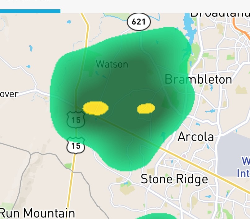
vere Weather Statement
National Weather Service Baltimore MD/Washington DC
322 PM EDT Thu Jun 19 2025

VAC047-059-061-107-153-179-683-685-192000-
/O.CON.KLWX.SV.W.0157.000000T0000Z-250619T2000Z/
Loudoun VA-Stafford VA-Fairfax VA-Fauquier VA-Culpeper VA-
City of Manassas Park VA-Prince William VA-City of Manassas VA-
322 PM EDT Thu Jun 19 2025

...A SEVERE THUNDERSTORM WARNING REMAINS IN EFFECT UNTIL 400 PM EDT
FOR SOUTHEASTERN LOUDOUN...NORTHWESTERN STAFFORD...WESTERN FAIRFAX...
EASTERN FAUQUIER...CENTRAL CULPEPER...AND PRINCE WILLIAM COUNTIES...
THE CITY OF MANASSAS PARK AND THE CITY OF MANASSAS...

At 321 PM EDT, a severe thunderstorm was located near Bealeton, or 8
miles southwest of Warrenton, moving east at 45 mph.

HAZARD...70 mph wind gusts.

SOURCE...Emergency management reports a history of downed trees with
         this line of storms.

IMPACT...Damaging winds will cause some trees and large branches to
         fall. This could injure those outdoors, as well as damage
         homes and vehicles. Roadways may become blocked by downed
         trees. Localized power outages are possible. Unsecured
         light objects may become projectiles.

Locations impacted include...
Centreville, Dale City, South Riding, Broadlands, Brambleton,
Warrenton, Dulles International Airport, Ashburn, Linton Hall,
Sterling, Chantilly, Montclair, Bull Run, Triangle, Dumfries,
Bealeton, Haymarket, Arcola, The Plains, and Manassas.

PRECAUTIONARY/PREPAREDNESS ACTIONS...

For your protection move to an interior room on the lowest floor of a
building.

Torrential rainfall is occurring with this storm, and may lead to
flash flooding. Do not drive your vehicle through flooded roadways.

&&

LAT...LON 3840 7801 3859 7782 3889 7786 3903 7743
      3853 7731
TIME...MOT...LOC 1921Z 259DEG 40KT 3862 7789

THUNDERSTORM DAMAGE THREAT...CONSIDERABLE
HAIL THREAT...RADAR INDICATED
MAX HAIL SIZE...<.75 IN
WIND THREAT...OBSERVED
MAX WIND GUST...70 MPH
Headed my way
-
Radar definitely looks gnarly...I was able to mow this morning so i'm ready for some more rain
")
-
2
-
-
Man it....is....gross....out
-
2 hours ago, WxUSAF said:
Looks like around 0.9” from the afternoon storms on top of 0.4-0.5” overnight.
You ok now lol
-
1 hour ago, WxUSAF said:
Storm around 3am woke me up and dropped 0.4-0.5”
You guys get all the rain
-
2
-
-
The volcano eruption will save us

July Discobs 2025
in Mid Atlantic
Posted
Sweatshirt weather in July