

KAOS
-
Posts
813 -
Joined
-
Last visited
Content Type
Profiles
Blogs
Forums
American Weather
Media Demo
Store
Gallery
Posts posted by KAOS
-
-
It appears as if we are experiencing yet another rare wind event.
-
 1
1
-
-
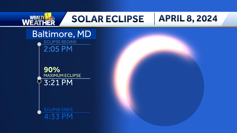
Happy eclipse... don't burn your eyes
-
-
I know it may be hard to believe.... but it is windy.
-
The rain needs to stop. Enough already. But this is typical... rain when we don't need it. No worries this summer is sure to be a drought-fest (when we really will need the rain). I want to move so bad.
-
Everything. No.
-
Thunder in February... totally normal.
-
 1
1
-
-
I hear thunder in Pasadena.
-
Grass has caved. sidewalks etc... soon.
-
Somehow this reminds me of the claw storm....
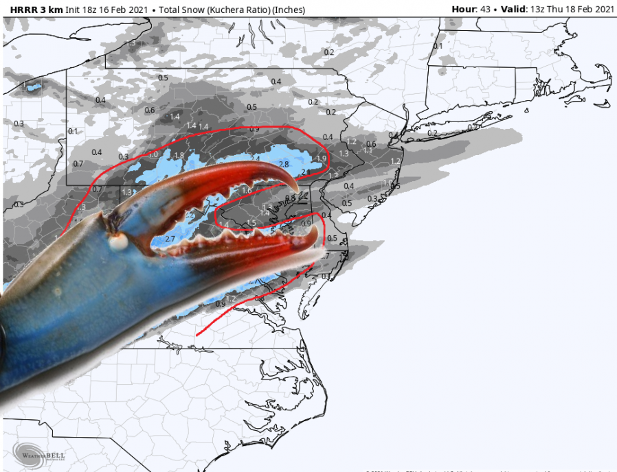
Kinda, sorta, maybe not? I just wanted to post a claw. I apologize in advance.
-
1
-
 1
1
-
3
-
-
-
Why is there a pine tree growing out of DC?
-
1
-
1
-
-
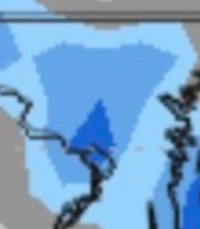
I have blue snow.
-
It is rockin!!! Heaviest snow of the day.
-
2
-
-
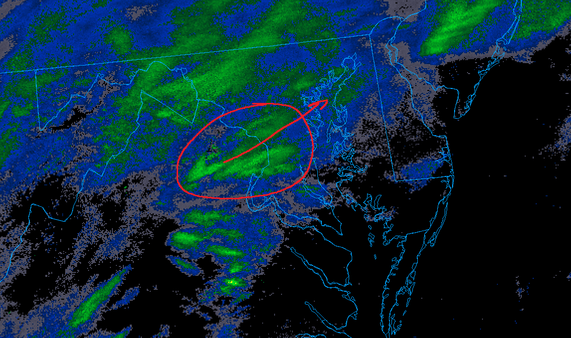
Looks like band incoming (mby)
-
-
Flakes are getting chunky. I like chunky flakes from time to time.

-
Just now, ravensrule said:
Did you know JFK got shot?.
I was shoveling snow... I missed it. Give me a break.

-
1
-
-
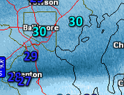
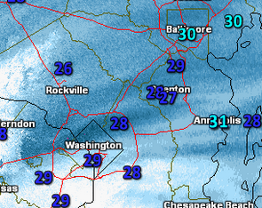
Probably missed that earlier. Surprised to see 4-6". TBH.
-
1
-
-
URGENT - WINTER WEATHER MESSAGE
National Weather Service Baltimore MD/Washington DC
1028 PM EST Mon Jan 15 2024

DCZ001-MDZ013-014-503>506-VAZ040-053-054-501-505>507-526-161130-
/O.UPG.KLWX.WW.Y.0007.000000T0000Z-240116T1200Z/
/O.EXA.KLWX.WS.W.0004.000000T0000Z-240116T1500Z/
District of Columbia-Prince Georges-Anne Arundel-
Northwest Montgomery-Central and Southeast Montgomery-
Northwest Howard-Central and Southeast Howard-Rappahannock-
Fairfax-Arlington/Falls Church/Alexandria-Northern Fauquier-
Western Loudoun-Eastern Loudoun-Northern Virginia Blue Ridge-
Northwest Prince William-
1028 PM EST Mon Jan 15 2024

...WINTER STORM WARNING IN EFFECT UNTIL 10 AM EST TUESDAY...

* WHAT...Heavy snow, possibly changing to light freezing rain or
  freezing drizzle along the Interstate 95 corridor toward
  morning. Total snow accumulation of 4 to 6 inches and ice
  accumulations of a light glaze.

* WHERE...Portions of central Maryland, The District of Columbia
  and northern Virginia.

* WHEN...Until 10 AM EST Tuesday.

* IMPACTS...Plan on slippery road conditions. The hazardous
  conditions could impact the Tuesday morning commute.

* ADDITIONAL DETAILS...Moderate to heavy snow this evening and
  overnight may produce snow of one half to one inch per hour and
  reduce visibility to one half mile or less at times. Snow
  intensity will taper off toward morning.

PRECAUTIONARY/PREPAREDNESS ACTIONS...

If you must travel, keep an extra flashlight, food, and water in
your vehicle in case of an emergency.

When venturing outside, watch your first few steps taken on
steps, sidewalks, and driveways, which could be icy and slippery,
increasing your risk of a fall and injury.
-
3 minutes ago, caviman2201 said:
nice little band establishing itself along and SE of the fall line moving NE as well... looks like everyone might cash in for the next hr or so...

Bring it home. I would say we had a little over 4 inches in Pasadena (21122). After compaction and sun angle...closer to 3 inches, more or less.
-
17 minutes ago, AdamHLG said:
1996 was my first winter online when I found the first internet relay chat and the Blizzard of 96 was my first online storm. It was different back then. IRC was a scrolling live feed like a ticker tape. If you walked away for 30 min you had to scroll all the way back.
About 30 min before the first flake I remember someone posted “2.8 inches of QPF!!!!! I see it but I can’t believe it”. And then it happened. And I was hooked.IRC... had a server back in the day.
-
1
-
-
Kinda miss the Eastern days,
-
4
-
-
3 minutes ago, Jebman said:
I have heard of something called ne.weather way back before WWBB. I was not on that group or whatever it was.
I remember it clearly.

May Discobs 2024
in Mid Atlantic
Posted