
Vol Man
-
Posts
234 -
Joined
-
Last visited
Content Type
Profiles
Blogs
Forums
American Weather
Media Demo
Store
Gallery
Posts posted by Vol Man
-
-
Definitely the hardest snow of the day...right at 4" east of Kingsport. Lots of melting today with the temps, as Carver described. Thanks to everyone for the great analysis and reports, especially the folks in north Knoxville area. My son now lives just off Tazewell Pike, so those reports were very helpful!
-
 4
4
-
-
Nice writeup by MRX
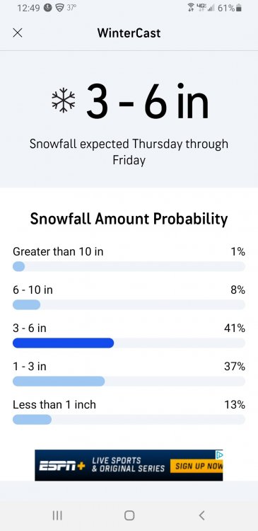
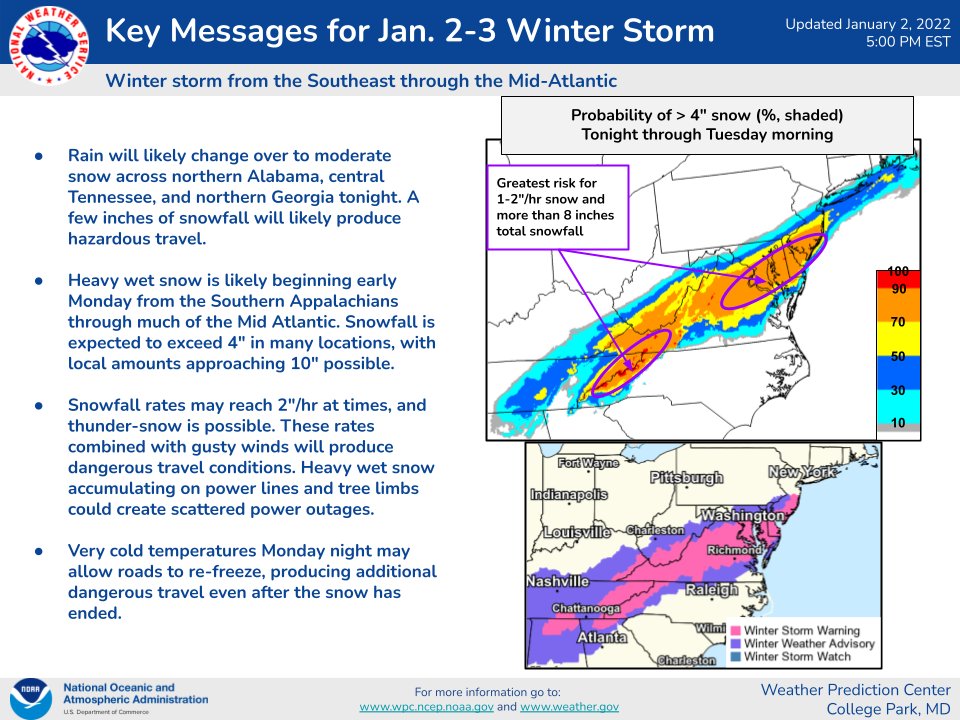
.LONG TERM... (Sunday night through next Saturday) Issued at 330 PM EST Sat Jan 13 2024 Key Messages: 1. Probability for an accumulating snow Monday into Tuesday is increasing. See Winter Storm Watch for additional details. Uncertainty regarding high temperatures especially in the southeastern part of Tennessee.
2. Very cold temperatures in the wake of the potential snow. Single digit temperatures and near or subzero wind chill possible Wednesday morning.
3. Additional wintry system possible Thursday night into Friday, details highly uncertain.
Discussion: Still on track for a significant winter storm for Eastern Tennessee and southwest Virginia. A 140 knot jet aloft will develop ahead of the upper trough dipping out of Canada. Closer to the surface low level convergence and strengthening isentropic lift will provide for a corridor of snow to develop. Expect snowfall to develop over eastern Tennessee Monday morning, with exact timing still a little unknown. Despite continued waffling in deterministic runs on exact track of the snow Monday into Tuesday, ensemble probabilities are increasing for not only accumulating snowfall, but several inches of snowfall. NBM probabilities and some guidance suggest localized higher amounts of snow, but there are some caveats. Biggest concern outside of exact track of the heaviest snow is temperatures on Monday. Guidance has a bifurcated solution set, with a multitude of members showing near or subfreezing temperatures as daytime highs, but some members, including the NAM, show temperatures getting above freezing on Monday in the southeastern portions of Tennessee. That could spell spoiler, at least in the southernmost counties and lower elevations of the foothills where those warmer temperatures reside. The northern portions of Tennessee and Virginia are likely to remain below freezing, allowing for quick accumulations. Beyond the snow, we`re in for a spell of absolutely frigid temperatures. Euro and GFS ensembles are keying on high probabilities of single digit temperatures Wednesday morning, with the best chances for temperatures 20 to 30 degrees below normal values in line with where the ensembles have snow accumulations. It is quite possible for many locations that once we slip below freezing Sunday evening, we will not get back above freezing until Thursday afternoon. After that we have another shortwave trough accompanied by a much larger upper trough digging into the Ohio River valley Thursday night into Friday that will bring with it another chance of wintry weather. Once the whole upper trough swings through, that will potentially bring another shot of significant cold to the region. Ensembles have very low probabilities of valley snow, but near 50% chance for an accumulating snow in the mountains, which is pretty good signal for the high elevations at the day 6 range. &&
-
3
-
-
Sweet ride, Powell!
-
1
-
-
First snowflakes of the year! And strong winds too....at least we got some flakes before Christmas!
-
3
-
-
3 hours ago, Carvers Gap said:
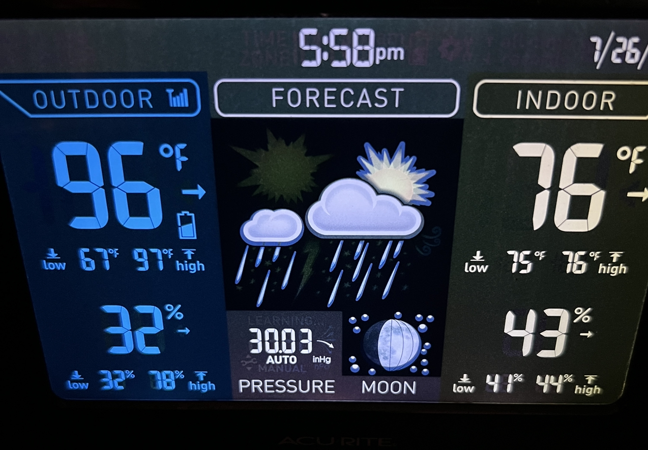
I think Kingsport might be one of the hottest place in E TN today. We have to be catching some downslope somewhere. Temps in town are ranging from 90-95F on wxunderground. Real feel right now at my place is 97F. Easily the hottest day of the summer here w/ worse to come later this week.
On a positive note, we got a popcorn storm that parked right over western Sullivan/eastern Hawkins yesterday. Amounts ranged from 0.75-1.30" of much needed rainfall. We prob got about an inch of rain IMBY. Two blocks away - zip. That kind of rain storm. I was no fan of the marble size hail. Holston will know this....not sure it even rained at the bridge into our hood.
I agree Carver...hottest day so far in Kingsport I believe. Been sitting on 96 here for the last hour or two.

-
2
-
 1
1
-
-
3 hours ago, Carvers Gap said:
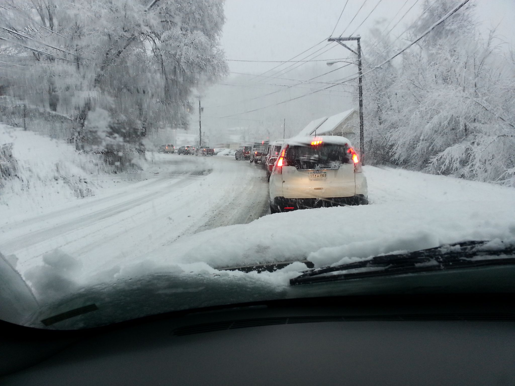
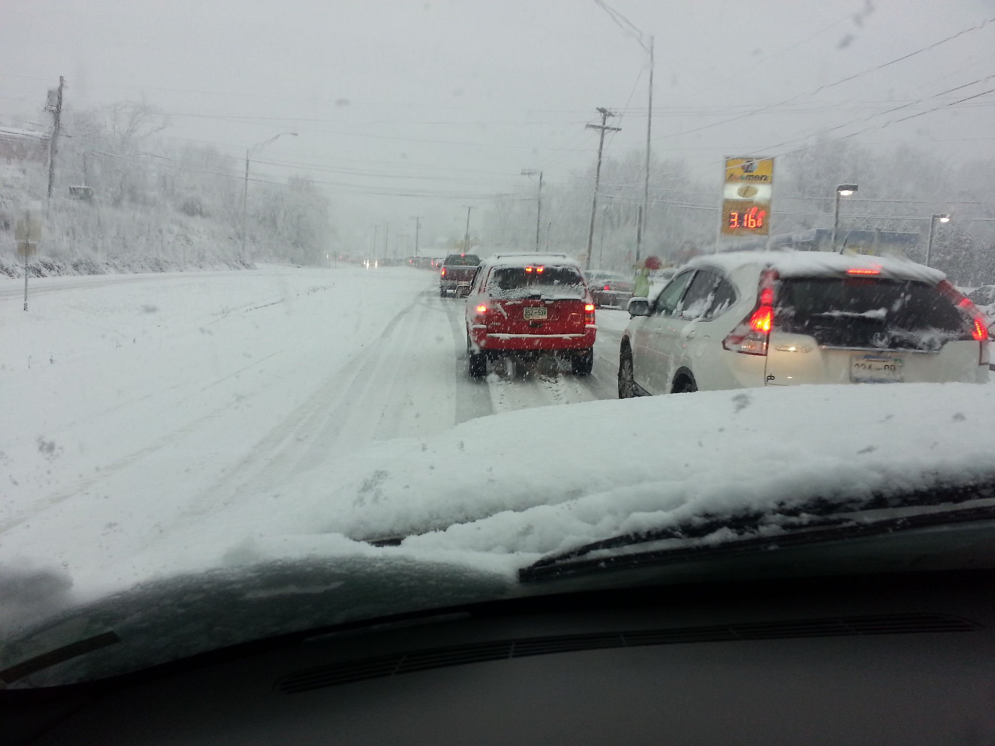
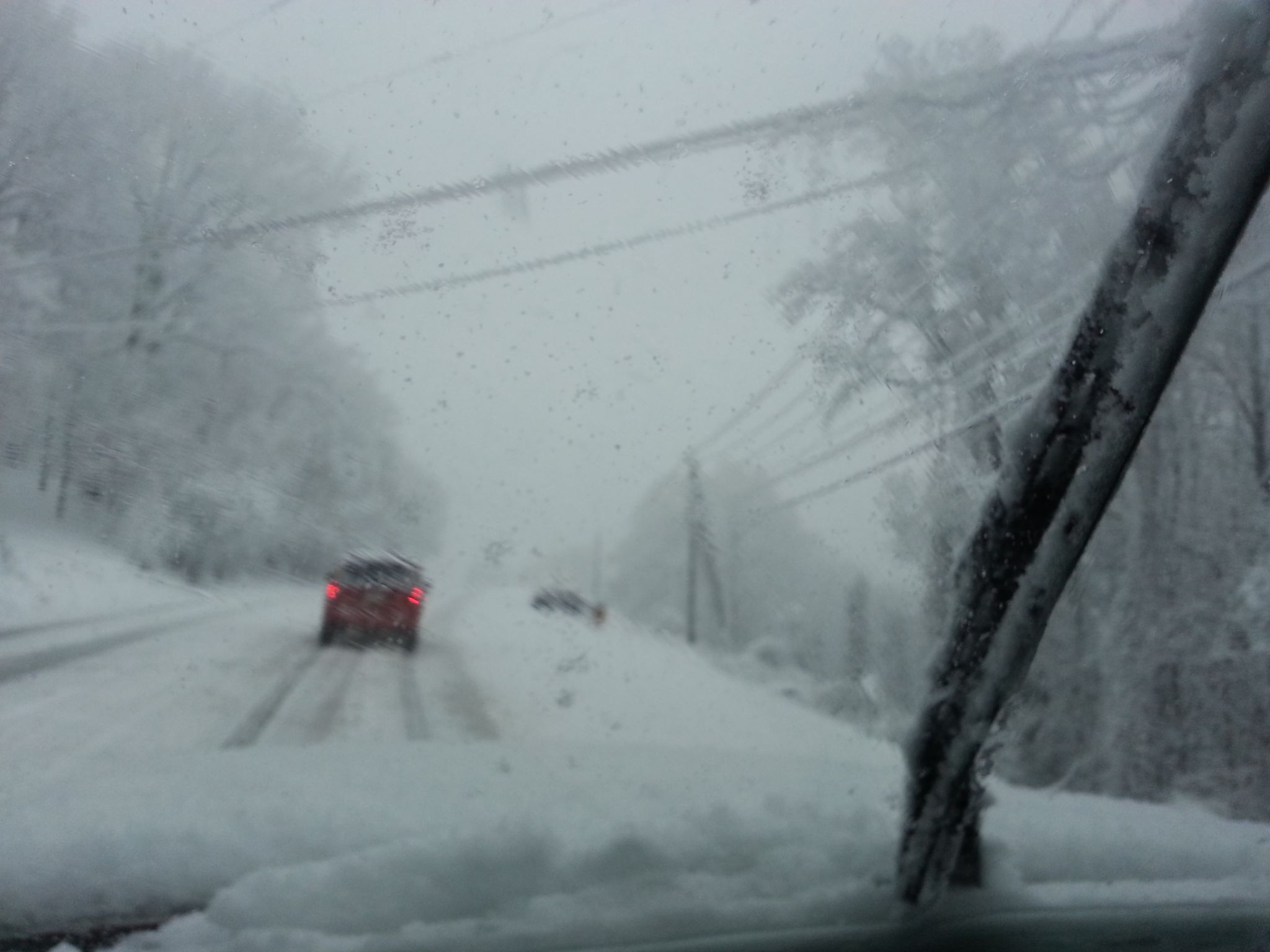
LOL. So my youngest daughter was born in Jan of 2013. We took her home from the hospital and just about couldn't get into the neighborhood as rain changed to snow. It was about a seven mile drive. We left the hospital while it as raining and spitting snow. As we got her to the door, the sky flashed and it began to thunder as the snow just poured down. I had left sub plans left at school, but didn't put the early dismissal procedures in the folder as I did not expect this! I quickly called school to make sure the sub had some guidance. Busses were stuck on Skyland Drive here in town. It was a glorious mess.
Hey Carver, My normal 10 minute trip home to Indian Springs that afternoon took almost 4 hours. I had stopped off at Food City on Eastman Road as the rain had just changed over...big mistake. These pictures are going up Chestnut Ridge about 2 miles from FC. By the way, I grew up on Skyland...back in the day, there were times where that little extra elevation really helped.

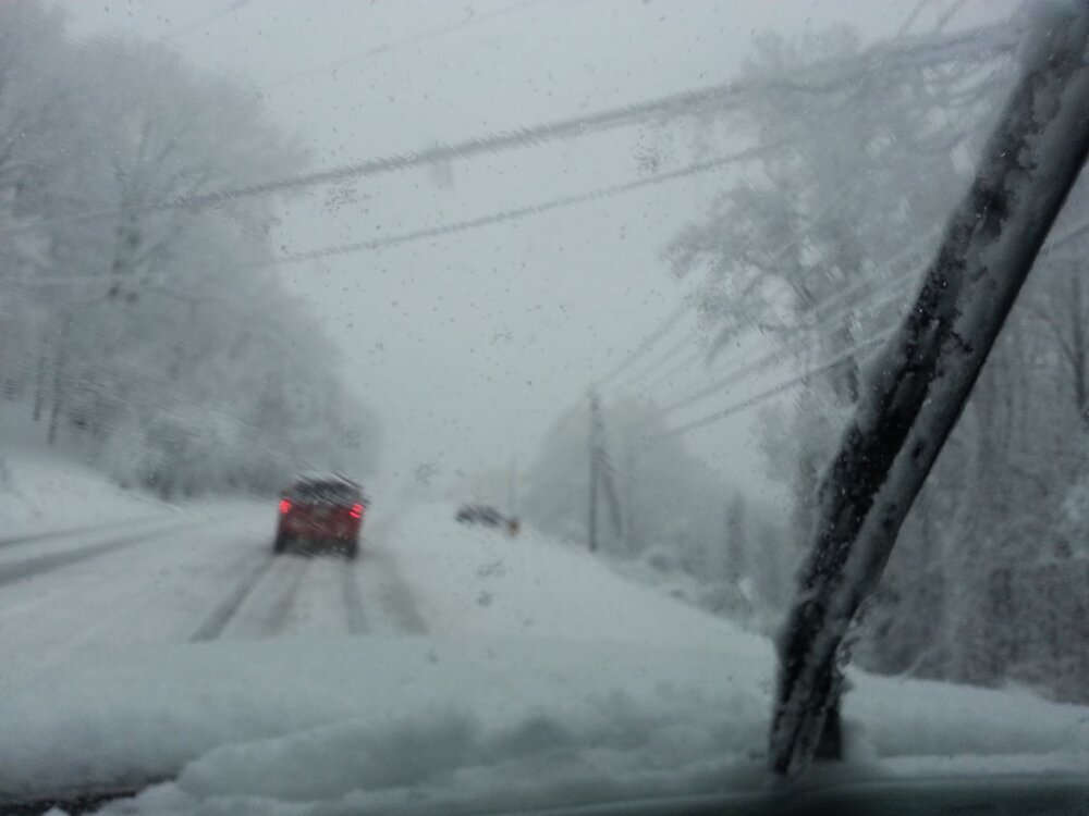
-
7
-
 1
1
-
-
Merry Christmas to all of our Tennessee Valley weather family!!!!


-
7
-
-
12 minutes ago, PowellVolz said:
@Carvers Gap I started a thread on VQ asking for real times obs. That should help us keep up with the R/S line as it moves across the state.
.Thanks, Powell...probably my 2 most accessed websites, especially during the winter and extra especially during a winter event!
-
1
-
-
I'm afraid the Wears Valley situation is getting worse by the minute. I just saw a reference that has decreased the expected rain amount tonight.
-
1
-
-
31 minutes ago, PowellVolz said:
I’m 47 but I remember multiple times in elementary and middle school getting stuck at school at or around Valentines Day. I can’t remember exactly what year but I remember on Valentine’s Day in middle school we got stuck at school from a surprise snow that was supposed to be mostly rain. It was an I-40 special because we ended up with several inches but Knoxville got nothing but rain.
.I believe it was Valentine's Day in 1987 that Kingsport got about a 7-8 inch snow. Started late afternoon, if I remember correctly. We live in Colonial Heights at the time, and had quite a time getting home from work in a Honda Prelude.
-
2
-
-
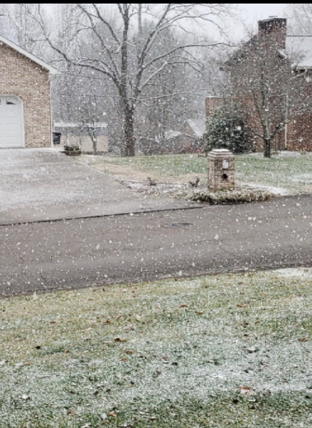
A little light snow in East Kingsport...temp down to 39 from 44 not too long ago
-
3
-
-
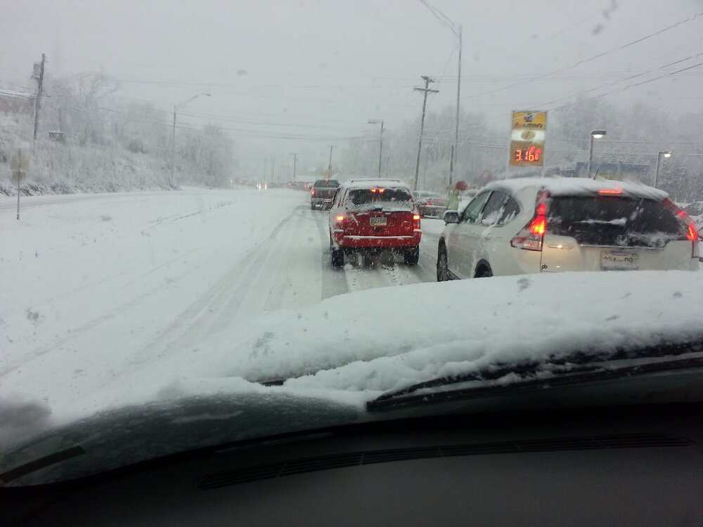
52 minutes ago, Carvers Gap said:
How big is the area for the regional average? TRI has already been in the teens 4x this month w/ an average low of 27 to date, and that includes two really warm days to start(out of 12 days)....I would think(no guarantees) that the timeframe after the 20th potentially could yield some pretty low numbers here. We have already hit 15 and 16 with just light snow cover.
Edit: To define "pretty low," maybe low teens or slightly lower. That looks like a really cold air mass. If any storm to our east deepens, TRI can get pretty cold with those. Potential is there for lower with a big system. In 17-18, our rivers froze with no snowfall on the ground.
Carver, did you see the FB post from WxSouth...Robert had some pretty ominous thoughts for energy for this weekend. I also saw JB post a very scary looking temp map for 24th...similar to what you referenced earlier.. I sort of expected to get a little warmer here leading up to this weekend's potential event...felt like it has stayed a little colder. Not sure how that relates, if at all, but starting from a lower base temp lately has to help some. Looking forward to tracking this thing.
-
Looks like we have squeezed out about 1.5" in East Kingsport...still snowing a little...had decent shower for about an hour or so. Sort of surprised after things developed as the afternoon ended.
-
8
-
-
10 minutes ago, John1122 said:

Looks beautiful, John!
-
2
-
-
Sorry if already posted...just ran across this and didn't see it in this thread
-
4
-
-
51 minutes ago, Carvers Gap said:
We really need a "wow" button.
I love the old style graphics! I just found that website...definitely adding to my list!
-
2
-
-
40 minutes ago, PowellVolz said:
That’s just a couple of items I have. I’ve got a good sized closet packed full of boxes with Tennessee “stuff” in it.
.Yep...I've built up quite a collection over the years, too...hard to let go of that stuff. I've got quite a collection of VHS tapes from the 80s and 90s, a lot with John Ward dubbed in...great memories.
BTW, I like your posts on VQ too....you do a great job!
-
1
-
-
Wow....what a great collection!
-
1
-
-
About 1.3" with decent snow right now in Kingsport.
-
1
-
-
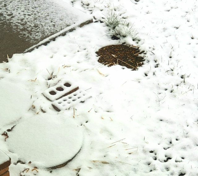
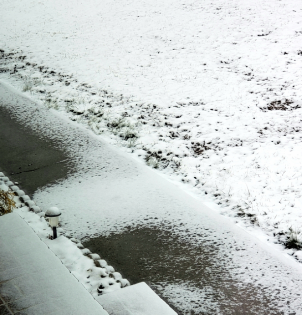
Check out these pictures...looks to show how really small temperature difference can affect accumulation from our light snow showers overnight. Two pictures: The sidewalk shows a section across the width of the sidewalk where the flurries stuck...that is where our water line comes into the house. We had to replace our line a few years ago, so there was some disturbed ground under the sidewalk at that location. The other picture shows a stepping stone in the ground, and next to it a couple of stepping stones and bricks that are top of the ground that we had Christmas decorations sitting on. Anyway, I thought it was interesting and wanted to share...does this seem logical?
-
5
-
-
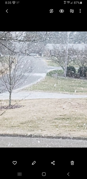
Just started in East Kingsport...some nice size flakes
-
6
-
-
1 hour ago, Daniel Boone said:
Margie!!! She was fun to watch. Those were the days buddy !
Wow...that brings back some memories..."Margie said it would"...
-
2
-
-
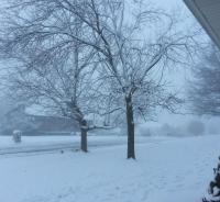
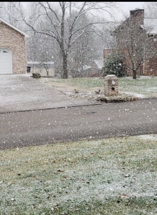
Nice little surprise this morning
-
7
-
-
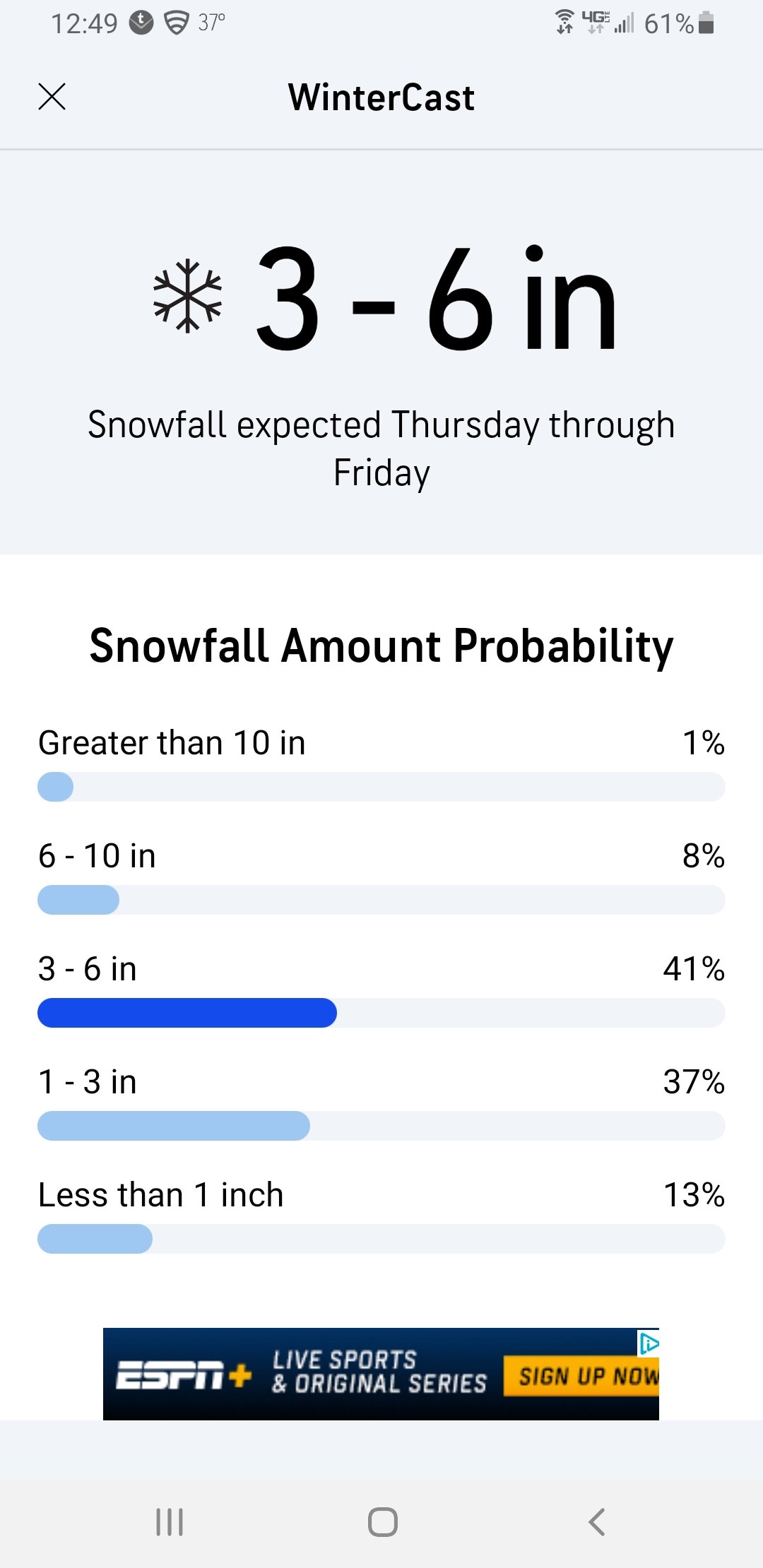
This just popped up on my AccuWeather app....for Kingsport
-
2
-

Fall/Winter Banter - Football, Basketball, Snowball?
in Tennessee Valley
Posted
So, I saw this posted from Archives of Kingsport Facebook page. Winter of 1936 saw two huge snows just a few weeks apart, early February and mid March! Here are the newspaper copies they posted for those two events. Interesting references to some incredible snow totals around the area, and to the issue of phone lines still working. Also some pictures in their post.
archives of the city of kingsport - Search Results | Facebook