CodyErvin
-
Posts
10 -
Joined
-
Last visited
About CodyErvin

-

Central/Western Medium-Long Range Discussion
CodyErvin replied to andyhb's topic in Central/Western States
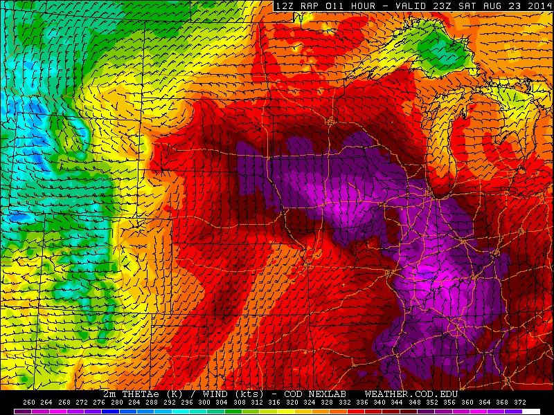
AS it has been a common theme this year, the NAM looks great a day out and the RAP decides to stomp all over it lol. Was rather impressed with the models until this morning, however we still could see some isolated tornadoes up in SD. Not exactly the best looking surface flow/theta E look to things attm though. Upper level flow is relatively marginal but it is doable. One thing to note is the 700s where there is a moderate influx of flow leading to enhanced surface-700mb shear which could be enough for a tornado or two today, though given the dynamics right now this looks to be mostly a wind and hail event. While likely not chasing this one, I will still keep an eye on it. Most likely area for tornadic development if we see it would likely be near and south a ways of Aberdeen, SD. I wouldn't be surprised to see a downgrade to a 5% tor again in the mid day outlooks.