

Jenkins
-
Posts
1,404 -
Joined
-
Last visited
Content Type
Profiles
Blogs
Forums
American Weather
Media Demo
Store
Gallery
Posts posted by Jenkins
-
-
6 minutes ago, DotRat_Wx said:
Mine is down.
-
 1
1
-
 1
1
-
-
Just now, bristolri_wx said:
LOL don't you own a real winter coat? I love LL Bean but even I didn't go out in just flannel!

Wear enough layers and jackets are optional
-
-
2 minutes ago, JayinRI said:
soooo....i didnt waste my money for a new snowblower is what everyone is saying
THIS IS ALL YOUR FAULT

-
 4
4
-
-
1 minute ago, Cyclone-68 said:
You gotta figure there will be a ton of thunder snow reports with this system?
Per BOX forecast discussion
QuoteThundersnow is possible on the nose of the dry slot, as intrusion of mid level dry air steepens lapse rates.
-
1
-
-
2 minutes ago, SouthCoastMA said:
Anyone notice that TT added 3 hour increments to the Euro? pretty nice
-
 5
5
-
1
-
-
Looks like it’s our turn for the band in EASTERN RI.
-
1
-
3
-
-
-
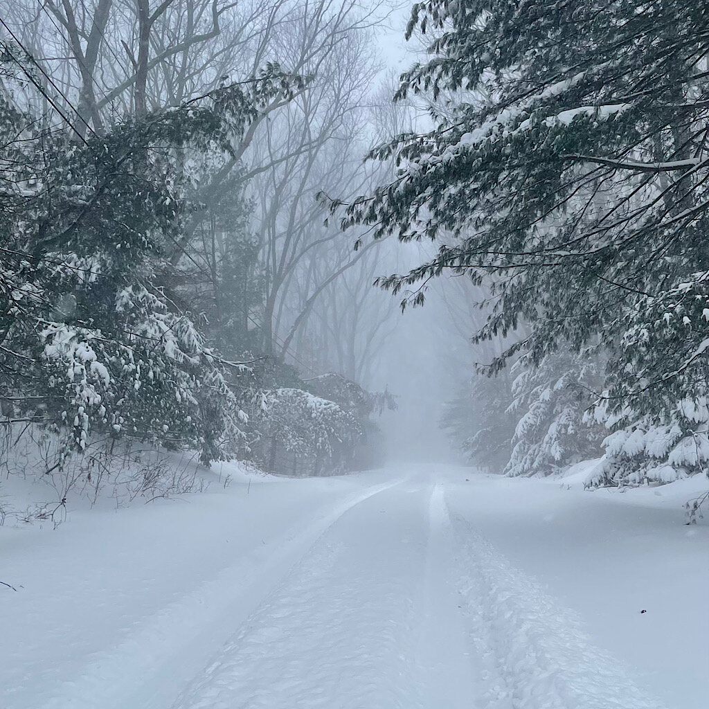
First flakes in East Greenwich
-
Awesome, great info guys. Thanks!
-
Trying to learn more about FGEN products here. Would anybody care to briefly explain how to use the various FGEN products at varying heights to predict where banding develops? In other words, in a setup like this, should I be looking at 700mb FGEN, 850mb FGEN, 900-500mb average, 800-600mb average? I'm taking a wild guess and perhaps the layer(s) which is the closest layer at which DGZ is located in?
-
Another East Greenwich lurker (formerly BFF) chiming in here. Moved back here from Charlotte after 5 years down in the snowless piedmont. Looking forward to a decent storm.
-
Brad P's latest thoughts. Does a good job of describing the soundings and would probably be helpful to anyone that isn't comfortable reading them.
-
Punting this pattern change over what the OP GFS spit out at 240+ hours seems like a bit of an overreaction.
-
-
8 minutes ago, Wow said:
Cleared cache on server side. Try now
Not able to view any threads again. Like an idiot, I selected the out of date theme.
-
15 minutes ago, DopplerWx said:
A lot more snow mixing in now with the sleet uptown !
starting to see a decent amount of flakes now near fairview and providence
-
2
-
-
9 minutes ago, Drummer said:
He's making some good points, specifically about how we're seeing temps trend colder than what was expected.
The heavy showers that we have been getting are perhaps cooling the column down faster than the models are expecting. FWIW, 1z HRRR initialized about 3-4 degrees too warm for CLT.
-
1
-
-
1 minute ago, SimeonNC said:
Weird, I am to the north of you yet my temp is higher. As for the dewpoints I must be reading the mesoanalysis wrong.
The precipitation rate is higher down here right now. As rates come up for your area, the temperature should drop some.
-
Brad P doing a storm update now
-
3
-
-
1 minute ago, SimeonNC said:
Still 36.5, I do not think the temp is gonna get any lower here, I guess the dewpoint is too high for most of CLT. Still sleeting pretty good though.
34.5/31.3 near providence and fairview
edit: 34.3/31.2
-
Temp steadily dropping with the onset of heavier precip. Sleet mixed with rain near Providence and Fairview.
35.2/32.7
-
1
-
-
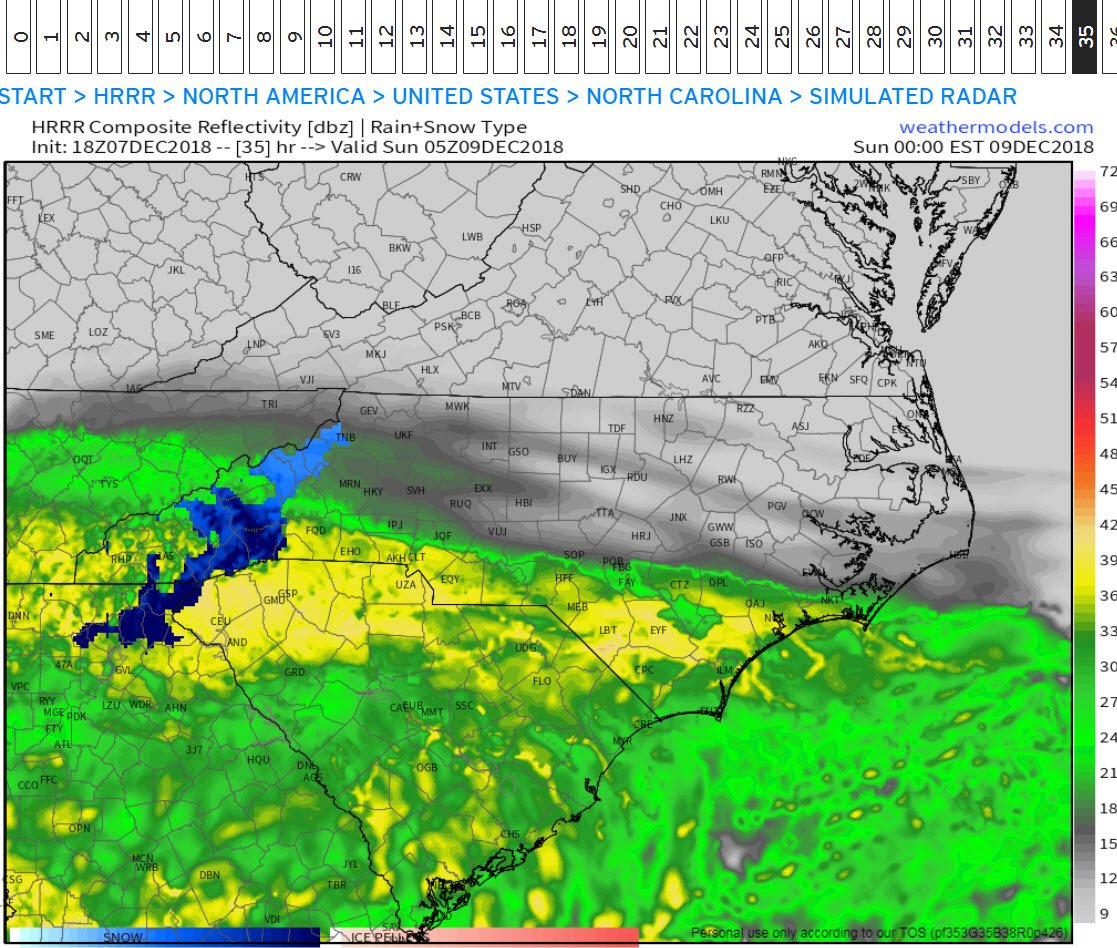
16 minutes ago, nchighcountrywx said:
And the Sunday 0Z HRRR Simulated Radar

35 hour output from HRRR is useless.
-
4
-
2
-
-
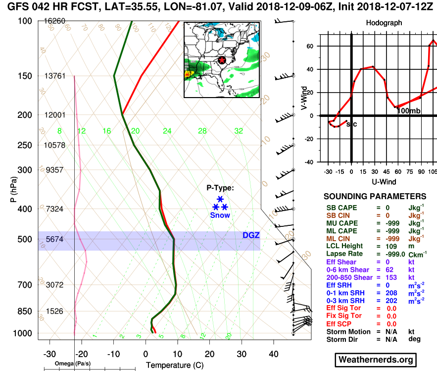
Not a bad sounding right there for CLT at H42. Fully saturated in the DGZ.
-
1
-

New England heavy rain event Sept 5/6 2022. Does this end the summer drought?
in New England
Posted
A quick 0.32" in East Greenwich.