

ValpoVike
-
Posts
634 -
Joined
-
Last visited
Content Type
Profiles
Blogs
Forums
American Weather
Media Demo
Store
Gallery
Everything posted by ValpoVike
-
The 12z GFS is still not backing off for the upcoming storm on Thursday-Friday, at least for the foothills. Regarding last night's precip, my snow melted fast this morning and my gauge recorded 0,40" in total including the rain yesterday. Not too bad and I am hoping that the next storm delivers whether it comes as rain or snow.
-
I picked up 2” overnight which was a bit of a surprise. This on top of the 0.19” rain from earlier in the afternoon.
-
It has been consistently there since last Thursday model runs.
-
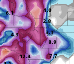
Both GFS and ECMWF are very bullish for next week. Here is a snippet of total snow thru Friday 5/1. We'll see....
-
Muted a bit, but good to see that it did materialize.
-
Yeah the models are already backing off. Sigh.
-
The models seem (today) to be in good agreement on a good snowstorm for the foothills and Palmer divide on Friday. Hopefully, this one does not evaporate as we get closer.
-
Yeah it’s been windier in the foothills than usual for sure. I lost 3 large and mature trees in December, and a couple of weeks later I lost a portion of fencing. Looking forward to eventual calm weather.
-
It hasn’t been a terrible March up here. Sitting at 1.26” LE for the month. YTD is 1.74”, so yeah January and most of Feb was underwhelming.
-
Fantasy-land, but the Euro and GFS are both showing a storm for the middle (Euro) to late (GFS) last week of the month. I hate posting long range stuff but since the last storm was spied in the long range, I thought what the heck
-
CSU closed their campus this afternoon due to falling trees. I have heard that someone was injured and a car damaged. I clocked a high gust up here of only 47mph, but apparently FoCo had gusts over 60mph.
-
6am and overnight I picked up about 4.5”. I am quite optimistic that we will significantly bust the high end point forecast of 6”. I will now finally get to use my tractor’s new rear plow blade Edit: Snow+ and picked up an additional 1.5” over 45 minutes. Now right at 6”.
-
Crazy, but we got our first advisory of the year for Friday. Unbelievable that we haven't had one yet.
-
I must have had some unmelted snow in the Davis gauge as the storm total increased to .43”. Best moisture in forever.
-
A pretty good day up here with rain, rain/snow, and even sleet. The gauge registered .28” so far for the day which is very welcome.
-
The models are hinting at a decent storm around March 8th or so, which is obviously fantasy-land. But given that we haven't even had fantasy-land storms to watch this year, it's nice to see.
-
Well, I took the plow blade off my Polaris Ranger today. Hoping for the “car wash” effect. LOL
-
Not astronomical, but things are dry up here typically in Jan and early Feb. What's killing us in the foothills goes back into the fall season. I'm sure we're all anxious to see what March and beyond will bring.
-
Last February my gauge recorded .15” total. So far for this Feb I am at .33” with more precip likely coming today. Last January came it at only .35”, and this January at .13”. Very comparable. All in all it was a decent spring here last year following Jan and Feb, so there is hope.
-
I received more precip than I expected today, with .13" so far. Mostly snow that melts in between the showers. There are a handful of similar days in the forecast, so I am somewhat hopeful that we can chew thru some of the deficit up here, and crossing my fingers that March/April delivers this year. There was even a rainbow this morning which was a pleasant surprise.
-
I clocked a high of 64 today. Crazy stuff up here at this elevation.
-
Exactly
-
I was referring to the snowfall amounts. I think you would agree that temps were not 60 during the event.
-
It was a very typical Dec/Jan type snowfall. Events in these months are much more typically nickels, sometimes dimes, until late Feb thru April.
-
At most - 1 inch up here, and all of that came in the morning with the first round. As expected, we totally whiffed on round 2 in central Larimer county. Glad to see that it performed for some of you.


