

winter_warlock
-
Posts
3,363 -
Joined
-
Last visited
Content Type
Profiles
Blogs
Forums
American Weather
Media Demo
Store
Gallery
Everything posted by winter_warlock
-

Feb 22nd/23rd "There's no way..." Storm Thread
winter_warlock replied to Maestrobjwa's topic in Mid Atlantic
Jesus we're getting hammered there!!!! -
Feb 22nd/23rd "There's no way..." Storm Thread
winter_warlock replied to Maestrobjwa's topic in Mid Atlantic
There it is!! Randy said Folks!! Lock that fucker in!!! -
Feb 22nd/23rd "There's no way..." Storm Thread
winter_warlock replied to Maestrobjwa's topic in Mid Atlantic
That is better!! -
Feb 22nd/23rd "There's no way..." Storm Thread
winter_warlock replied to Maestrobjwa's topic in Mid Atlantic
Love when Randy says.."guys" cause u know it's gonna be good!! -
Feb 22nd/23rd "There's no way..." Storm Thread
winter_warlock replied to Maestrobjwa's topic in Mid Atlantic
Babysteps!! -
Feb 22nd/23rd "There's no way..." Storm Thread
winter_warlock replied to Maestrobjwa's topic in Mid Atlantic
Jma does look more like GFS then the euro -
Feb 22nd/23rd "There's no way..." Storm Thread
winter_warlock replied to Maestrobjwa's topic in Mid Atlantic
I saw that but wasn't gonna post it cause. I didn't think anyone would put alot of stock In The JMA -
Feb 22nd/23rd "There's no way..." Storm Thread
winter_warlock replied to Maestrobjwa's topic in Mid Atlantic
All of us are gonna be really screwed up in the head if the GFS scores a coup and the other models eventually cave to it -
Feb 22nd/23rd "There's no way..." Storm Thread
winter_warlock replied to Maestrobjwa's topic in Mid Atlantic
Same reason my first wife is the way she is..... I don't trust her either -
Feb 22nd/23rd "There's no way..." Storm Thread
winter_warlock replied to Maestrobjwa's topic in Mid Atlantic
What if it don't pull the rug -
Feb 22nd/23rd "There's no way..." Storm Thread
winter_warlock replied to Maestrobjwa's topic in Mid Atlantic
I can imagine it.. in fact I'm praying for it!! -
Feb 22nd/23rd "There's no way..." Storm Thread
winter_warlock replied to Maestrobjwa's topic in Mid Atlantic
If euro shows anything that resembles what GFS just showed, this forum will lose their minds! -
Feb 22nd/23rd "There's no way..." Storm Thread
winter_warlock replied to Maestrobjwa's topic in Mid Atlantic
Jesus effin Christ!!! It's a beaut Clark!!! -
Feb 22nd/23rd "There's no way..." Storm Thread
winter_warlock replied to Maestrobjwa's topic in Mid Atlantic
Very true!! I'd love for the GFS to be right this time -
Feb 22nd/23rd "There's no way..." Storm Thread
winter_warlock replied to Maestrobjwa's topic in Mid Atlantic
If people think the GFS is so bad then why post the model and snow maps ? -
Feb 22nd/23rd "There's no way..." Storm Thread
winter_warlock replied to Maestrobjwa's topic in Mid Atlantic
-
Feb 22nd/23rd "There's no way..." Storm Thread
winter_warlock replied to Maestrobjwa's topic in Mid Atlantic
Right or wrong.. it's been consistent -
Feb 22nd/23rd "There's no way..." Storm Thread
winter_warlock replied to Maestrobjwa's topic in Mid Atlantic
One last shot? Did the GFS also show that? -
Feb 22nd/23rd "There's no way..." Storm Thread
winter_warlock replied to Maestrobjwa's topic in Mid Atlantic
At least it's been the most consistent last couple days -
Feb 22nd/23rd "There's no way..." Storm Thread
winter_warlock replied to Maestrobjwa's topic in Mid Atlantic
I'd ignore any weather prognosis on social media, chances are its run by a 60 y o man who has never left his mom's basement his entire life -
Feb 22nd/23rd "There's no way..." Storm Thread
winter_warlock replied to Maestrobjwa's topic in Mid Atlantic
They don't call you the Amazing Scraff. For nothing! -
Feb 22nd/23rd "There's no way..." Storm Thread
winter_warlock replied to Maestrobjwa's topic in Mid Atlantic
Locking in?? At 4 days out? -
Feb 22nd/23rd "There's no way..." Storm Thread
winter_warlock replied to Maestrobjwa's topic in Mid Atlantic
GFS AI actually came nw a bit. Also. FWIW..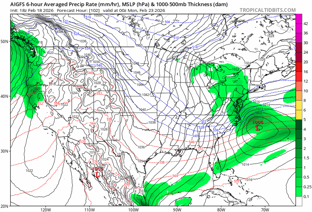
-
Feb 22nd/23rd "There's no way..." Storm Thread
winter_warlock replied to Maestrobjwa's topic in Mid Atlantic
Love that nw tick!! -
Feb 22nd/23rd "There's no way..." Storm Thread
winter_warlock replied to Maestrobjwa's topic in Mid Atlantic
Don't add me. I gotta get up at 5 30 am so I won't be up with the overnight crew


