winter_warlock
-
Posts
3,359 -
Joined
-
Last visited
Content Type
Profiles
Blogs
Forums
American Weather
Media Demo
Store
Gallery
Everything posted by winter_warlock
-
Yup!!!!
-
Maybe he saw the digital snow map and fainted lol
-
Wow!!
-
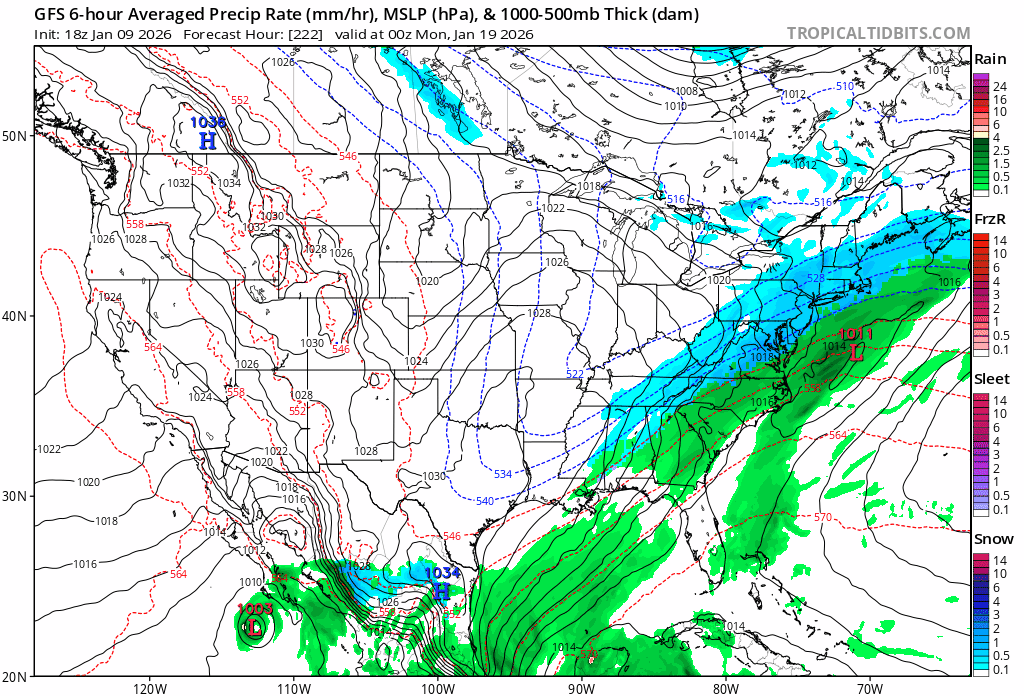
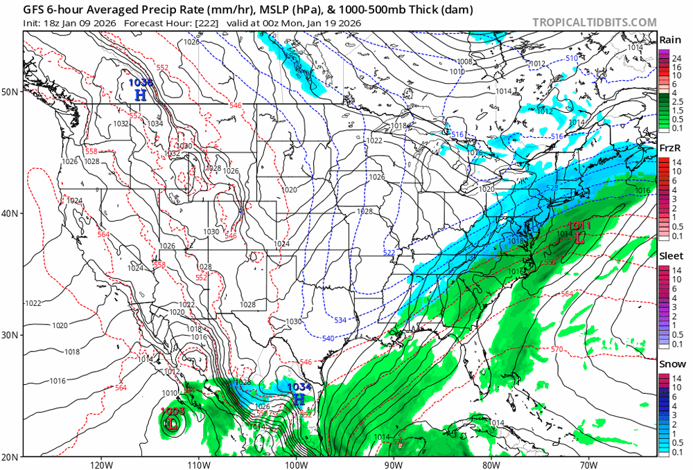
Agreed!!! The second storm is over 200 hours out. We got plenty of time for that. Need to nail down the first storm before worrying about the next one lol
-
18z and 00z couldn't be any more different lol
-
2nd storm over 200 hours away im sure it's gonna change more then a few more times in the next 9 to 10 days lol
-
What's new lol
-
Damn that does look eerily similar!!!
-
ITS A BEAUT CLARK!!!
-
Love when Randy uses the word Mauled!!
-
I got pivotal now ty bro!
-
I'll have to try that thanks!!
-
Tropical tidbits has lots of missing frames jumps from 144 to 180 lol
-
I'd still rather have that at 144 instead of being in the bullseye. Lots of time to improve
-
JB when he flipflops lol
-
Oops sry I thought I posted it in the banter thread. I deleted it lol
-
I agree. I can understand using analogs to a point. But I think JB uses analogs too much, no matter how many different variables there are. He will follow an analog over a cliff if it agrees with his thinking.
-
Me too!!..Definitely!!!!
-
To be honest I trust the Pro Mets we have in here a hell of a lot more then I trust JB!
-
His ass too
-
JB also said a week ago that. It was gonna get brutally cold. Rivalling the 1985 brutal cold .. JB. Changes his tune every week lol . He's so inaccurate I don't even watch his videos anymore
-
A cutter?? Lol I doubt that
-
Cutter???
-
Dude first storm is still a week out , at least give it a few more days lol
-
Punt it 8 days out??? We've had many storms not even show up till we were within 72 hours . I say wait till at were at least within 72 hours