TalcottWx
-
Posts
28,808 -
Joined
Content Type
Profiles
Blogs
Forums
American Weather
Media Demo
Store
Gallery
Everything posted by TalcottWx
-

March 2022 Obs/Disc: In Like a Lamb, Out Like a Butterfly
TalcottWx replied to 40/70 Benchmark's topic in New England
Will today be legit 74 in Boston? Or that early season 74 when we end up getting a wind off the water and it's 45? -
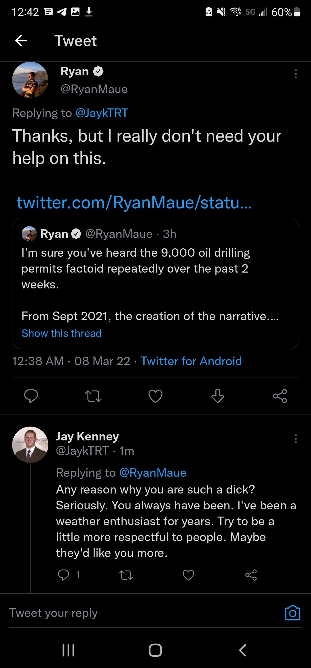
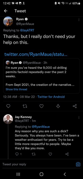
Ryan Maue is one of the biggest azz holes in weather
-
https://www.bostonglobe.com/2022/02/25/metro/blizzards-floods-droughts-hurricanes-meteorologist-harvey-leonard-has-seen-foreseen-them-all/?camp=bg%3Abrief%3Arss%3Afeedly&rss_id=feedly_rss_brief&s_campaign=bostonglobe%3Asocialflow%3Atwitter
-
Where is the snow coming from that people talked about? To me it looks like it's done.
-
Just a box of rain?
-
So essentially maybe some pings here and then radar fills in and snow later?
-
I'm wrapped up in other stuff... Radar looks almost over?
-
Winter storm for the 25th of February is imminent.
TalcottWx replied to Typhoon Tip's topic in New England
Has Pete b ever once had a good map? -
Winter storm for the 25th of February is imminent.
TalcottWx replied to Typhoon Tip's topic in New England
It won't snow. Warm ground. Impossible to stick. -
For whatever reason, my apartment really gets hammered on south and southeast winds. I'm on the third floor. So probably 110 feet. Relatively higher than the ground just south and east of me. Maybe someone can explain why.
-
Uhm. House shaking gusts here. Where did this come from?
-
Winter storm for the 25th of February is imminent.
TalcottWx replied to Typhoon Tip's topic in New England
What is this guy talking about? https://twitter.com/seckhardt/status/1496291106526478341?t=3XcENh4BglQyClTtGxRqKg&s=19 -
This goes from meh to OK with the thunder snow. OK I'm trolling. Wine time bizzitches.
-
Thundersnow at 545pm
-
This event stinkz
-
Looks to me like best stuff will slide south of BOS, IMO.
-
Dead and Company Mayer >>>>
-
Are we going to see more snow in Windsor ct?
-
Have you gotten as porked this winter as it feels like you have?
-
It's amazing what lack of proper funding does.
-
31F
-
I've been out of the loop. Pretty impressive acreation map from BOX. This would be one of the more substantial icing events I've ever seen inside Boston. We used to barely ever ice. We've had several of these the past few years. Less than a half inch of ice?! That's a ton for here!
-
OBS/DISCO - The Historic James Blizzard of 2022
TalcottWx replied to TalcottWx's topic in New England
Great job Ray! -
OBS/DISCO - The Historic James Blizzard of 2022
TalcottWx replied to TalcottWx's topic in New England
Nice -
OBS/DISCO - The Historic James Blizzard of 2022
TalcottWx replied to TalcottWx's topic in New England
So blue hills had 27.5. Where did Logan end up? Top 5? Multi or single day?