

WeatherQ
-
Posts
154 -
Joined
-
Last visited
Content Type
Profiles
Blogs
Forums
American Weather
Media Demo
Store
Gallery
Posts posted by WeatherQ
-
-
5 minutes ago, MillvilleWx said:
That would be some serious mashed potatoes if that verified. Huge flakes
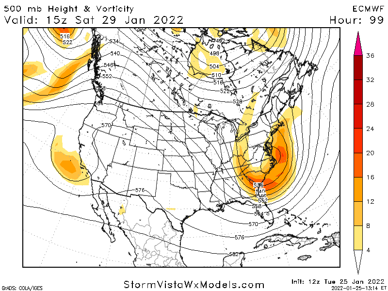
Ok MillvilleWx .. I need your no BS assessment … we have 2 globals and multiple regionals now with the NEMD crushed signal .. The RAP shows a perfect SLP pass off ORF … what’s the red tagger thought?
-
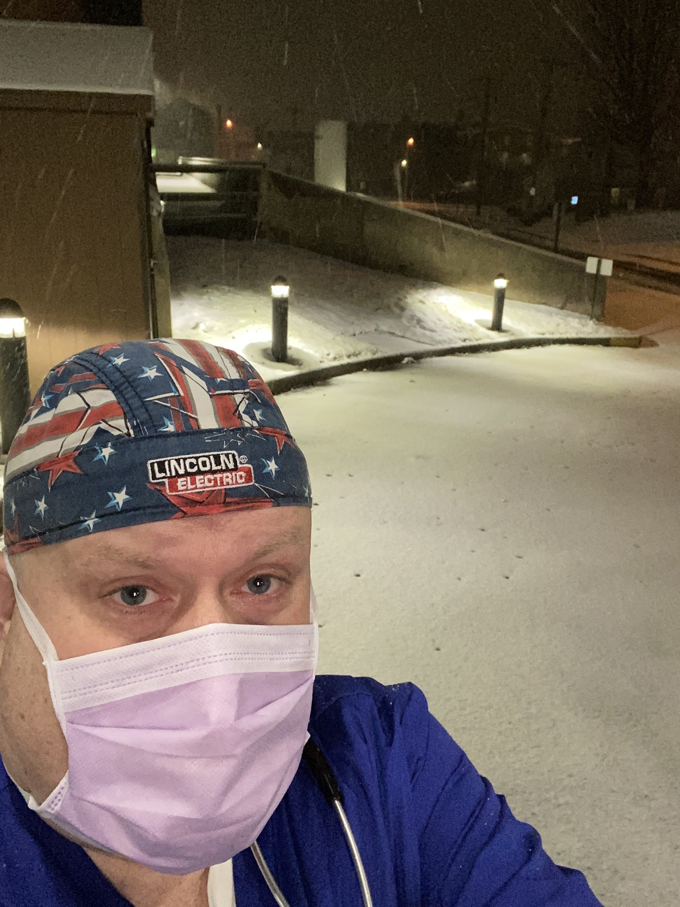
University of MD Medical System
Bel Air MD
Warm and Dry feels like 87F
Heat Index 105F
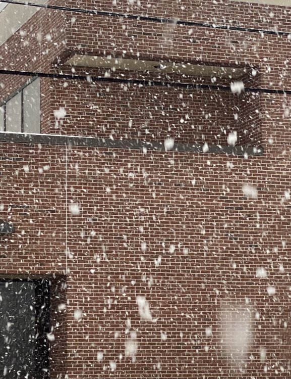
oh … moderate snow outside
ambulances getting covered

-
 8
8
-
 6
6
-
-
751 days without measurable snow … and now 2 storms in a week. El Niño … you rock!
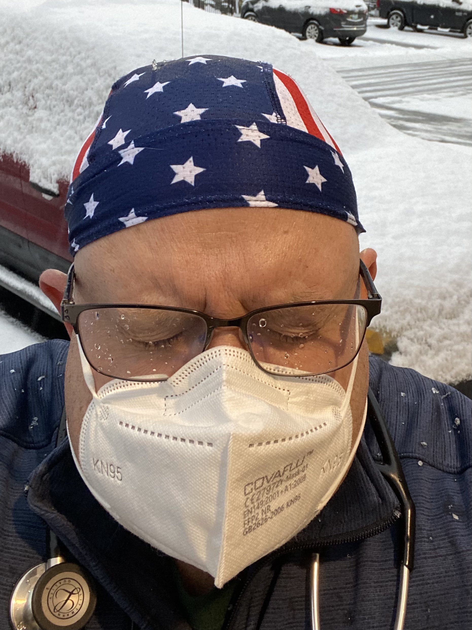
NE MD - New London Rd (Elkton)
+ Flakage
28F/77% RH
BP 998 mb
my BP 300/150 driving to hospital!

-
3
-
-
1 minute ago, Deck Pic said:
If lives are depending on you, I hope you make it. If it's non-essential or someone can fill in, I hope I-95 is impassable
Emergency Room —- so I’ll be busy with falls, shoveling cardiacs, respiratory due to cold air and inevitable snowblower injuries and back pain … sorry Mods … banter .. but thx Deck Pic! Don’t come visit! Any of you! Stay safe!
-
3
-
 5
5
-
-
4 minutes ago, Deck Pic said:
Are you able to have someone fill in for you? Because I hope the storm is severe enough that you don't make it.
Not likely … I’ll slug down 95 .. nice and slow and hopefully see some rakeage flakeage. Radar returns already starting to light up west of us … atmosphere must be pre-gaming
-
Actually posted WSW 5-6” for MD/DE line. Do I get my bingo piece for NE MD jackpot? Have to pull a shift in UMMS Hospital tmrw … should be an interesting commute
-
4
-
-
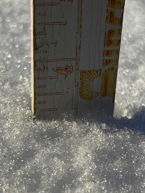
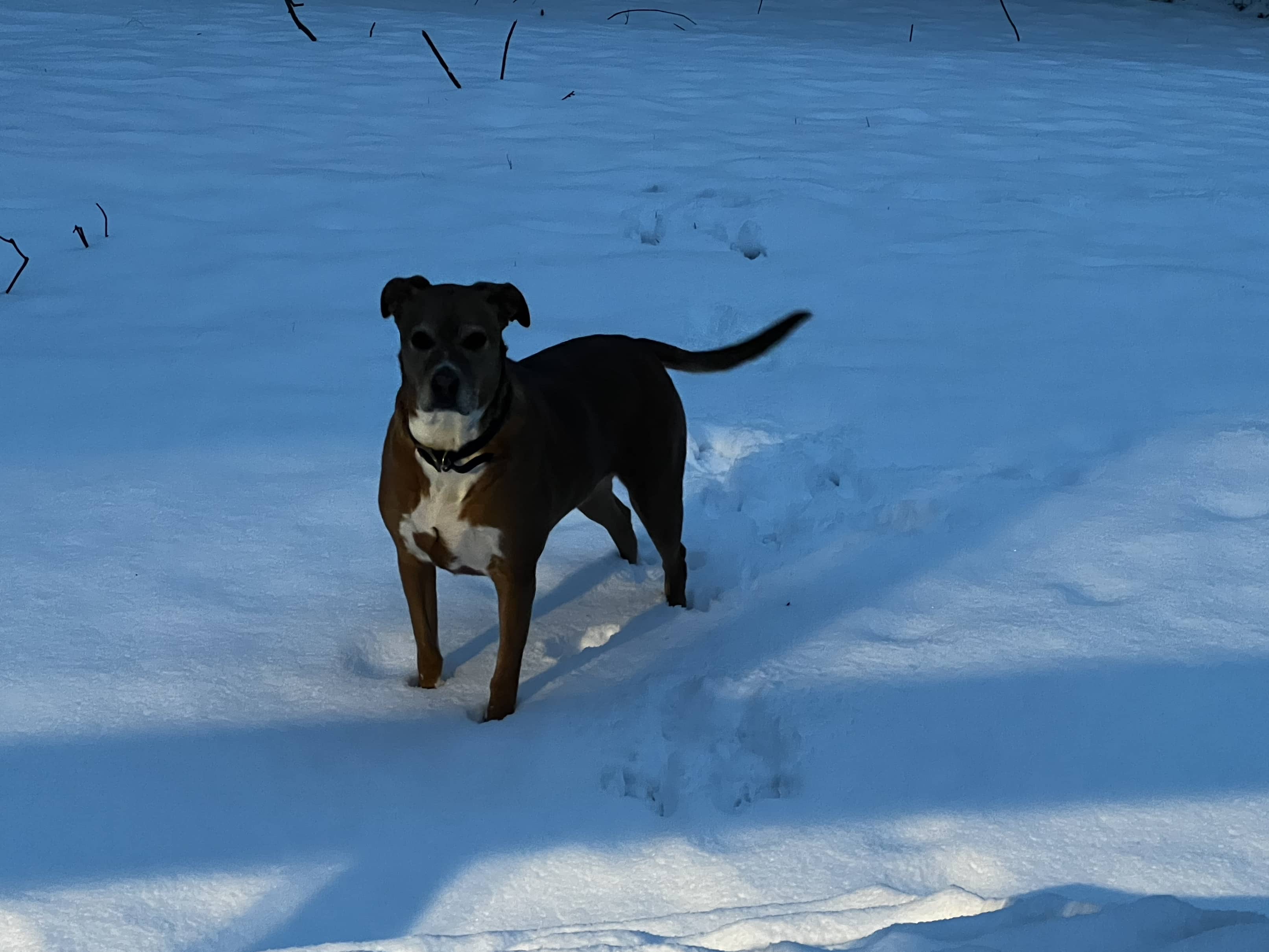
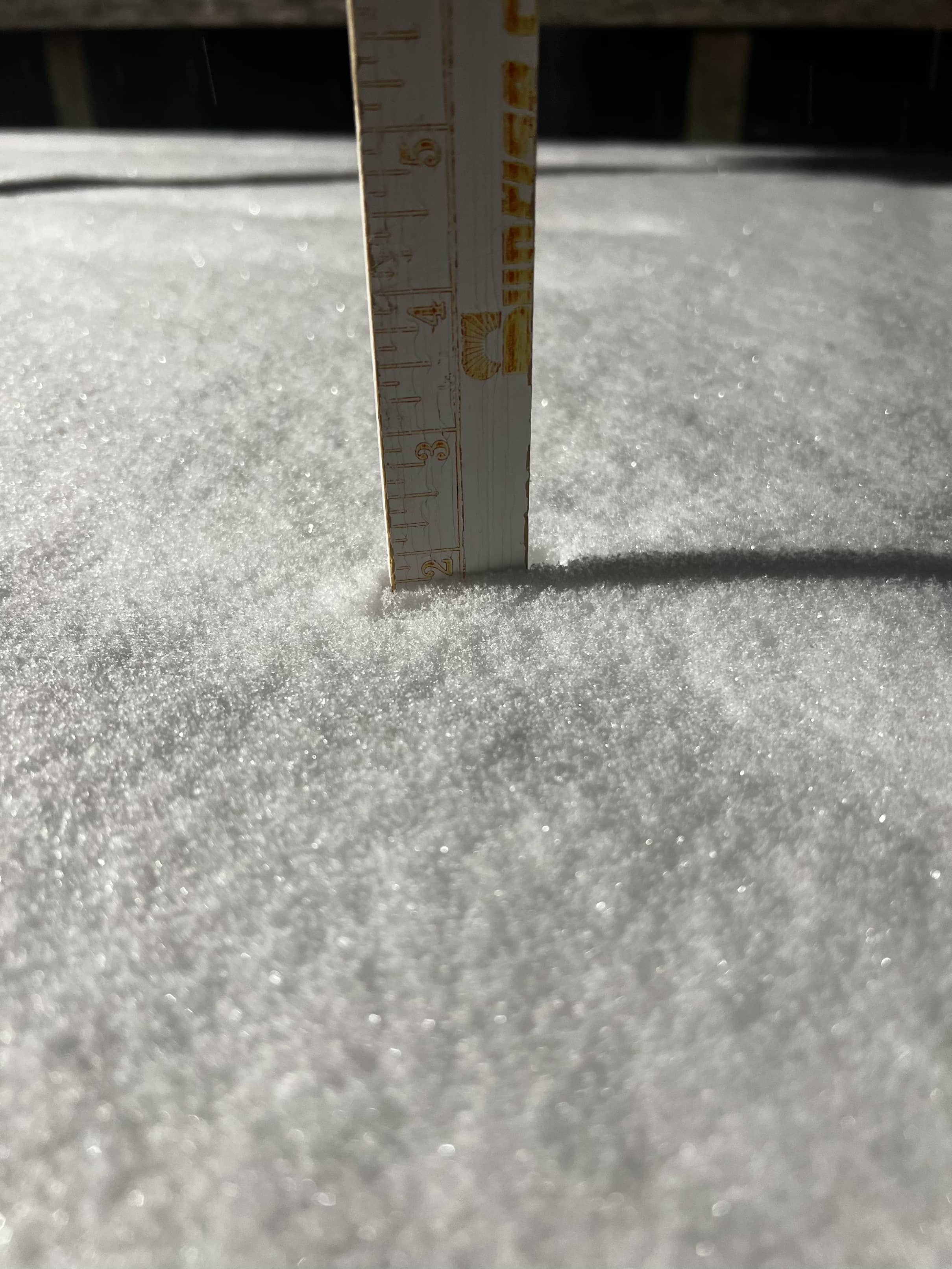
First light and my 6 yo rescued puppers isn’t quite sure what this POWDAH is ,… LOL.
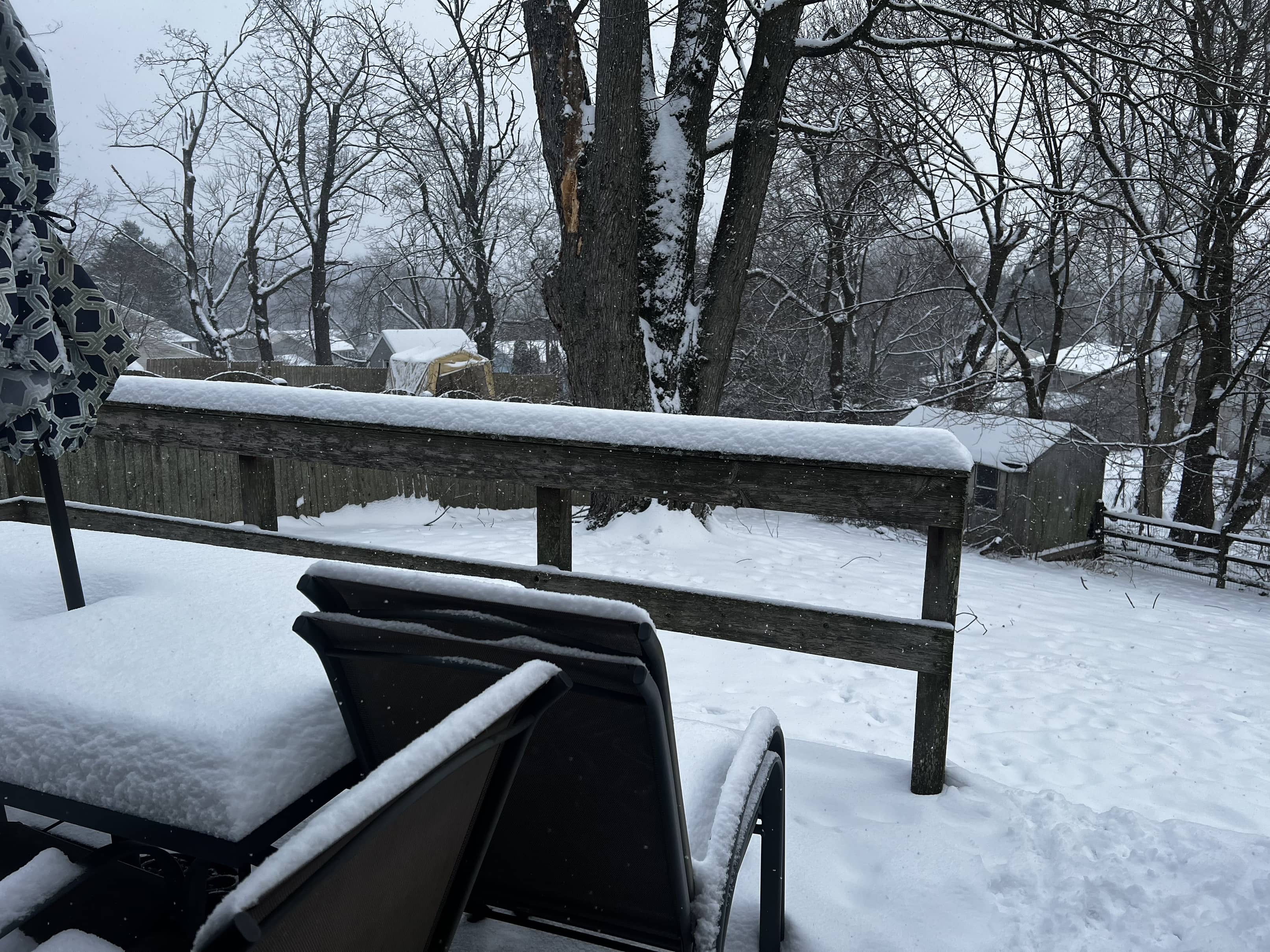
several 4” lollies at 3 separate places. The official deck is 3.85” with some sleet crunch compaction. Gorgeous view … missed it!
27F/77%RH
1001 mb pressure
wind - calm
loc: NE MD - extreme NE Cecil County -New London Road (border PA/MD/DE)

-
7
-
-
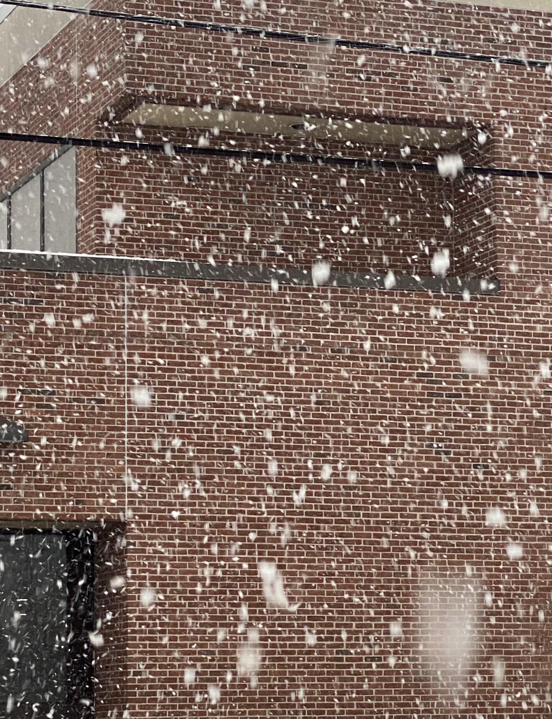
Really moderate fine powdah …
1.9 in
27F/68% RH
BPress 1012 mb
Locality: NE MD - NE of Elkton MD
-
6
-
-
Heavy clouds with Full on Snizzle … just E of the very NE tip of NE MD by the Tri State Marker (MD/PA/DE) convergence .. for those that know .. White Clay Creek State Park .. New London Road
27F/64%RH
BP 1012 mb
-
6
-
-
2 minutes ago, psuhoffman said:
That is getting way closer to what we want, uts definitely workable as is, and it’s a slight “pinwheel” retrogression in that nao and associated drop SE of the mid lat trough from becoming REALLY good.
I know it’s subtle but the key is getting the trough out of western Canada. Everything will cut with it anchored there. Ideally the best look for snow in the mid Atlantic is when the positive over the top is anchored west of the negative to the south. That’s not far from that if the trough trends any further east and can get a wave break in the 50/50.
That’s the trend we want to see for mid January.
Does the Atlantic get more “blocky” if the Wstrn Canadian trough relaxes or does it just allow for more confluence towards the East Coast? I’m trying to picture the upper air physics in how you’ve described the WCand airmass
-
2 hours ago, psuhoffman said:
Icon was Jaws music worthy at the end of the run
Pretty certain this is the best post of the day. “you’re gonna need a bigger boat” (or Omega block)
-
1
-
-
Near Elkton MD … pretty scene … the Start of a Nino winter???
anyone have a statistical nod to how we do in Nino winters when first measurable snow is before Dec. 10??
-
1 hour ago, Maestrobjwa said:
You're really not wrong about that--I mean seriously. Any lurkers here that were psych majors? I'd pay to hear a psychoanalysis of this forum, lol I mean I'd legit welcome it, actually--many of us have got to learn to cope better, seriously.
Straight up cray cray. But I do love it here
ER Nurse Practitioner
-
1
-
2
-
-
Just NW Elkton MD 7F
-
1
-
-
14 minutes ago, stormtracker said:
To all members,
I feel like I need to apologize to you all for what happened earlier. I'm sorry. I lost my temper. I'm not going to blame a "bad day" or some external reason. There is no reason or excuse. I just lost it and I'm sorry y'all had to see it. I can't say it was behavior unbecoming of an admin because let's face it, I suck as an admin and I don't even look at myself as one. I'm only an admin because I co-founded this board. Yeah, I joke about banning people, but most of you all know it's just that...jokes. Thank God @IronTy wife isn't the sole owner of this board, because after this morning, she'd be driving down 95 to pay me a visit. With that said, I'm opting out of pbp. Not because of what happened today (well mostly not), it's because I'm just sick of this see-sawing GD storm.
Again, apologies to the board.
Give yourself a pass and a break. Very much enjoy your commentary
-
43 minutes ago, ravensrule said:
OMG that looks classic for a coastal bomb
-
1
-
 1
1
-
-
1 minute ago, snowfan said:
Chopin > Beethoven
1. Rachmaninoff
2. Ludwig v B
3. Wolfe
and the NS seems to be on a dig
-
1
-
-
2 hours ago, WxUSAF said:
GEFS and GEPS means both moved toward a snowier outcome for us based on what I can see. And EPS still looks pretty good. Still plenty of hope for a nice powder event.
40% of the Euro ENS (20/50 members) were absolute crushers … or is that a bad ensemble run after a bad op run? Clarify: meaning the Euro has moved towards a GFSish outcome.
-
Marker for PA-MD-DE Boundary
https://goo.gl/maps/FoBdowztyku4z7an8
at the TriState Marker DE/PA/MD
13F/-1F
RH 40%
-
2 hours ago, nw baltimore wx said:
DT can be such a great teacher when he’s medicated. There’s a lot of good info in this video. A lot of self-back-patting too, but worth the watch IMO.
Thanks very much for this. For those of us in the forum who studied meteorology but chose a different path in life … this was a great refresher in synoptic meteorology!
-
2
-
-
2 hours ago, Baltimorewx said:
At least we rarely get the wind Denver is getting today..up to 80mph gusts in the zone forecast
100-107mph gusts recorded in CO already
-
3
-
-
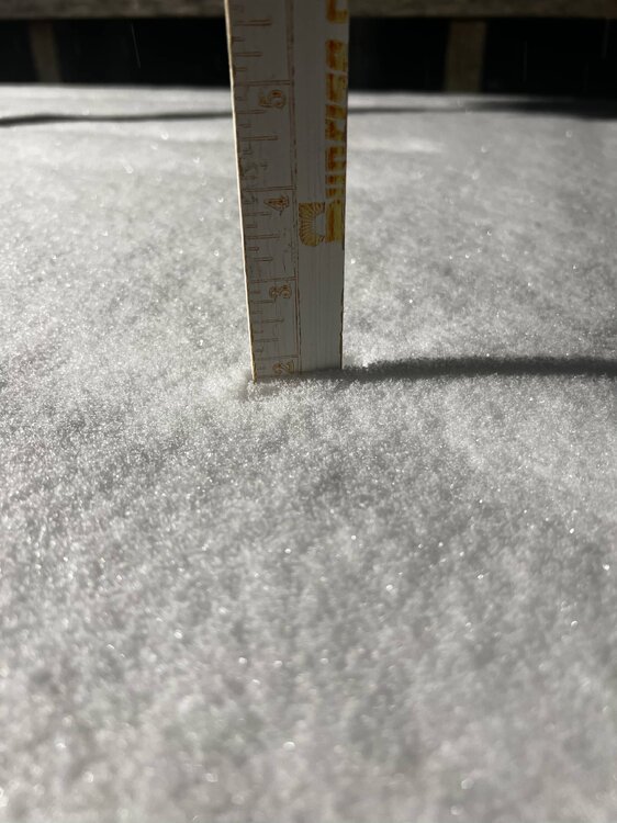
Extreme NE MD (Elkton). Beautiful fine powder falling. 27F and falling. 1.2” on ground at Hospital

-
9
-
-
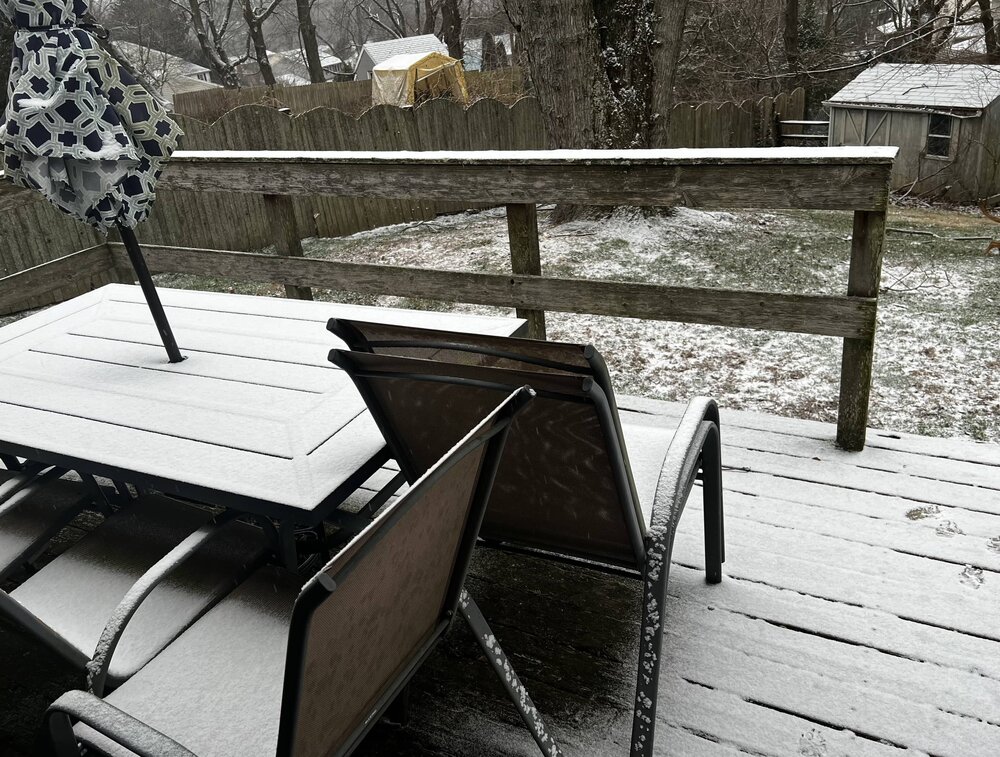
(Elkton MD) At 1545 hrs Winter Storm Assface quietly passed away surrounded by friends. He went over to IP/ZR. Farewell. We hardly knew ye!
30F. 1.5 inches. Currently IP/ZR

-
3
-
2
-
 1
1
-
-
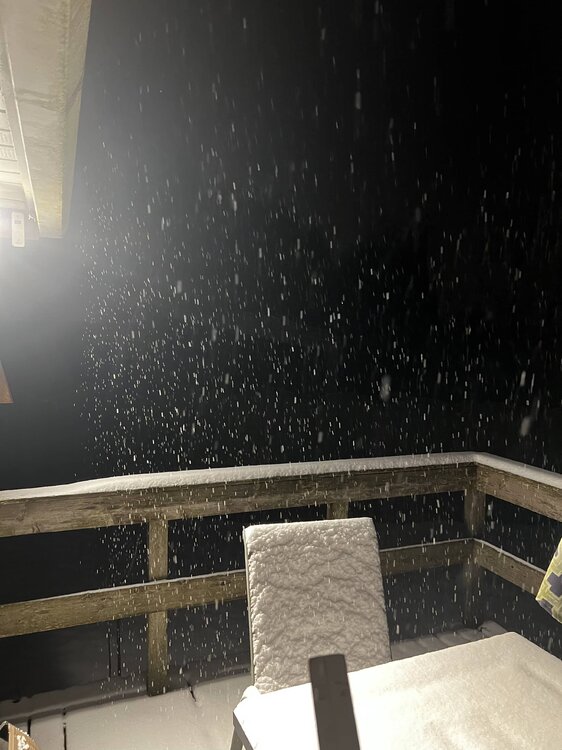
Biggest Flakeage I’ve seen in years ... absolutely ripping white meteors in Elkton MD.
30F
-
2
-


2024 Valentines Day Who the Hell Knows - Comeback Thread
in Mid Atlantic
Posted
Well .. New Castle Co DE Emergency Operations Division is getting very interested which bodes well for NE MD and the upper Eastern Shore… they titled this flash “Surprise Snow Storm”