phillyPete
-
Posts
7 -
Joined
-
Last visited
About phillyPete

-
I've come to recognize the NBM model as the NIMBY model, or the NVM model.
-
I just want to see the snow before it switches over. Any idea what time it might start in SEPA? I'd be thrilled if this thump verified.
-
Yup. Nice to see! Going to have to see what the other models do, I'm sure the short range ones will troll us too.
-
Yeah, I think that's pretty much what I would expect at this point. Been novice tracking for almost 20 years now and historically that's how it pans out. Never underestimate the WAA for SEPA. That being said, after last year I would take the crappy 3" of weekend wet snow
-
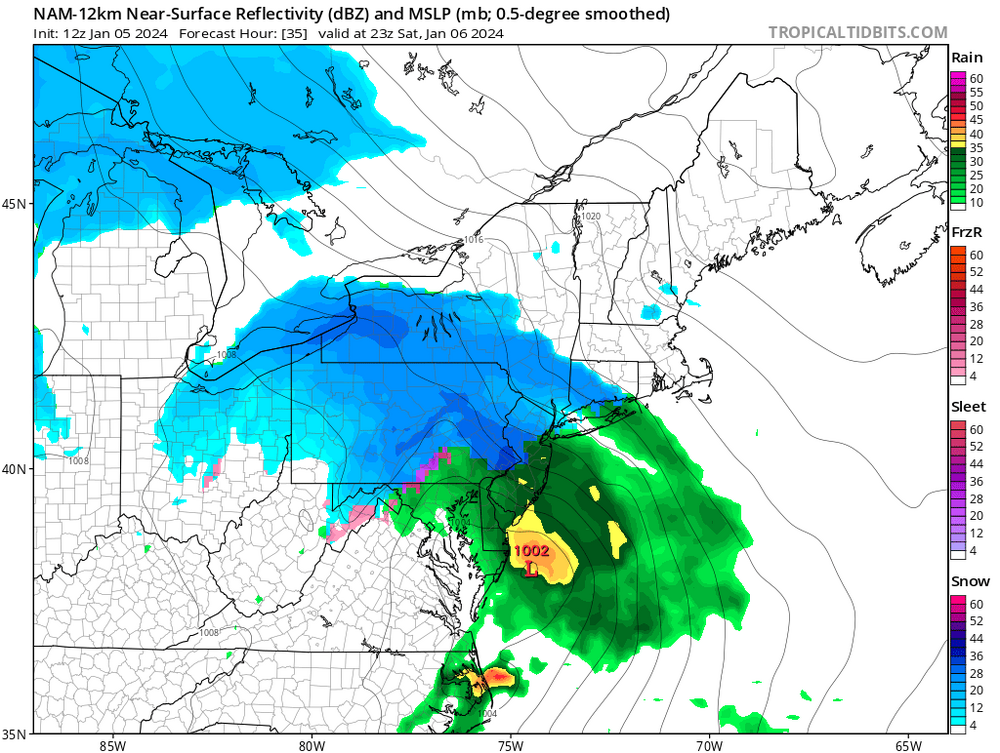
My post was premature. Here is the pivotal snow load for PHL. I'd buy that for a dollar!
-
It's funny 06z GFS MSLP/Precip has a lot of great looking, cold precip. But the snow map still looks like PHL is going to have low totals.
-
Well, we knew the NW trend was going to come. Now we get to watch the windshield wiper effect that says we'll get between 1-12" in PHL. It's the classic coastal plain battle.. although I don't remember seeing much of this last year at all.