
nvck
-
Posts
78 -
Joined
-
Last visited
Content Type
Profiles
Blogs
Forums
American Weather
Media Demo
Store
Gallery
Posts posted by nvck
-
-
Day 4/5/6 outlooks posted below >
day 4 looks like it will be affecting some of the same areas that got hit fairly hard over the last week. I would expect the day 6 outlook to shift NE a lot, especially based off of the 12z GFS, but the euro is a lot less bullish. Either way, looking forward to an active pattern with storms to track
-
13 minutes ago, Ed, snow and hurricane fan said:
Time to see if Ryan Hall is livestreaming chasers.
IIRC, he said that he had access to 30 chaser feeds, so should be pretty good coverage of the storms
-
 1
1
-
-
absolutely insane...
-
1
-
-
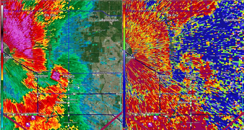
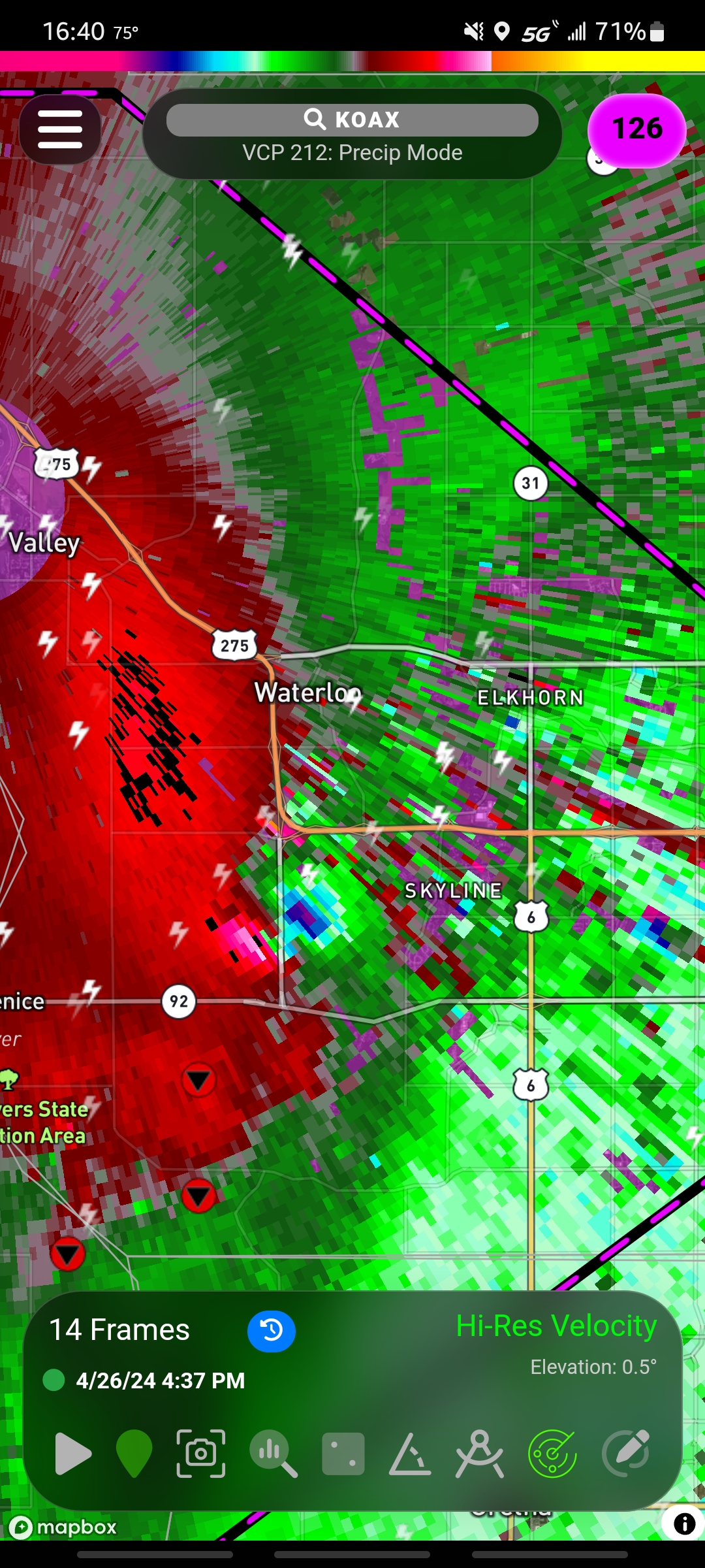
not really in this area, but tor-e in west Omaha suburbs, pretty nasty looking wedge. this is a crazy couplet considering this is only about 6 miles from the radar site
-
1
-
-
76/65 here, with steady winds from the south. I'm just out of the tornado watch but definitely a fairly primed atmosphere
-
Storms just south of the ohio river are absolutely crawling, this one near lagrange, ky has barely moved in the last hour! (warning says moving SE at 5mph...)
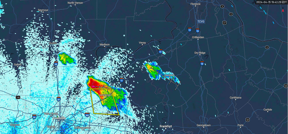
7:40pm
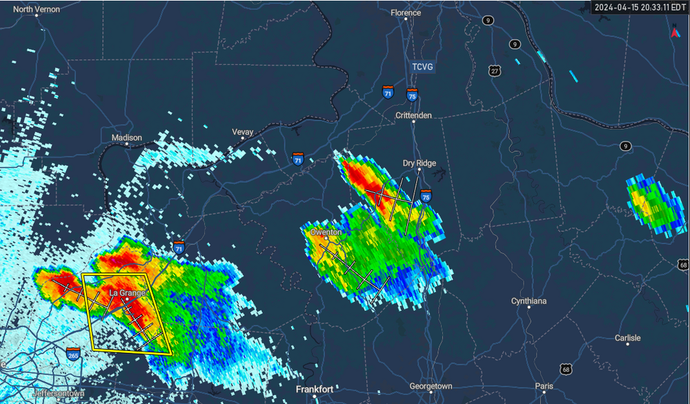
8:30pm
-
peaked at 84 yesterday, already at 81 today
-
LOL at all the weenies on Twitter disappointed that tomorrow is downtrending for OK
-
1
-
 1
1
-
-
22 hours ago, buckeye said:
I don't know what it is about that place. I have one about 5 mins from me and I never go. It's fcking chicken fingers with a dip that's basically ranch and ketchup mixed.
Cane's is decent, but Joella's Hot Chicken absolutely wipes the floor with them. not sure how widespread they are though
-
glad to see the forecast showing a decent amount of clearing in SE IN. I remember the 2017 eclipse, I was in 6th grade and not able to see it, but set my sights on this one lol. about seven years in the making for me
-
1
-
-
what a bust... I feel like this will degrade the public's confidence in the NWS, seeing as the event was so extensively discussed
-
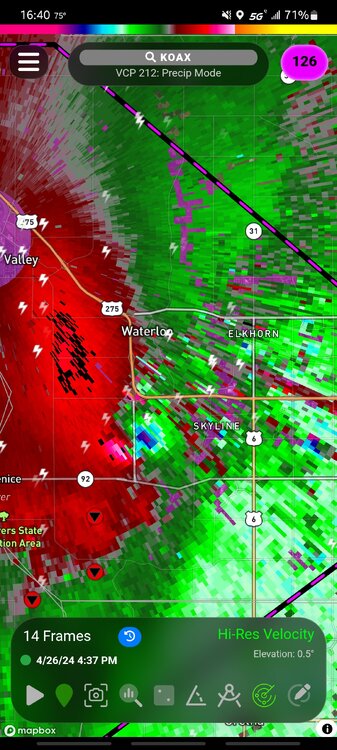
Tornado likely about to touchdown soon in S IN, near Crothersville. pretty concerning velocity couplet
-
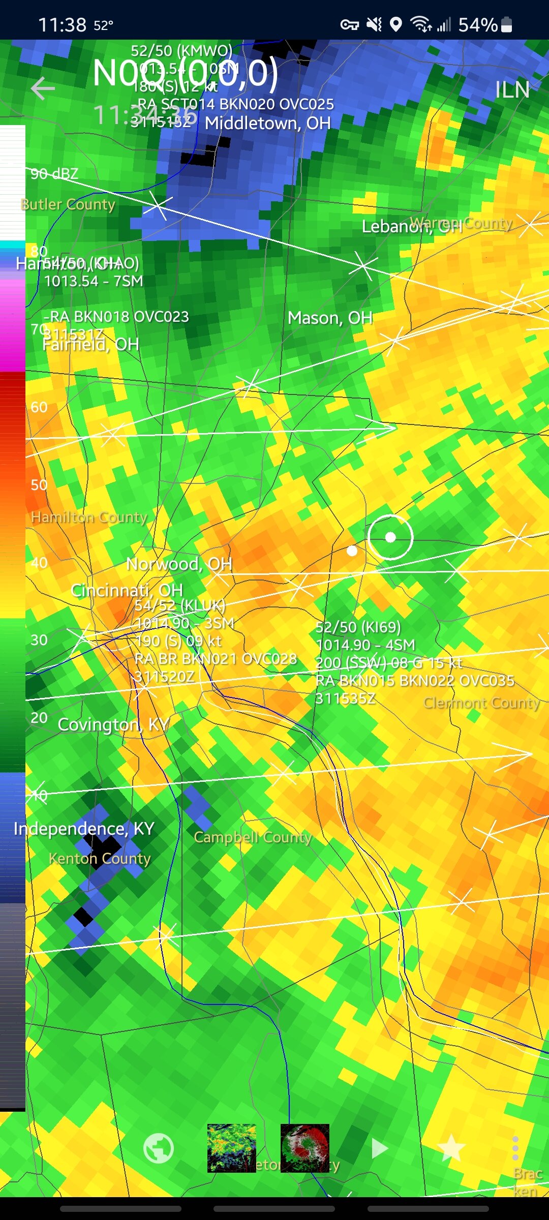
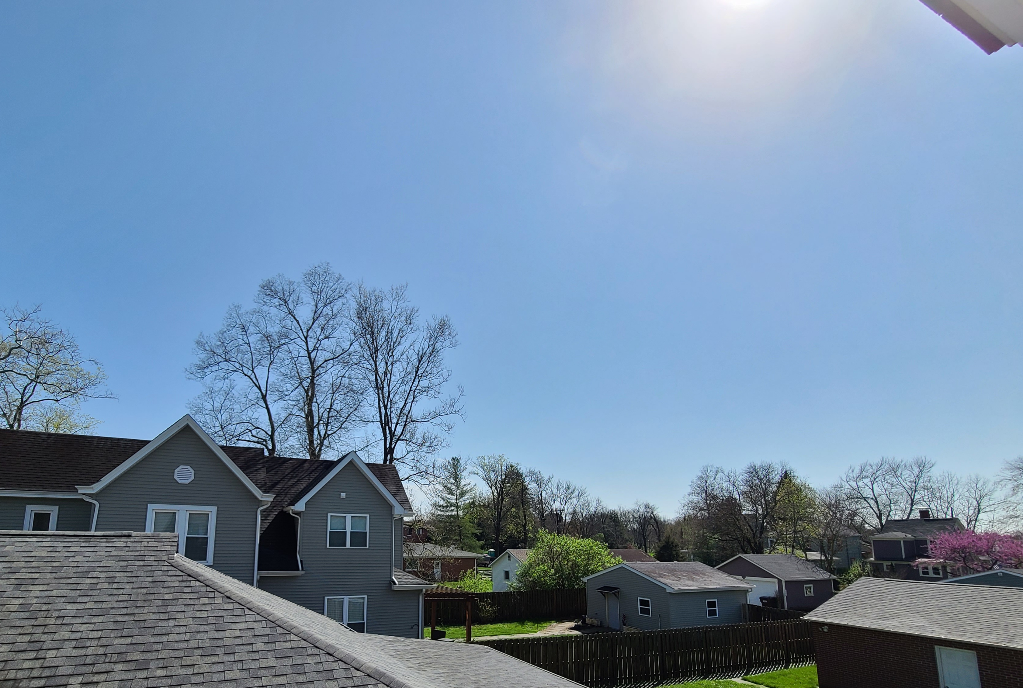
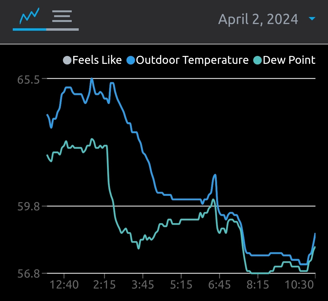
after some fairly intense rain and a bit of thunder, the skies are fairly clear again in the Cincinnati area. 70 with a 65° dew point. photo attached is looking SSW

-
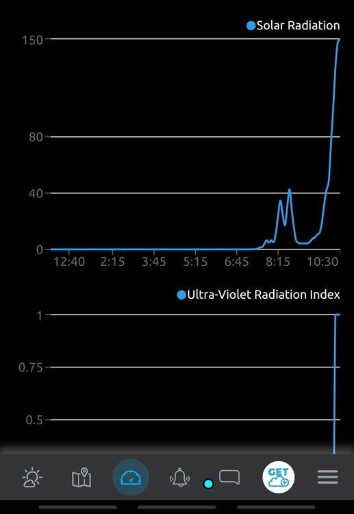
recovery beginning here in SW ohio, with dews and temps starting to rise back up. solar radiation is also picking up, per the weather station

-
looks like clearing is beginning in the area around indy, rain is moving out of the Cincinnati area now, with some weak sunshine trying to get through the clouds
-
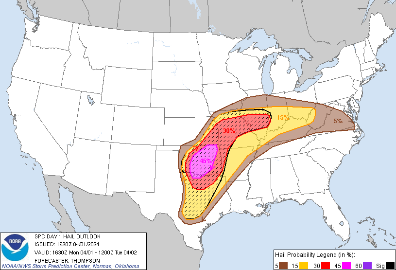
Not really impacting this area, but a hail-driven MDT was added for what I believe is the first MDT of the year? Also, a large area of 10# tornado, with the 5% coming maybe a bit more east than the previous outlook
-
1
-
-
12z HRRR for E IN and W OH ... one of the most impressive runs in quite some time
-
1
-
-
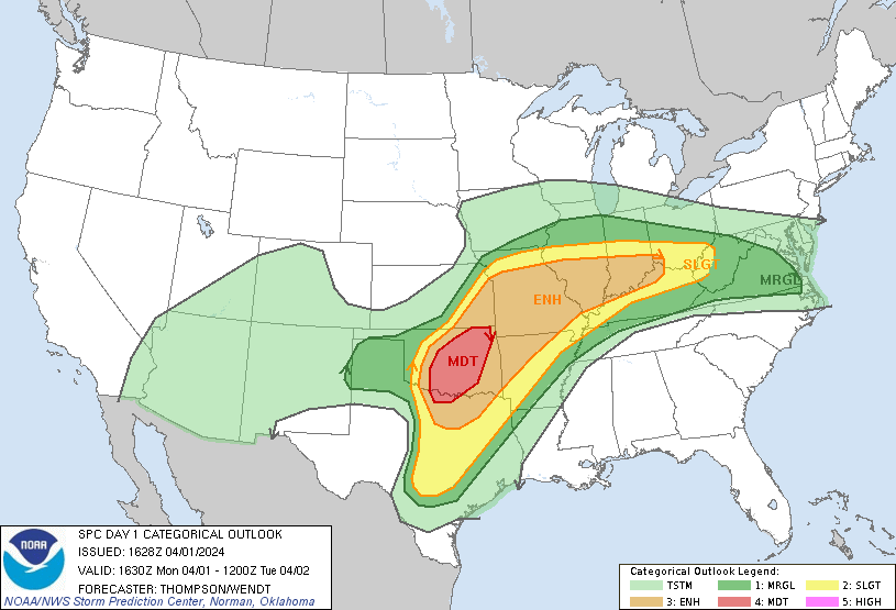
SPC goes with a d2 enhanced, which makes sense, although I almost expected a 10# risk rather than just a 10. most surprising thing for me is the placement, a lot of models have been showing this a lot further north than the area that the SPC has the enhanced
-
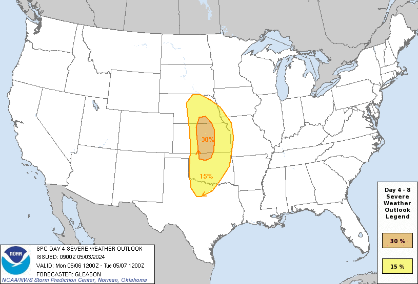
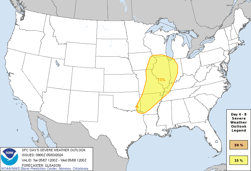
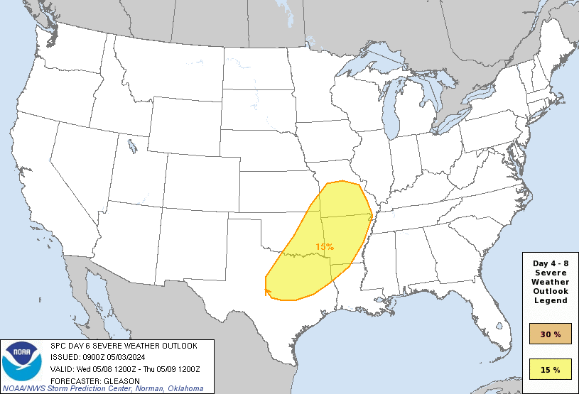
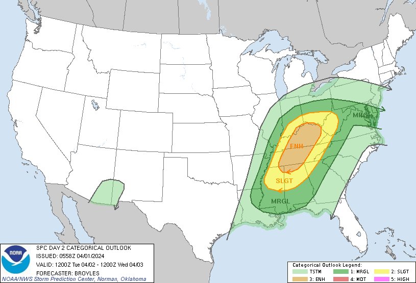
30% added to the D4 outlook for Monday, with most of the Southern area of the sub under a 15%. Does this mean that tomorrow's D3 outlook will more likely be slight/enhanced, or marginal/slight?

-
3 minutes ago, SchaumburgStormer said:

that lil blob in the corner of se IN and sw OH is my only hope for this one
-
1 hour ago, Sciascia said:
kind of a similar situation to this last storm, models slowly start pulling nw until we are fully in the rain area
-
30 minutes ago, Thundersnow12 said:
needs to come back se to avoid a repeat of today's cold rain hell
-
So far about 1.3 inches of rain today, is up to 50 now. Pressure is 980mb, lowest I've seen since installing the weather station about six months ago.
-
1
-
-
2 hours ago, King James said:
Cold rain and a muddy back yard coming my way.
feel that. hoping this weekend brings some excitement


5/6-5/9 Severe Threats
in Lakes/Ohio Valley
Posted
yeah really thought they'd go enhanced for tomorrow, especially because it looks a bit more potent than wednesday