-
Posts
413 -
Joined
-
Last visited
Content Type
Profiles
Blogs
Forums
American Weather
Media Demo
Store
Gallery
Posts posted by nvck
-
-
11 hours ago, Jackstraw said:
Sux to waste a stout EML that worked its way this far East. Those will be harder and harder to come by as we move into mid June.
could be wrong, but IMO there'll be more of these easterly EMLs than usual this summer, given the incredible drought out west.
-
Quote
The National Weather Service in Grand Rapids has issued a
* Special Marine Warning for...
Nearshore and Open Waters from St Joseph to Pentwater MI...* Until 630 PM EDT.
* At 323 PM EDT, destructive winds behind an area of precipitation
will spread east across the waters. Winds will be from the east or
southeast, making it extremely difficult for small craft to return
to port if caught in these winds.HAZARD...Wind gusts in excess of 50 knots.
Pretty aggressive wording on this SMW over Lake Michigan
-
 1
1
-
-
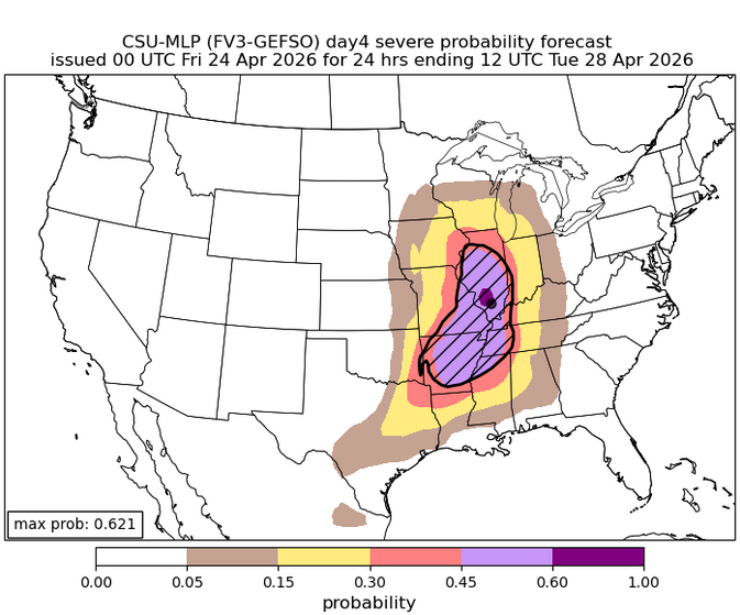
Really, really rare to see this highest level contour on the CSU maps this far out
-
A rare (the first this season?) warm spring day here with very calm winds. usually we pay a price with these 60s/70s, but thankfully not today
-
 1
1
-
 1
1
-
-
just ripped snow here for about 3 minutes, hasn't dropped below 32 yet today, though.
-
-
barely hit 70 today, but plenty of showers/weak tstorms around. campus wx camera has a nice view:
http://weather.eas.cmich.edu/current/webcam/2026-04-16-17-56.jpg
-
 1
1
-
-
Also, thinking they may go MDT with the 1630z update
-
 2
2
-
-
Beautiful light show last night here, went and sat out in a field for ~90 minutes, with constant lightning 20-40 miles away, first from the cell that moved through Saginaw, and then new stuff that back built from it, probably off of outflow?
-
What a time for the IWX radar to go down...
QuotePublic Information Statement National Weather Service Northern Indiana 448 PM EDT Mon Apr 13 2026 /348 PM CDT Mon Apr 13 2026/ ...KIWX Radar is Out of Service... KIWX is currently out of service due to an unknown issue. Technicans are in route to troubleshoot the problem. A return to service time is not known. Alternate radar sites include LOT, IND, GRR, DTX, CLE and ILN. $$
-
 1
1
-
-
MD and then watch just issued pretty much back to back for IWX area
-
Surprised that the D2 update at 1730z didn't introduce any sort of ENH in Michigan
-
went ahead and started a thread
-
 1
1
-
-
-
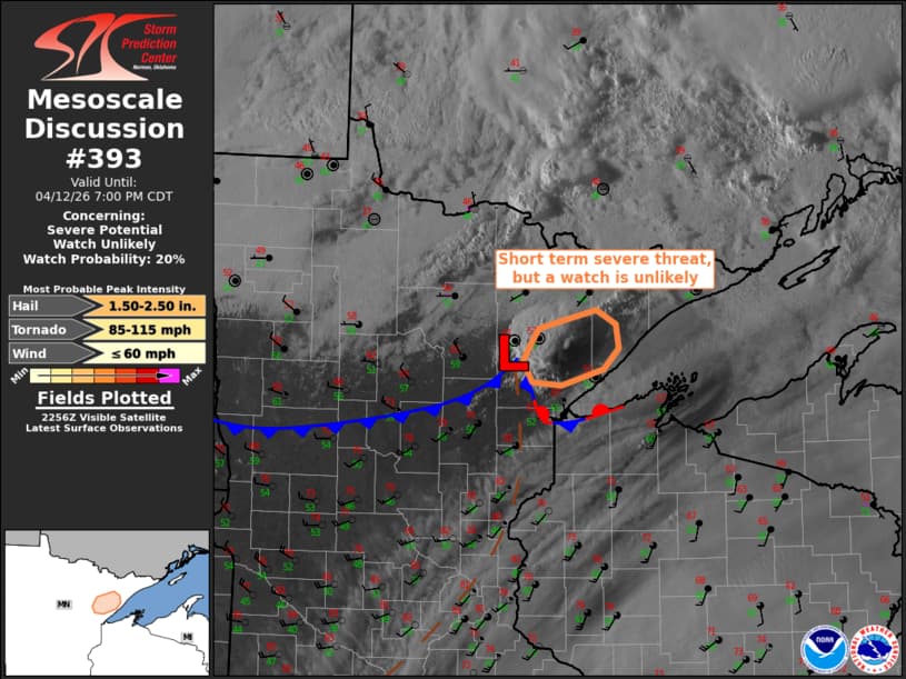
Single-cell MD up in your neck of the woods, @Brian D
-
 1
1
-
-
warm front finally made it up here, about 45 minutes ago, 75/55 now, really feeling like we've got some good juice for storms
-
9 hours ago, Harry Perry said:
Was driving through Grand Rapids yesterday and noticed the Grand River was awfully high. Same with local rivers and streams around my neck of the woods in Battle Creek. Going to be a humid summer.
yeah, kinda concerned about flooding potential in the area this week, especially as soils are pretty saturated already
-
 1
1
-
-
-
absolute peak weather here today, with what will probably be the last fully sunny day for a while.
-
 1
1
-
-
tis the season

-
 1
1
-
 1
1
-
-
555
NOUS43 KDTX 052346
PNSDTX
MIZ047>049-053>055-060>063-068>070-075-076-082-083-061200-

Public Information Statement
National Weather Service Detroit/Pontiac MI
746 PM EDT Sun Apr 5 2026

...NWS Damage Survey for 04/04/2026 Tornado Event...

.Van Buren Township Tornado...

Rating:                 EF-1
Estimated Peak Wind:    100 mph
Path Length /statute/:  3.25 miles
Path Width /maximum/:   200 yards
Fatalities:             0
Injuries:               0

Start Date:             April 4, 2026
Start Time:             5:46 PM EDT
Start Location:         2 NE Willis / Wayne County / MI
Start Lat/Lon:          42.1788 / -83.5371

End Date:               April 4, 2026
End Time:               5:50 PM EDT
End Location:           Belleville / Wayne County / MI
End Lat/Lon:            42.2009 / -83.4749

The tornado started just south of Martz Rd between Rawsonville Rd
and Hoeft Rd. It first flipped a hayride trailer and continued
northeast toward Hull Rd. EF-1 damage occurred along Hull Rd with
the greatest concentration of EF-1 damage along and just south of
Hull Rd between Elwell Rd and Bak Rd. This damage included
multiple trees uprooted and snapped, telephone poles snapped, and
a large barn wall blown out. The tornado continued northeast
crossing Sumpter Rd producing EF-0 damage with scattered large
tree limbs and power lines downed. The tornado lifted right
before reaching Savage Rd.

&&

EF Scale: The Enhanced Fujita Scale classifies tornadoes into the
following categories:

EF0.....65 to 85 mph
EF1.....86 to 110 mph
EF2.....111 to 135 mph
EF3.....136 to 165 mph
EF4.....166 to 200 mph
EF5.....>200 mph

NOTE:
The information in this statement is preliminary and subject to
change pending final review of the event and publication in NWS
Storm Data.

$$
DTX confirmed an EF1 yesterday near Belleville, kinda surprised I didn't see more (any) talk about those spin-ups on here yesterday
-
 1
1
-
-
approaching 3/4 of an " at the campus wx station, enough to cause some minor ponding in the fields
-
2 hours ago, A-L-E-K said:
So what's up with this
boring answer would be "frequency illusion", fun answer is that the US and (russia/china/iran) are knocking each other's military satellites out of orbit
-
 3
3
-
-
up to 71 here, sunny, with a nice breeze. really the type of day you could just spend entirely outside and not complain
-
 2
2
-


.thumb.jpg.ad3a2e31d30aff035044689b311a0540.jpg)
.thumb.jpg.142e0379be7558c789233b95a8908331.jpg)
Spring 2026 Banter Thread
in Lakes/Ohio Valley
Posted
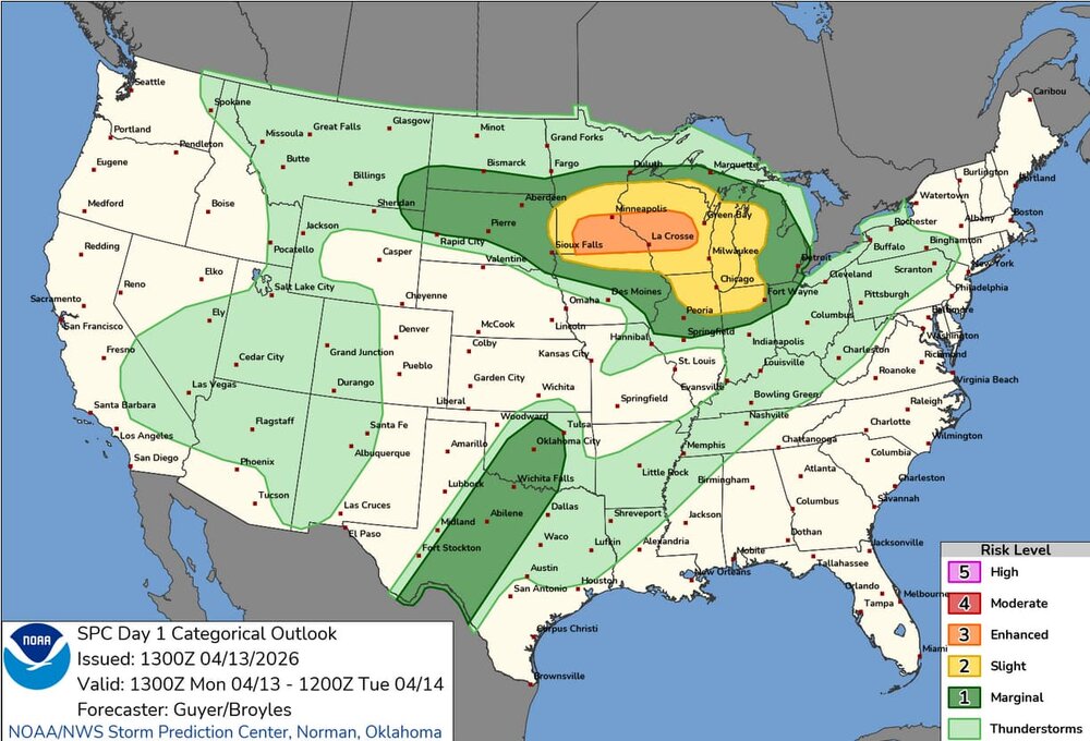
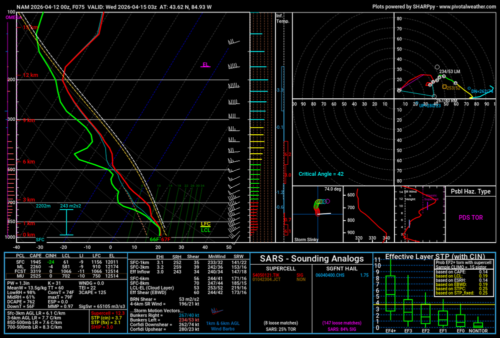
Heading out monday to try and chase tuesday in E KS/MO, looks like a dismal pattern if you're a tornado fan, but could be daily chances for ISO svrs with good hail, which is what we're after. will be out for ~2 weeks, so looks like the pattern should become a bit more favorable after next weekend