

Jet Stream Rider
-
Posts
1,085 -
Joined
-
Last visited
Content Type
Profiles
Blogs
Forums
American Weather
Media Demo
Store
Gallery
Posts posted by Jet Stream Rider
-
-
Ended up with about 3 here. Looks like jackpot with this system was well south of here. We never got the frontogenesis across large areas of the state that the models showed, slp was weaker and further east and south. The shear from the st jet that gave us all the over-running early, hampered the coastal development I think. Nice marginal event though. One of the best snows for looking great in the trees in a while!
Thanks for all the diligent tracking folks!
Trees from the front yard:

-
 6
6
-
-
17 minutes ago, goldman75 said:
What is this possible pivot you guys are talking about? Is it something similar to a hurricane wobble? This pivot is suppose to help snow out east? Thanks for any clarification
")
The coastal slp (surface low pressure) will add an eastern component to the air flow for areas north of the slp. That can cause the eastward progression of the precipitation field to slow down, halt, and even fill-in in some cases - resulting in an apparent pivot of the precip shield. This is forecast to be a relatively weak low and developing relatively far off shore, hence why I say it likely will not affect anyone west of say Raleigh imo.
-
 3
3
-
-
9 minutes ago, mackerel_sky said:
CJ, our local met, just said the coastal is going to slow down the back edge of our precip s eastward progression, even said wraparound for our area!
 what a
Thats the idea, looks to maybe be a bit too far east to do too much beyond the enhancement in downeast NC. We will have to see once it develops though. Still some variability and chances for folks for the next 6 hours or so.
-
Coastal SLP starting to develop now at 1014.

-
Had occasion to drive across town just now. Some accumulation on the roads now. Snowing light to moderate at 32.
-
Big flakes in light to moderate snow. dusting on vegetative surfaces. Down to 32.
-
Moderate snow now, 35. No accumulation
-
Mixed precip rn, ip, sn started here 20min ago in northeastern NC.
-
In the eyewall wow!
-
1
-
-
Frying Pan Shoals in the eyewall!
-
7 minutes ago, downeastnc said:
Watching the radar loop from ILM and he is moving pretty much dead on NNE and if he does not turn quite a bit he is going to at the very least skirt Cape Fear...that Sat loop is deceiving
try running ILM radar loop etc he may have bumped east a hair but overall he is still NNE or NE at best.....speeding up a bit too....
I know what you mean. I always double check myself for confirmation bias. But note the 5pm update moving NE rather than NNE as it has been up to now. We need every bit of E and less N that we can get. Possibly now will miss Cape Fear (actual landfall I mean of course). If it stays out of Pamlico Sound it will help just about everyone downeast.
-
1 hour ago, downeastnc said:
I do not know what to make of all the models with the west side wind max they form overnight over my neck of the woods....a lot of models have a band of 40-50 sustained gusting to 60-80 mph forming over the coastal plains as the center gets out over the Pamlico Sound...I would be right in the middle of it....and well a few gust of 50-60 is one thing 4-5 hrs of gust well into the 70's is something else all together....
HRRR shows it, all the models have something very similar to this....
Noticed that too and have been concerned. Possibly could be due to the interaction with the trough that is kicking it east. The deformation of the structure bringing down some of the upper level winds more effectively. Saw this last year on the back side remnant eyewall of the major that hit along the gulf as it exited northeastern NC. btw - Dorian just got a pretty swift kick, looks like it has taken on a more easterly component. Could really help us out!
-
Good morning and good luck to all downeast and coastal areas NC & SC. Looks like it will be hard to avoid a landfall by daybreak tomorrow.

-
1
-
-
0z GFS did not follow suit with a more inland pass downeast, but it is alarming that several of the other models show it. Here is an example from the 0z WRF-ARW2
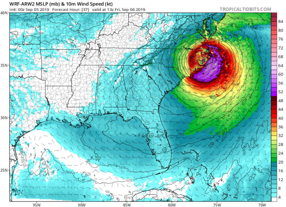
-
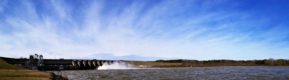
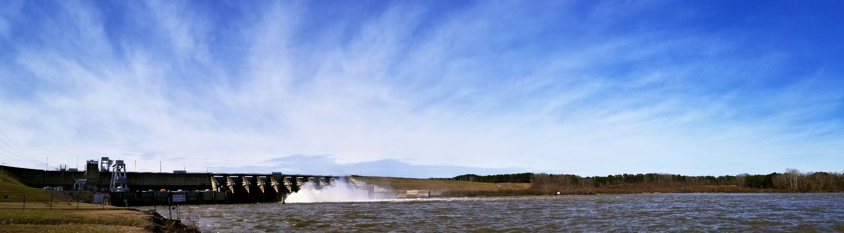
Cold rain at 37. Deja vu. And its heavy to moderate rain too. Floodgates are open on both the Gaston Lake and Roanoke Rapids lake dams. Flooding here.
-
1
-
-
Last night had a good thump of moderate sleet and snow for a few hours, light accumulation and below freezing for about 7 hours. Today is the archetypal cold rain at 35.
-
Moderate mix of sleet and snow and its accumulating a bit in spots.
-
Cold rain at 33. Had a bit of ice overnight but no impact.
-
Sleet and zr at 31. Initial thump, don't expect it to last.
-
Ah yes, sleet, my old friend. And its accumulating.
-
12 minutes ago, jtgus said:
Where is the ULL currently?
There are at least two parts to it. The first part is the original west coast energy that spawned our slp (now off the NC coast), and that is being sheared as it traverses the mountains. The second part is dropping down the backside of the trough and the 2 will begin to interact.
-
2
-
-
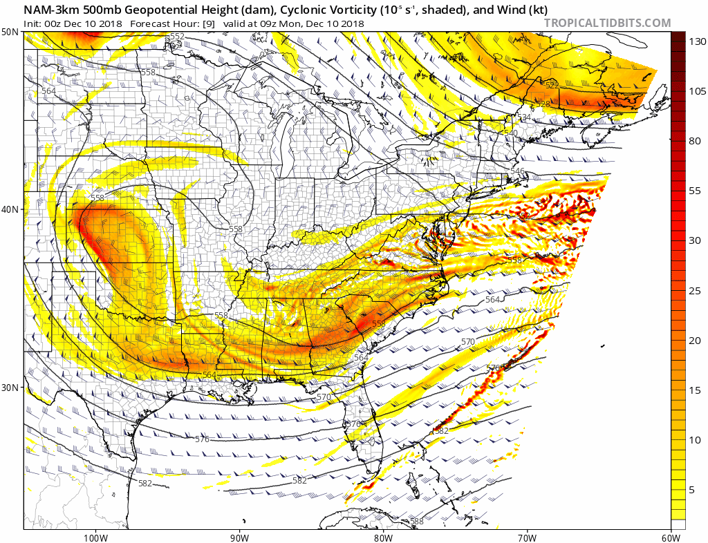
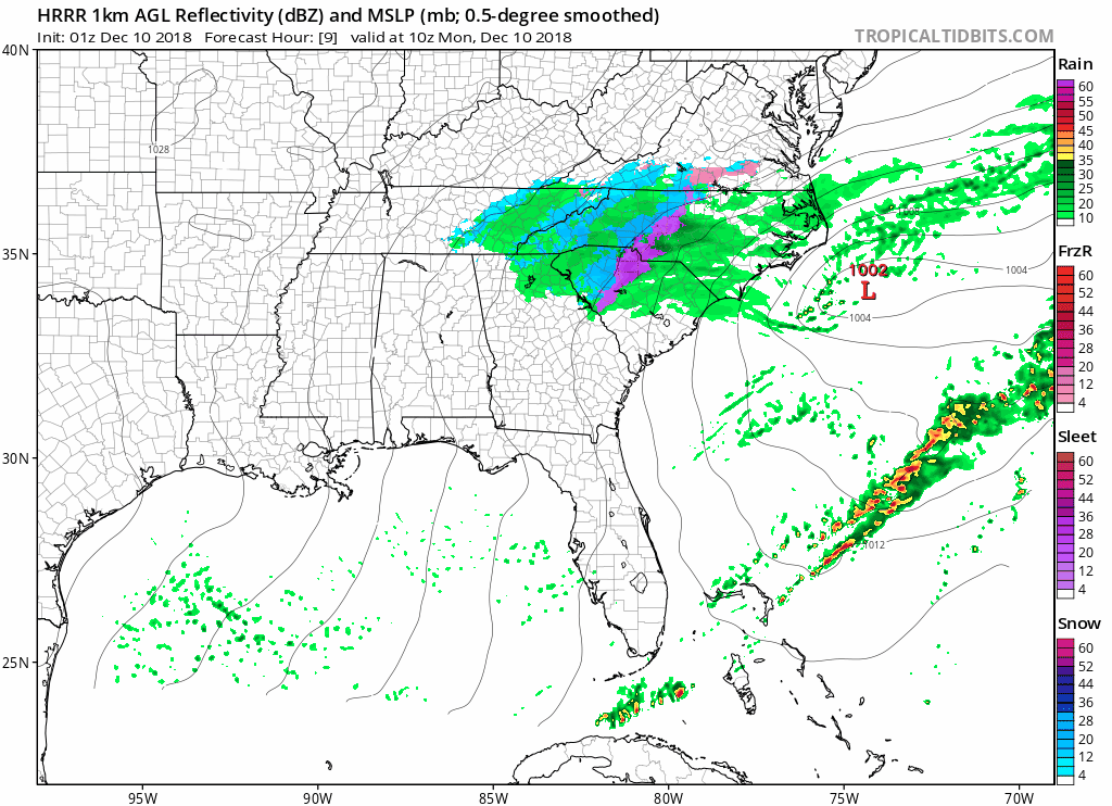
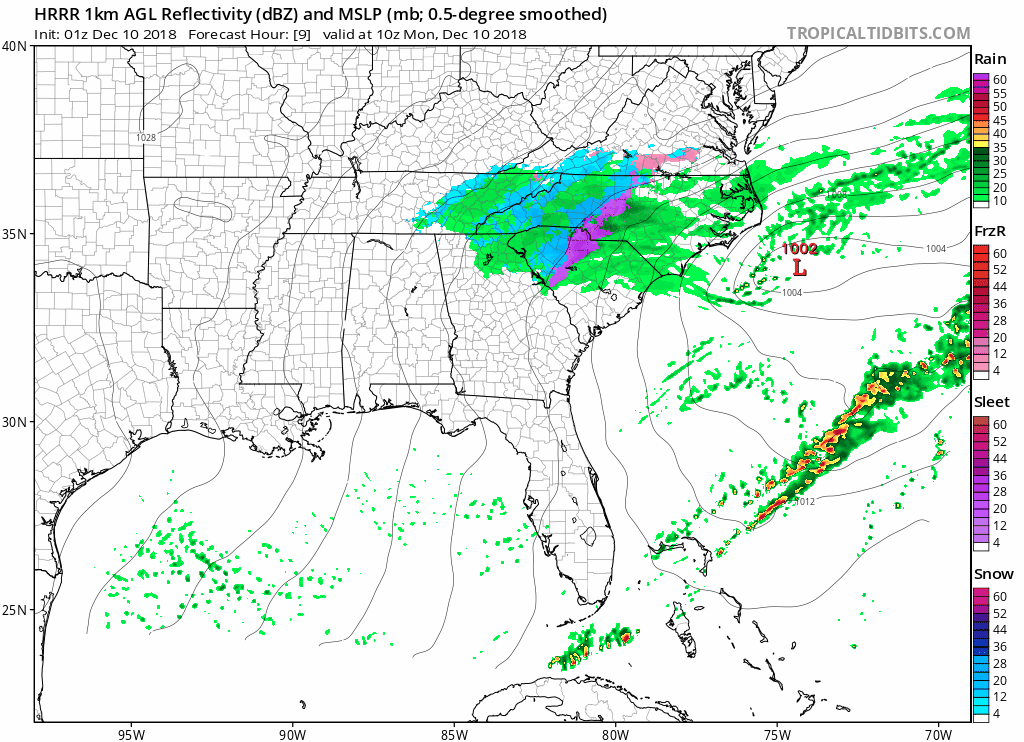
HRRR 9z-15z Monday depiction - Thats tomorrow morning
-
1
-
-
18 minutes ago, SouthCentralWakeCo said:
True, but it is interesting. Didn't the NAM verify the best for the last nights/today's band of snow/sleet/freezing rain? And didn't it nail the warm nose? Don't know for sure, but I think it did better than any other model.
HRRR did better with placement of transition zone and timing for my area.
-
35 minutes ago, cmh90 said:
I’ll eat my own shoe if that happens!
Are you familiar with film maker Werner Herzog?


11/12 Heavy Rain/Flooding Event
in Southeastern States
Posted
This site is pretty good. https://climate.ncsu.edu/