
OKwx_2001
-
Posts
69 -
Joined
-
Last visited
Content Type
Profiles
Blogs
Forums
American Weather
Media Demo
Store
Gallery
Posts posted by OKwx_2001
-
-
HMON shows 95L hitting PR as a near major
Meanwhile the HWRF shows an open wave
Gotta love the hurricane models

-
19 minutes ago, WxWatcher007 said:
12z Euro tries to clear the center from the coast by tomorrow morning and while it avoids Cuba, it brings it further east over Florida.
I don’t buy the stronger HWRF solution. It has been rushing intensification from what I’ve seen with Fred so far, and it can certainly take a while for a robust center to regenerate, much less become vertically aligned. And this is expected to happen in the presence of shear?
Possible, but unlikely. The 24 hours are critical to defining the ceiling of this system IMO, which I still think is relatively low.
There's definitely quite a bit of possibilities. I think we'll be looking at a remnant low trying to get going in the gulf. That being said, if it can get to the gulf without much interaction with Cuba, I think it may be able to make a run for strong TS maybe even a Cat 1 hurricane. But if it gets tangled up with Cuba then there might not be anything left of it
-
29 minutes ago, Muhammad2922 said:
Hwrf will be right in this case, and also underdone. Significantly underdone for upper gulf coast
I highly doubt that. We'll have to see if it survives the islands first. Not to mention a major hurricane in the first half of August is very rare. There hasn't been one since Dean in 2007.
Conditions may be favorable, but I don't think it's going to be a major. Still needs to be watched though.
-
I know the focus is on PTC6 (and rightfully so) but the wave in the eastern Atlantic looks like it might be trouble down the road. It's a long ways out but it may have a chance to get pretty strong if it avoids land. It's just been tagged as Invest 95L
-
1 minute ago, AmpedVort said:
I have no clue as well. Some discussion on the topic "match" the numbers to a logical meaning. Like a game or something... Obviously somebody is throwing wrecking balls in here but it is not me believe me!
")
Well I came here for a discussion and that's tough when I see you posting nonsense like every 30 seconds
-
 4
4
-
-
43 minutes ago, AmpedVort said:
2x6x4 = 48
"in 48 Hours"
F264 is a code for a special EF-4 WIND hope this does not turn into a monster! The formula is subtract 2 from 6 = 4 and check if result matches the last number if it matches then EF-4 (range mid-first up to last number) winds are possible within the COC of a TC
Learned this back in the days where IT certifications were talking about SUPERCOMPUTERS so they taught us SOCIAL ENGINEERING AND CRYPTIC BIOS POST CODES...
Keep in mind also UV and RI and a missing S signifying VIRU (S) like infected vapor producing circuit (NOT A BIGGIE)
What is this post? I have no idea what I just read lol
-
 2
2
-
1
-
-
16 hours ago, ldub23 said:
GFS continues to show a hyper active el nino like east pac. My guess is 1 or 2 very weak quickly dissapating storms this month. 2 or 3 in Sept. El Nino like seasons dont usually have too much of interest. Maybe oct will be busier but by then winter is coming and its just not that interesting.
Come on now just because one model shows an active EPAC and one guy lowers his numbers a bit does not mean the season is cancelled. Early August isn't usually very active in the Atlantic anyway. Later in the month things start to pick up.
Not to mention the GFS showed major after major in the EPAC last year and that didn't happen and so far it's not happening this year either, although the system behind TD11-E might have a better chance to get strong.
And this isn't even an El Niño season lol
-
3 minutes ago, StormChaser4Life said:
I agree with you. Someone needs to call out this page for spreading false information.

They do that all the time. They come up with their own intensity estimates that many times have zero data to support it. I don't pay any attention to them.
-
2
-
-
This looks like at least a TD to me, even though the center is exposed. Up to 70/70 odds of development on the latest TWO.
-
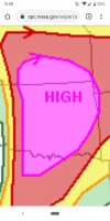
Huge severe warning
-
-
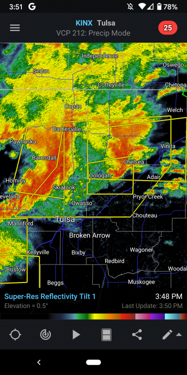
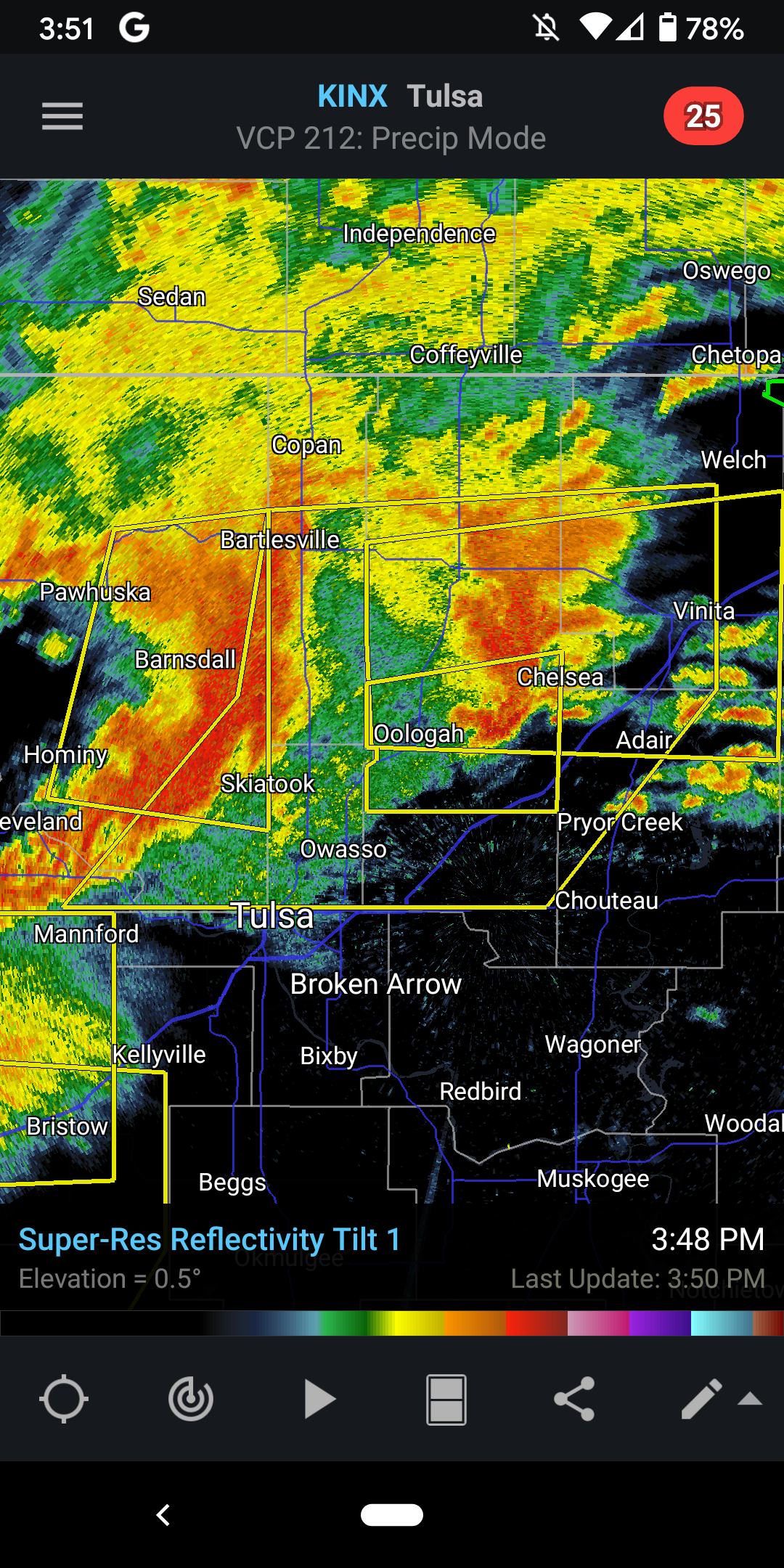
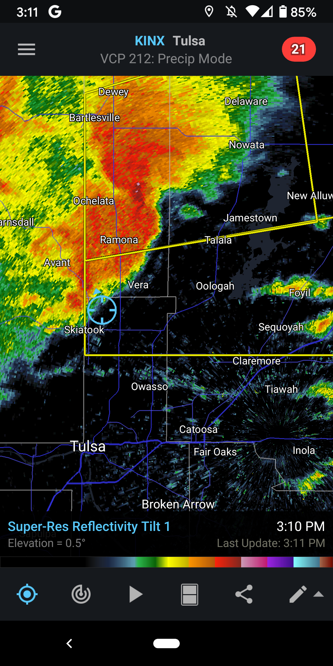
Looks really sloppy for tornado potential but that was never the main threat. Hail and wind potential is definitely there
-
Looks like an OFB about to enter Tulsa county from the north
-
17 minutes ago, StormChazer said:
Can confirm, we've been cooking in the sun here in Tulsa for a bit now...85 degrees out.Yep it's been a warm one for sure... The potential is there
-
Starting to get some clearing here in Tulsa so that will be concerning if it continues. Currently at my outdoor job so I hope the big stuff holds off until I get home (I'm off at 2). I would much rather track it at home than drive in it.
-
1
-
-
10z HRRR has the storms developing much earlier than previous runs. As early as late morning. I feel like that's too early for tornado potential but it will be interesting if those storm end up materializing or they even remain on later runs
-
Tomorrow still looks like a big severe weather day but not as big as it did earlier. Might see a wind-driven moderate somewhere but I think they'll hold off until the 13z or 1630z outlook for that, if even at all. I think morning convection could be a big issue but then again it's late May so who knows. We'll have to see if we get any clearing later in the day.
-
I'm in the southern part of the 10% tor risk for tomorrow. We'll see what happens. I've only had 1 severe thunderstorm warning this year so this should break the inactive streak. As long as the tors stay away from my house... And anyone else's
-
1 hour ago, OKTWISTER said:
Latest from NWS Tulsa for Thursday.
Hazardous Weather Outlook
National Weather Service Tulsa OK
147 PM CDT Tue May 25 2021

ARZ001-002-010-011-019-020-029-OKZ049-053>076-261045-
Adair OK-Benton AR-Carroll AR-Cherokee OK-Choctaw OK-Craig OK-
Crawford AR-Creek OK-Delaware OK-Franklin AR-Haskell OK-Latimer OK-
Le Flore OK-Madison AR-Mayes OK-McIntosh OK-Muskogee OK-Nowata OK-
Okfuskee OK-Okmulgee OK-Osage OK-Ottawa OK-Pawnee OK-Pittsburg OK-
Pushmataha OK-Rogers OK-Sebastian AR-Sequoyah OK-Tulsa OK-Wagoner OK-
Washington OK-Washington AR-
147 PM CDT Tue May 25 2021

This Outlook is for Northwest and West Central Arkansas as well as
much of Eastern Oklahoma.

.DAY ONE...This Afternoon and Tonight.

SEVERE THUNDERSTORM.
RISK...Limited.
AREA...Far Southeast Oklahoma.
ONSET...Ongoing...ending by early evening.

FLASH FLOOD.
RISK...Limited.
AREA...Southeast Oklahoma; Northwest Arkansas.
ONSET...Ongoing.

HEAVY RAIN.
RISK...Limited.
AREA...Southeast Oklahoma; Northwest Arkansas.
ONSET...Ongoing.

DISCUSSION...

There is a limited severe storm risk mainly across southeast
Oklahoma this afternoon. Damaging winds are the main threat.
Locally heavy rainfall fell across portions of southeast Oklahoma
this afternoon, shifting into northwest Arkansas. Another round of
heavy rain is possible with the afternoon storms over the same
areas. Thus, there is limited flash flood potential thru early
evening.

SPOTTER AND EMERGENCY MANAGEMENT ACTION STATEMENT...
Local Spotter Activation May Be Needed.

.DAYS TWO THROUGH SEVEN...Wednesday through Monday.
WEDNESDAY...Thunderstorm Potential.
THURSDAY...Severe Thunderstorm Potential...High Wind Potential...Heavy Rain Potential.
FRIDAY thru MONDAY...Thunderstorm Potential.

EXTENDED DISCUSSION...

Storm coverage on Wednesday will be isolated at best and during
the afternoon, mainly across far eastern Oklahoma and western
Arkansas. Severe weather is not expected.

A high impact weather event is expected from Thursday afternoon
and night. Severe storms are expected to form ahead of a cool
front across northeast Oklahoma Thursday afternoon and then grow
into a complex and move into western Arkansas and southeast
Oklahoma Thursday night. The initial storms across northeast
Oklahoma will pose the threat for tornadoes, very large hail to 2
inches in diameter or greater, and damaging winds. Due to the very
unstable airmass expected to be in place, and the potential for a
boundary to be draped across the region, there is potential for a
strong tornado. After storms congeal into a complex, wider swaths
of damaging winds will become the main severe concern. The severe
threat on Friday afternoon will be confined mainly to southeast
Oklahoma ahead of a cool front.

While storm chances remain in the forecast thru the weekend and
into early next week, severe weather is not expected during this
time.

Repeated heavy rainfall on top of saturated soils may lead to
an increasing flood threat later this week in addition to the
severe weather potential.
Wow that's one of the more bullish ones I've seen from them at this range. Usually they are a bit more on the conservative side. Definitely concerning and I think we'll see a wind-driven moderate risk (tornado risk might be lower but still significant) by Day 1.
-
It's shots like these that make me want to start chasing
https://mobile.twitter.com/matternst34/status/1394091020556673028
-
3
-
-
2 hours ago, Iceresistance said:
Several News Channels (KFOR News 4 & News 9 to name a few.) have highlighted Next Monday & Tuesday to have potential severe weather . . . The uncertainty on the Cut-off low is too high . . .
It may have some severe potential but likely not much
-
Looks like a weakening closed low will be moving into the plains early next week which shouldn't bring much of a severe threat I would think, at least for the first part of the week. Could bring quite a bit of rain though.
SPC hinting at a possible severe threat after that though.
-
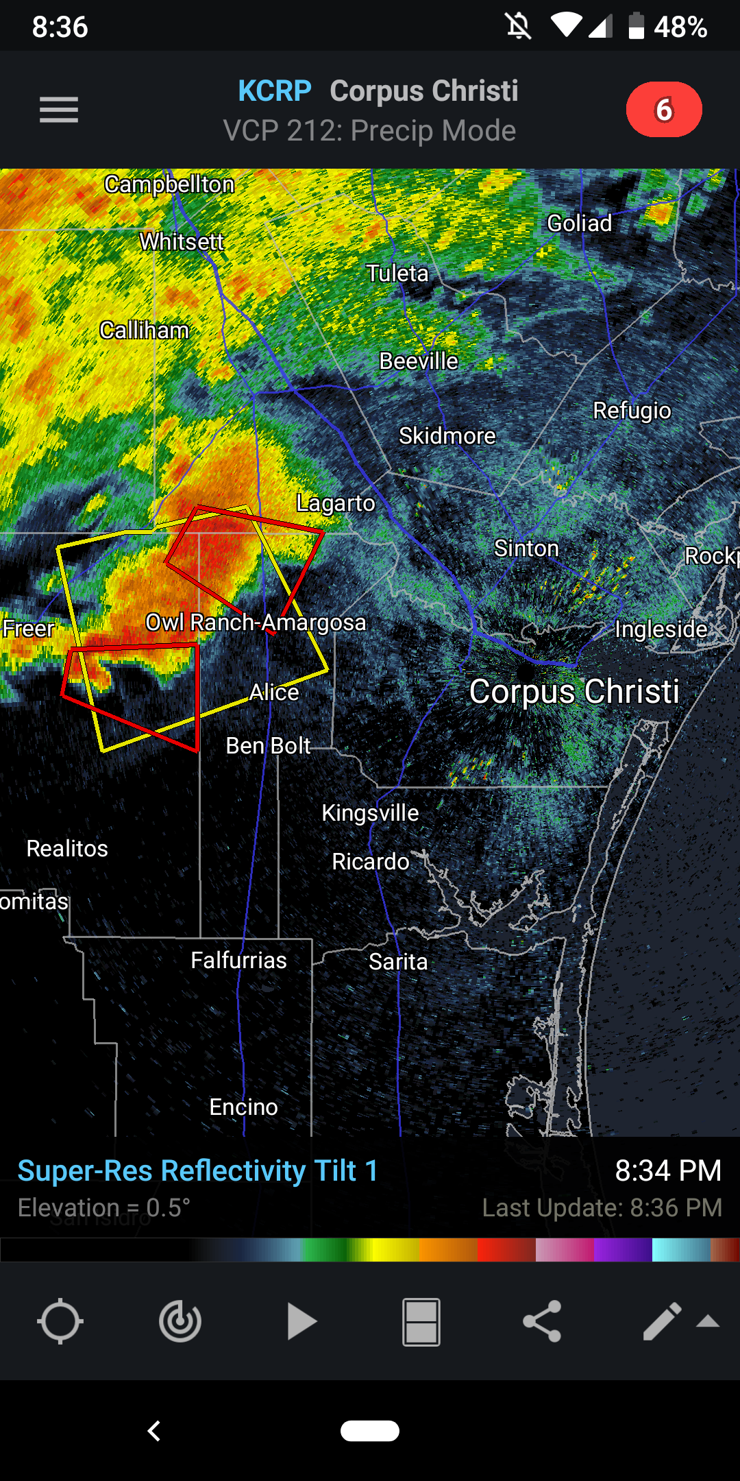
A couple of tor warned cells heading towards Corpus Christi

-
2 hours ago, Iceresistance said:
Yeah, it's mostly the CFSv2 that is trying a sequence from the Dakotas to Texas, but most other models are showing nothing of that sort . . .
The next focus of attention for Tornado Alley Severe Weather starts around May 15th . . . Even though that the model agreement is too uncertain for this to happen, I always watch ANY chances, because I've seen it happen on days where it was supposed to be a Marginal . . .
Many Severe weather days have been over-performing this year, especially in Texas . . . & I don't want to take ANY chances with Oklahoma weather . . .I think it'll get more active but it'll likely change between now and then. A little over a week or so ago, it looked like this week could have been active but here we with nothing but cold in most of the Plains...
Meanwhile, could be some massive hail in S TX today

2021 Atlantic Hurricane season
in Tropical Headquarters
Posted
It's not even peak season yet. It's not like August first hits and then it's a cane fest. There's a reason why many consider 8/20 to be the start of peak season. In the last decade there have only been 3 storms before 8/20 to get stronger than Cat 1, and none of those were majors. I've got a feeling a lot of your posts on here claiming this season is going to be inactive are going to age very very poorly...